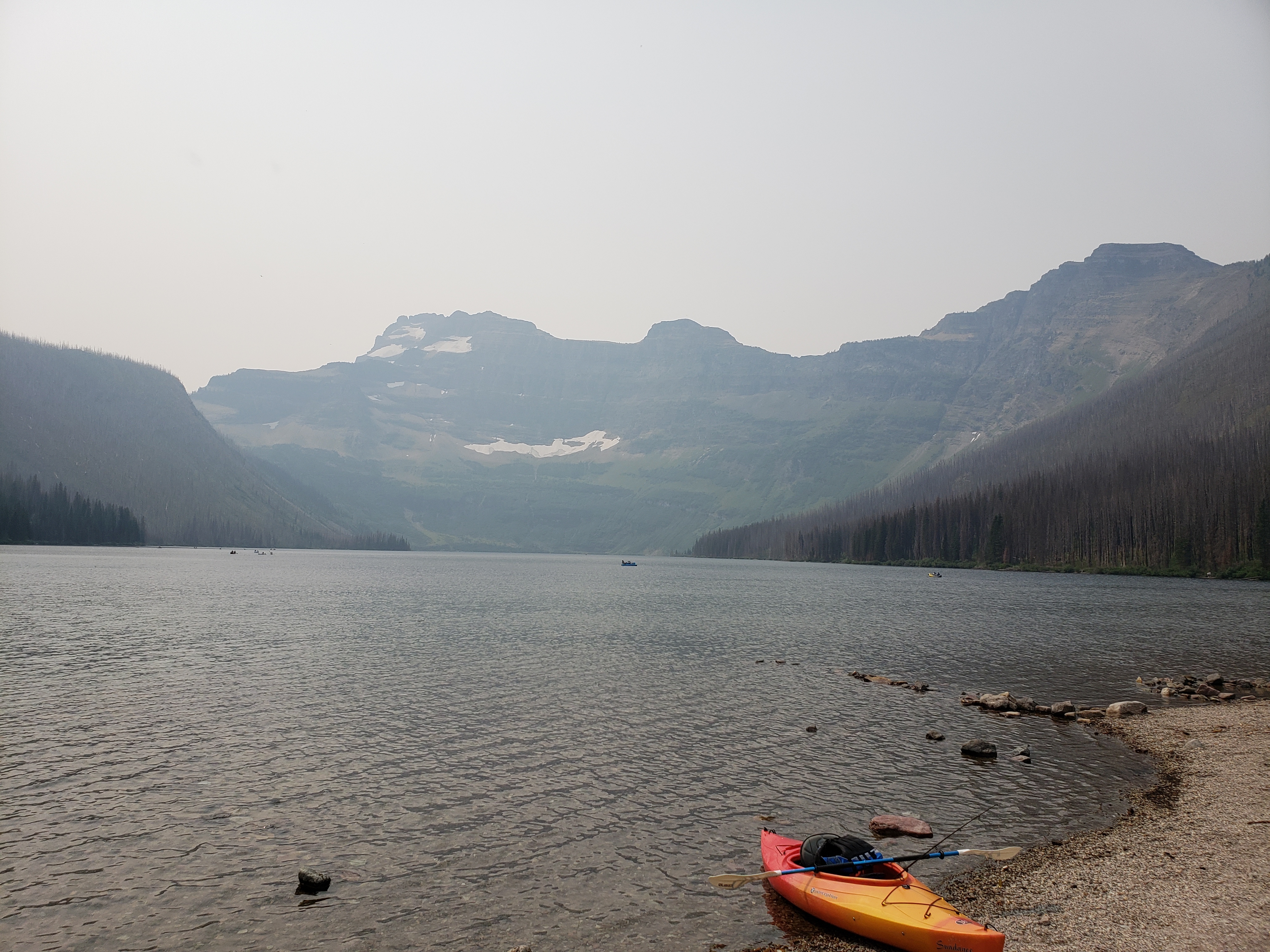
Waterton Lakes National Park
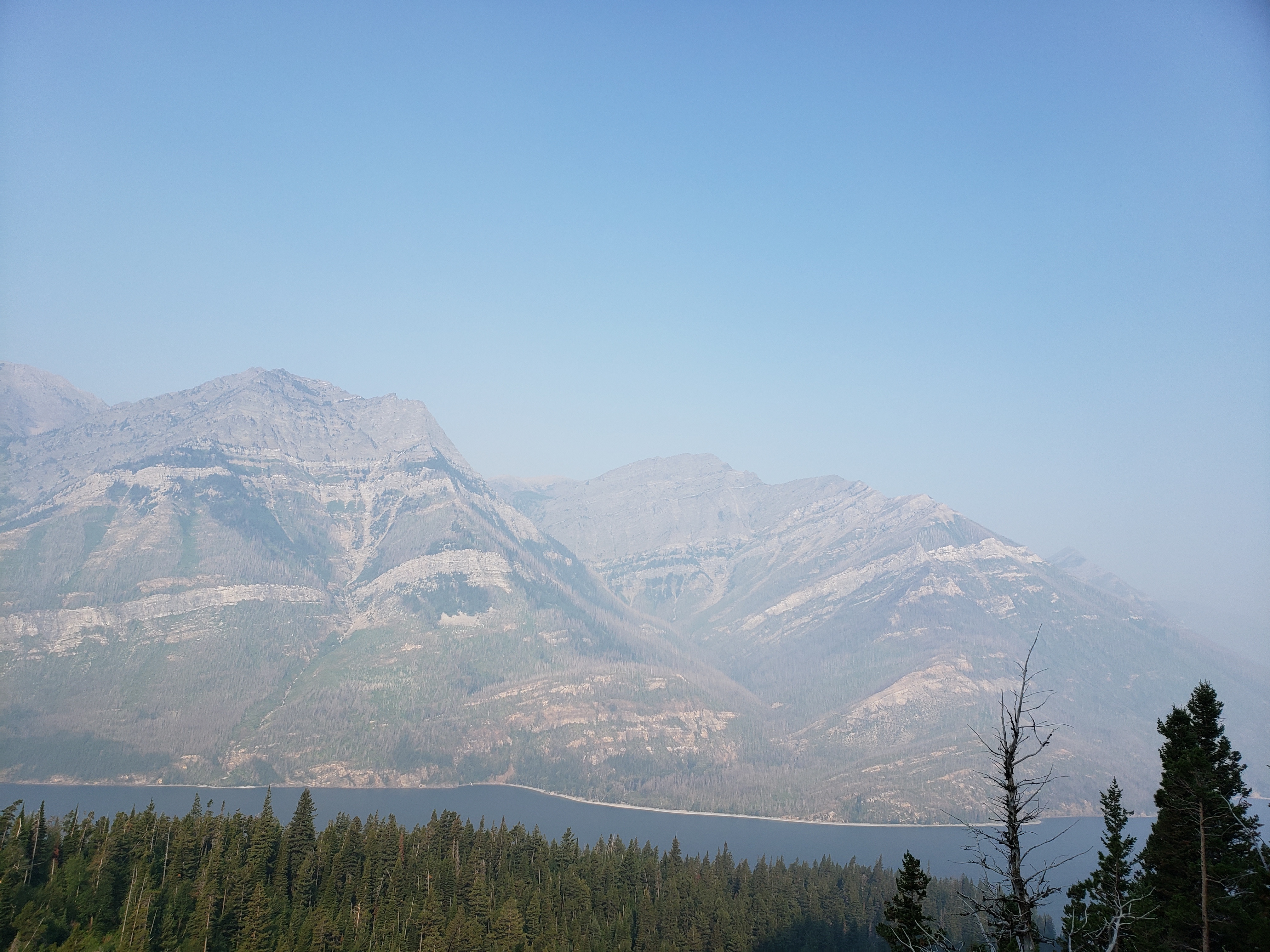
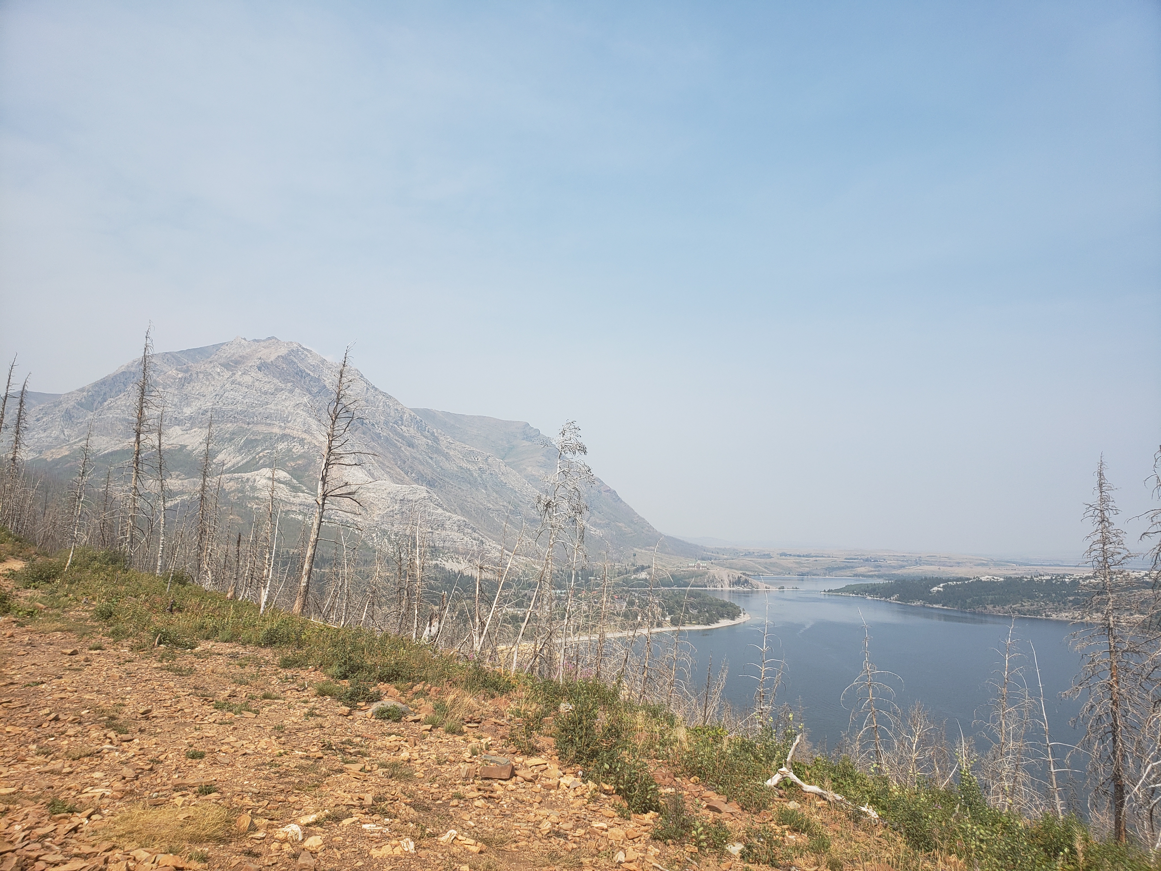
We drove from Winnipeg out west to the rockies and did some hiking with the cousins. Unfortunately, forest fires from the US and perhaps out west obscured visibility of further away mountains, and recent fires in Waterton had killed most trees that weren't protected in a valley or high up enough. Fortunately, mountains are mountains, and it was still gorgeous.
Red Rock Canyon
Unfortunately I have no photos of this, but if given the chance, bring water shoes and wade through up-to-hip-deep water in an gorgeous, well, red rock canyon.
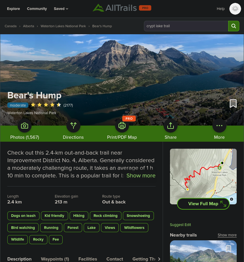
Bear's Hump
A short trail with lots of elevation gain (2.4km both ways, 210m elevation gain), but with switchbacks to make the ascent less continuous. You get a nice view of Waterton and the surrounding peaks at the top. We continued a bit higher up the mountain, but turned back after 20-ish minutes when scrambling over boulders became necessary.
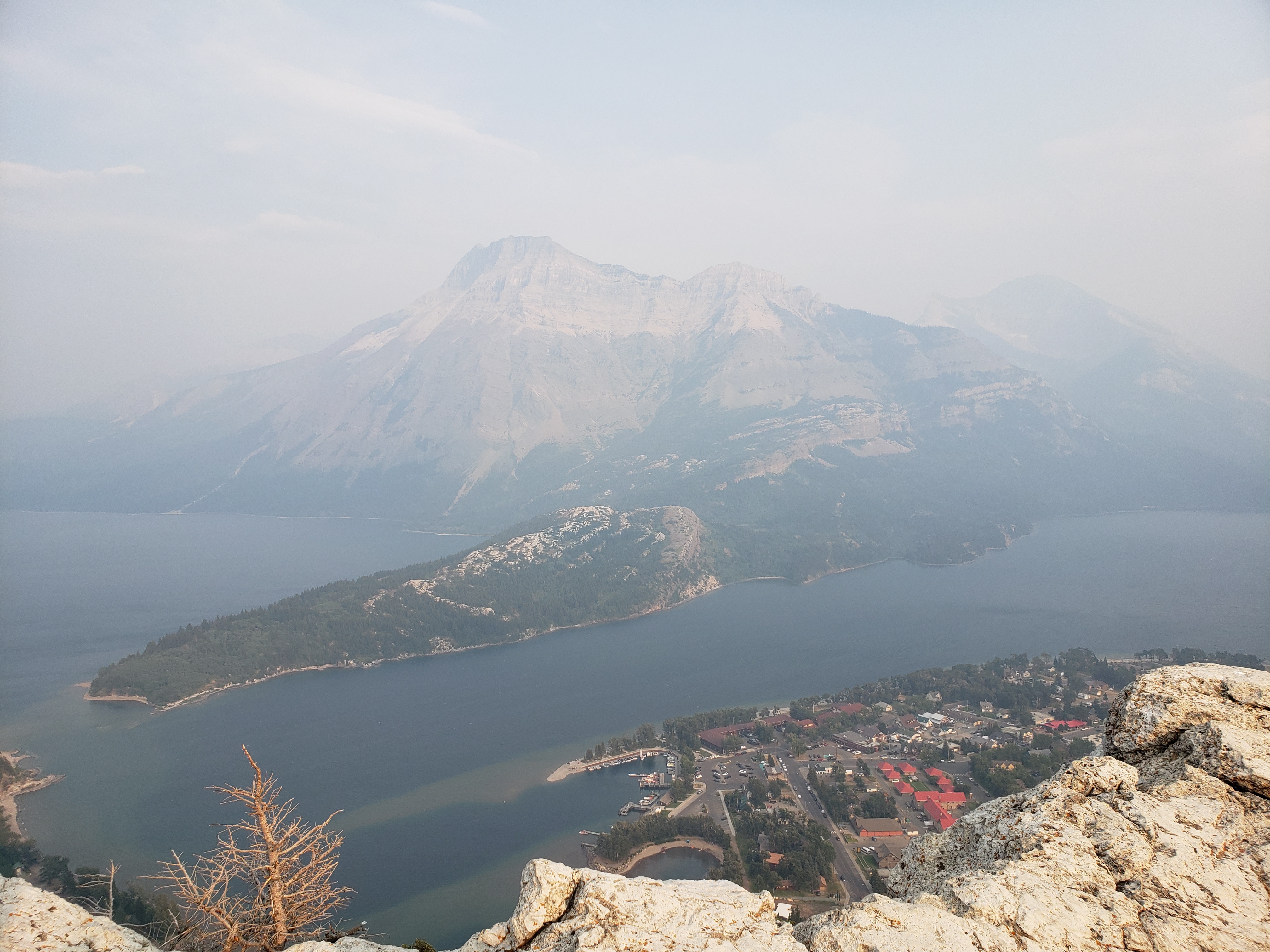
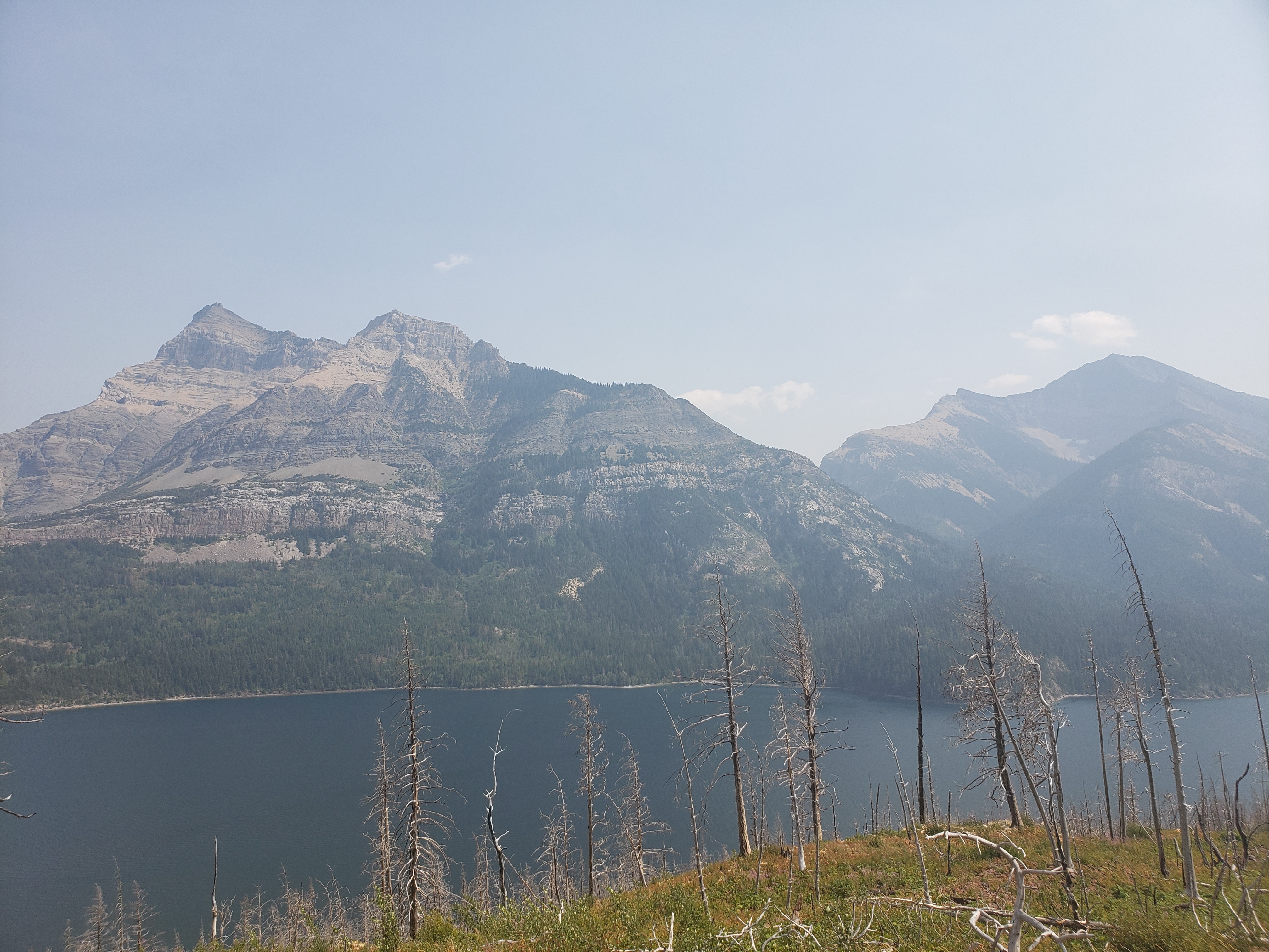
View of Waterton and Vimy Peak, with a thick blanket of smoke.
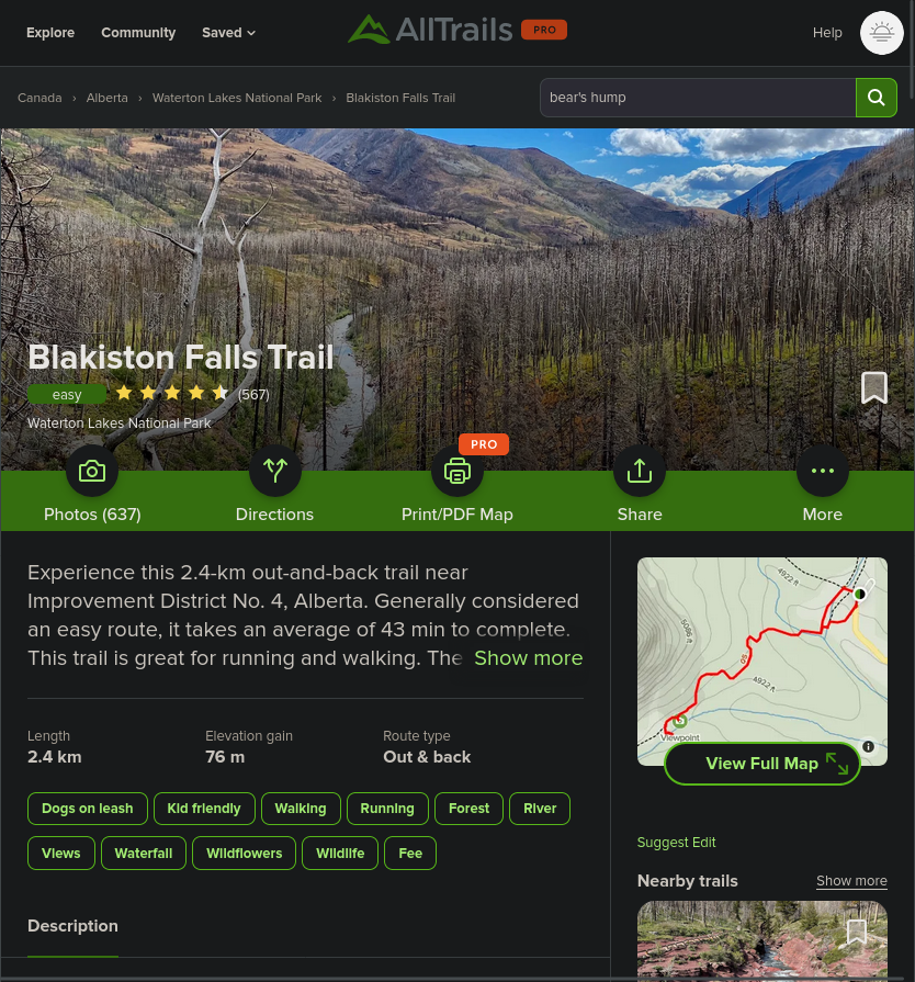
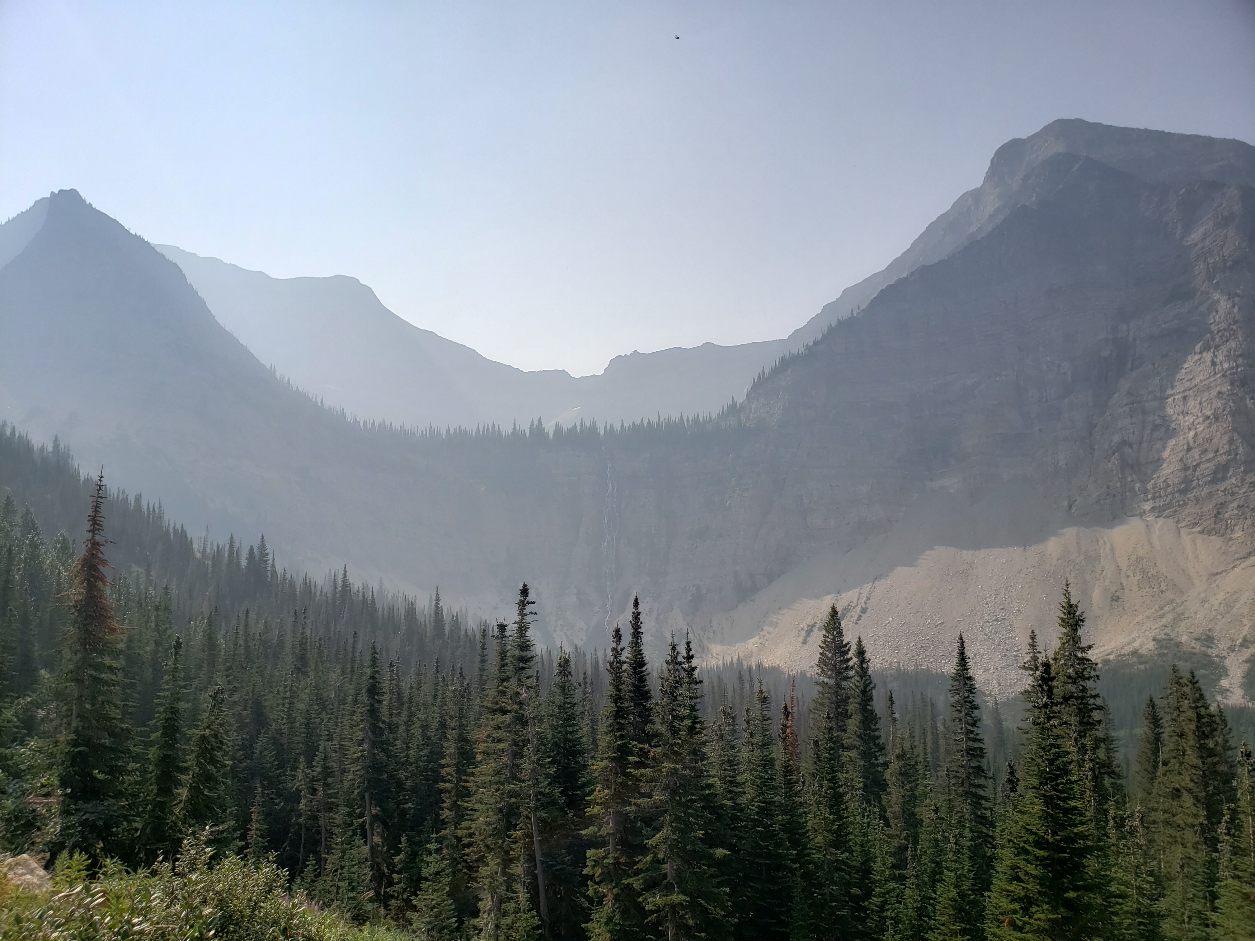
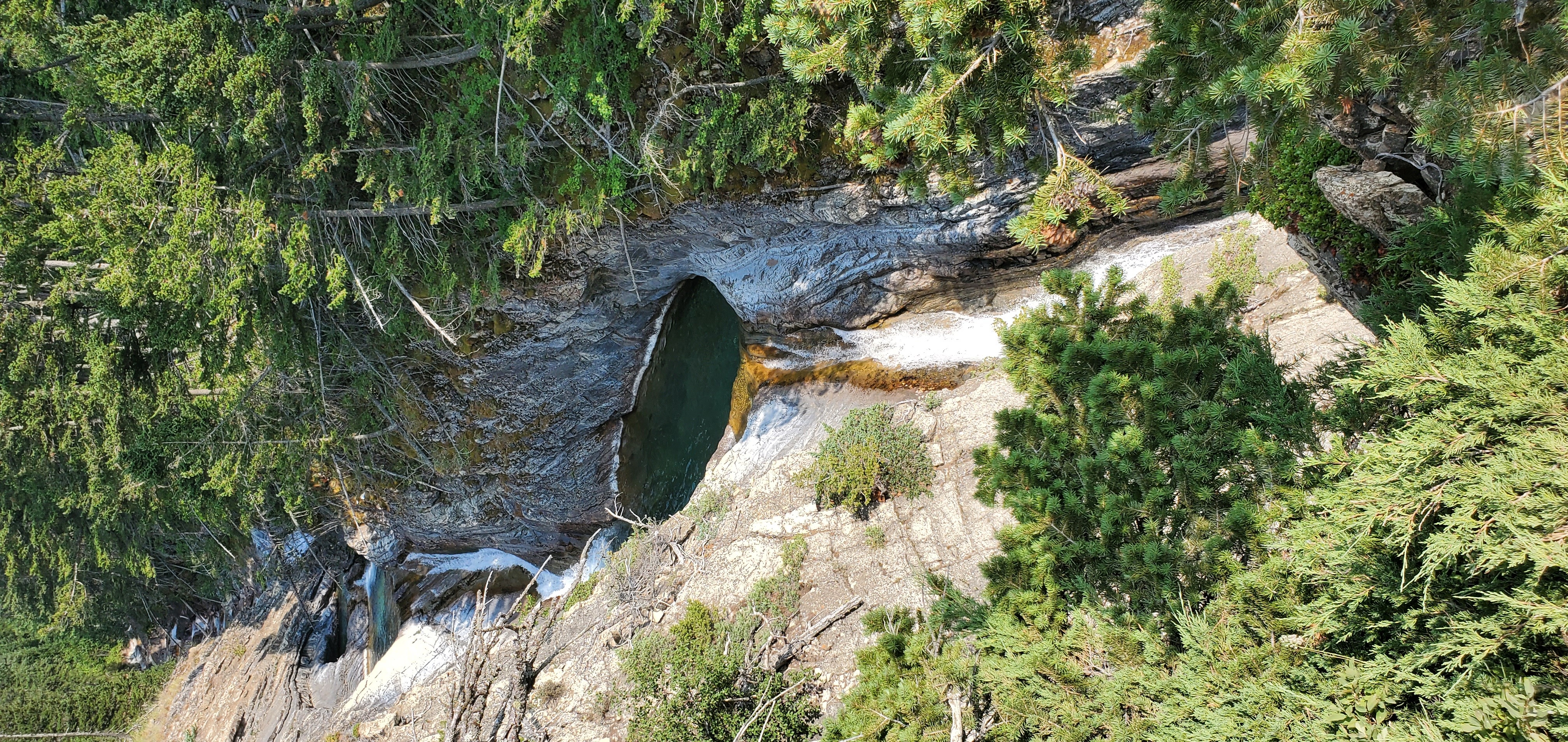
Blakiston Falls
A nice, short, easy hike to some waterfalls.
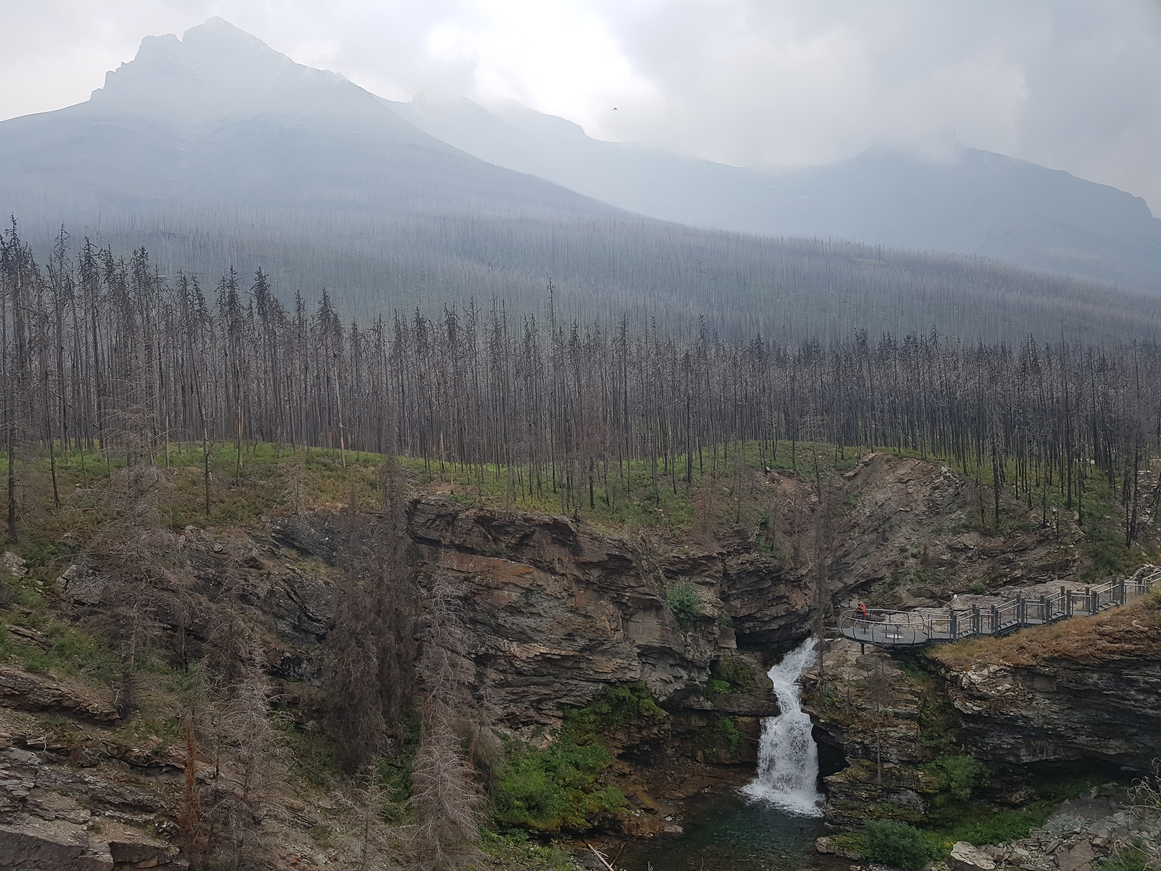
Blakiston Falls and Mount Blakiston, ft. a really really buff dude and his partner.
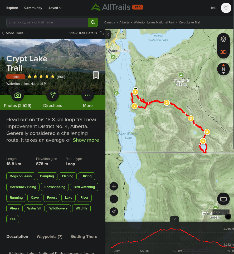
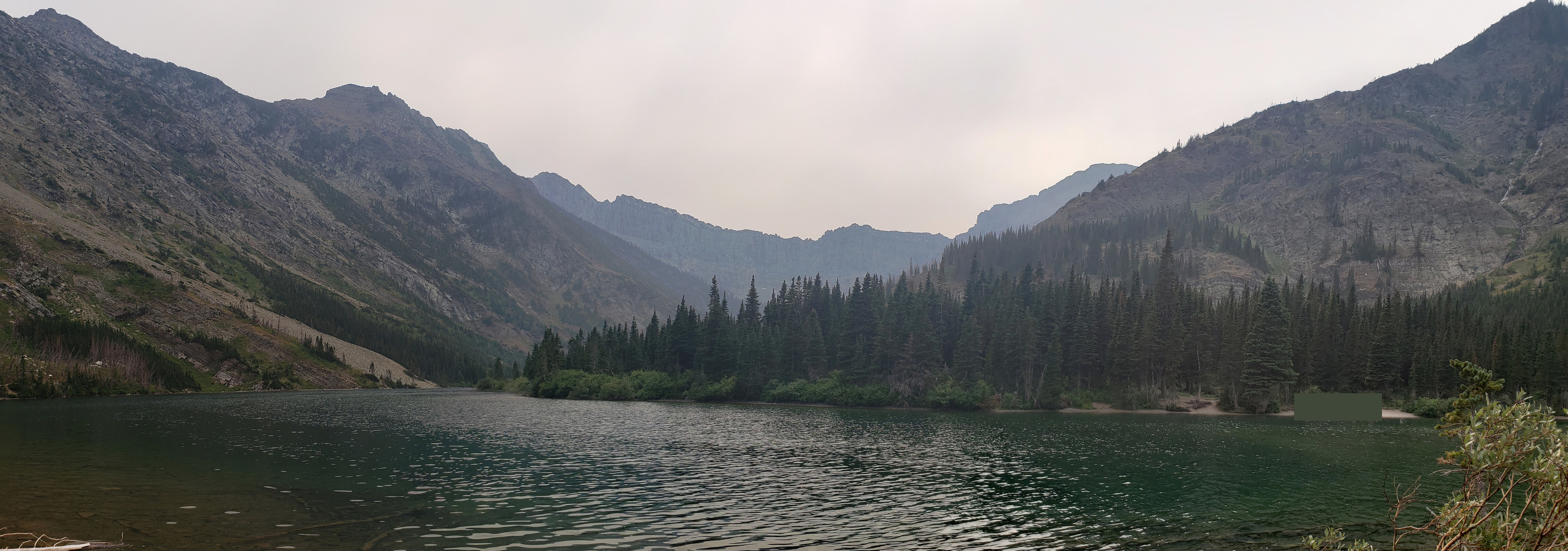
Crypt Lake Trail
Easily the most gorgeous hike I had ever done. You first take a ferry from Waterton to the Crypt Lake Trailhead, then enter the valley between Vimy Peak and Mt Boswell, gradually weaving your way up the mountains. We stopped part of the way up at a little waterfall and (tried) to wade around in a crystal clear, absolutely freezing water pool. The section with the ladder, tunnel, and rope at the end is fun, if not slightly sketchy (having done quite a bit of hiking in Switzerland now, in hindsight, not that bad). The lake is beautiful, and there’s a nice spot for cliff jumping. Across the lake, you can get up a ridge of shale to the leftover snow, where there are some cute little waterfalls leading down into the rock (which I assume eventually makes its way into the lake). We took the detour to Hells Roaring Falls on the way back down, which wasn't quite roaring thanks to dry weather.
The path to Bertha Lake is visible from near Crypt Lake Trailhead, before being swallowed up by the mountains.
Crypt Falls at a distance with some seemingly unnamed peaks on the Glacier National Park side.
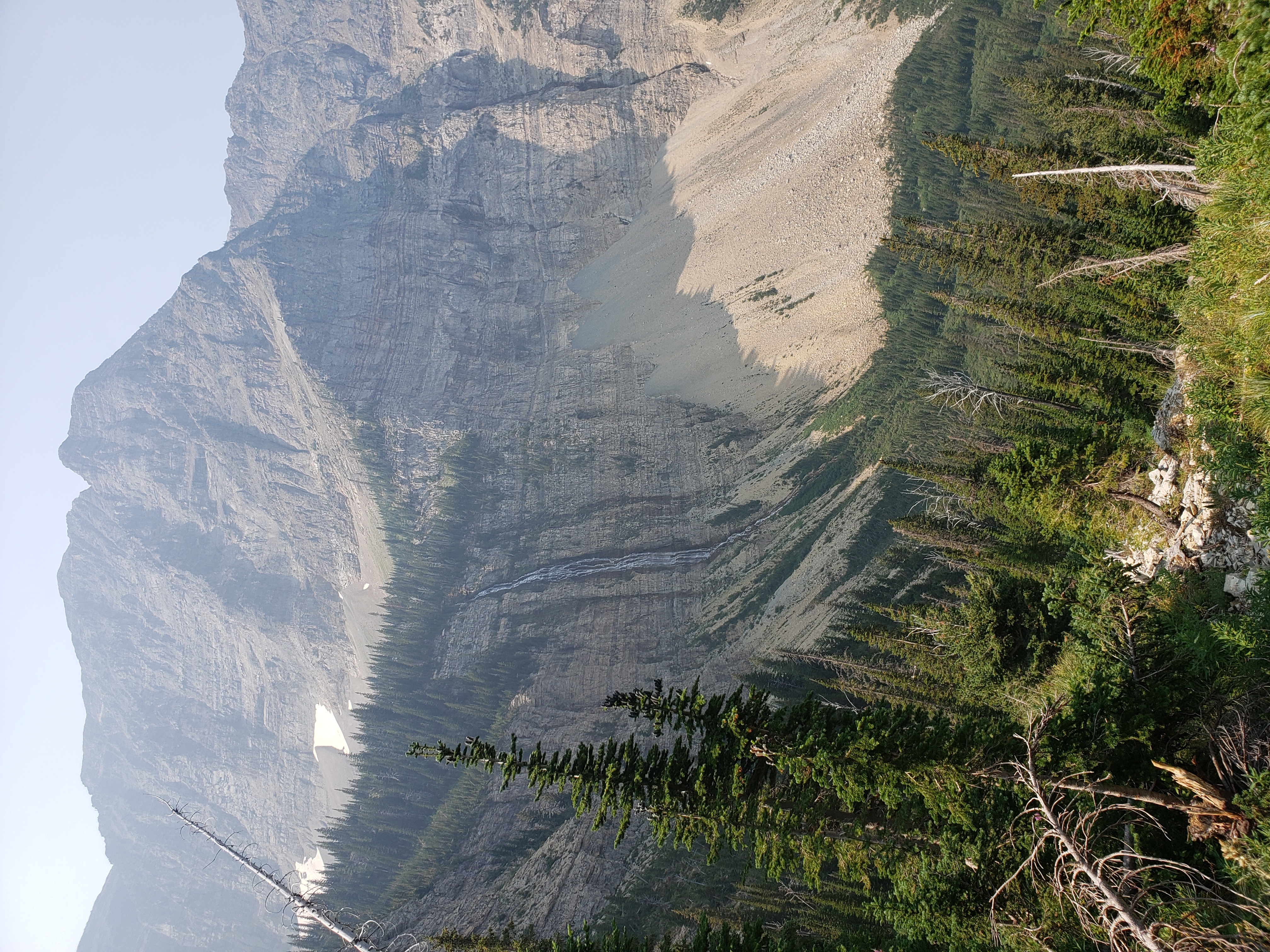
Crypt Falls from a bit closer.
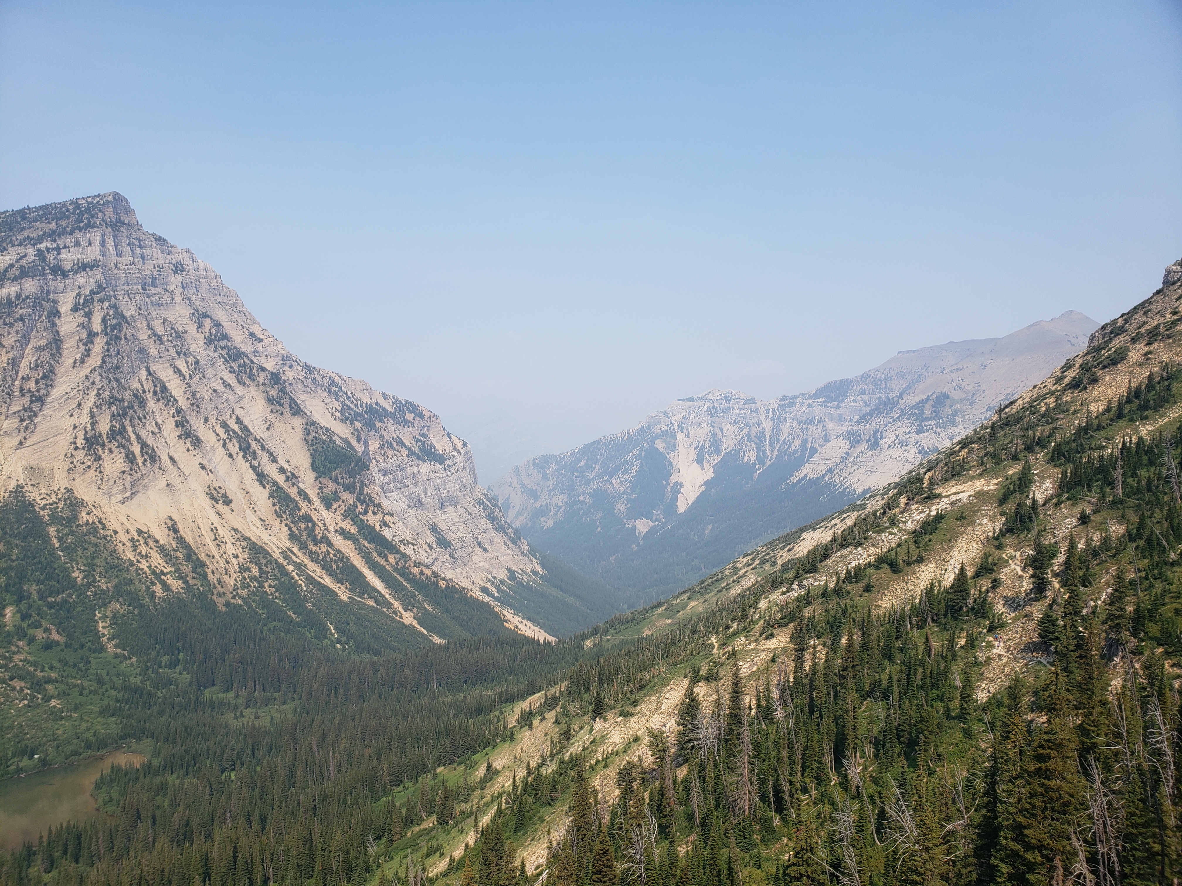
Looking back the way we came, towards Mt Boswell and Vimy Peak.
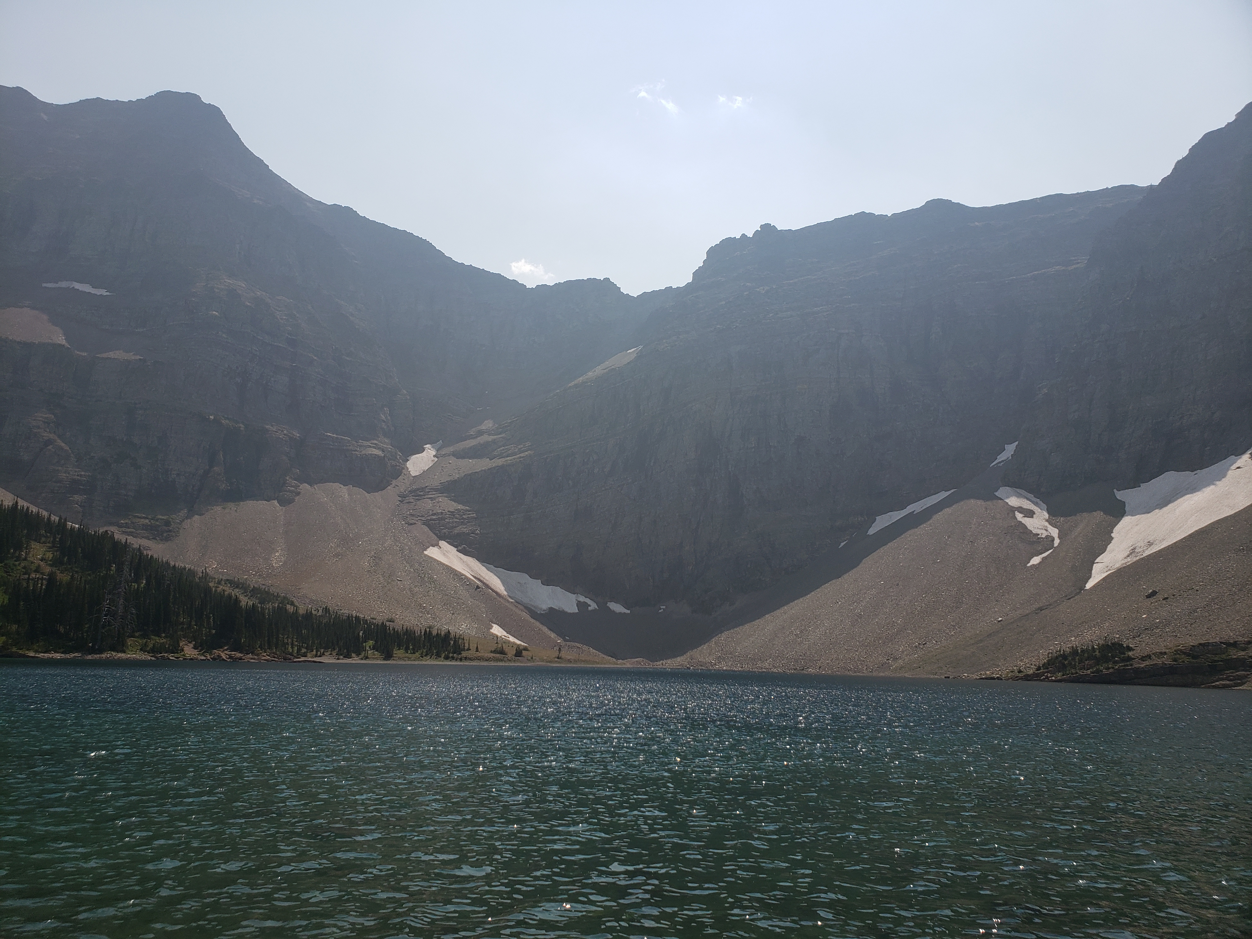
Crypt Lake itself.
Hell Roaring Falls, but not exactly roaring.
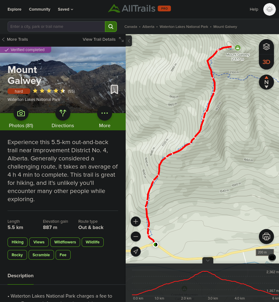
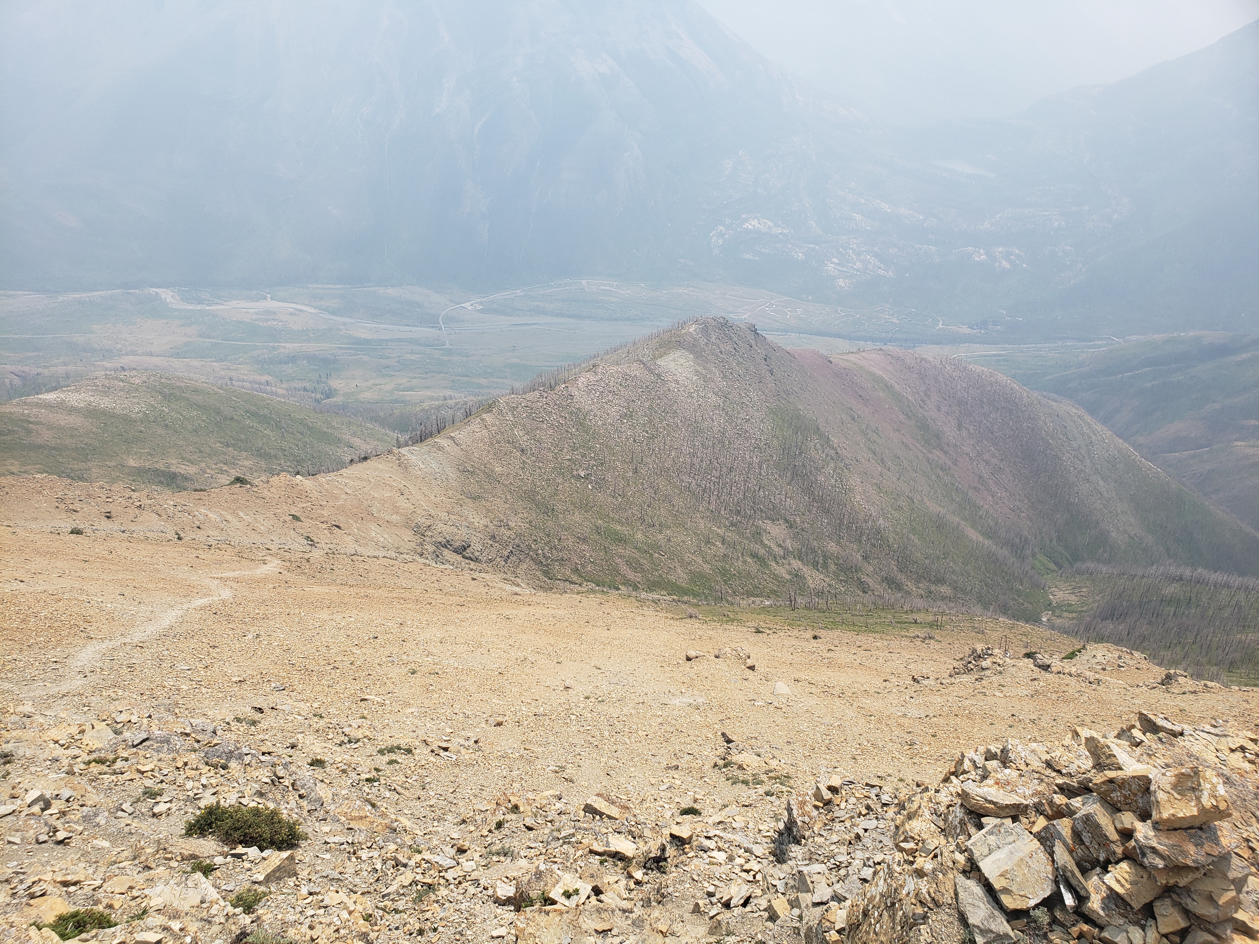
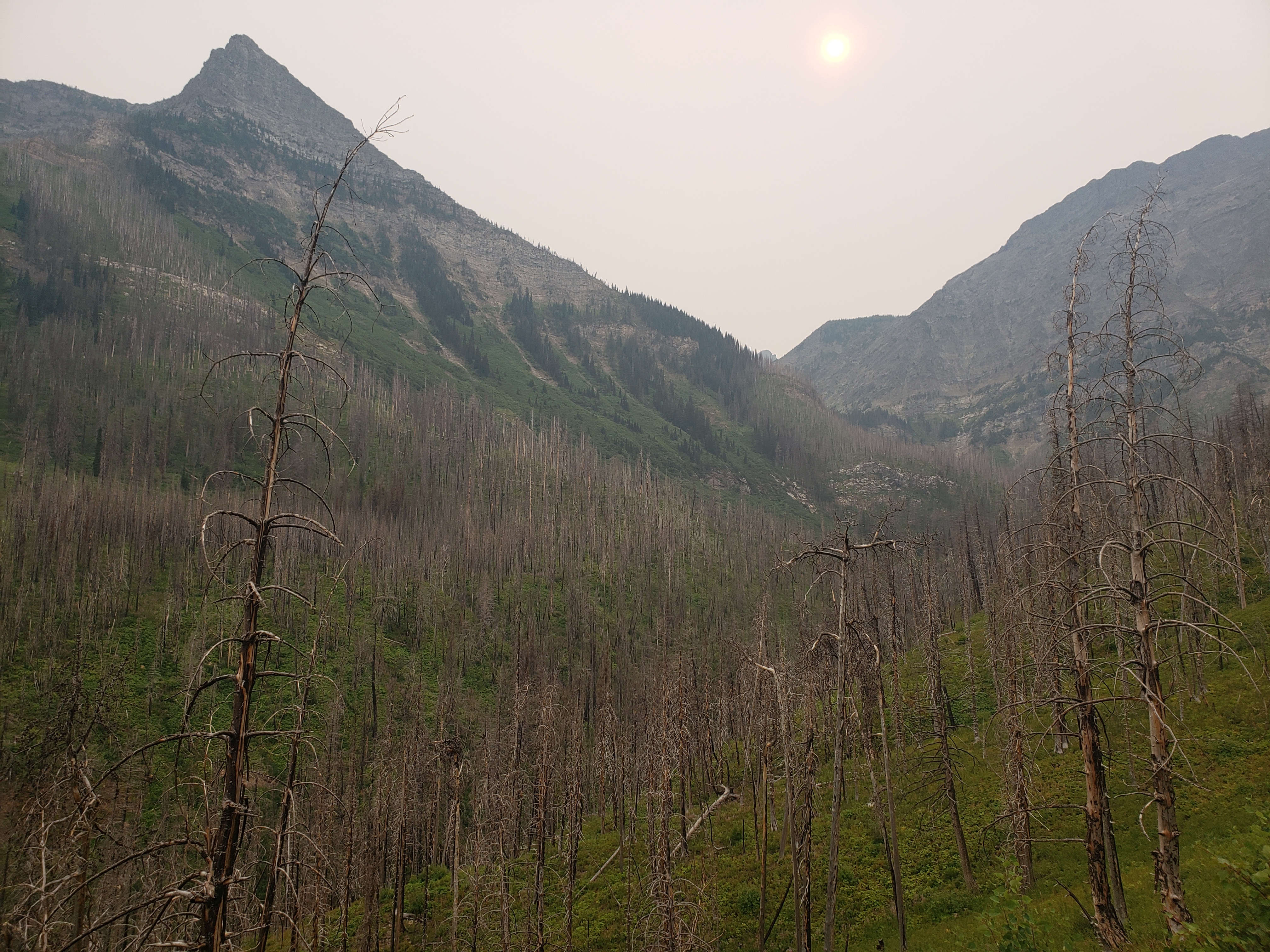
Mount Galwey
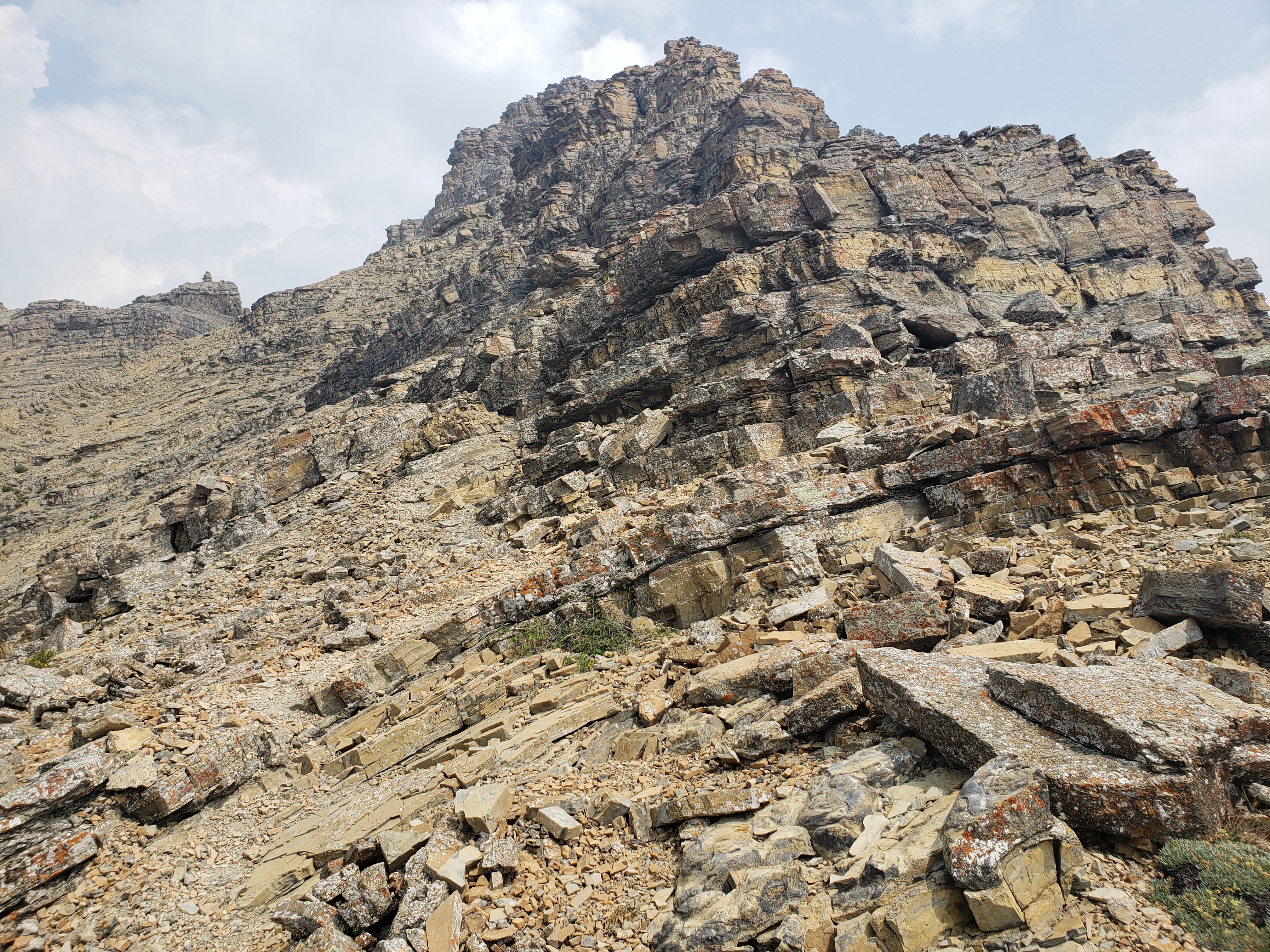
The hardest hike I’d ever done (Switzerland has been really good for beating previous records). While Crypt Lake has 900m elevation gain in 20km (and was still pretty difficult), Mount Galwey does about the same elevation, but in 5.5km. We did some perhaps incorrectd math, for every km of horizontal distance, you’re going one third that upwards, making the average angle of incination 30 degrees. I’d say most of the time, you’re going up 45 degree hills of shale and pebbles. Then there’s the 70 degree shale scramble up to the rocky outcrop at the top, and for every step you take, you lose half your stride because of sliding back down. We ended up stopping before reaching the summit because the trail disappeared and we weren’t experienced enough to try and find out own way. AllTrails said this trail would take 2 hours, but it took us 2.5 just to get to the top and another hour to get down. I’d love to do this again with more experience under my belt (and a lighter pack, and trekking poles).
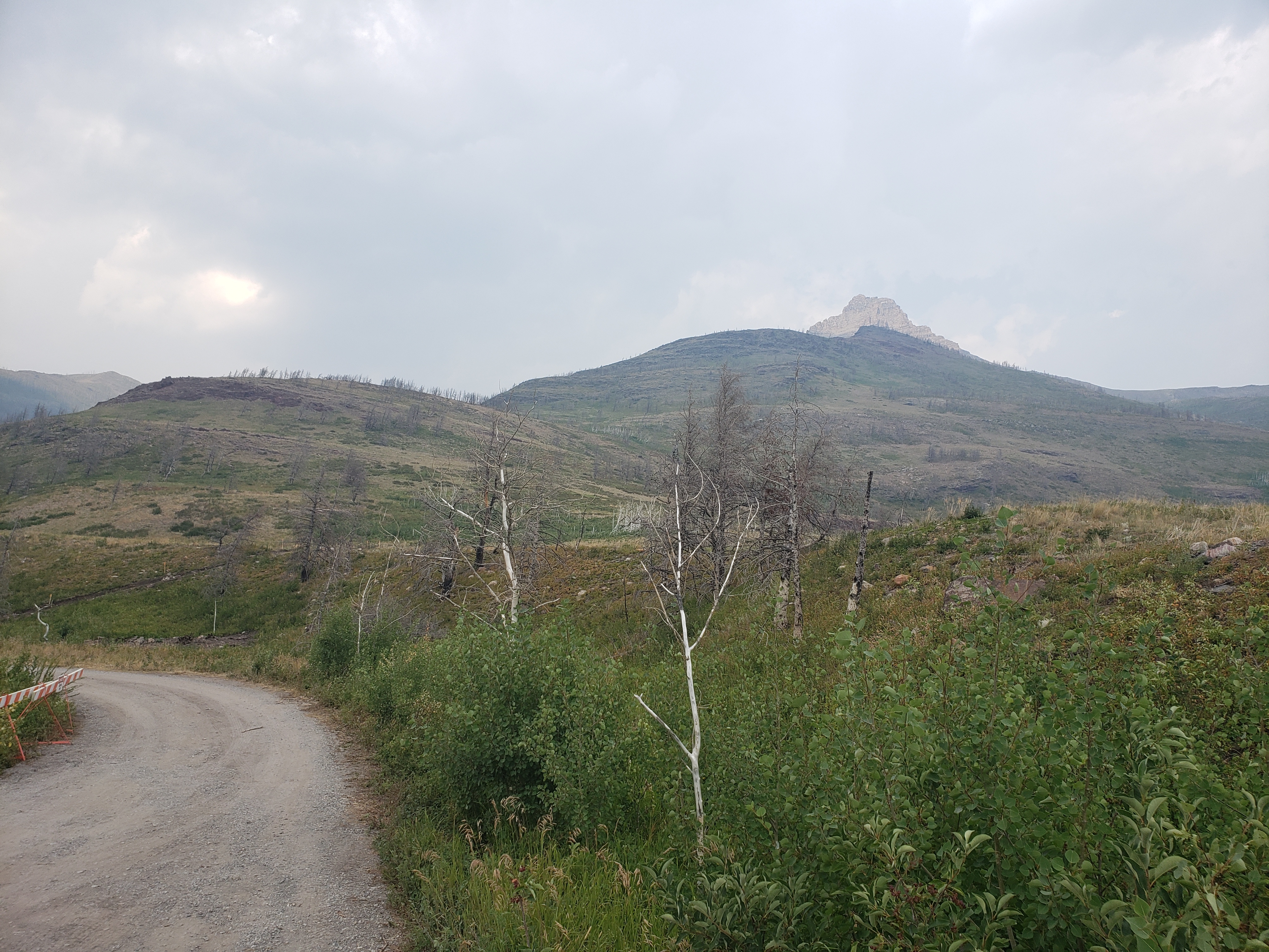
View of Mount Galwey from the parking lot, mostly obscured by the deceptively steep hills on the way.
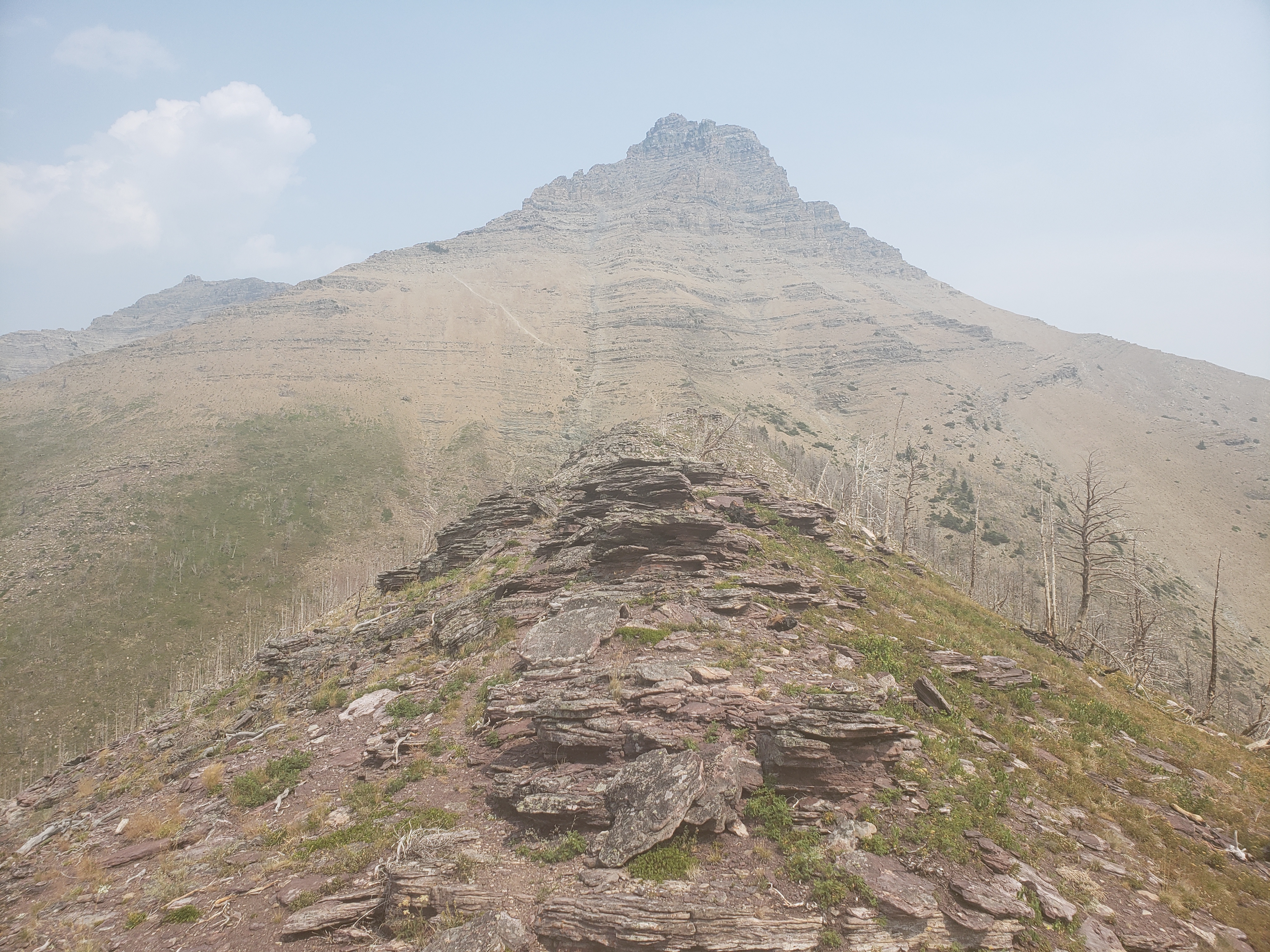
Up most of the hills, the pale line of the scramble is just visible. Lots of dead trees up here from the fires.
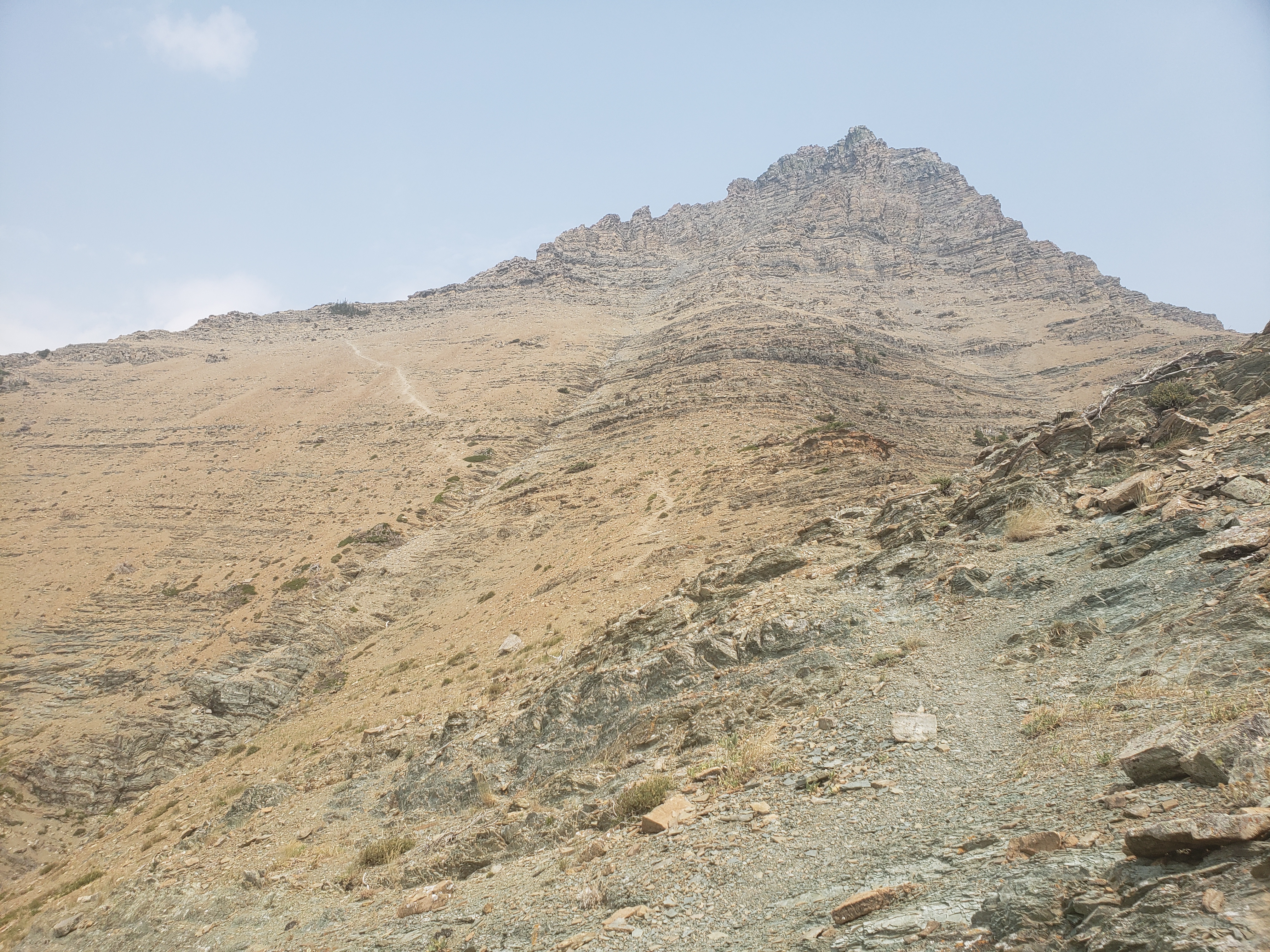
Past the hills, now for scrambling.
Looking back from part-way up the scramble.
As far as we got; no-one had serious mountain experience, so we figured better safe than sorry.
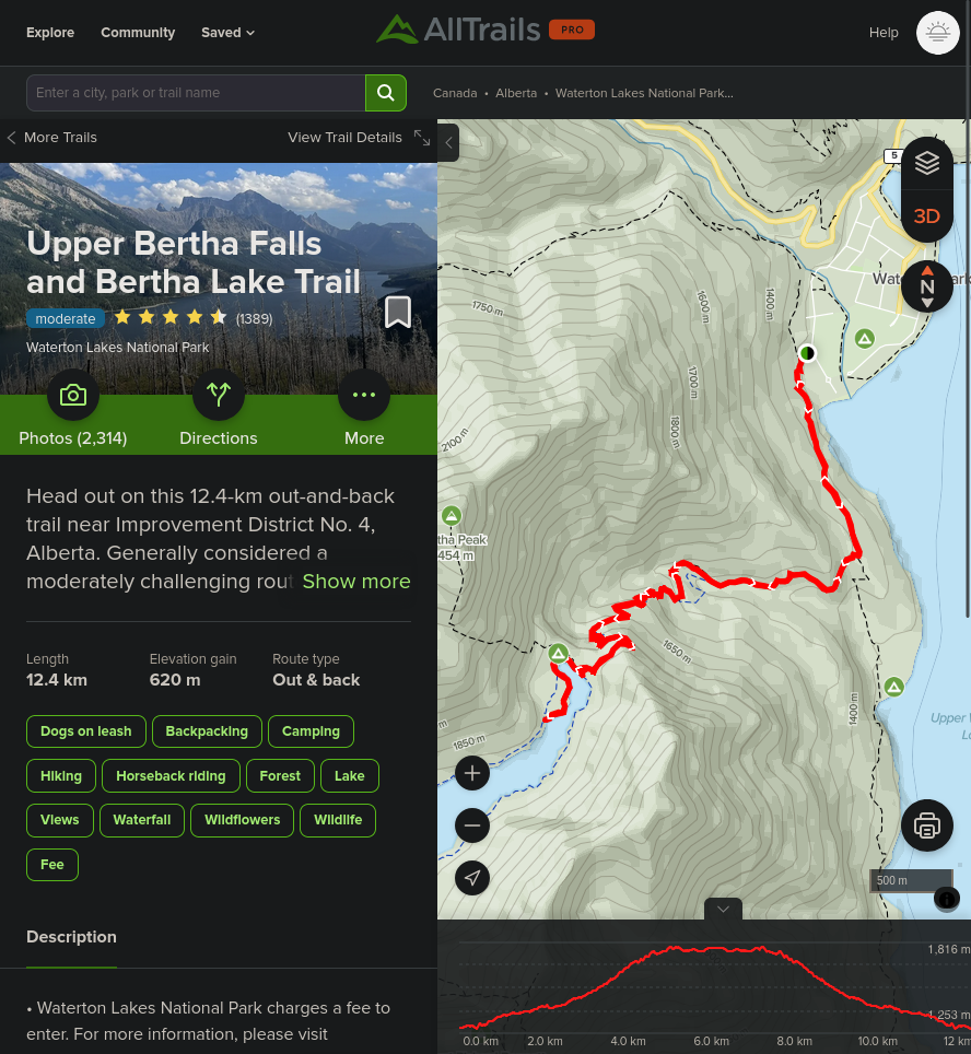
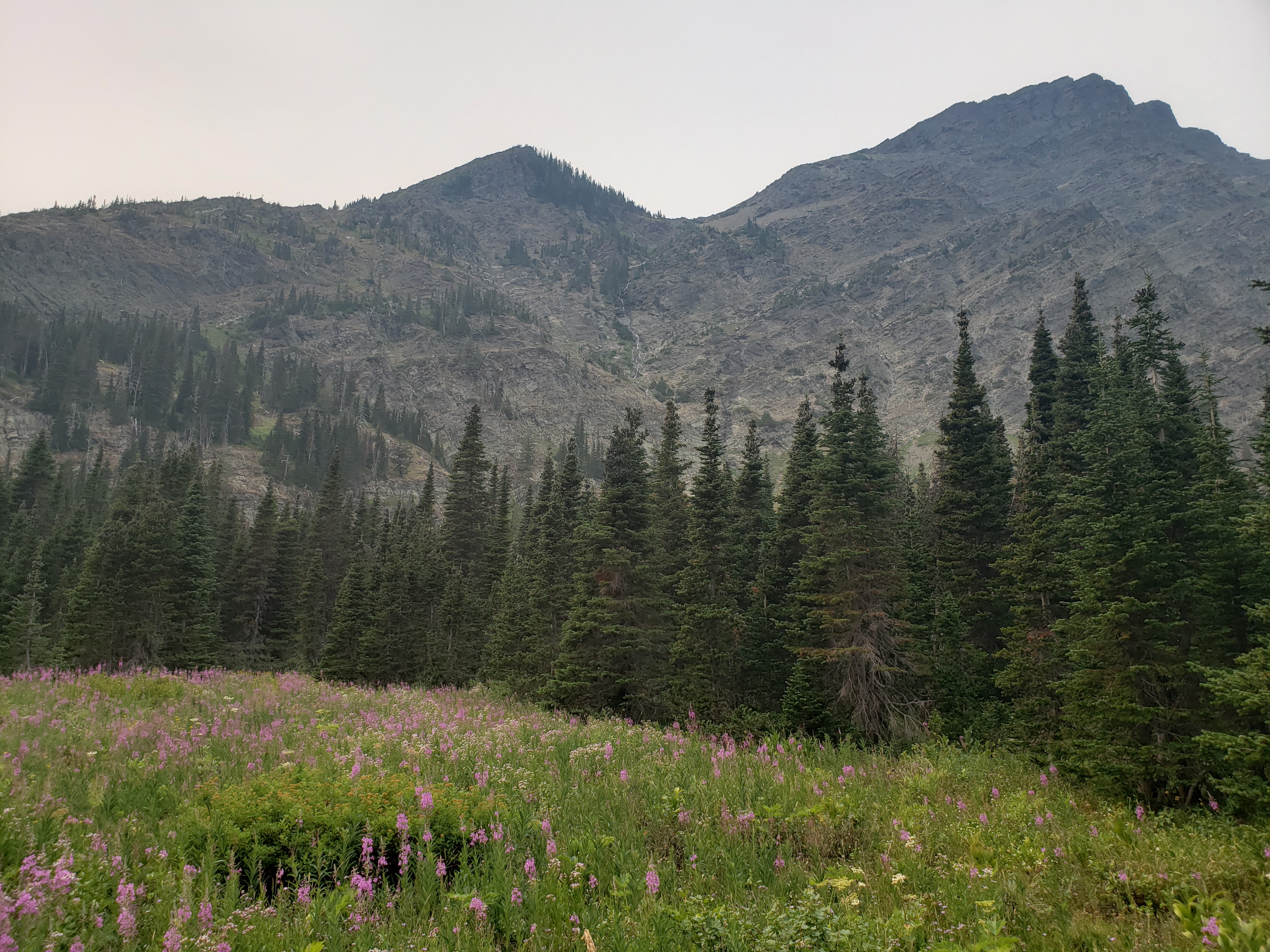
Lower Bertha Falls, Upper Bertha Falls, Bertha Lake
Very similar to Crypt Lake, in that you're ascending pretty continuously first through burnt-out forest, then higher-altitude survivors, and finally arriving at a bowl in the mountains with a lake. While Crypt Lake arguably was unbeatable in terms of view and hike experience, Bertha Lake has relative obscurity on its side, and actually allowed camping (not that we took advantage of this).
Vimy Peak, Mt Boswell, and the route to Crypt Lake are visible from across Upper Waterton Lake.
As are Bear's Hump and Waterton itself.
Bertha Peak and Mt Richards, facing back the other way.
View of Mt Richards, Mt Alderson, and Bertha Peak from the south end of Bertha Lake. Covered section is some other hikers.
Facing Bertha Peak from the west side of Bertha Lake.
Cameron Lake Trail
Did this little trail while the famjam was fishing. Cute with lots of berries at the end.
Cameron Lake with Mt Custer on the american side.
Route Maps