Jungfrau Region
I had some Endgame-level convergence of family the last week, and decided to take the group to one of the most stereotypically pictureque parts of Switzerland: the Bernese Oberland/Lauterbrunnen valley. Our original plan was to hike the Eiger trail, then the Mountain View Trail from Lauterbrunnen to Murren and spend the first night there, then hike to the Gspalthornhütte the second day, then the Blüemlisalphütte the third, and finally down to Oeschinensee on the last.
Day 1
We got to the Eigergletscher and discovered what felt like a half foot of snow covering the trail and surrounding hills. We figured that, if there’s already snow at 2300m, then 2800m is faring quite a bit worse, and sure enough, a quick webcam check at the Gspalthornhütte revealed a not insignificant amount of snow on and around the hut; I managed to rip a hole in my hiking boots without realizing when on Säntis and had only brought runners, as had a couple other family members, so we decided to scrap our plan and stick around the valley. We ended up visited Trümmelbachfälle that afternoon and called it a night in Gimmelwald at the Mountain Hostel Gimmelwald (which was very cute, if not a little rowdy).
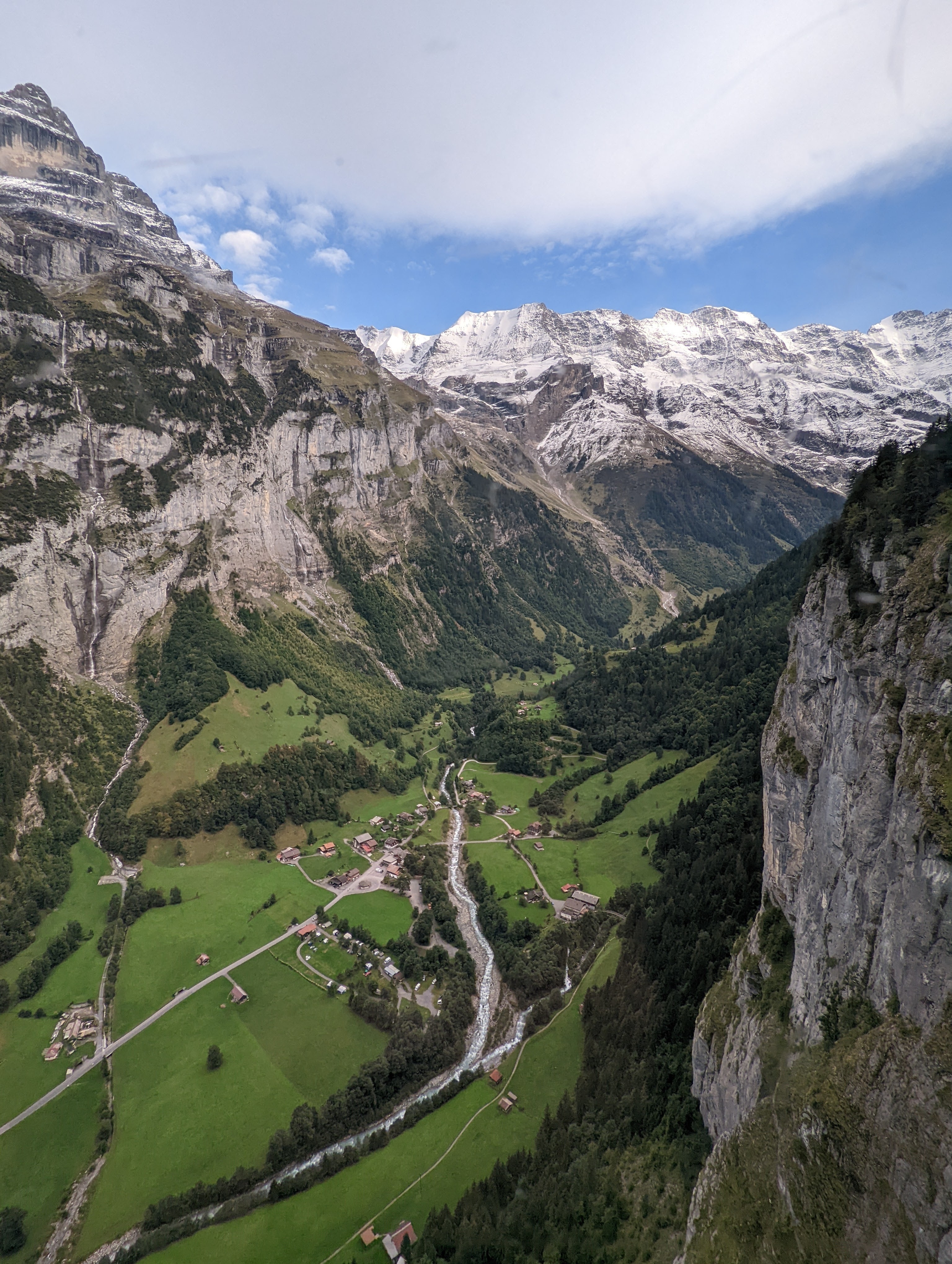
Looking down the valley from the train to the Eigergletscher, photo probably taken somewhere around Wengen. Apparently this area was Tolkien's inspiration for Rivendell. In the spring, waterfalls drop off the cliffs into the valley below.
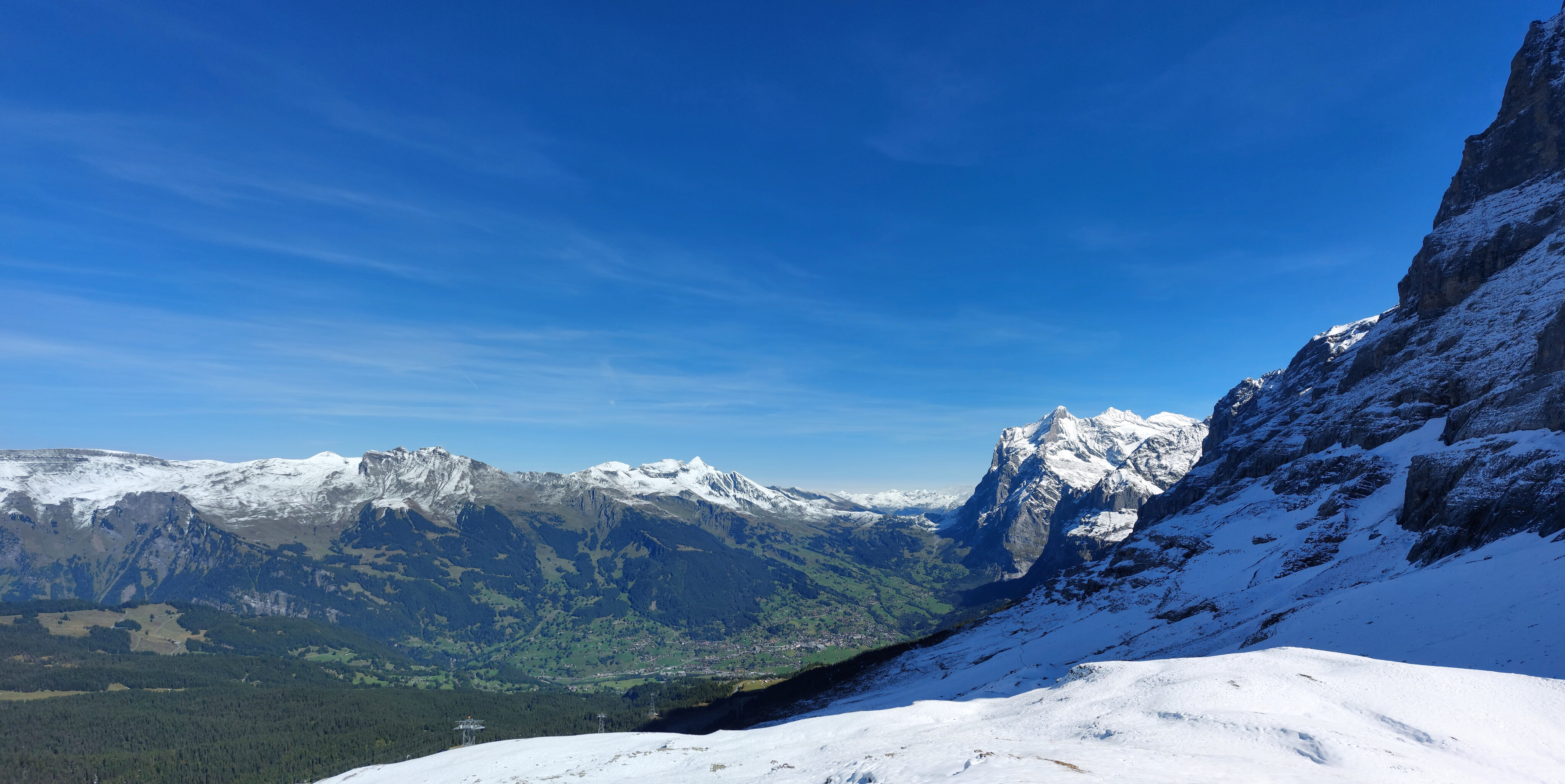
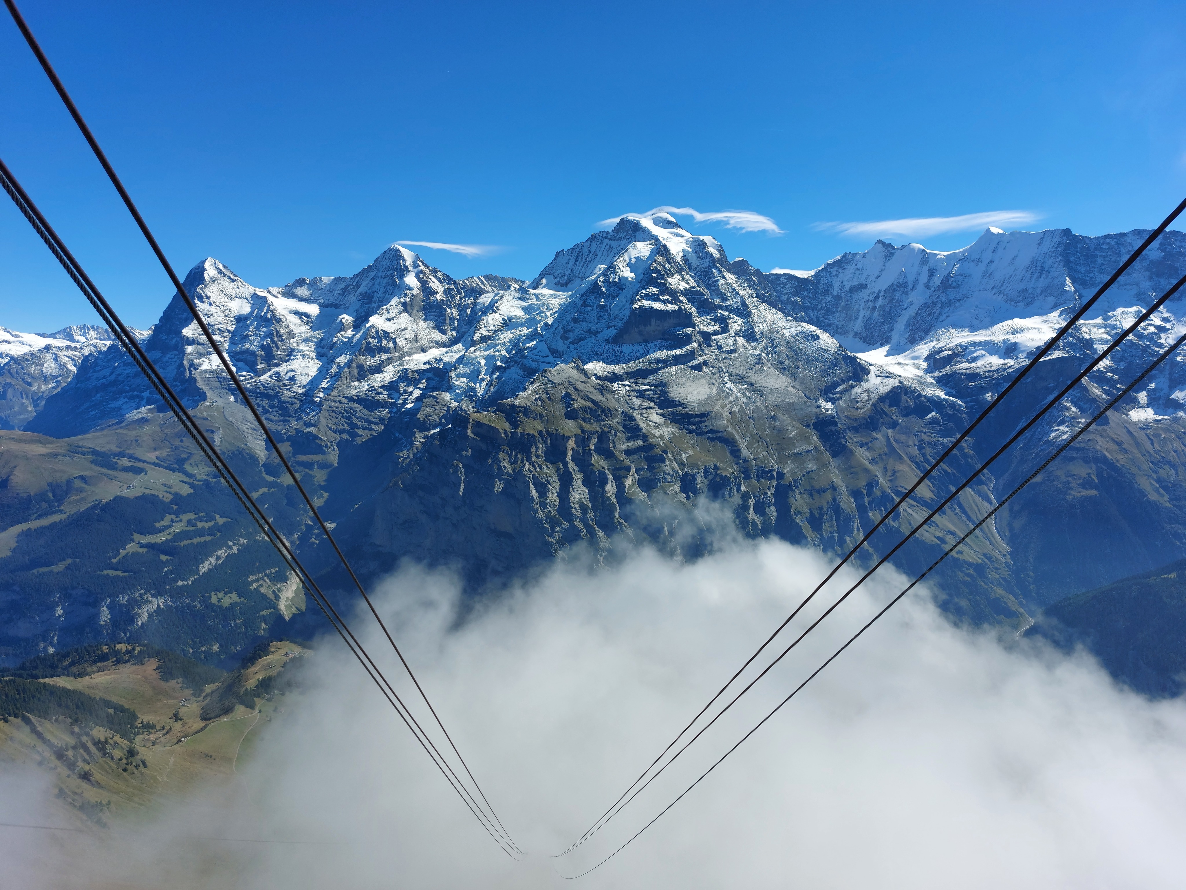
Eigergletscher and Mönch.
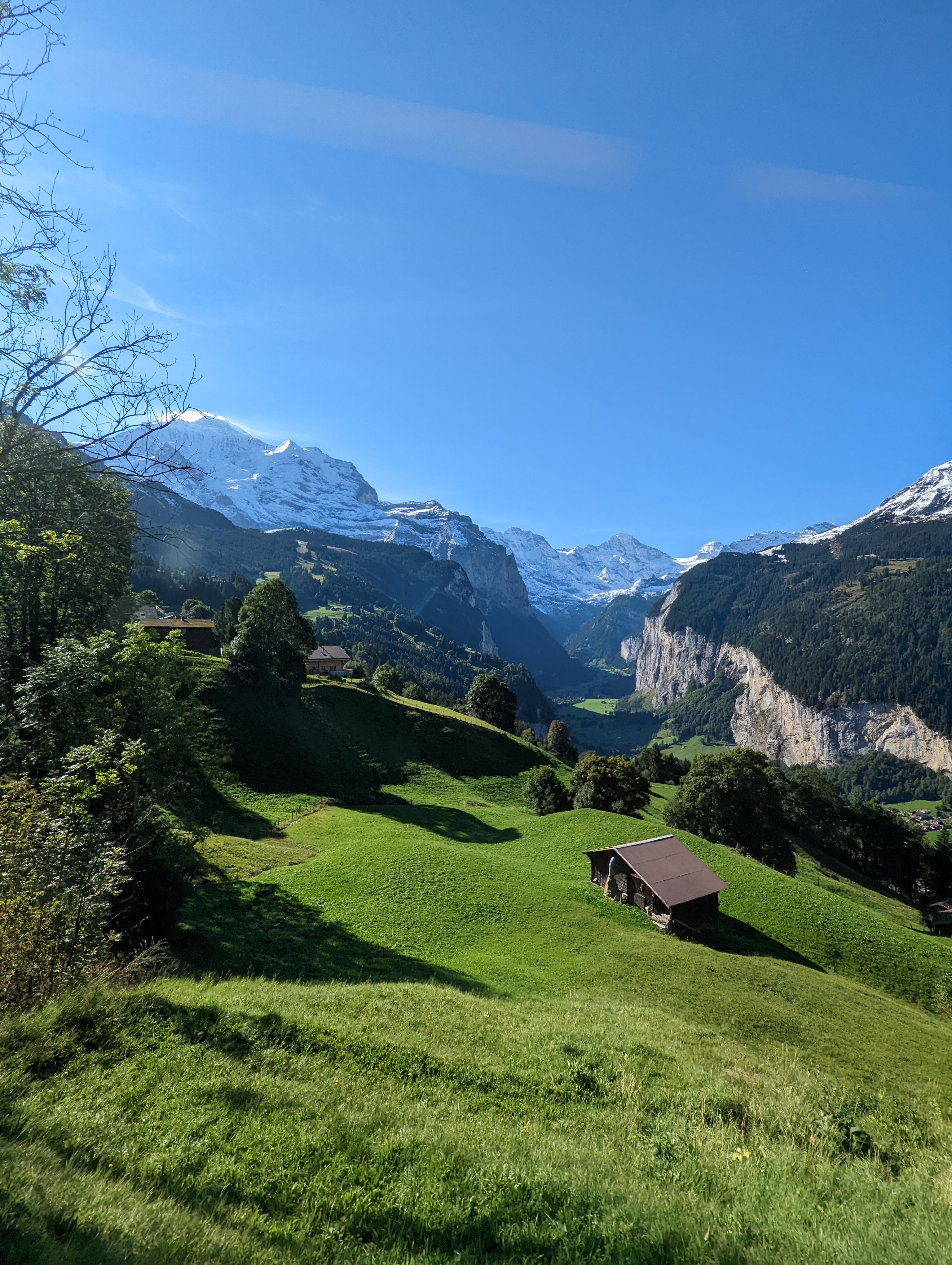
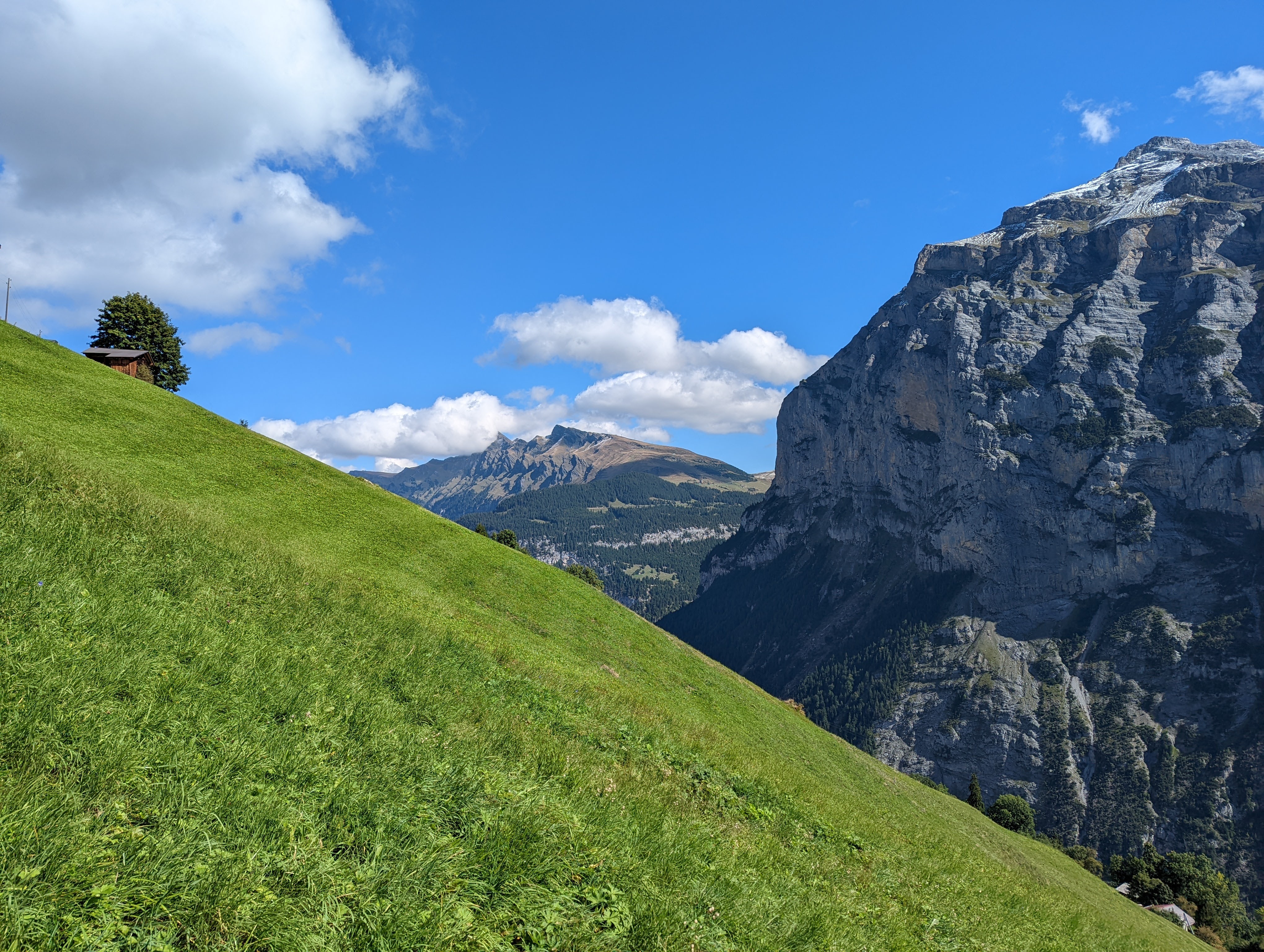
Gimmelwald across the valley, where we'll be staying for the night. Piz Gloria is just visible on the Schilthorn. Most of the low snow will melt off by the afternoon, which explains the green-and-brown hills of the pictures of day 2.
The town of Grindelwald with the Wetterhorn looming to the right.
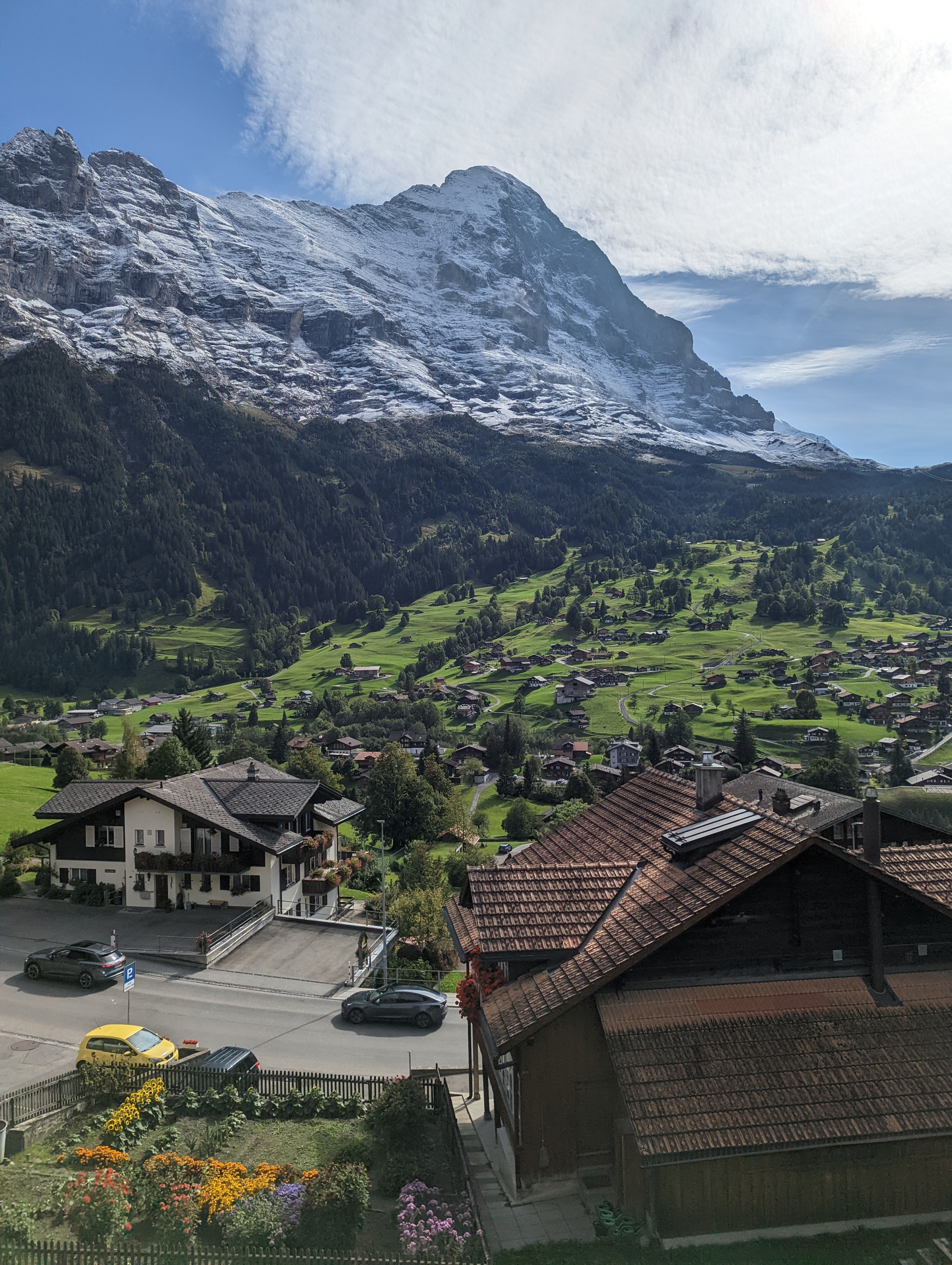
The Eiger as seen from Grindelwald train station.
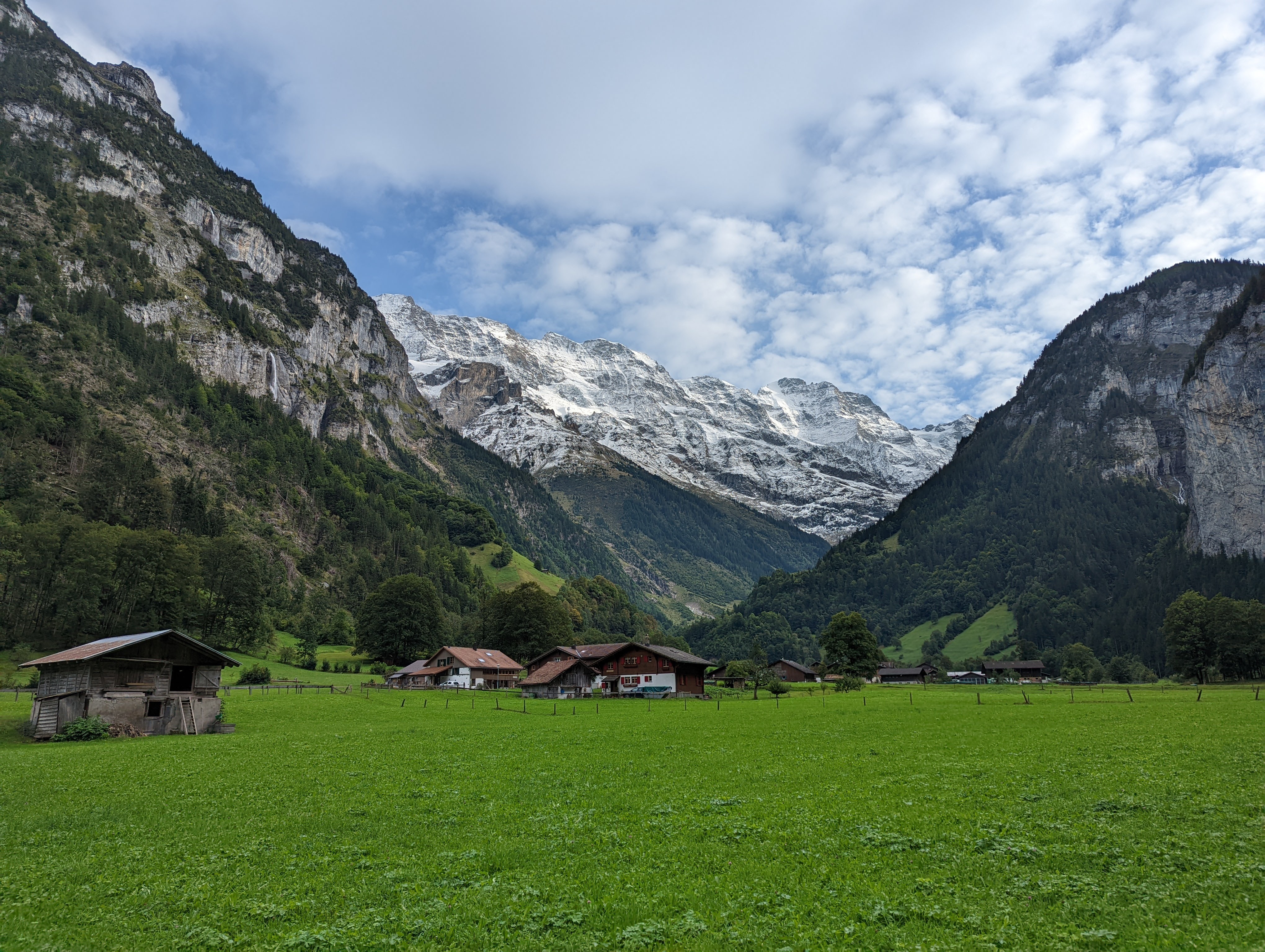
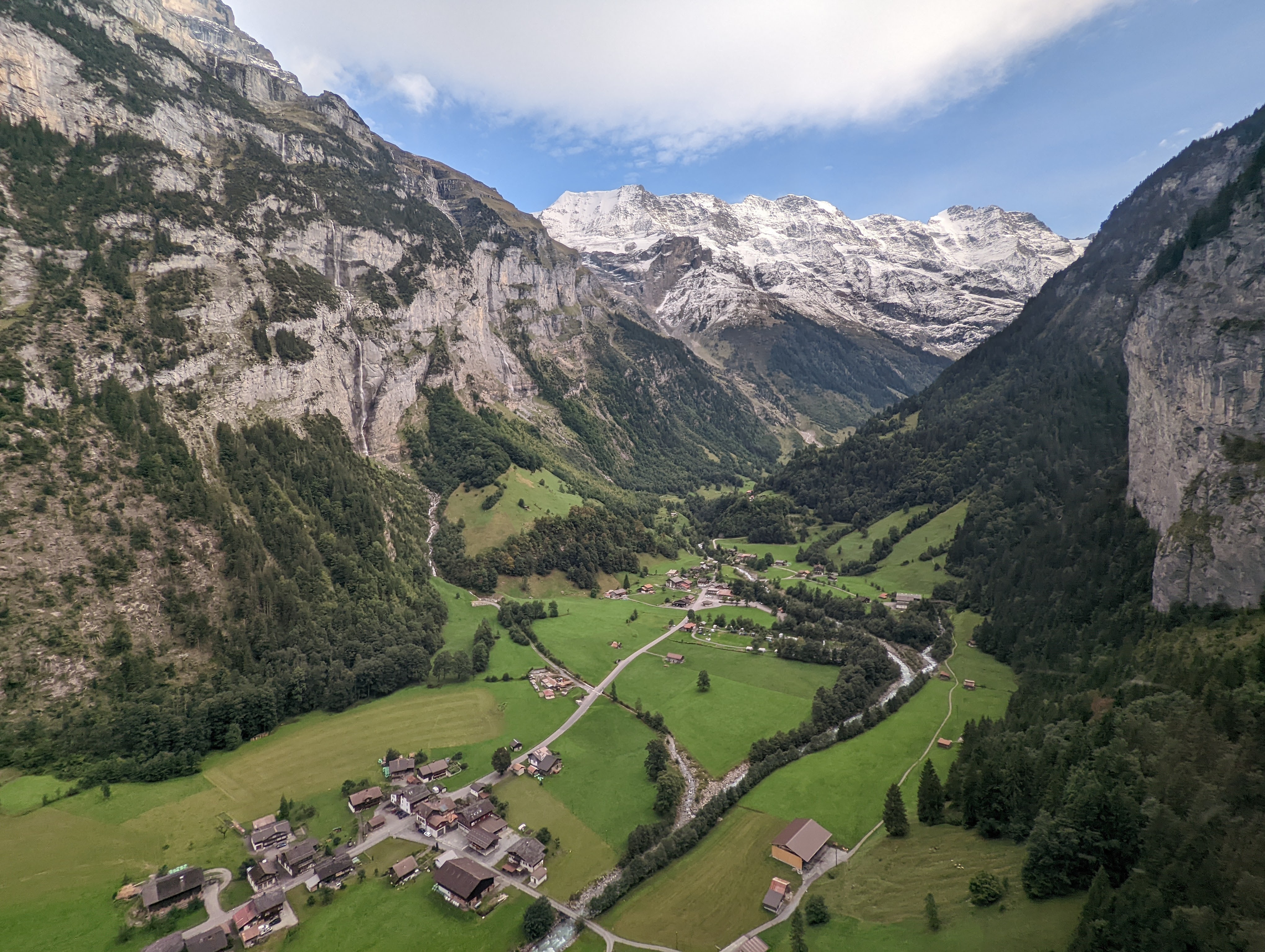
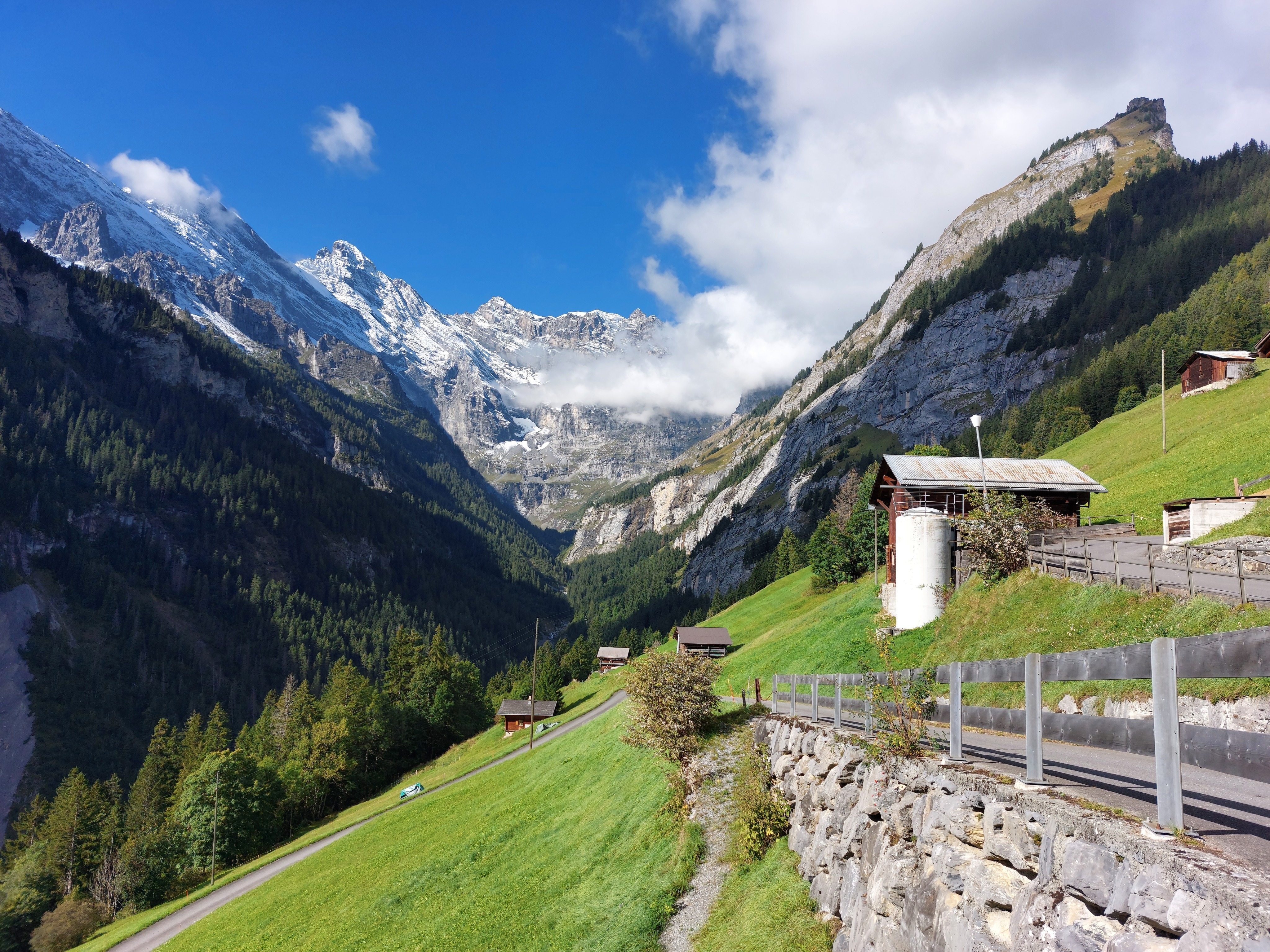
End of the Lauterbrunnen valley, just past the cable car up to Gimmelwald (Stechelberg); the town is only accessible by cable-car.

Going up!
And up.
Maybe three pictures of this was overkill. Maybe it's really pretty. Maybe it's Maybelline.
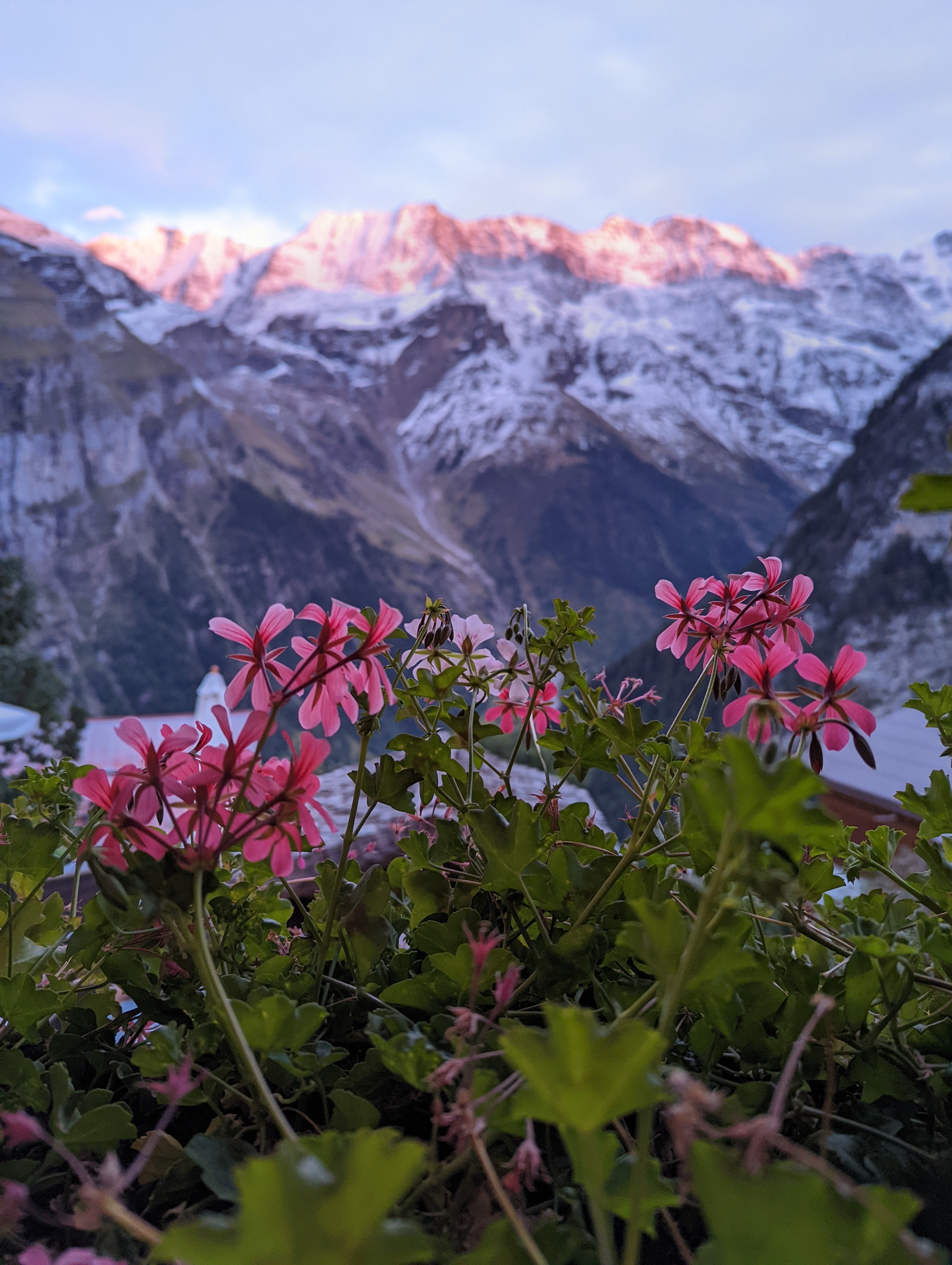
Flowers outside our room, the sun just peeking out in the early morning.
Day 2
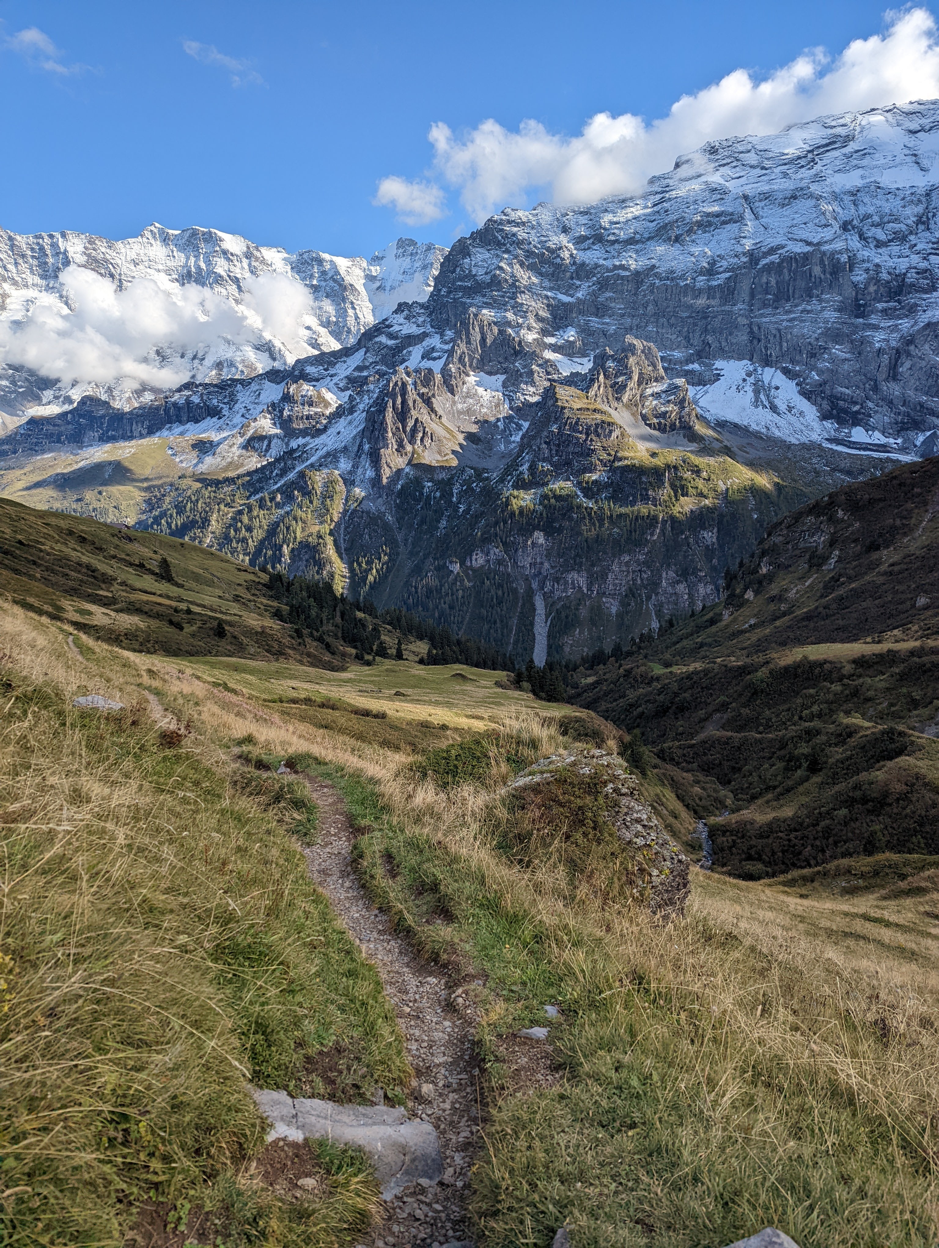
We hiked up to Bryndli, then to the Rotstockhütte, and finally back down through the valley to Gimmelwald. Near the hut, we encountered two hikers who had attempted to visit the Gspalthornhütte and turned around due to copious amounts of ice on the trail; I had previously been a little on the fence about our decision to cancel our original plans, since the snow near the Eigergletscher had melted by mid-day, but their anecdote help squash the regret I was nurturing. On the way back down, we ended up stuck behind a small army of cows which had migrated to lower pastures for the winter; the trail was a churned mess of mud. Minus the hour spent navigating this and some packs of very stubbern trail-hogging bovine, it was a really fun hike, with some great views, including a from-below view of Piz Gloria.
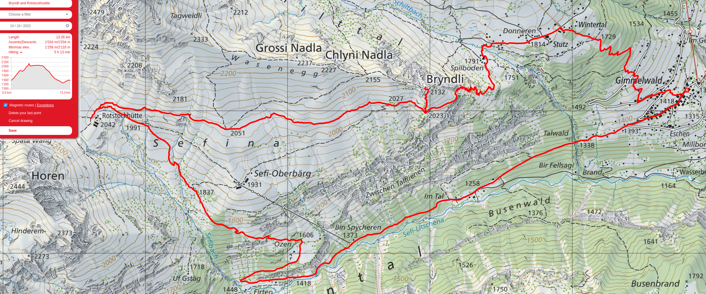
The valley we hiked day 2 (Sefinental), with the highest peak on the right our destination for the day (Bryndli). We continued to the end of the valley along the top, then descended and returned along the base.
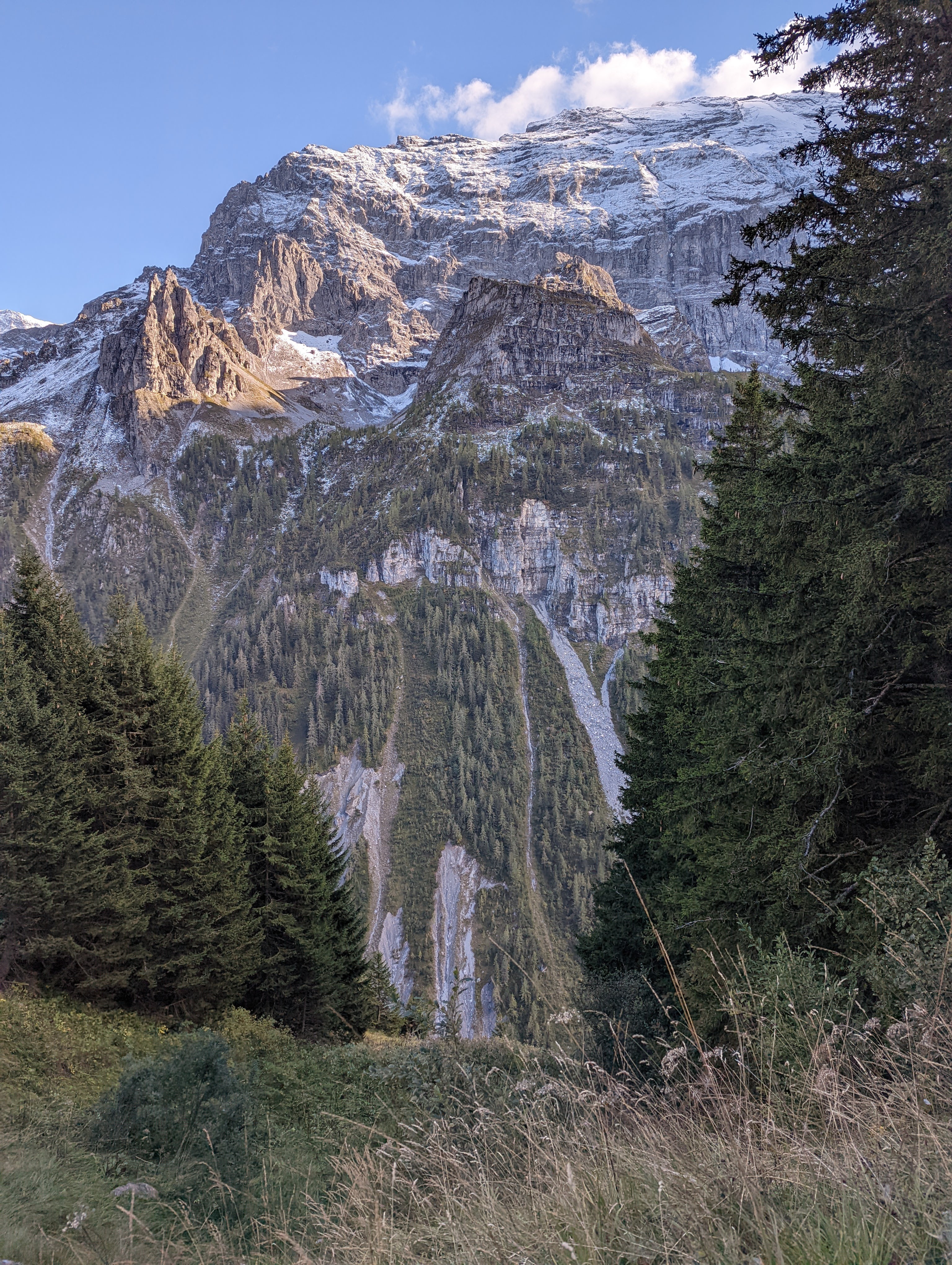
Sometimes photos are oversaturated by the taker or the phone. Sometimes Switzerland decides to crank up its own saturation slider.
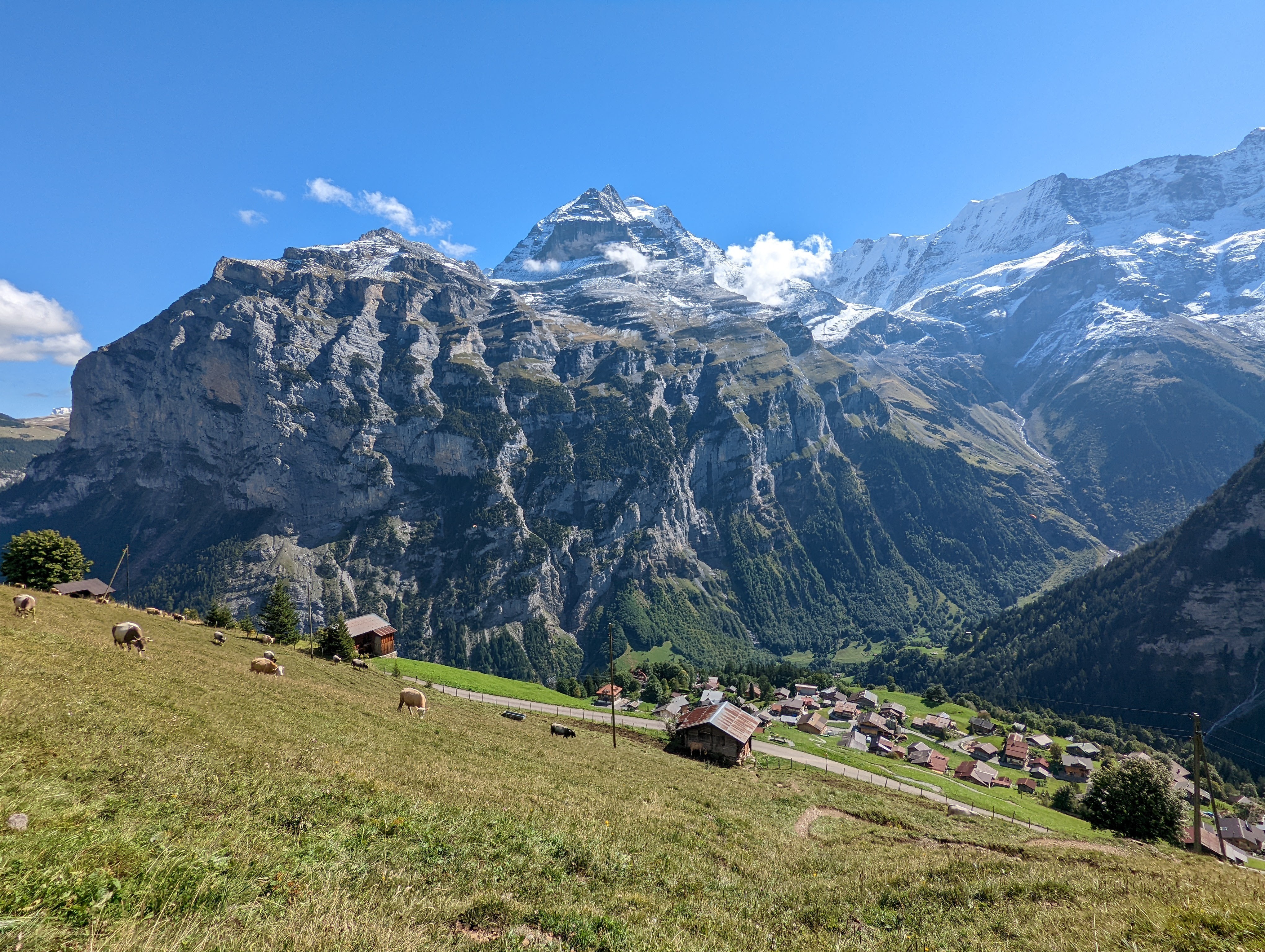
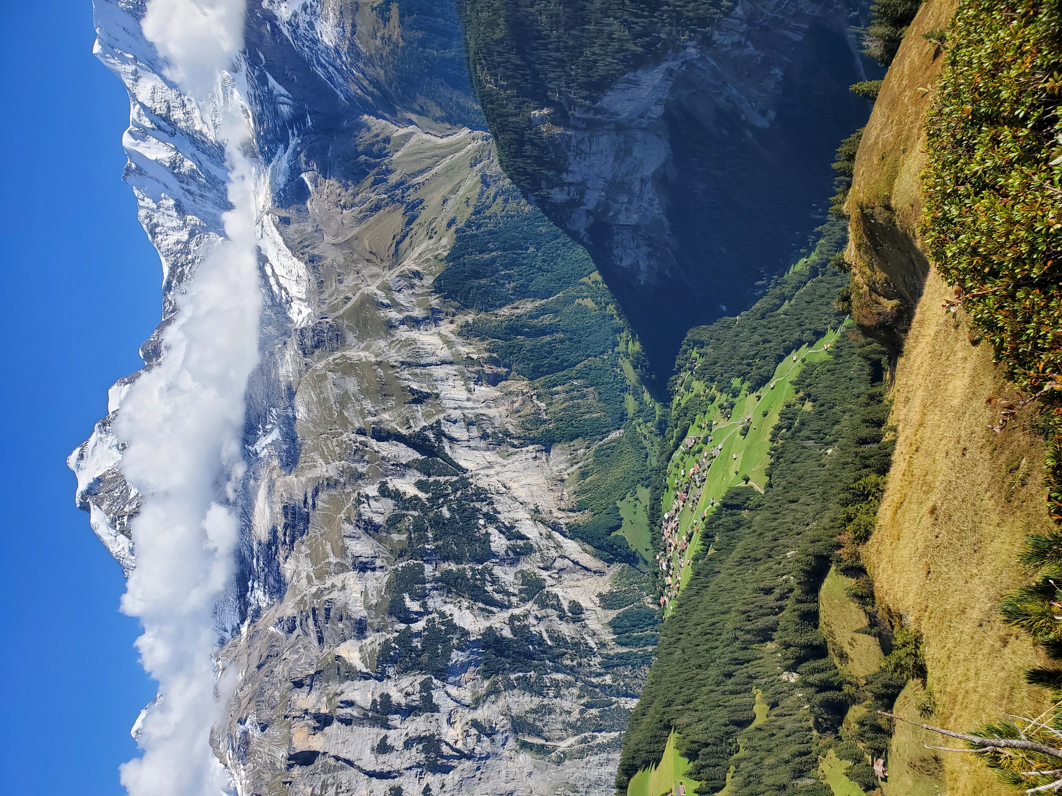
The Jungfrau peeking out with our starting point, the town of Gimmelwald, below. Gimmelwald is actually on the cliff about 500m above the valley floor, so the "ground" is quite a bit lower.
Ah, dog.
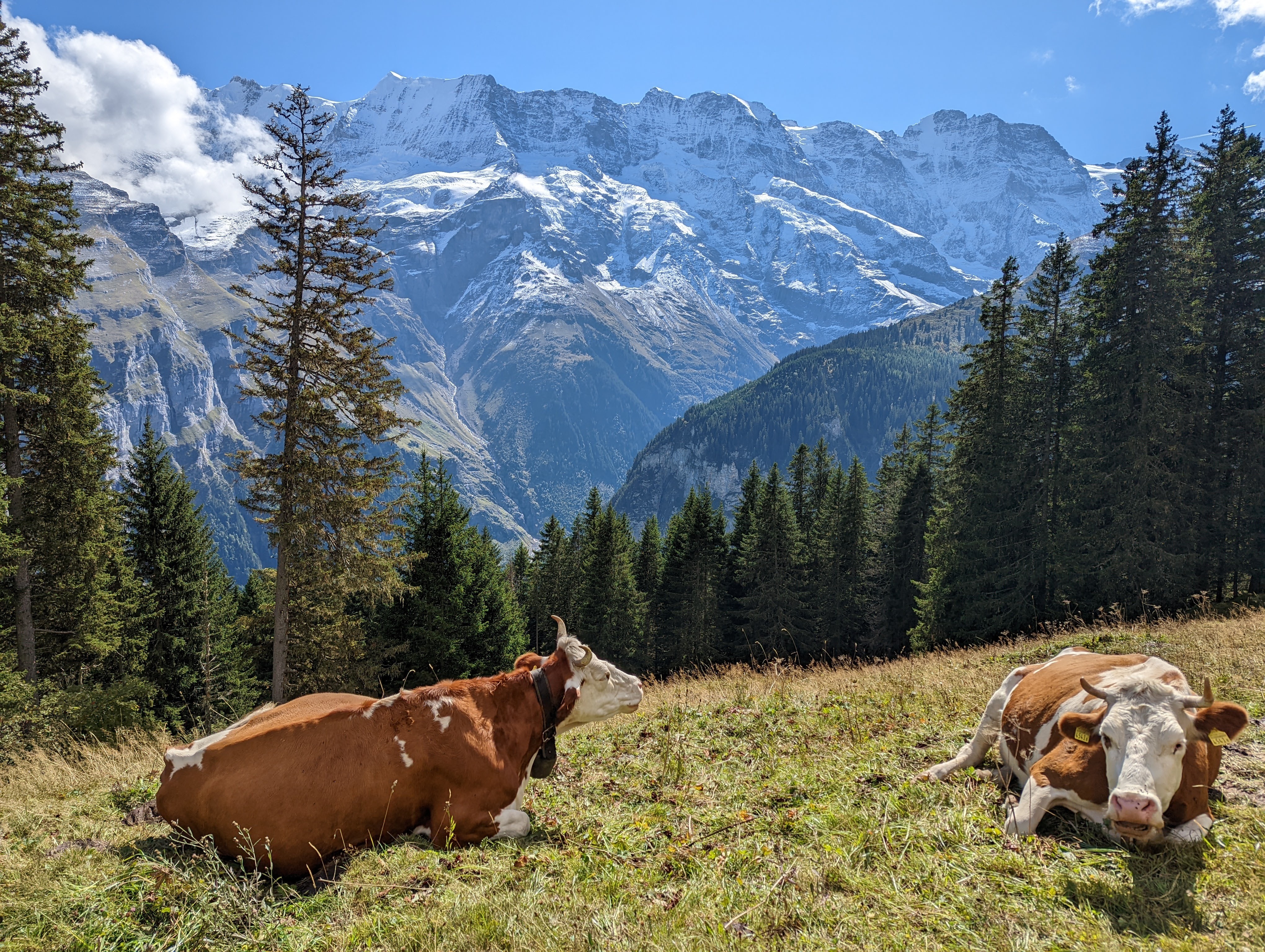
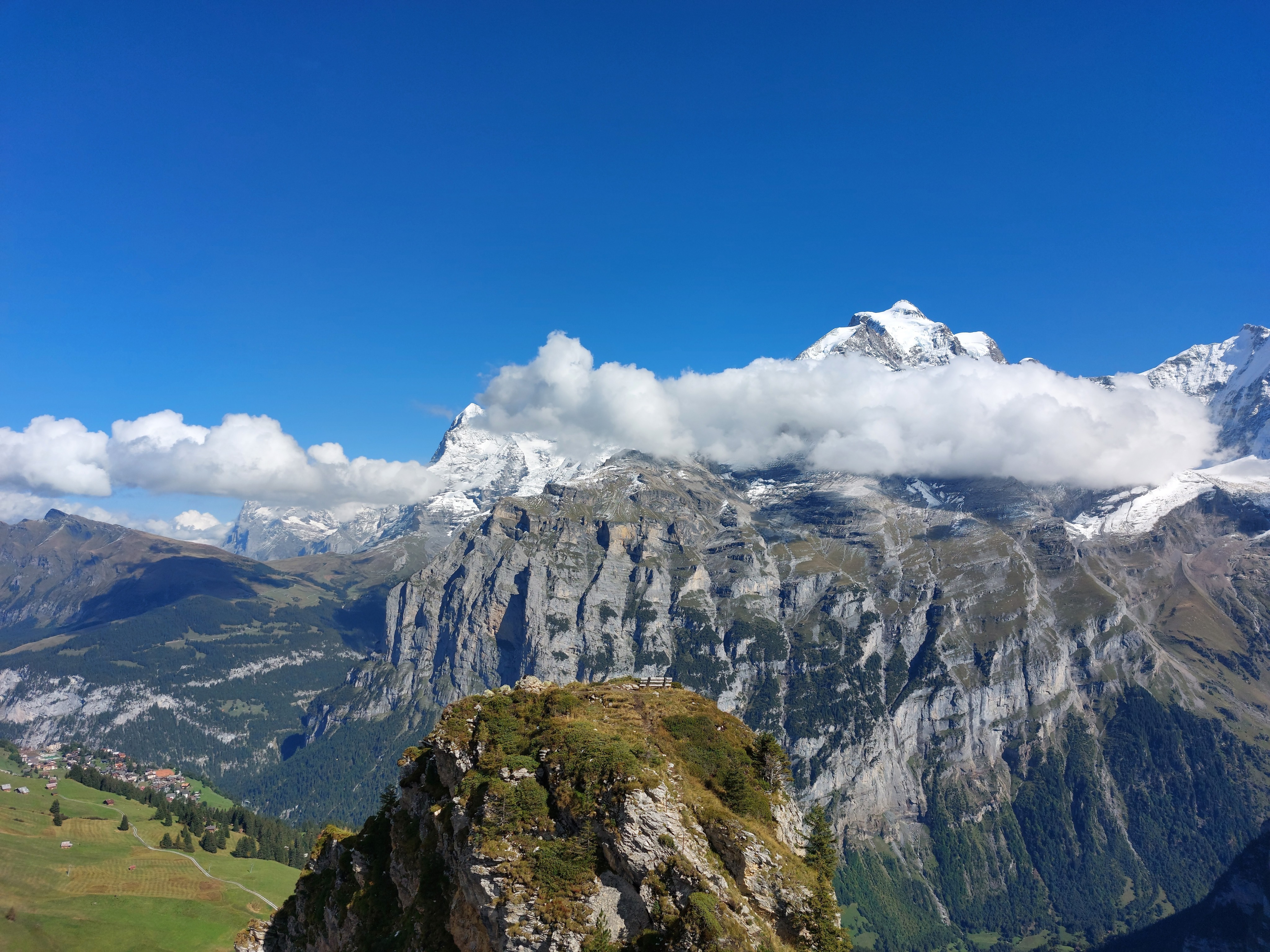
Jungfrau and Eiger, with the Eigergletscher (where we were yesterday) a smear below them.
Gimmelwald further below now, from the summit of Bryndli.
Bryndli from the subpeak right behind it.
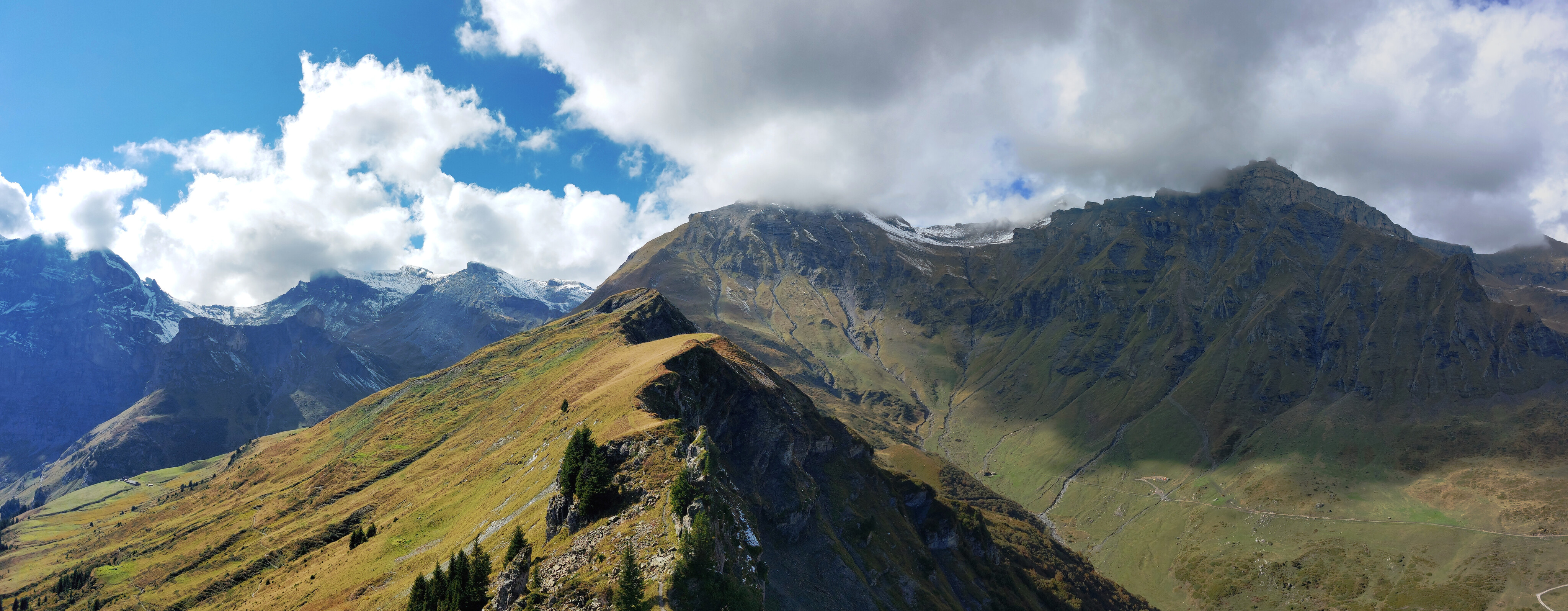
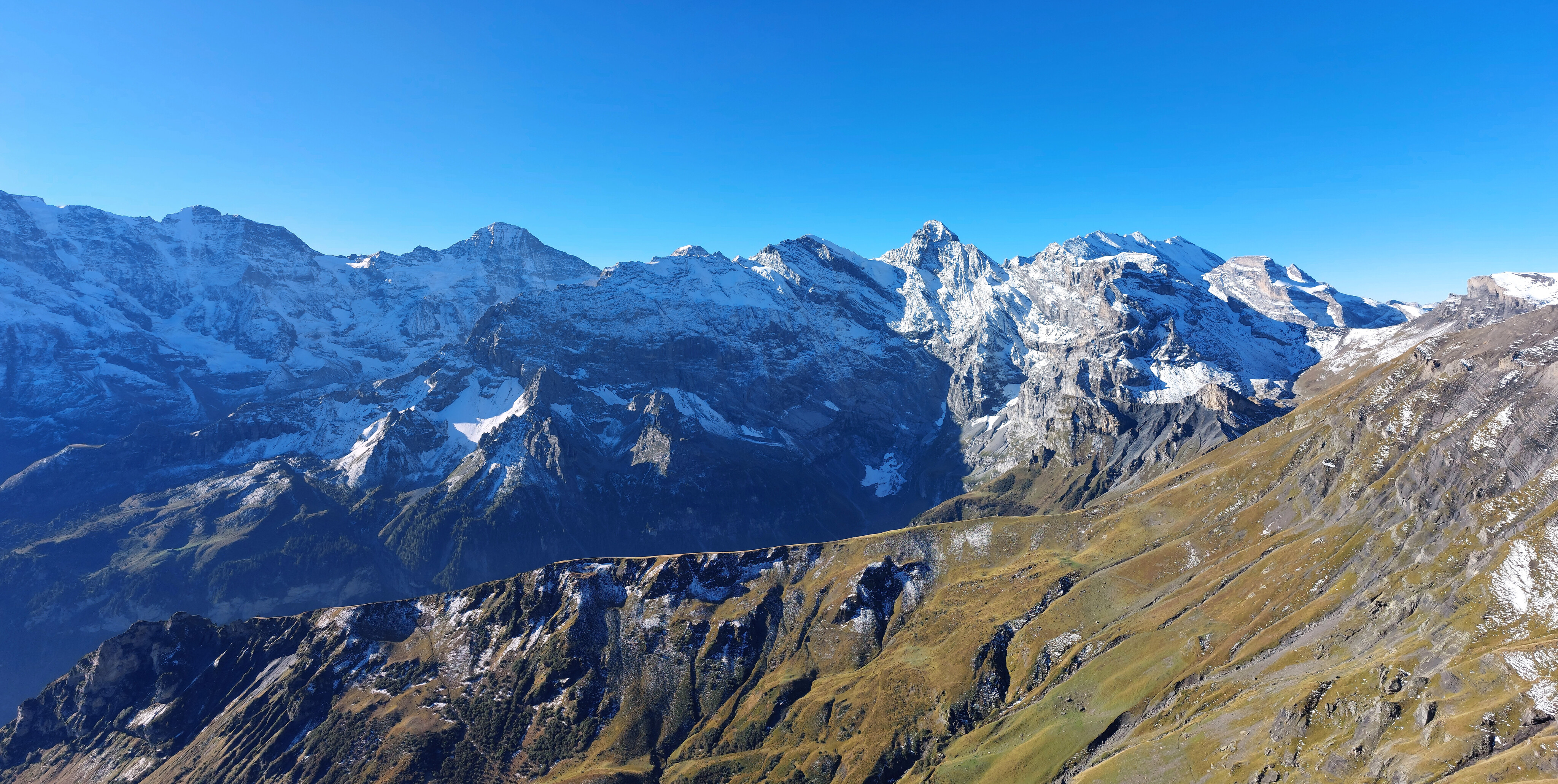
Looking the other way towards the Schilthorn, which is buried in the clouds, and the mountain pass we were originally planning to take to the left.
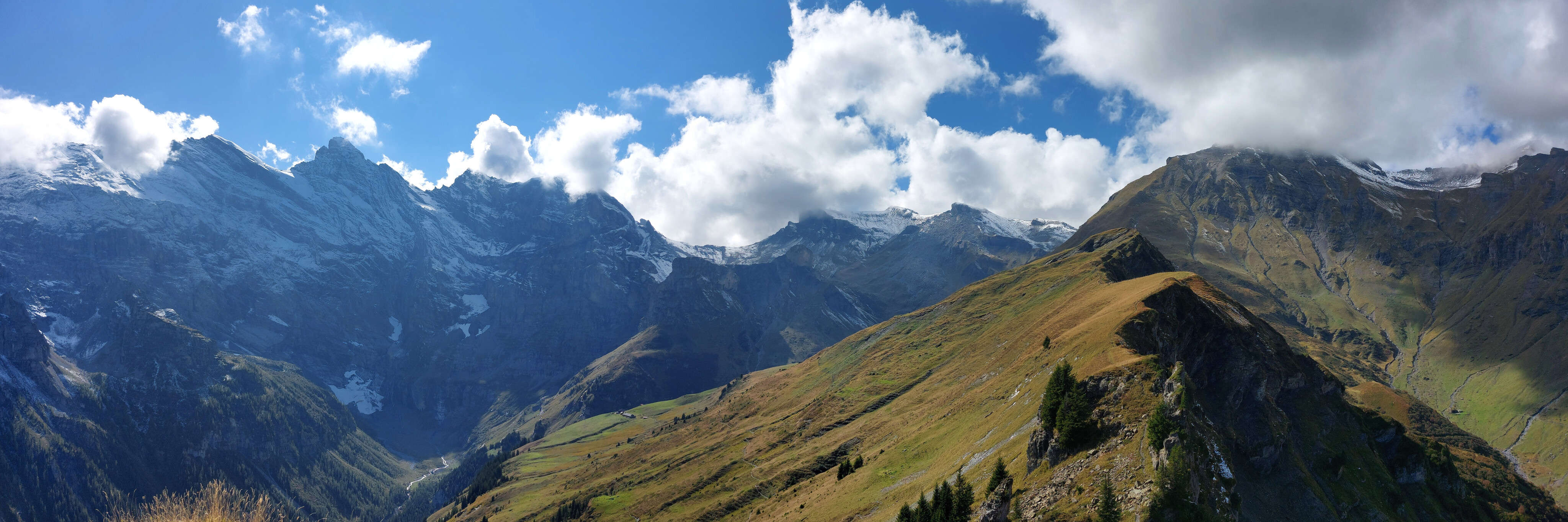
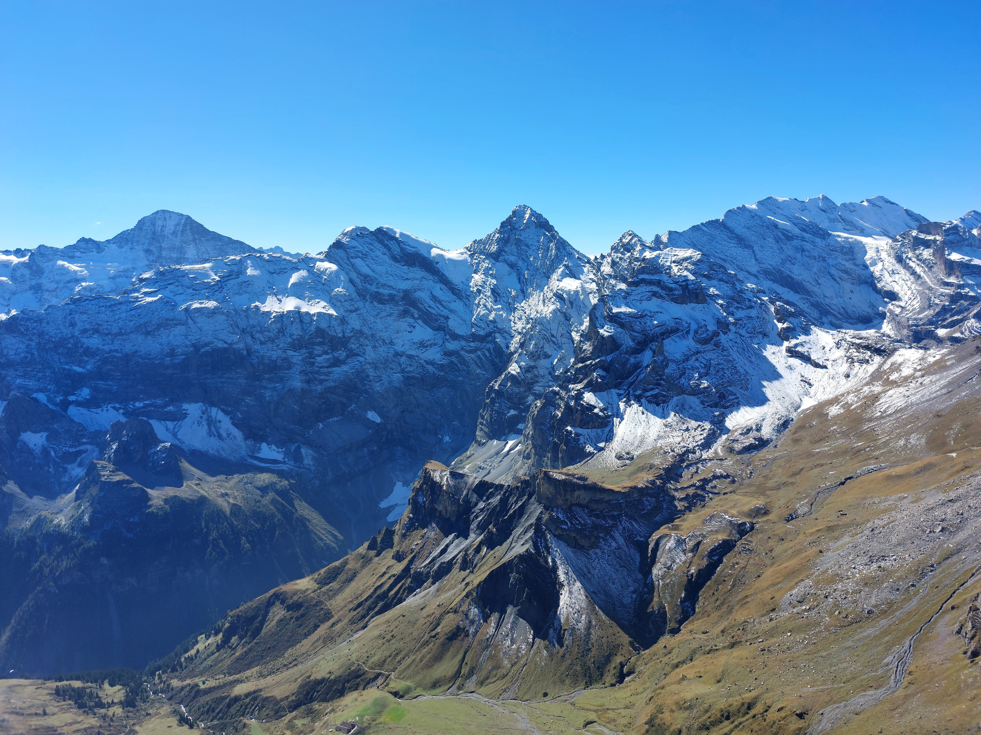
The other half of the panorama.
We continued beside the ridge until we hit the Rotstockhütte, then turned down into the valley to return.
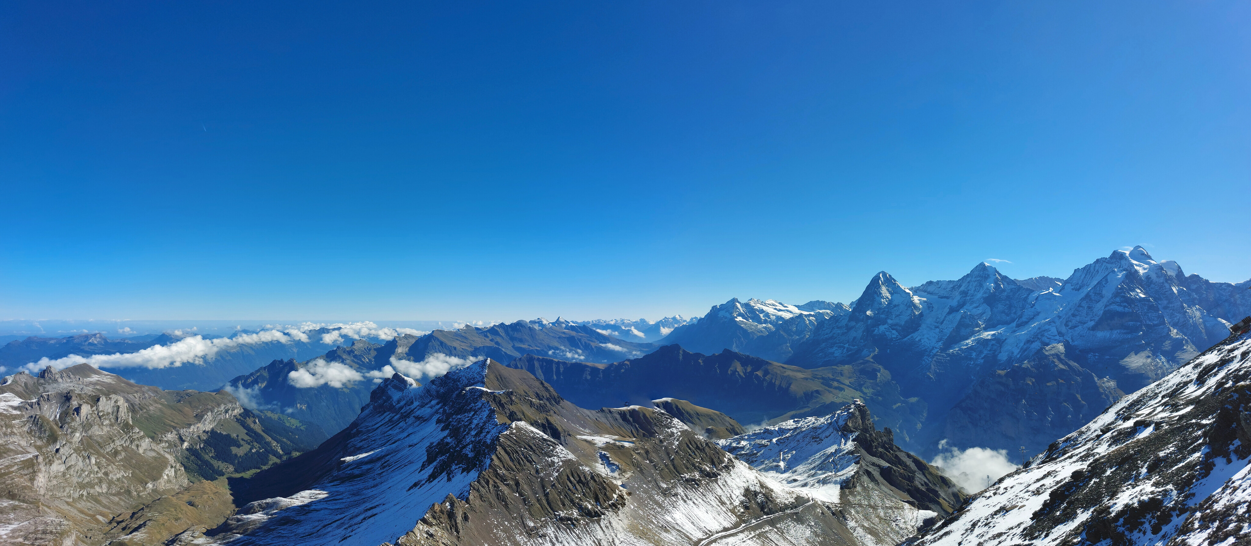
Looking back up at the Schilthorn and Piz Gloria, where we visited the next day.
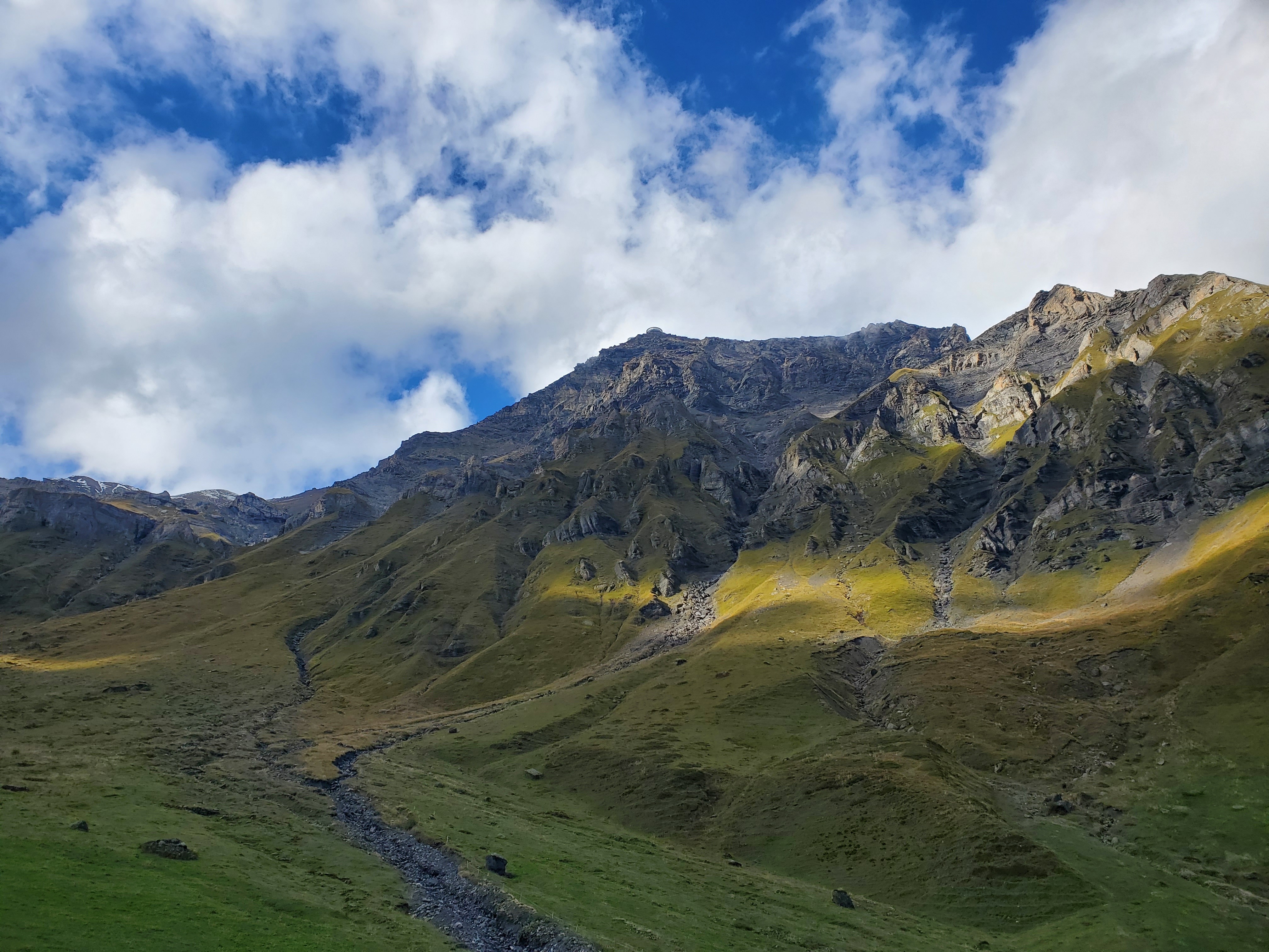
No really caption, it's just pretty.
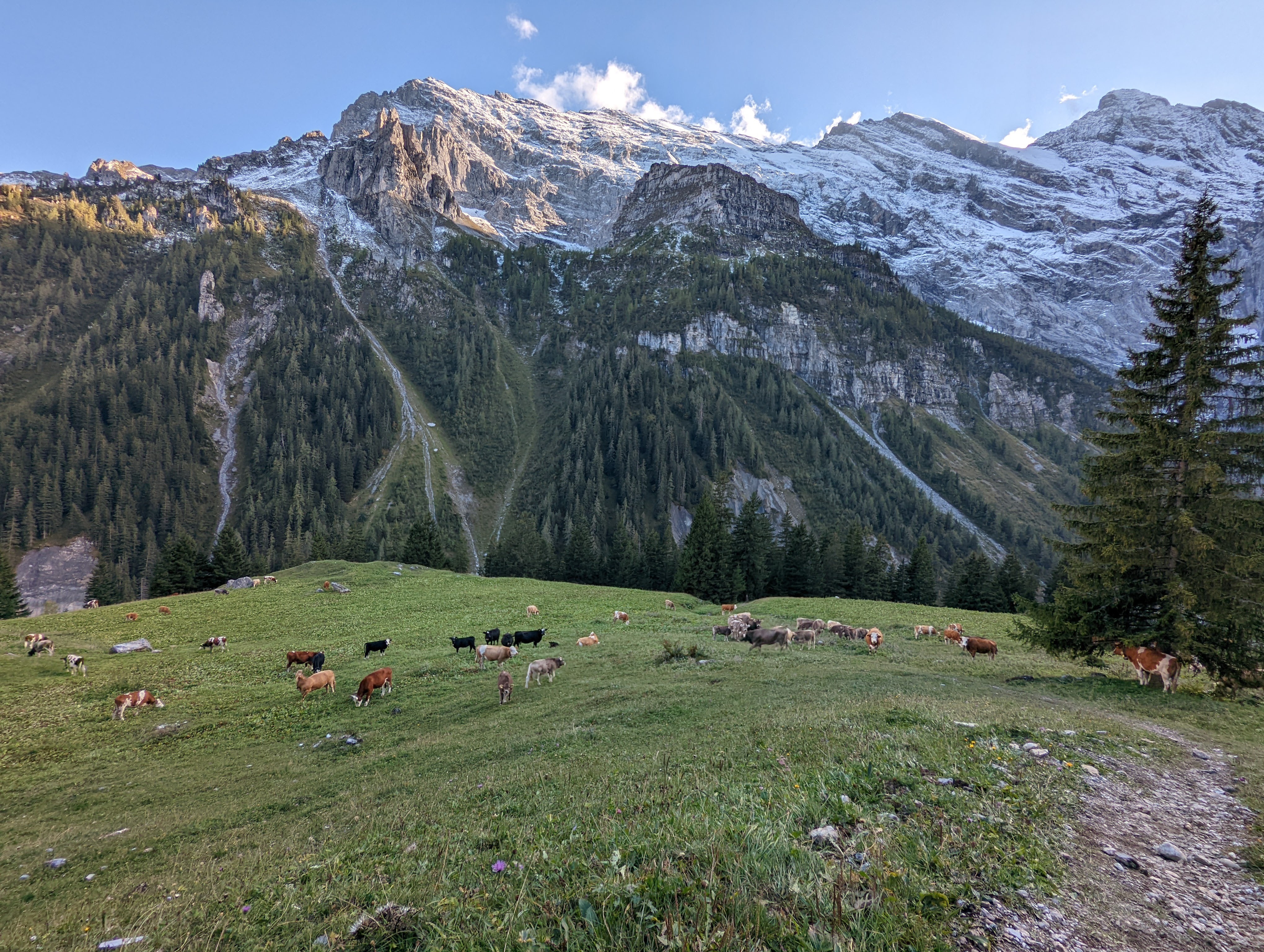
Our adversaries for the day; the brazen bovine blocked our path on multiple occasions.
Day 3
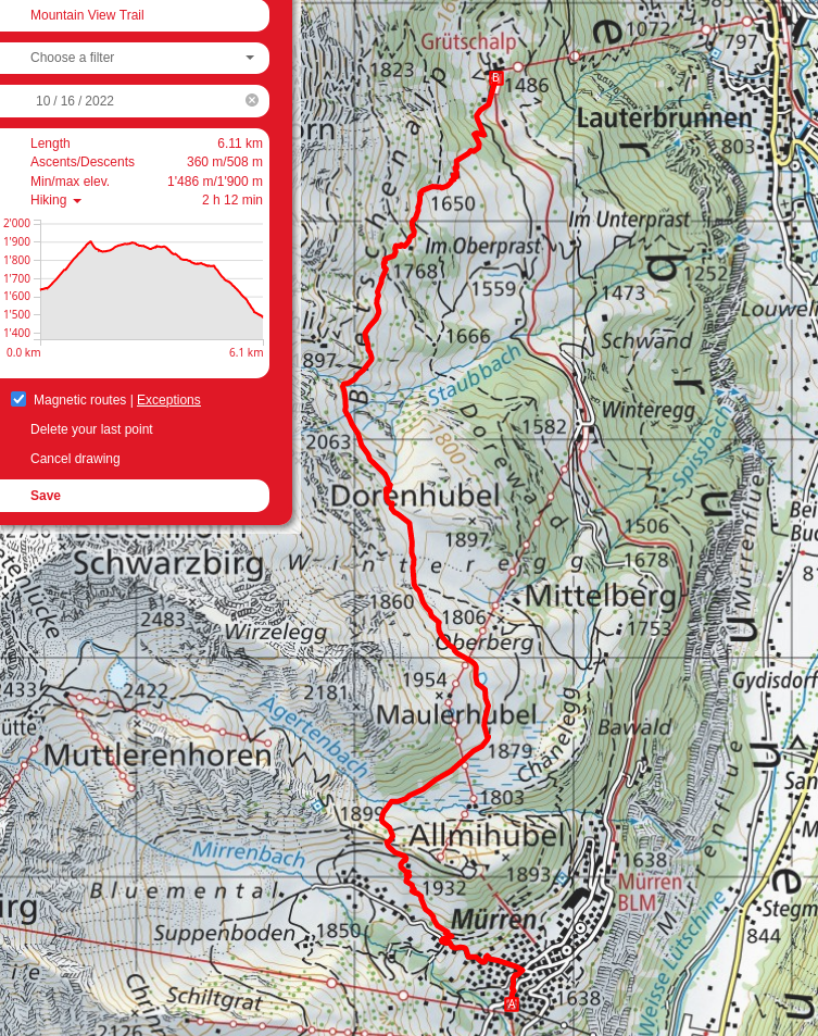
We took the cable car up to the Schilthorn, then came back down and hiked along the Mountain View Trail back to Lauterbrunnen. There were sadly no cows in their usual pastures there, but a helicopter coming and going to resupply something hidden by a cliff and some brush provided alternative entertainment.
I haven’t visited the Bernese Oberland since a two-day visit in 2018, and the mixture of nastolgia, extra exploration, and perfect weather made for a very enjoyable and slow-paced few days. I’ll definitely have to go back and explore some of the less traversed sections with proper equipment.
Bryndli from the cable-car up to Birg (and then the Schilthorn).
The building at the very bottom of the image is the Rotstockhütte, where we descended into the valley and returned to Gimmelwald yesterday.
Panning left to connect to the panorama:
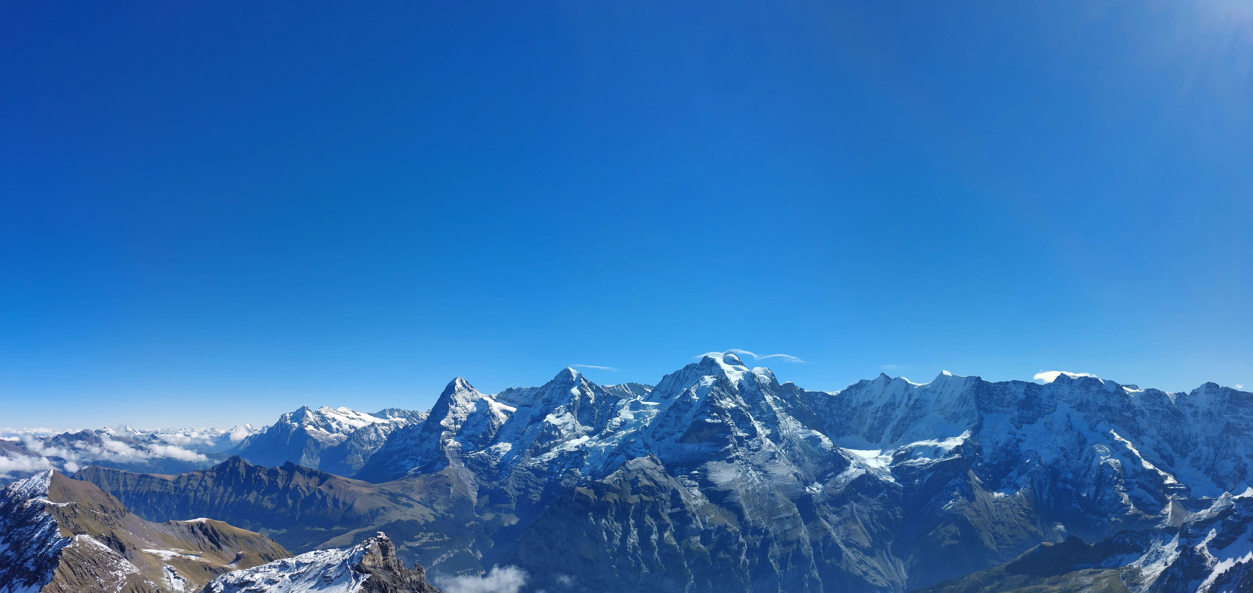
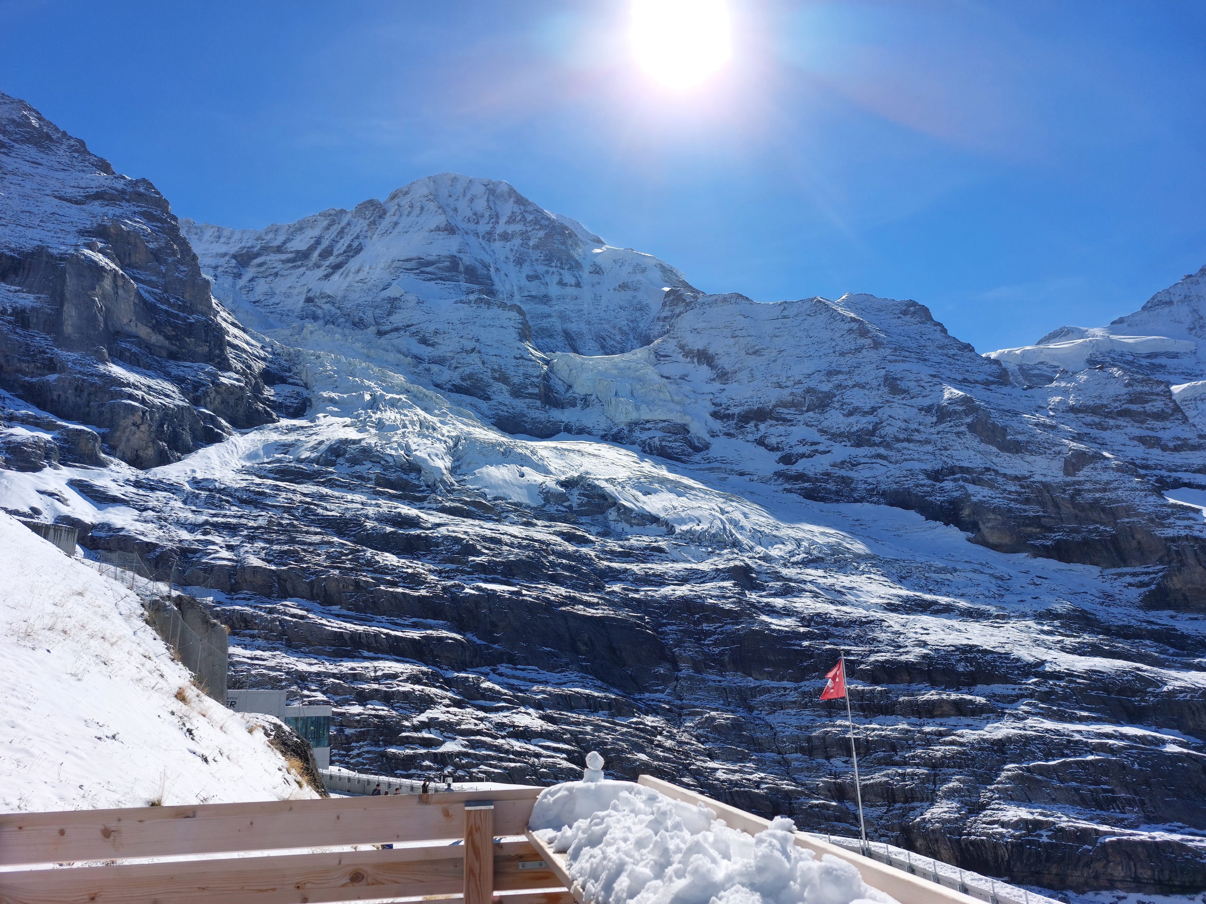
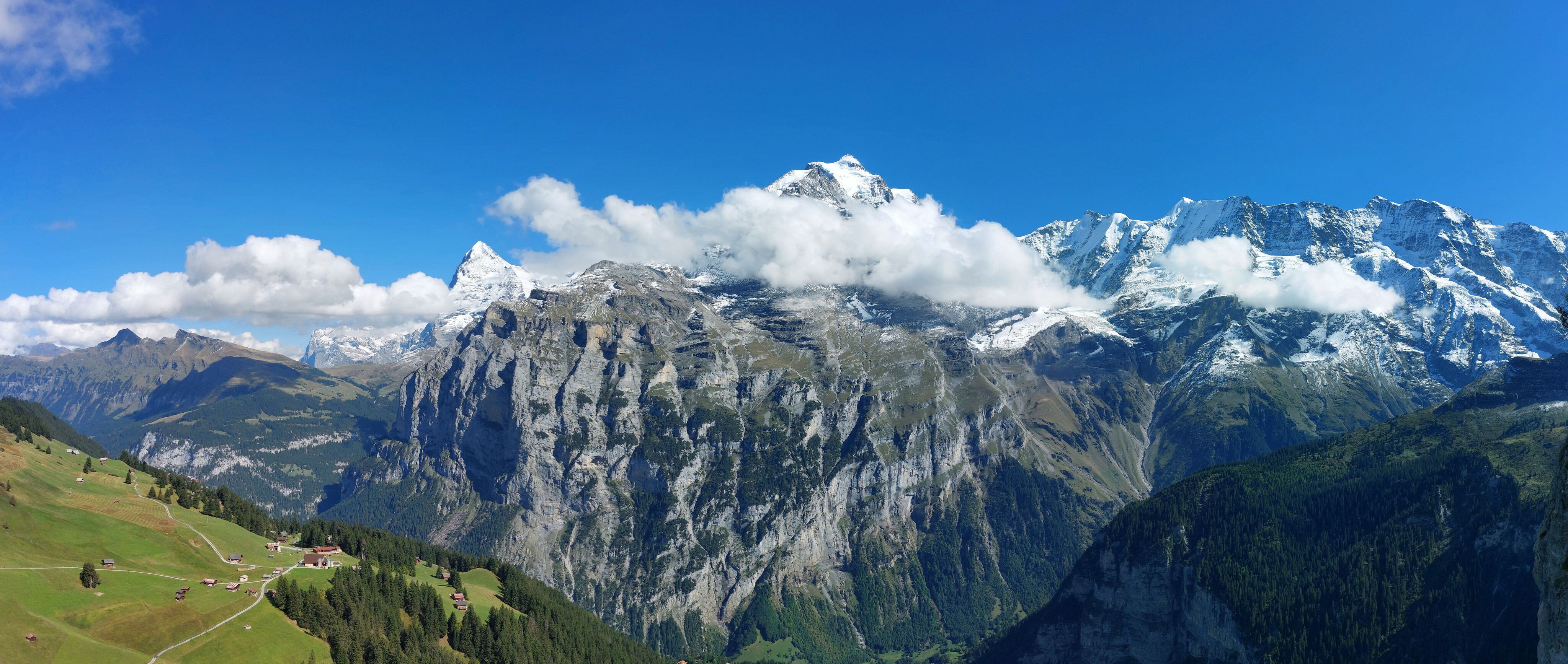
Pretty darn pretty. Jungfrau, Mönch, and Eiger. Our trail from two days ago started at the Eigergletscher (zoom in below the triangle-iest peak), then continued along its base to the left and down towards Grindelwald.
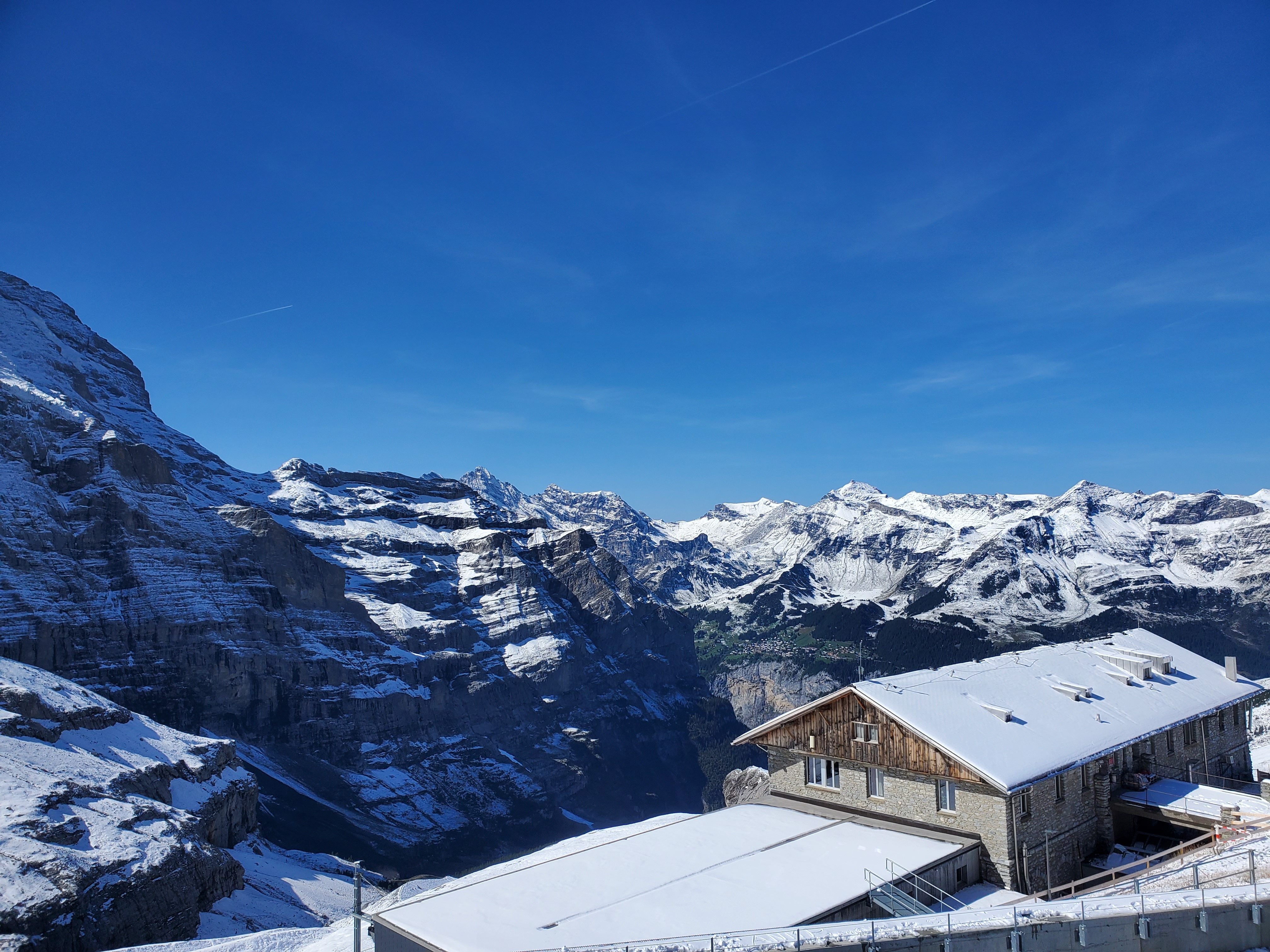
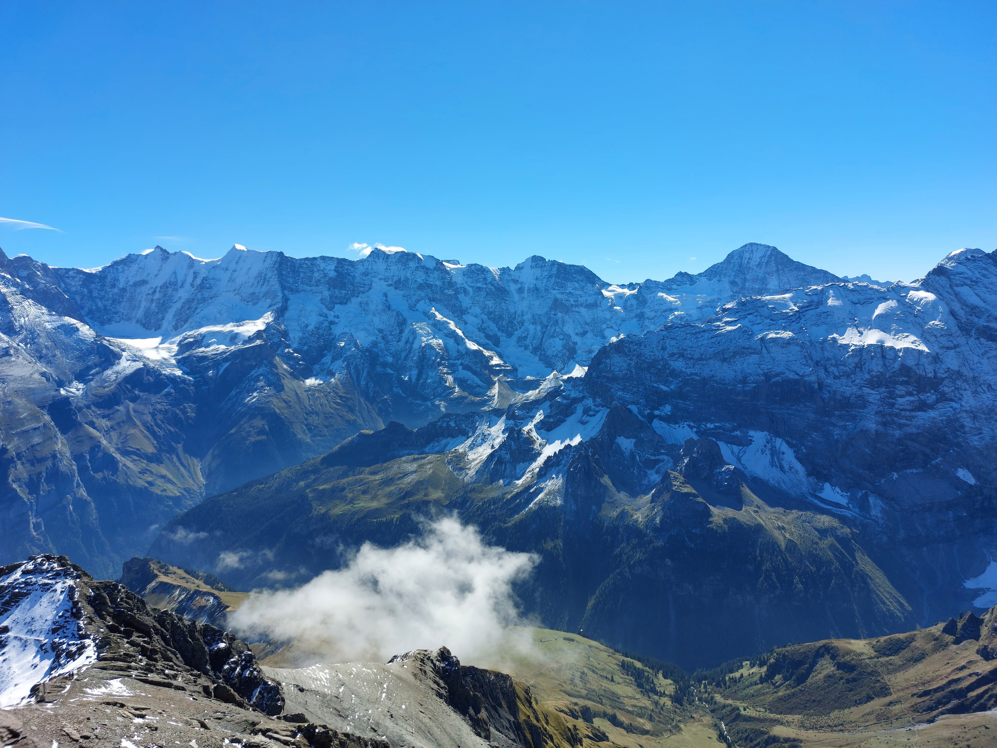
Looking north-west-ish. One of those mountains on the chain to the left is the Brienzer Rothorn, which I hiked a little while later.
Descending from Birg into an isolated cloud.
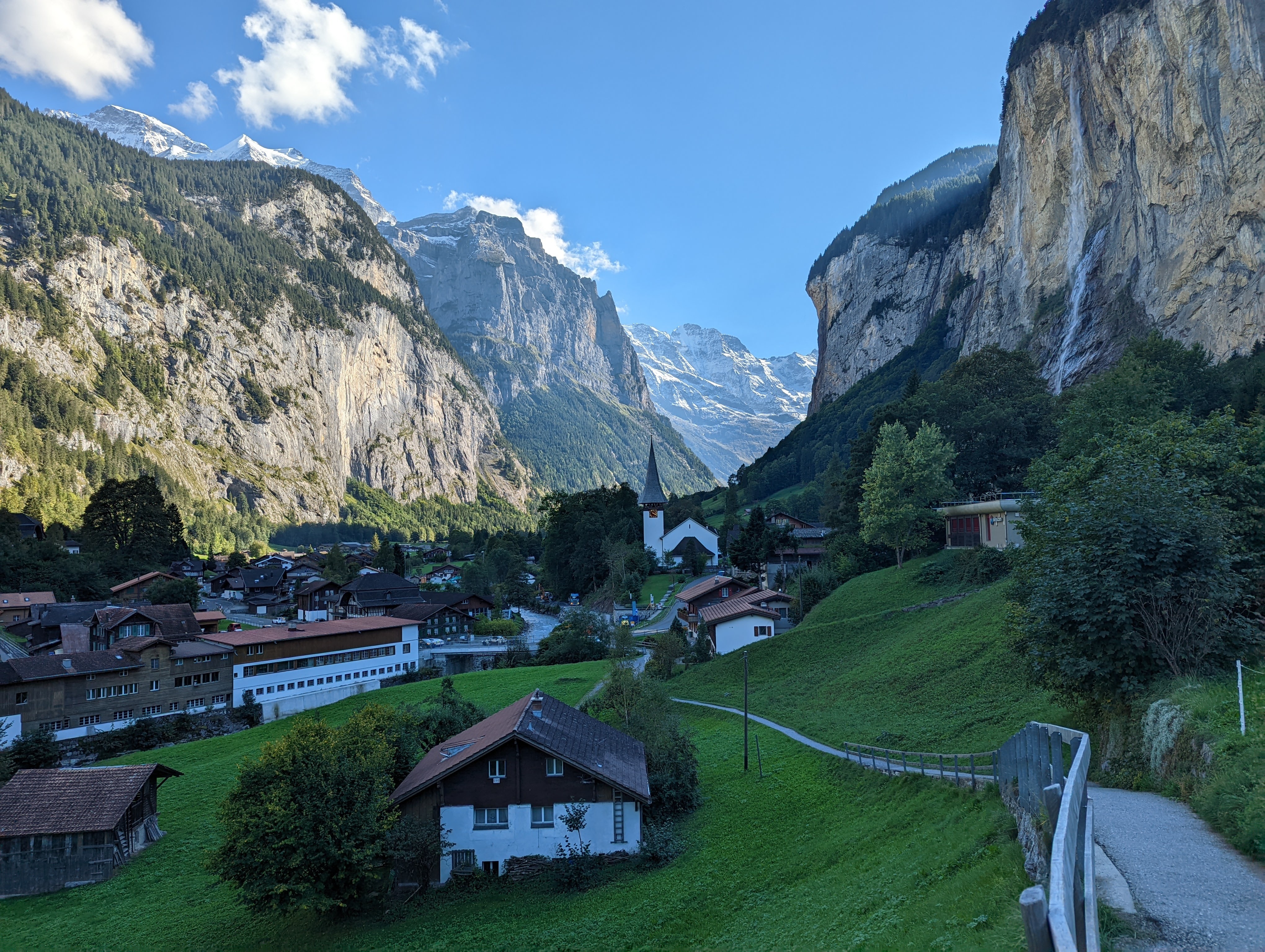
The view from Lauterbrunnen. No pics from along the Mountain View Trail, since they're much of the same as above, but from lower down.