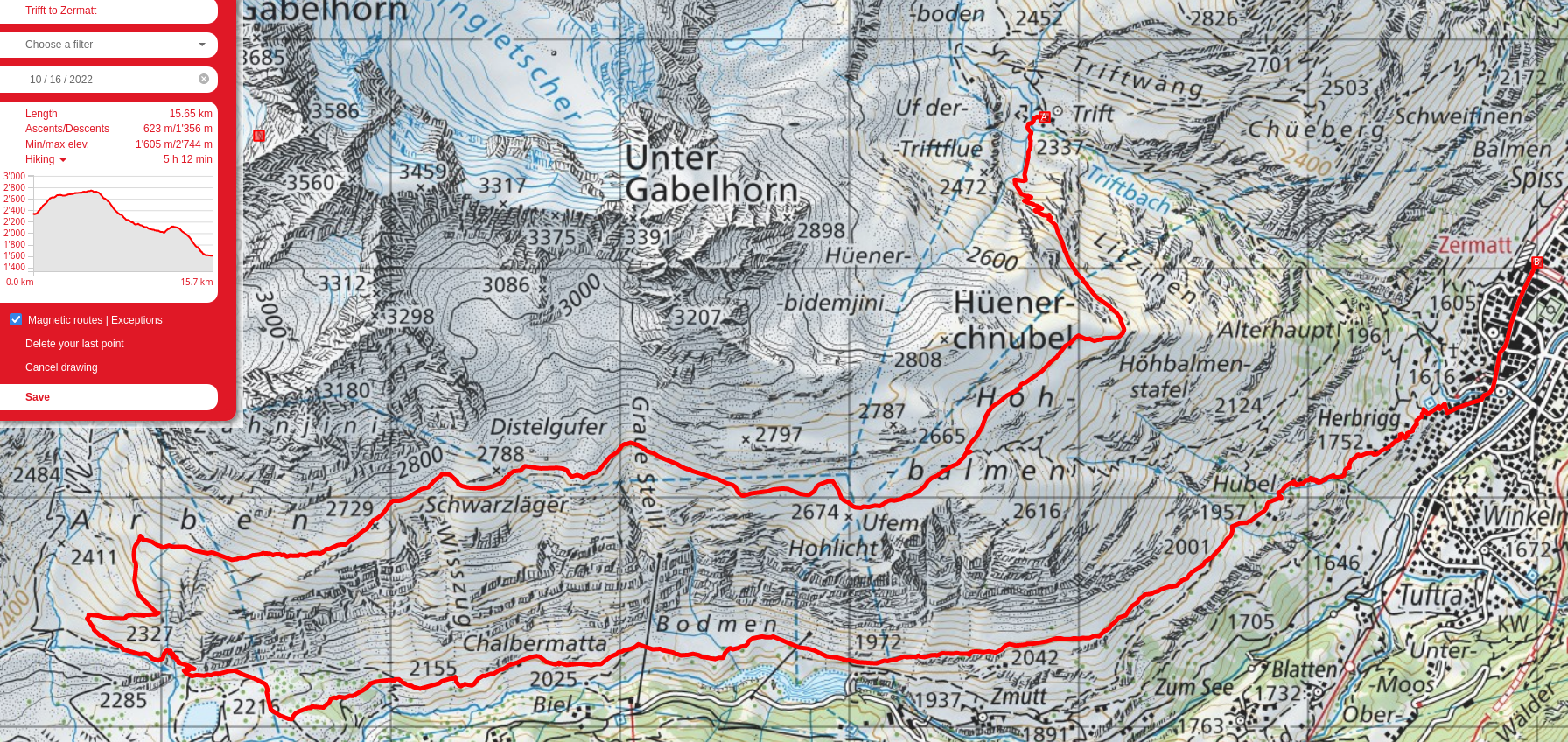
Zermatt, Trift, and Platthorn
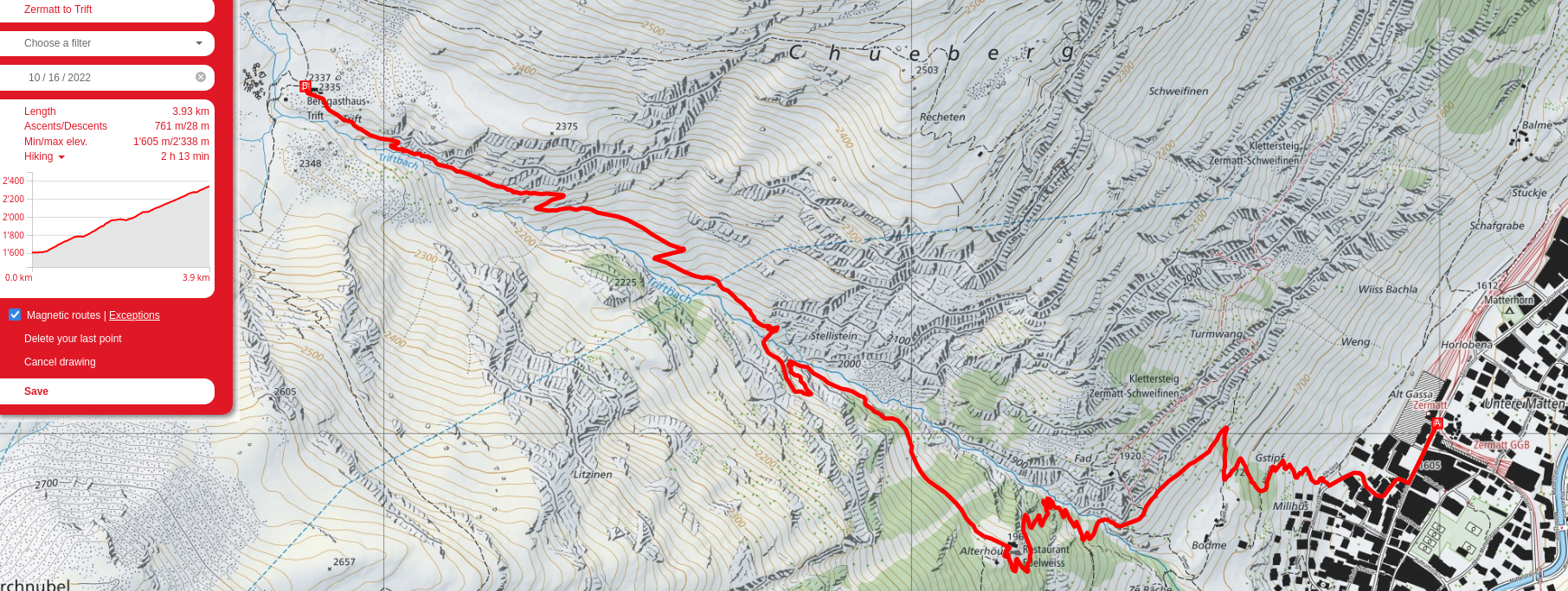
My partner and I went down to Zermatt for a weekend in the mountains. Day one, we hiked from town to the Berggasthaus Trift, a very cute little hotel nestled in a valley above Zermatt. From there, we went a good chunk of the way to the Rothornhütte before coming back down for supper. The next day, we hiked up to the Platthorn, then futzed around on the glacier between that and the Mettelhorn before returning to the hotel. The last day was along the Edelweissweg, almost to the base of the Matterhorn atop Hüenerchnubel and back to Zermatt again along the valley floor.
So far, this area takes a podium spot with the Jungfrau region and Säntis; it doesn't have the lush green foreground and massive mountains in the backdrop of the former, nor the limestone knives and cable sections of the latter, but being surrounded by giant glaciers, ice-carved stone, looming peaks, and sparse vegetation is certainly its own memorable experience.
Some random fun happenings:
- We could see a light from who I presume was a climber on the Trifhorn or Wellenkuppe late at night
- We could also see the lights of the Rothornhütte from Berggasthaus Trift at night
- We got to watch the moon rise over the mountains to the east
- Someone mountain-biked down from the summit of the Mettelhorn to at least the Berggasthaus, and was recording their descent with a drone set to follow them
- Walking on a glacier for the first time, a very cool experience!
- Valais Blacknose sheep and mountain goats galore
- Had Ovomaltine for the first time at the hotel. It's pretty good
Day 1: Zermatt to Berggasthaus Trift, and there to near the Rothornhütte
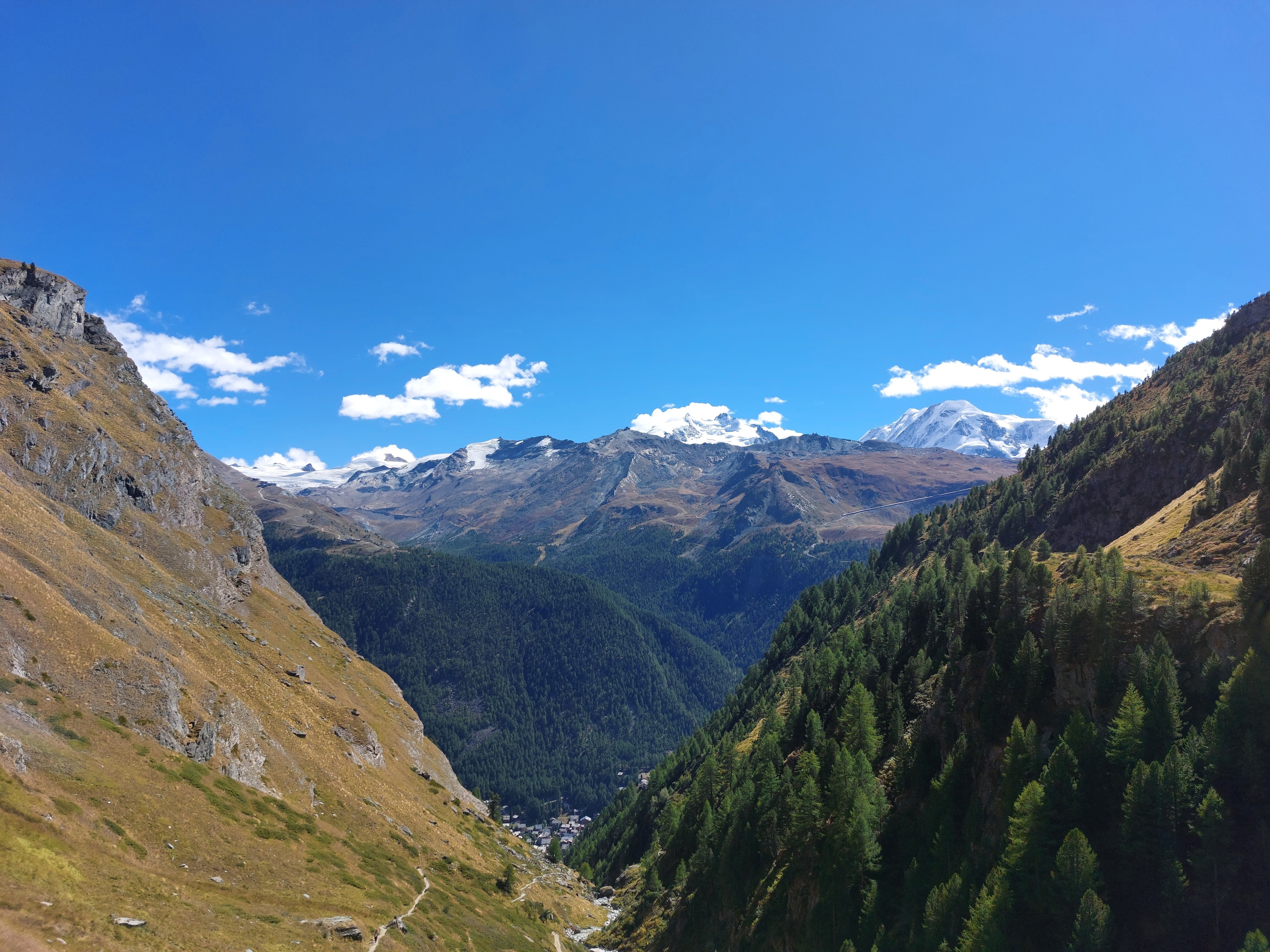
Huts a bit above Zermatt, Monte Rosa just peaking out over Sunnegga(?). We couldn't have asked for better weather over the weekend.
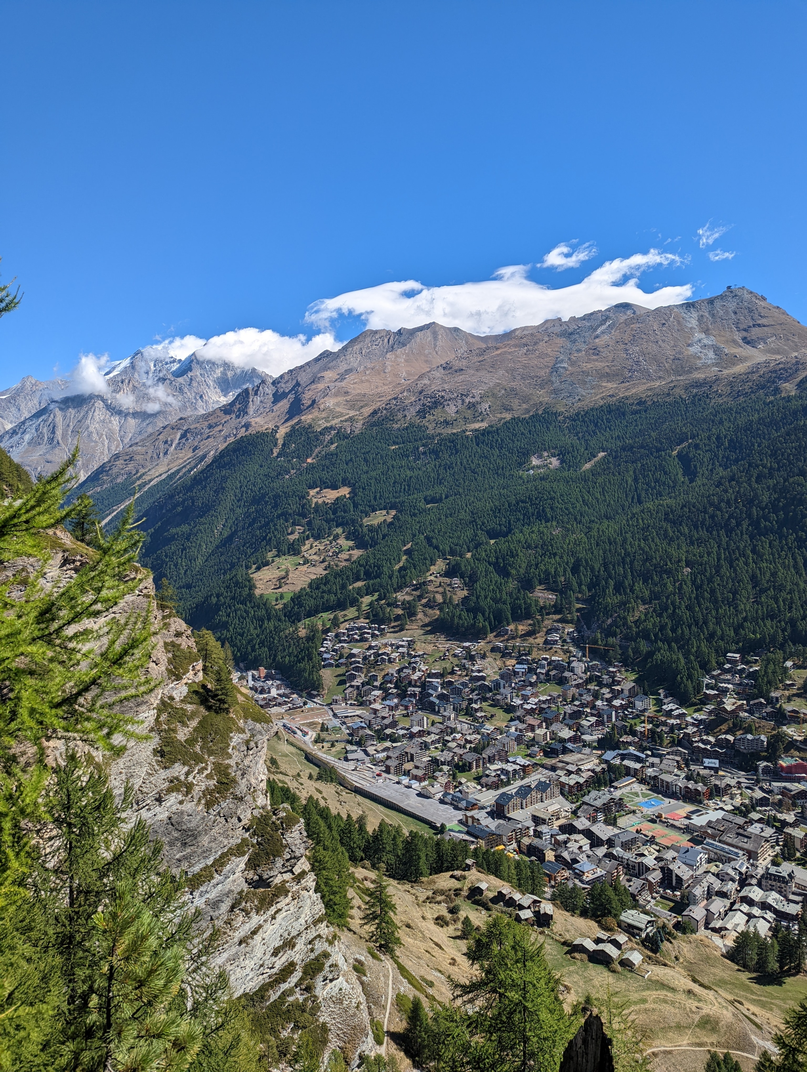
Zermatt from a bit higher up, the huts of the previous image visible below on the cliff. The sense of scale here is completely broken; those mountains behind Zermatt are 3500m tall, but they sure don't look it.
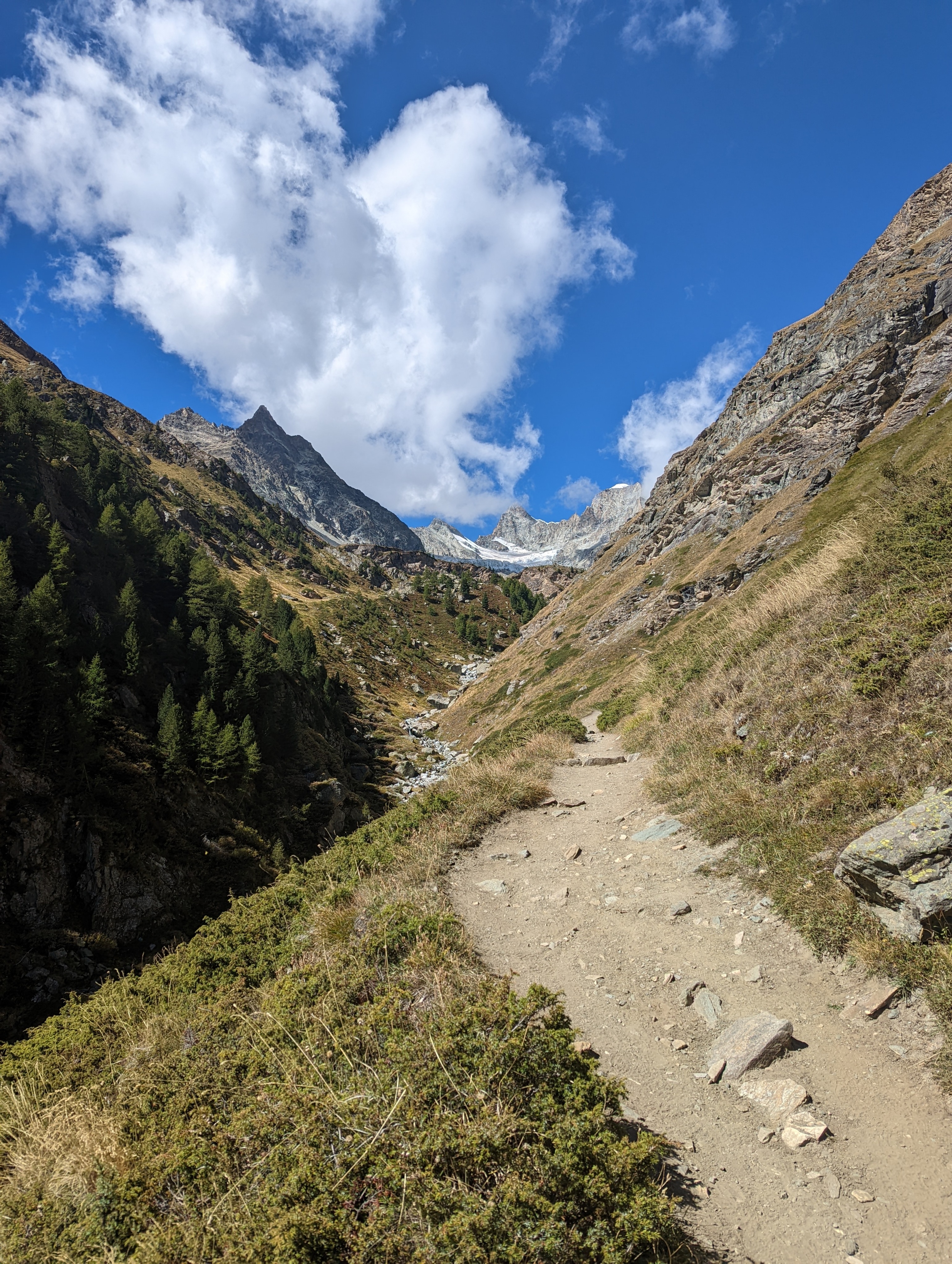
Trail leading to Trift, following the river.
The last view we get of Zermatt before being swallowed up by the valley.
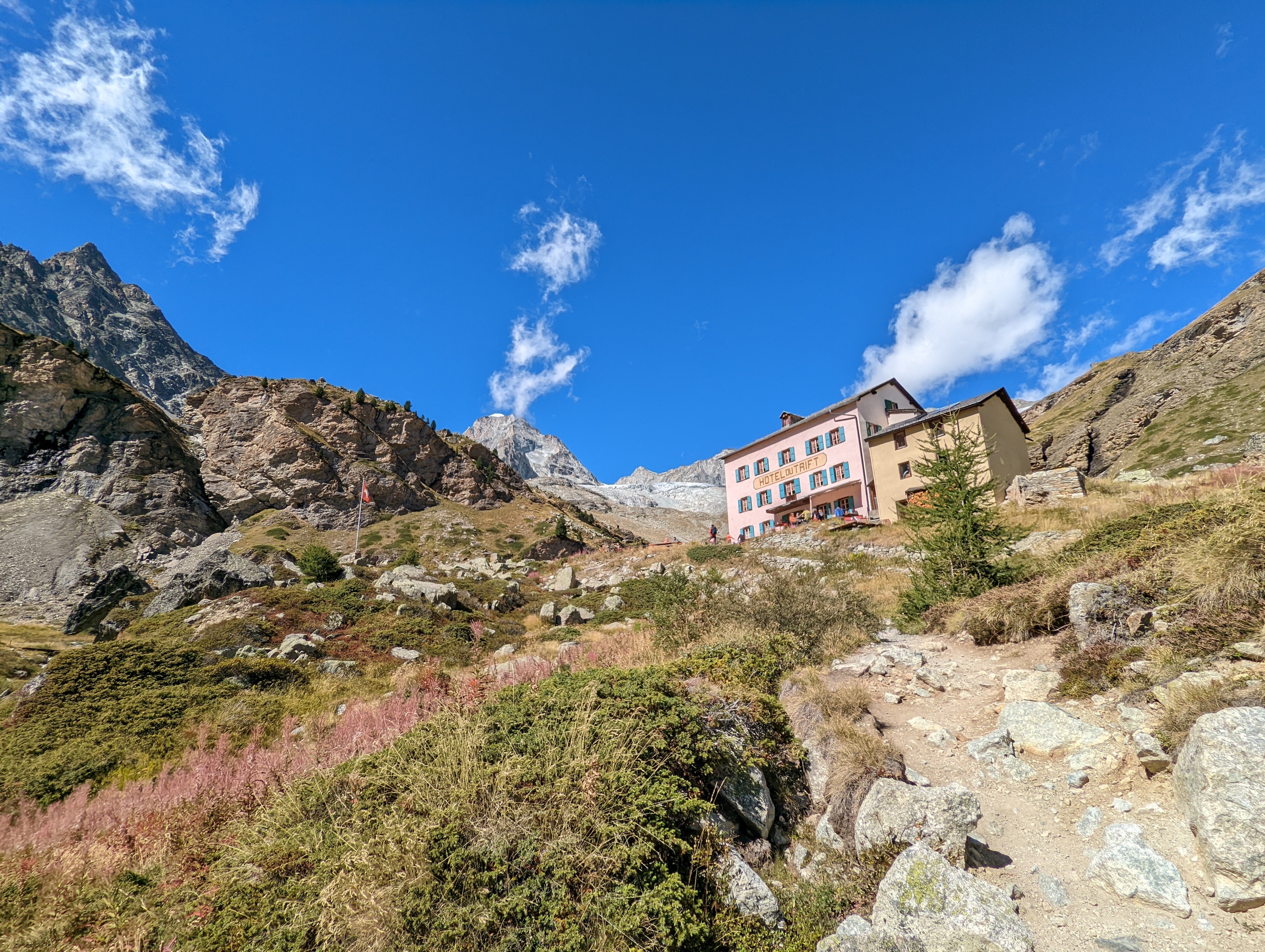
Berggasthaus Trift. Good food, good hosts, and great location.
We dropped our stuff in our room, took a quick pic, then head out in the direction of the Rothornhütte.
Part-way up; our return to Zermatt on the third day goes up the mountain behind the Berggasthaus.
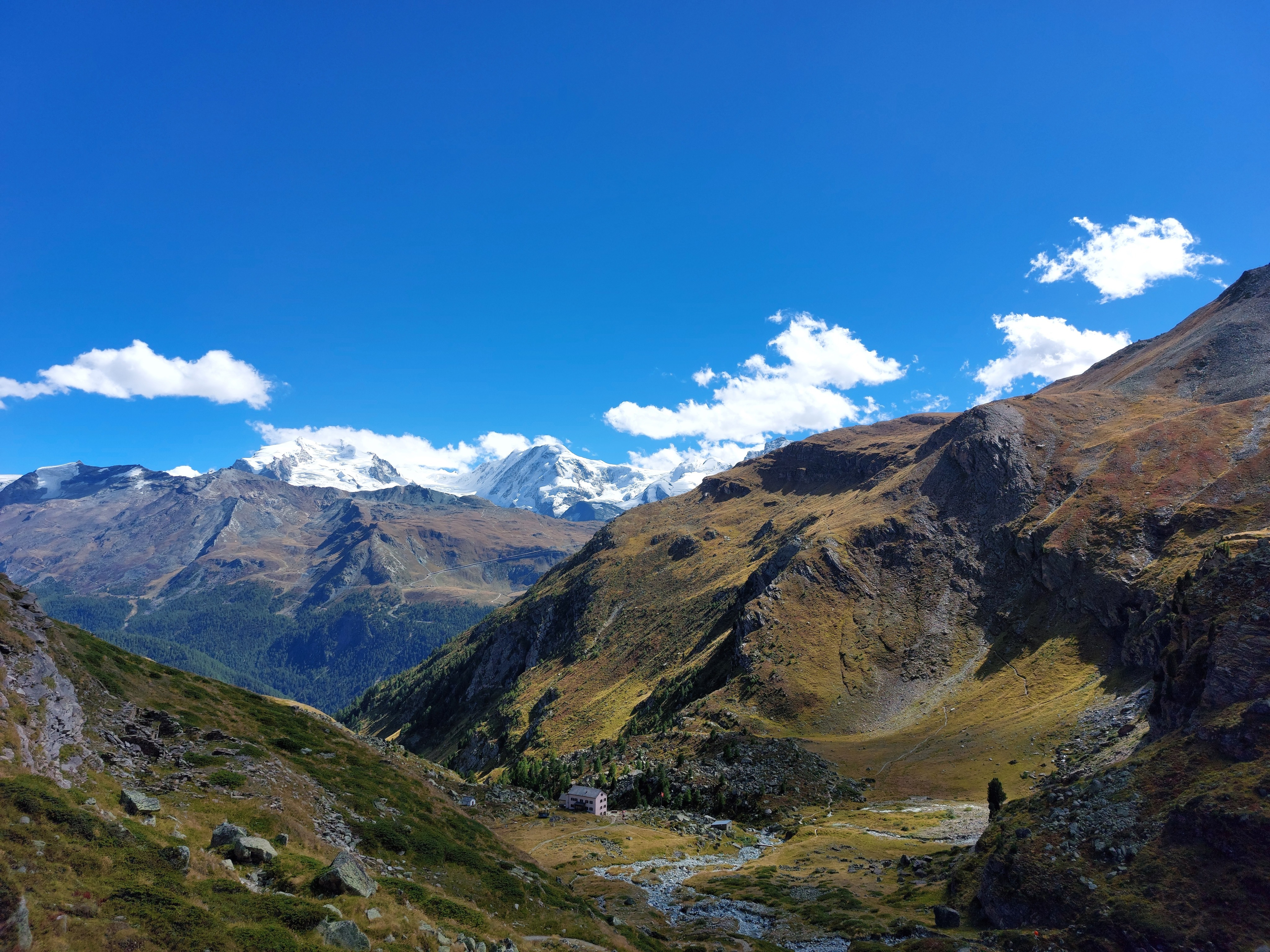
Higher up, with (I think) the Unter Gabelhorn to the right.
From left to right: Unter Gabelhorn, then the Gabelhorngletscher, the Mittler and Ober Gabelhorn, the Triftgletscher, and finally sitting on a little rock outcrop, the Rothornhütte (if you really zoom in and follow the trail along the ridge in the center). Again, all sense of scale is lost here; we hiked for a good long while and got maybe half-way up the hill to the hut. There were plenty of waterfalls feeding off the glaciers, which also appear diminutive in the image, but must have been many people-lengths high. All in all, absolutely gorgeous.
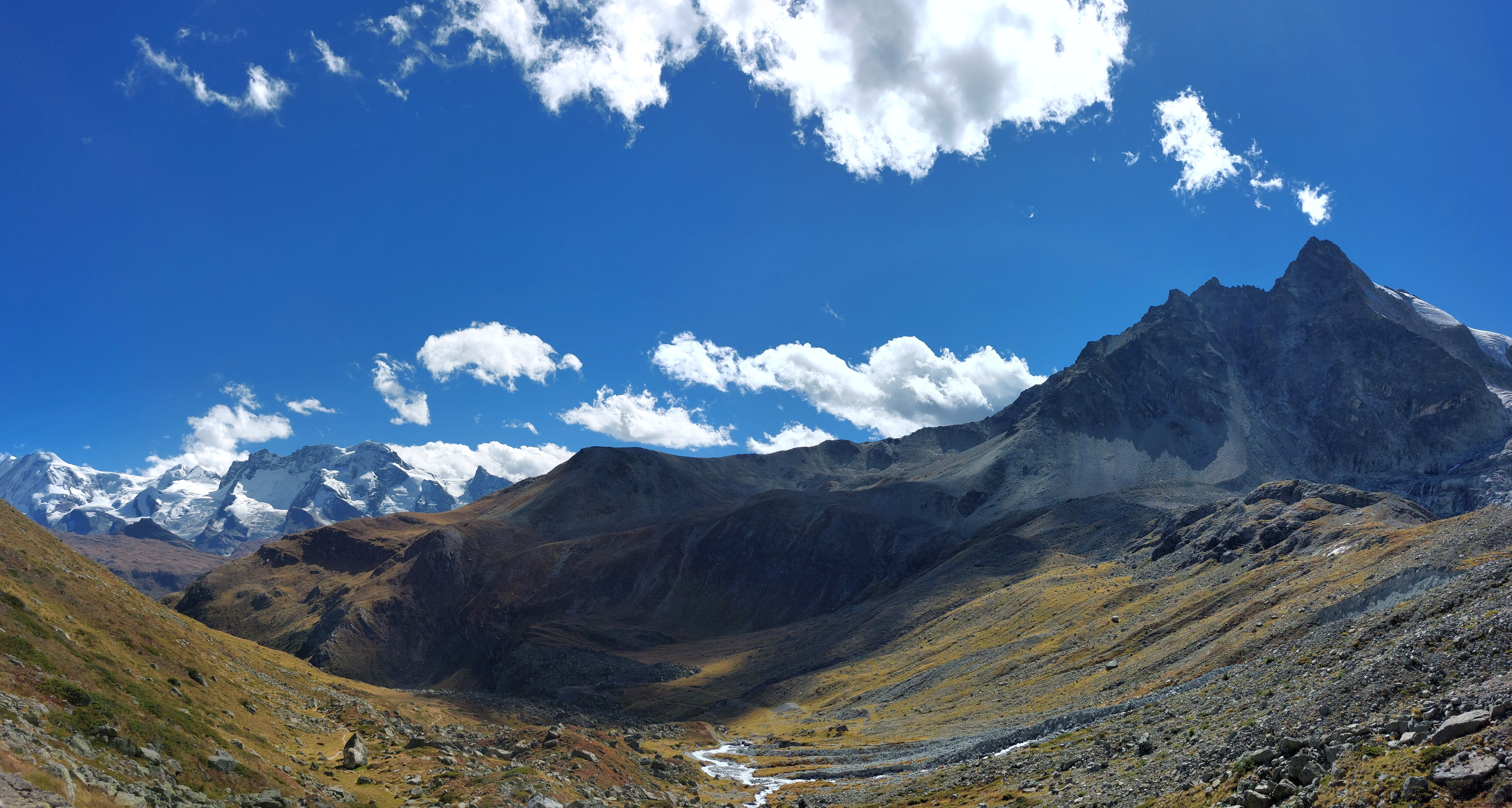
Looking back from the base of the ridge in the previous image, towards Monte Rosa.
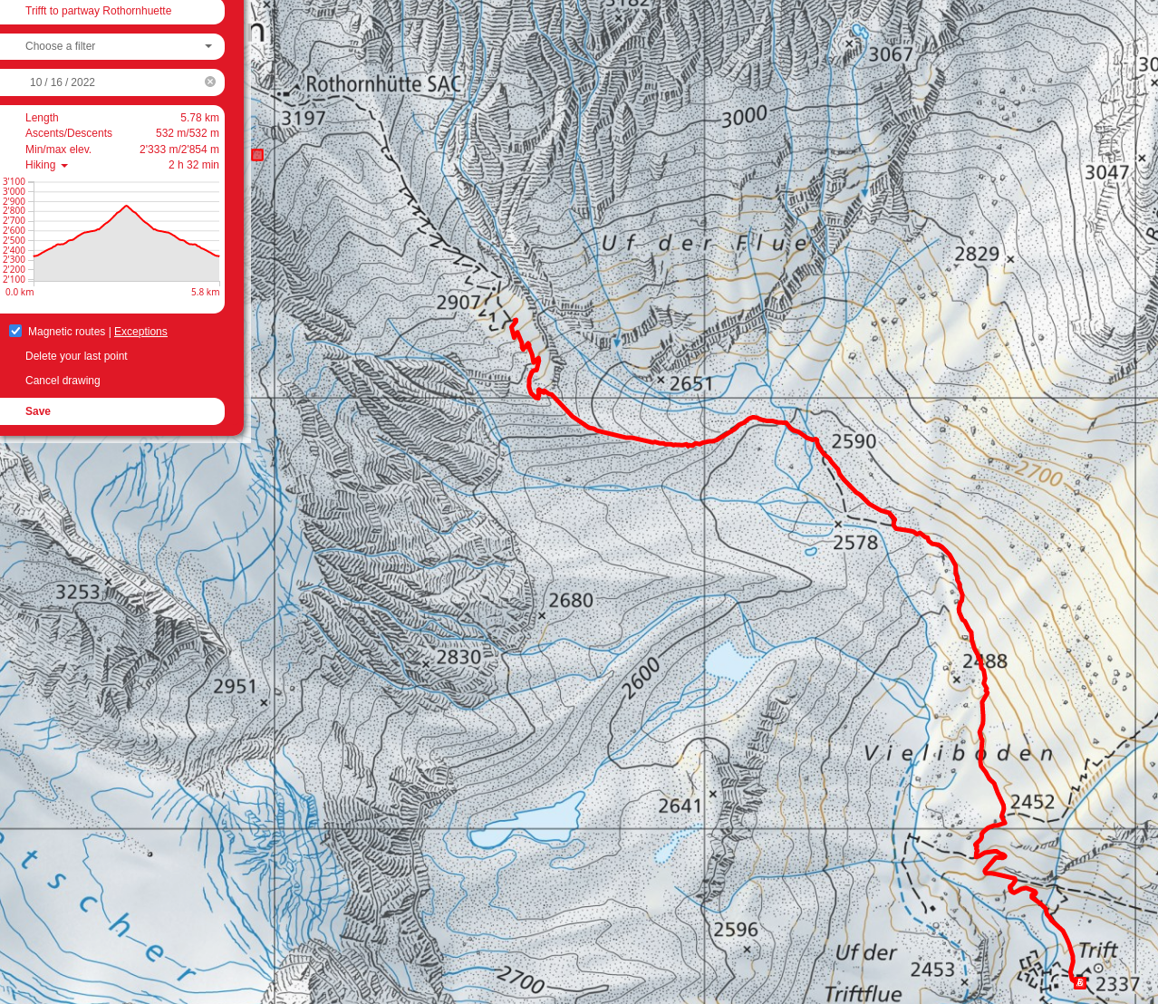
We turned back at this point and returned to the Berggasthaus Trift for the evening.
Day 2: Berggasthaus Trift to Platthorn
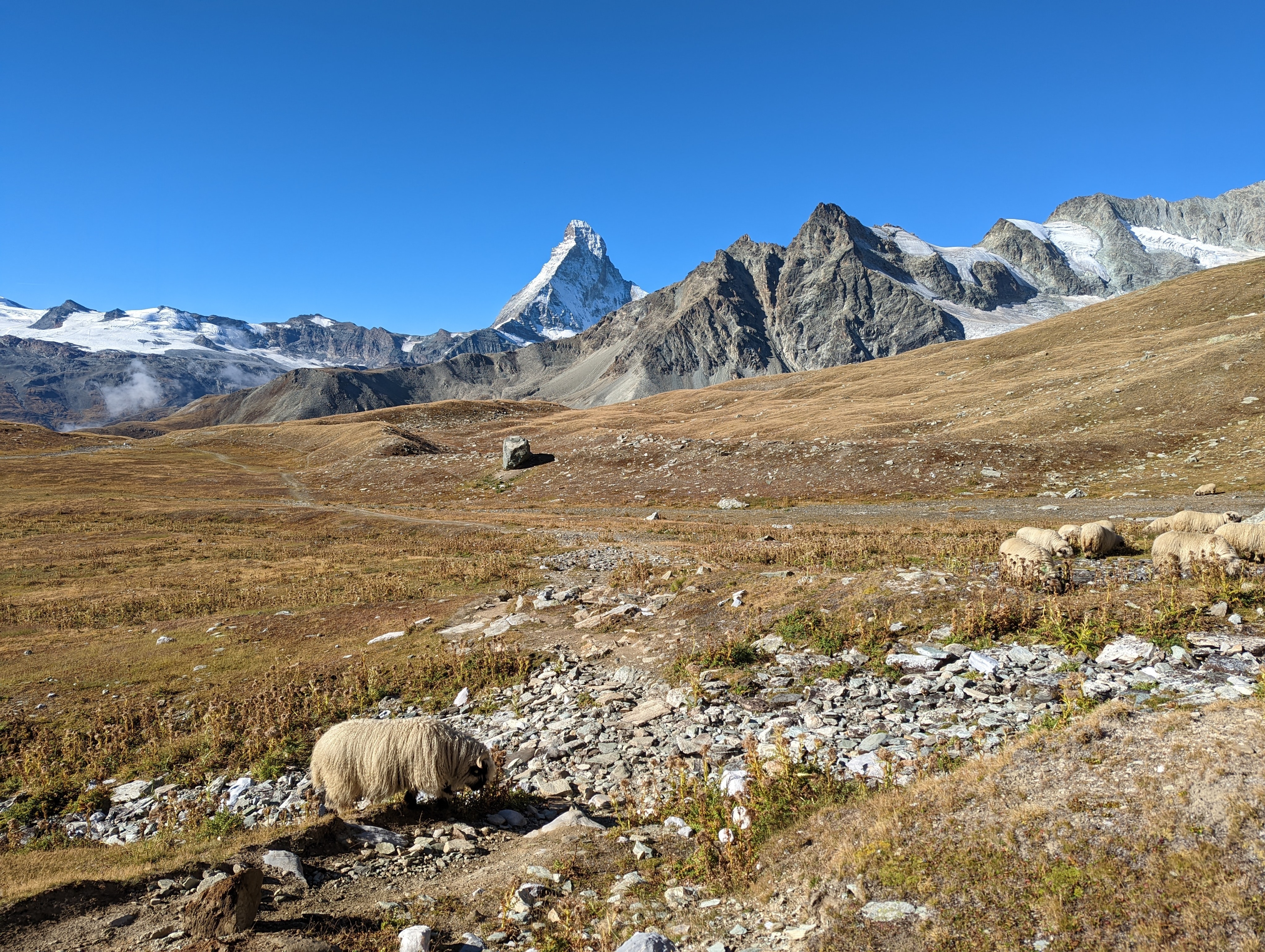
The legendary Valoi Blacknose Sheep with chocolate mountain slowly poking up in the background.
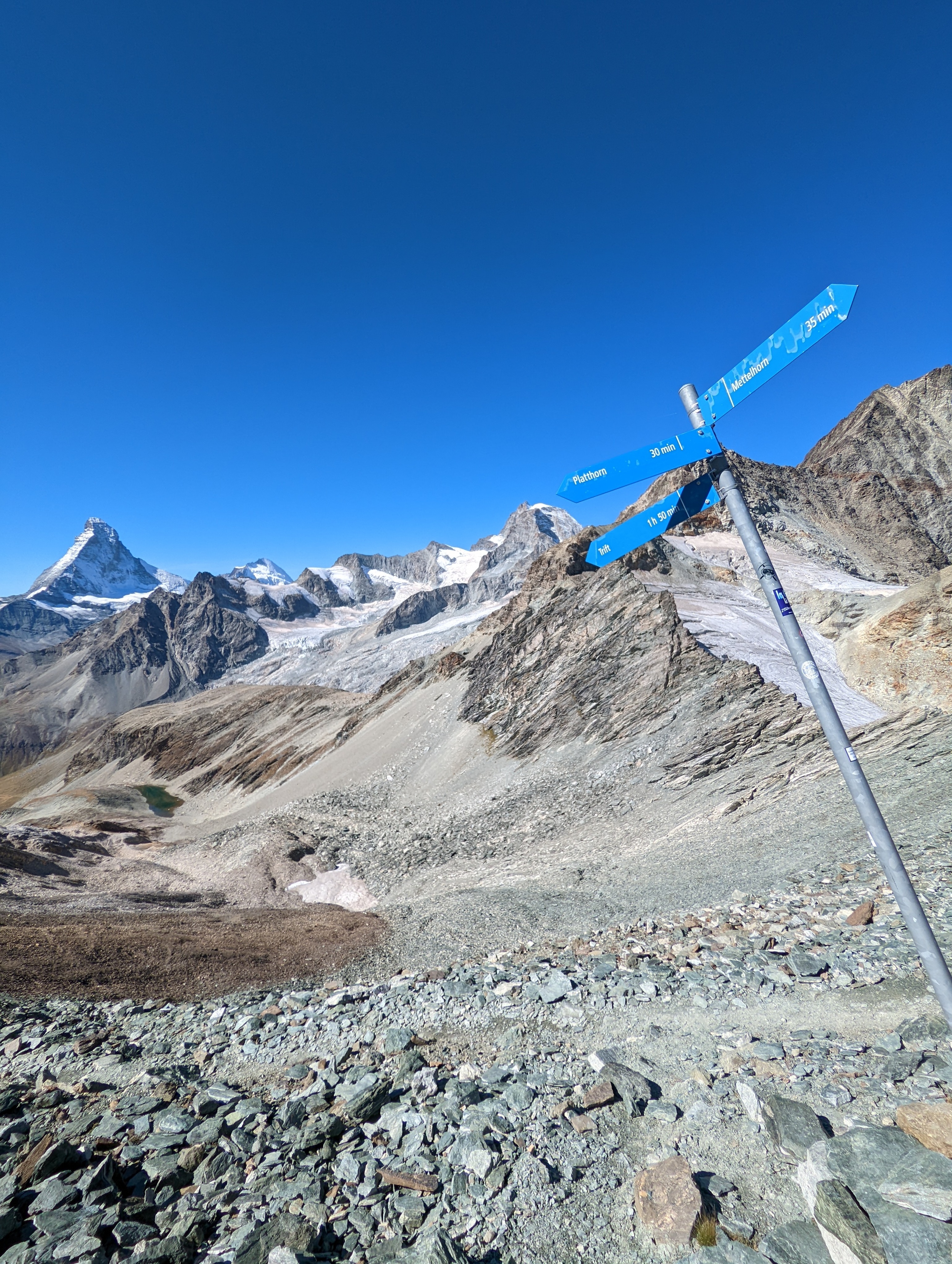
Chocolate mountain stays mostly hidden until you reach the sign for the Platthorn at the Hohlichtgletscher, at which point it becomes switchbacks up the mountain to the summit.
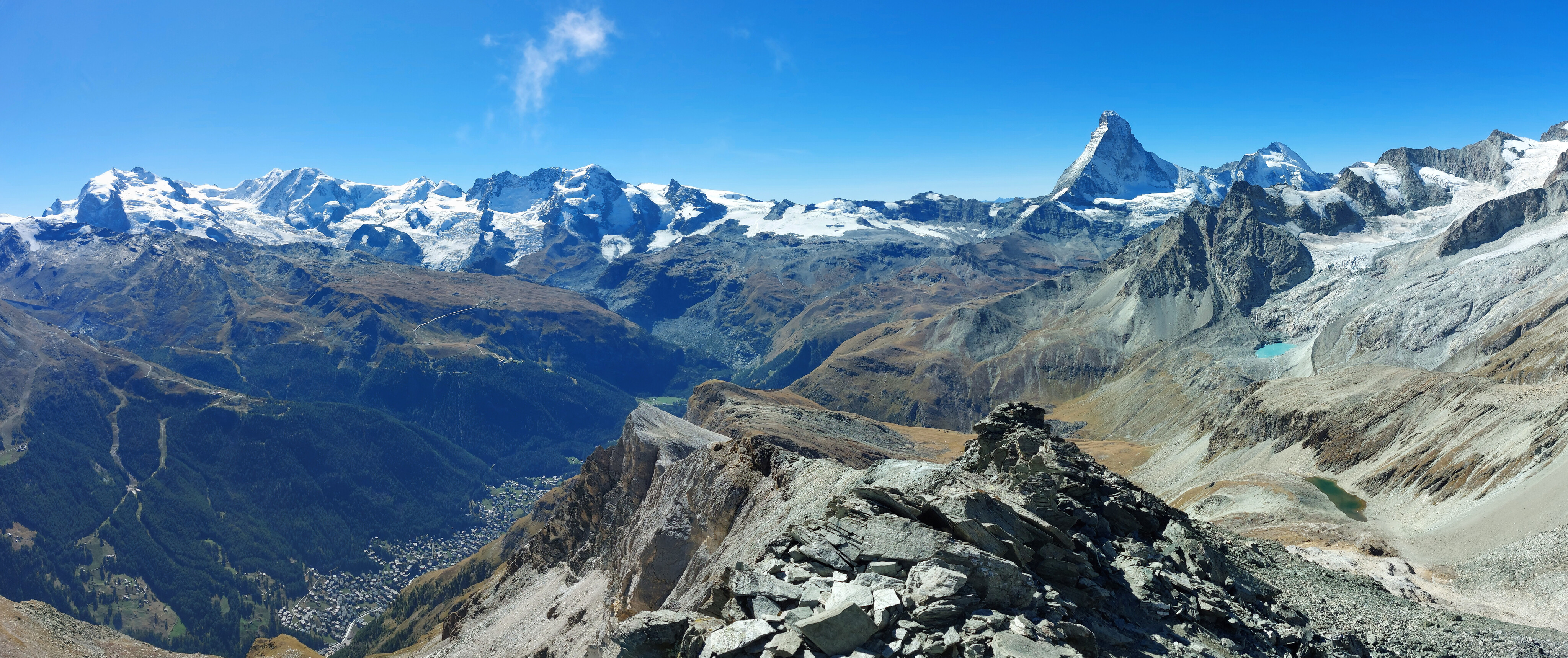
The summit view, with Zermatt, candy mountain, and Monte Rosa all visible (also a cute little alpine lake). Behind us is the Matthorn and the Hohlichtgletscher.
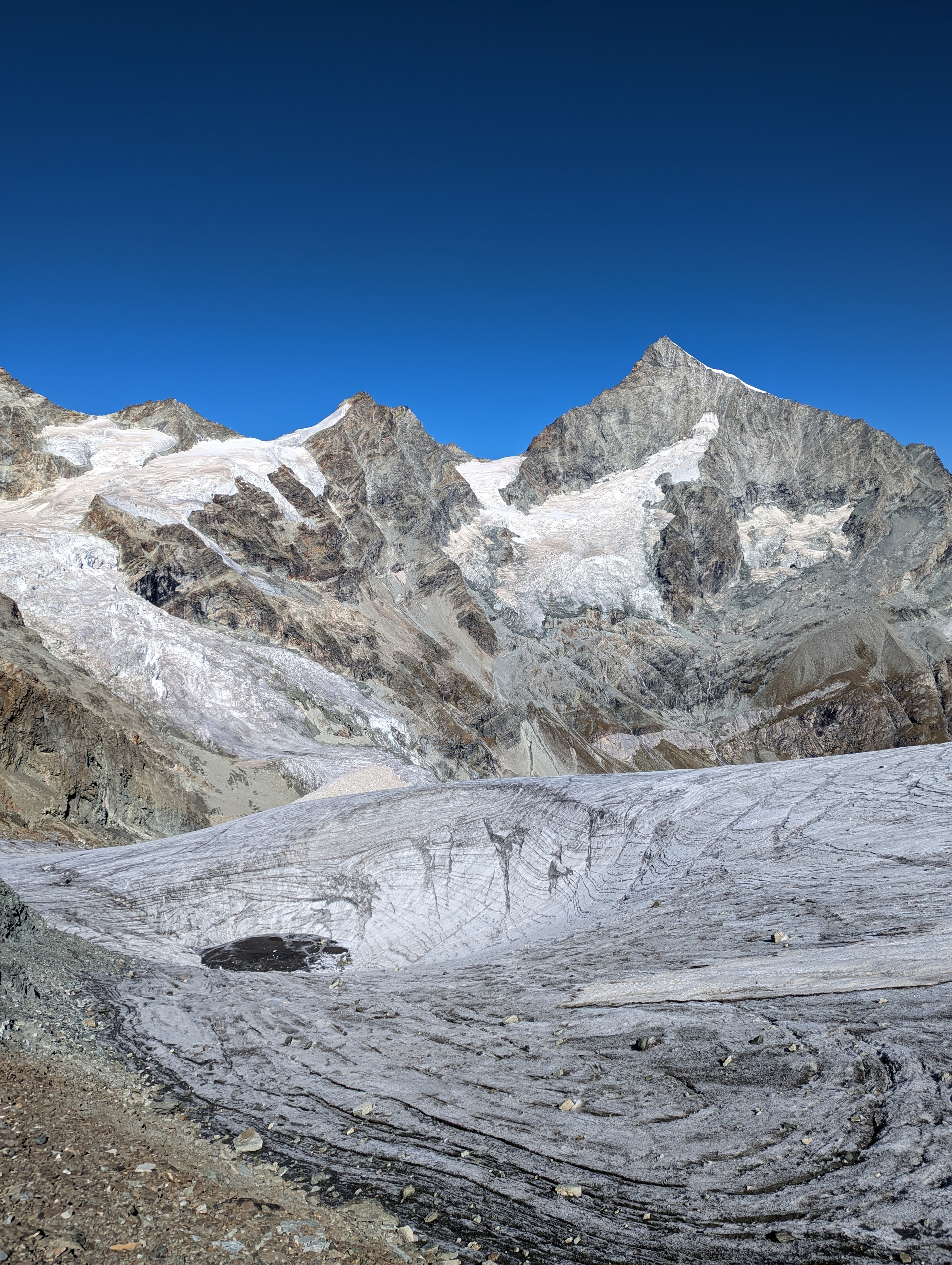
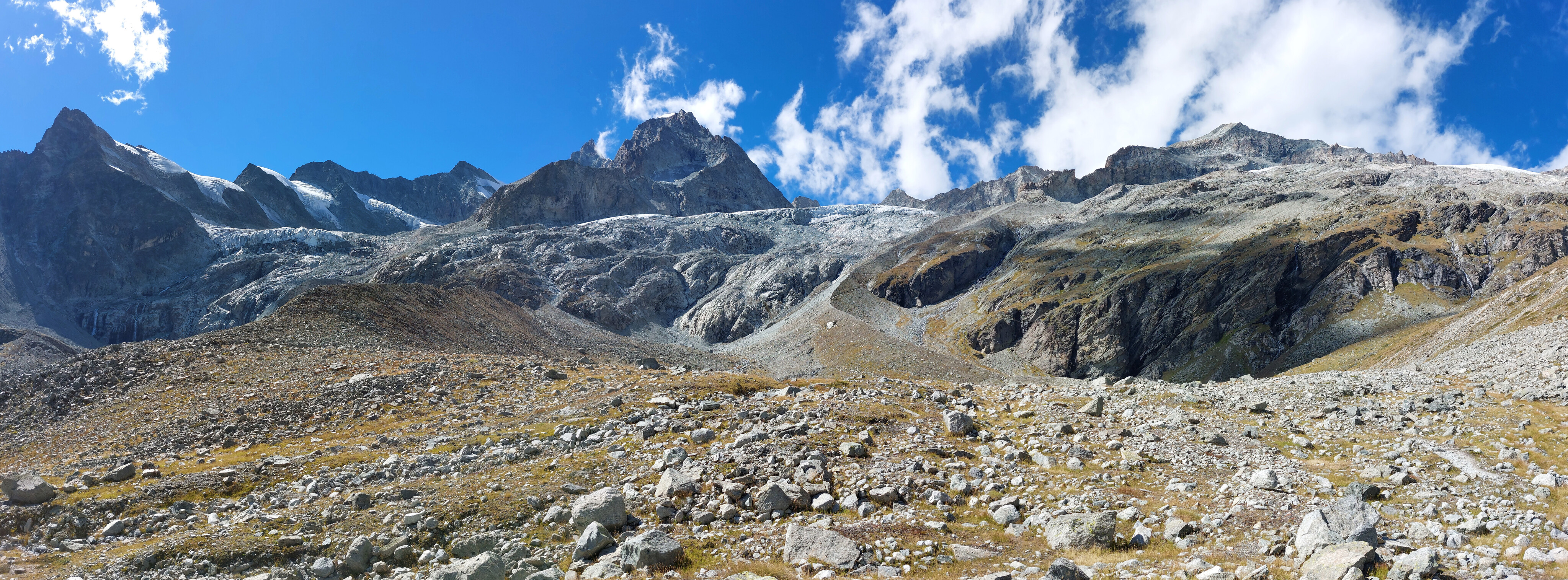
Hohlichtgletscher and friends; we went half-way across it to the Matthorn, but decided we didn't want to add another couple hundred meters of elevation gain to our hike, so we head back to the Berggasthaus for the night.
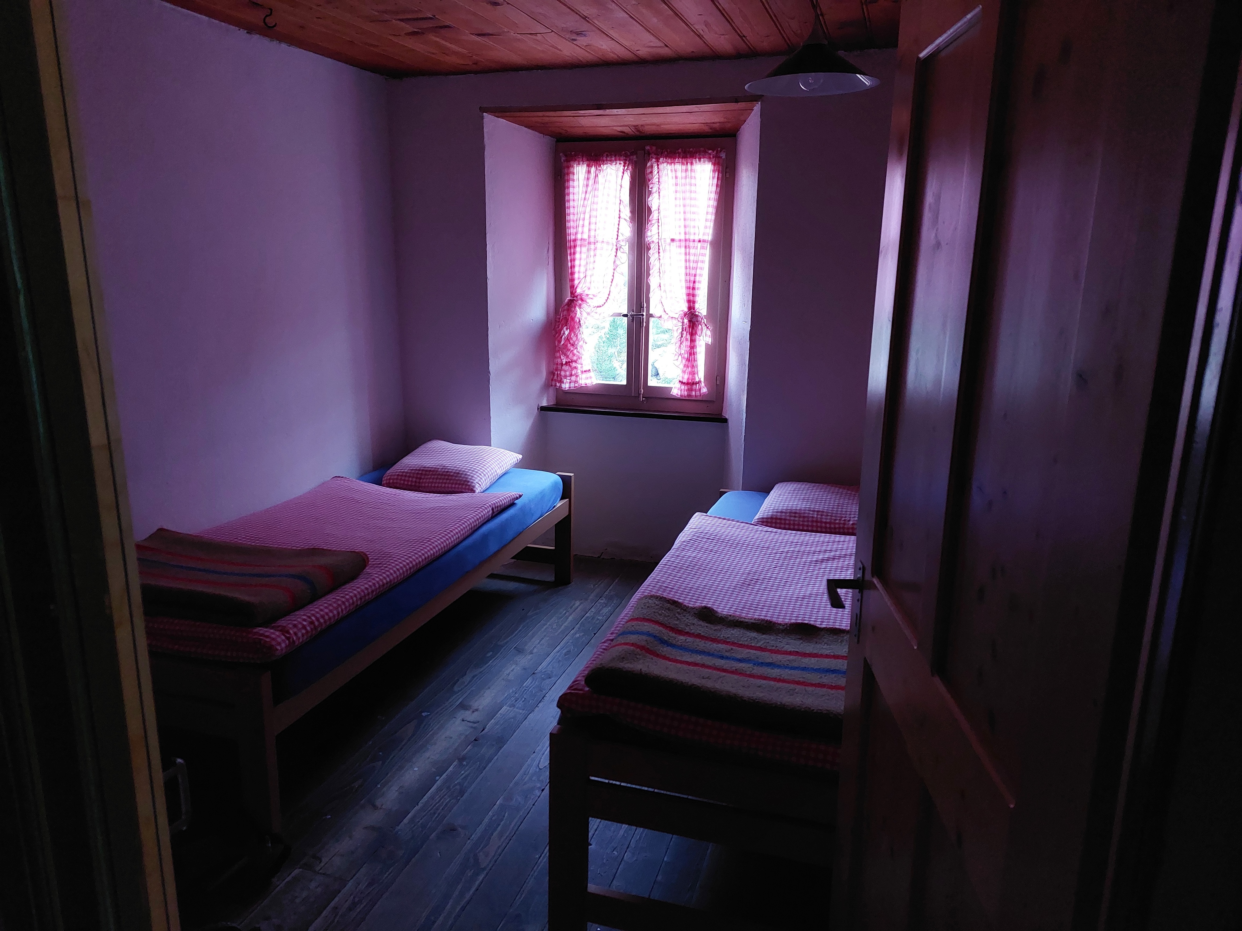
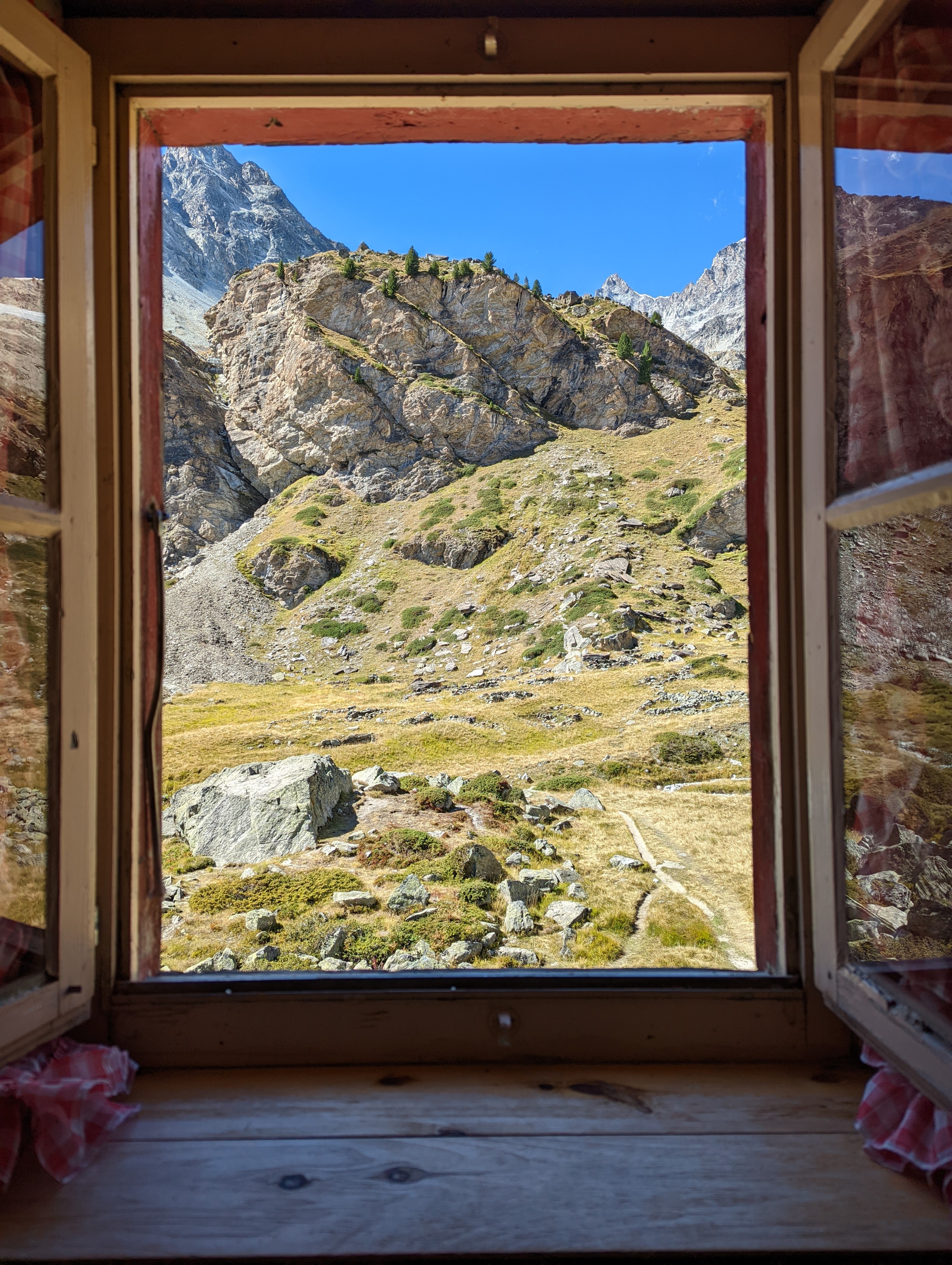
We were in the dorms for the first night and in a double room for the second. Highly recommend it for the privacy and quiet! I also recommend paying for the showers, they make a wonderful end to the hike.
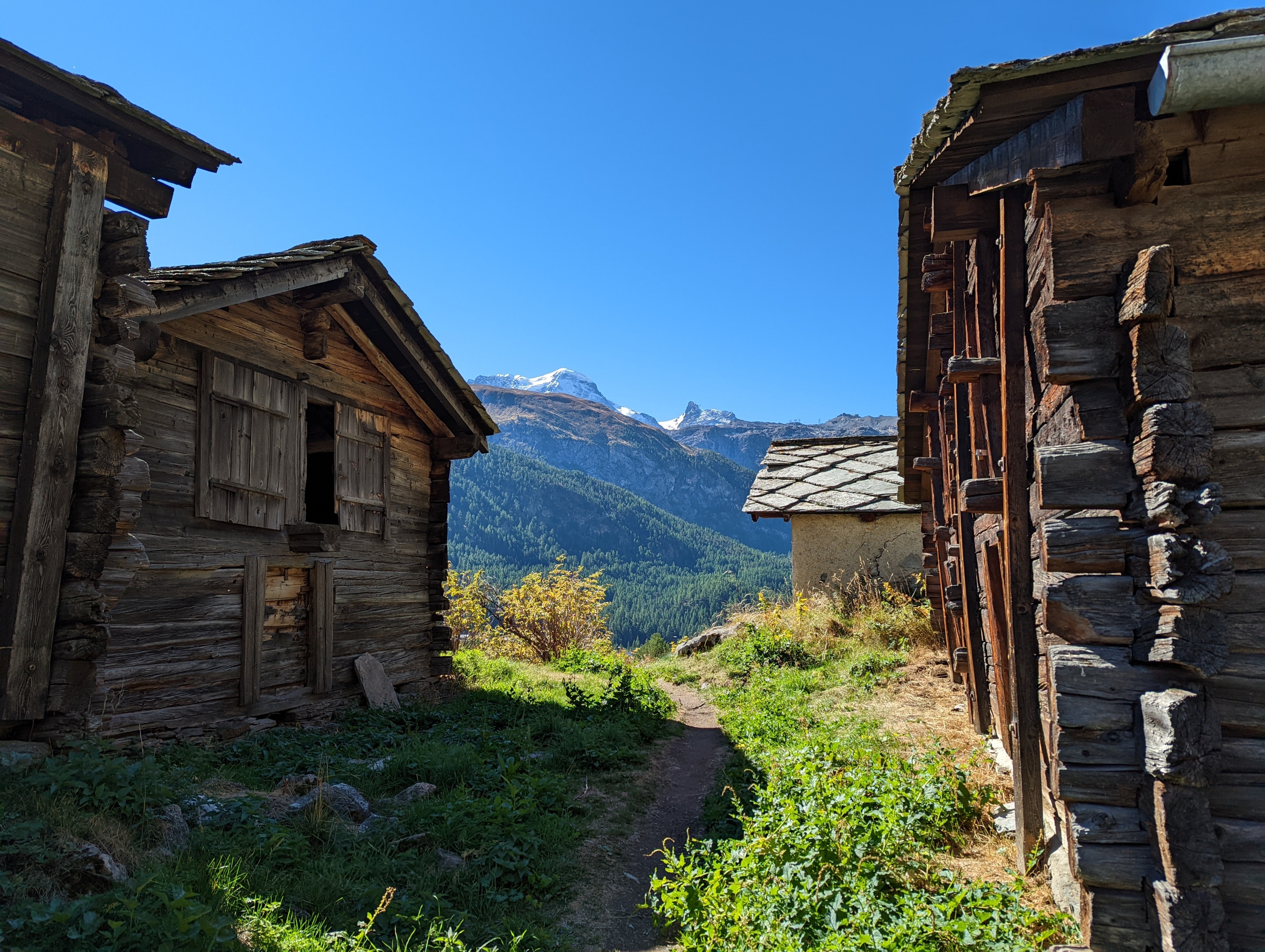
Day 3: Berggasthaus Trift to Zermatt via Edelweissweg
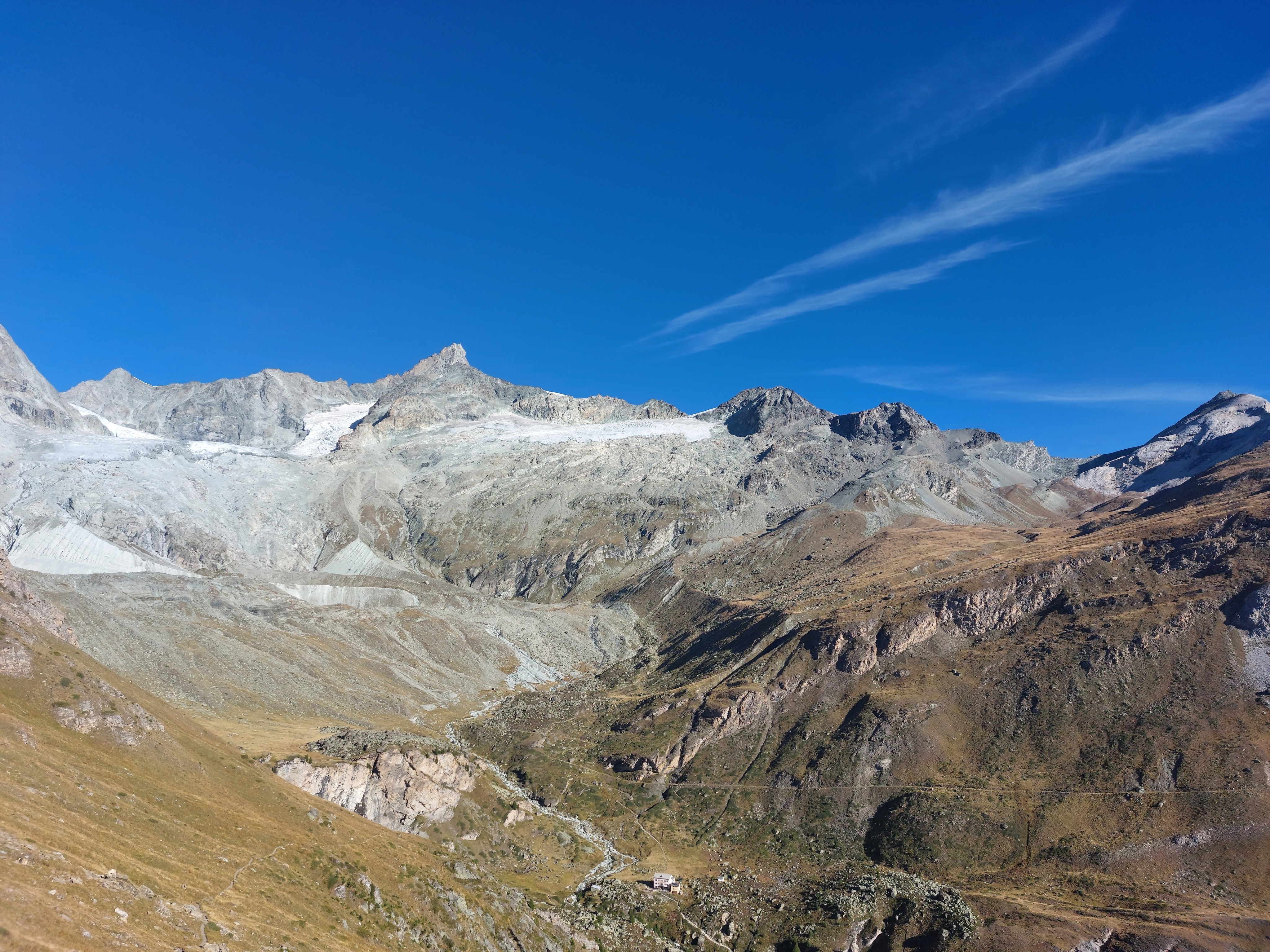
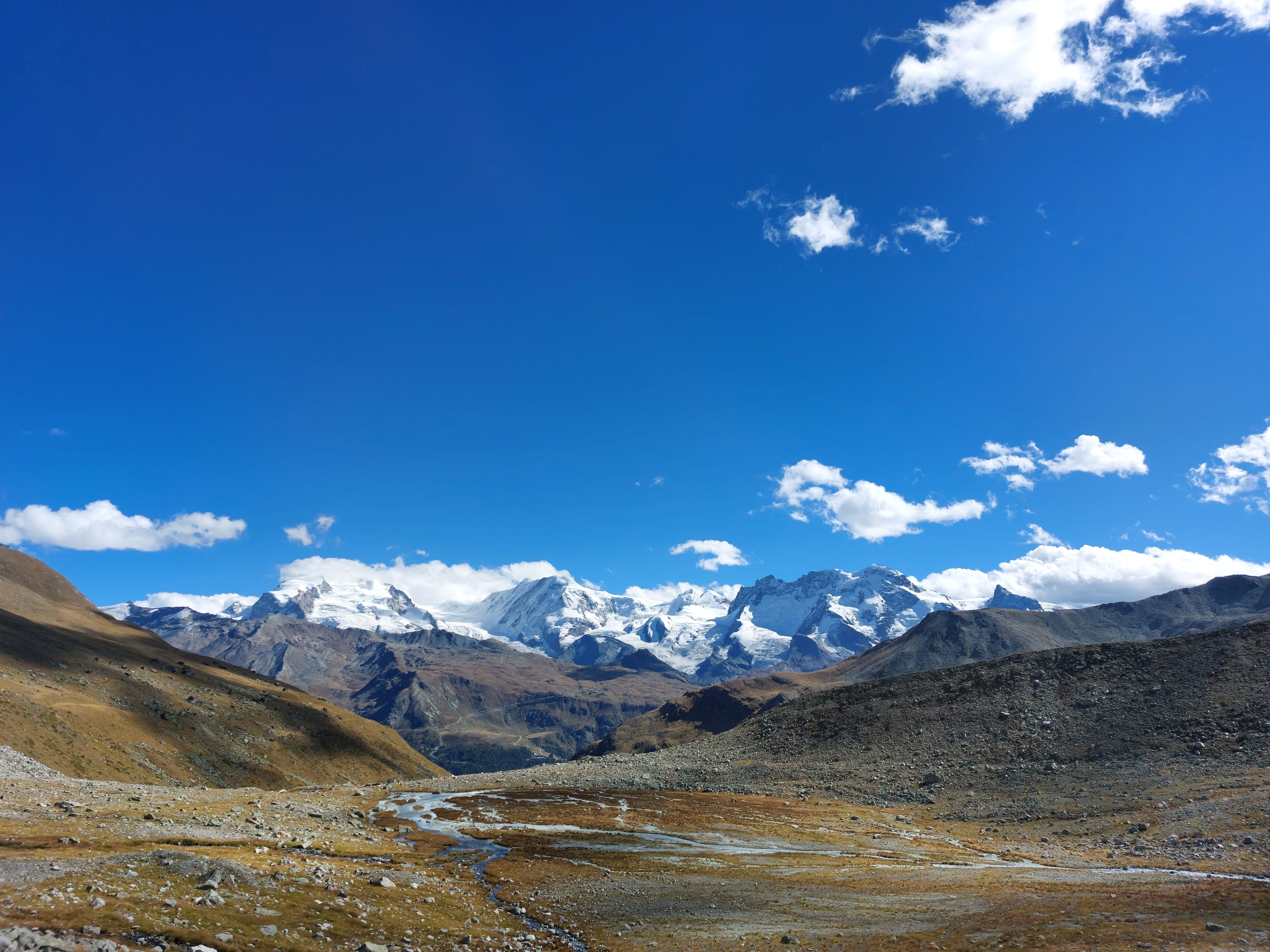
Up on the cliff south of the Berggasthaus; the Rothornhütte is a smear of pixels hidden in the mountains to the back left, while the Platthorn is the furthest-right mountain.
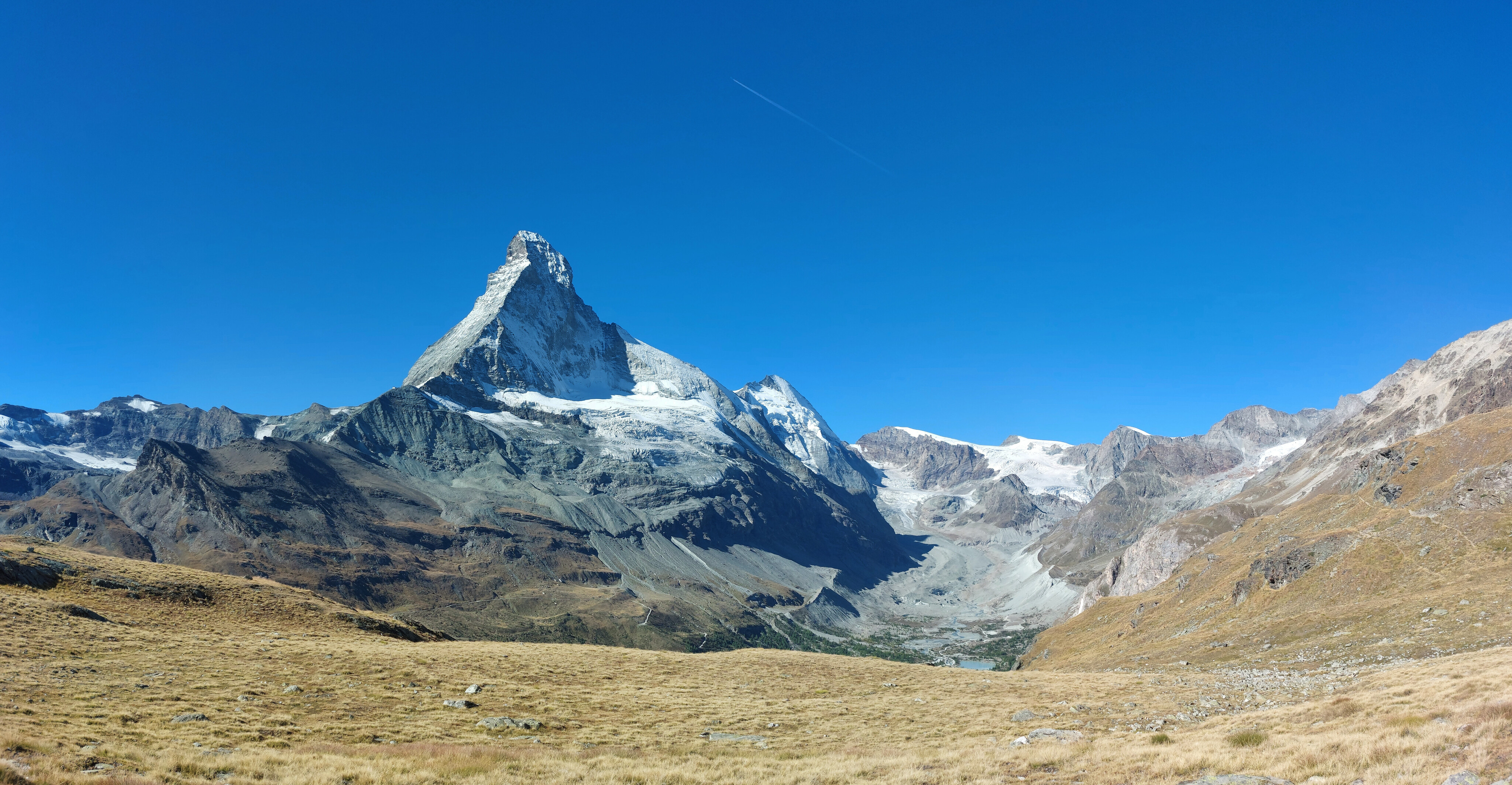
You may have seen the triangular part of Toblerone Mountain, but have you seen its blobby base?
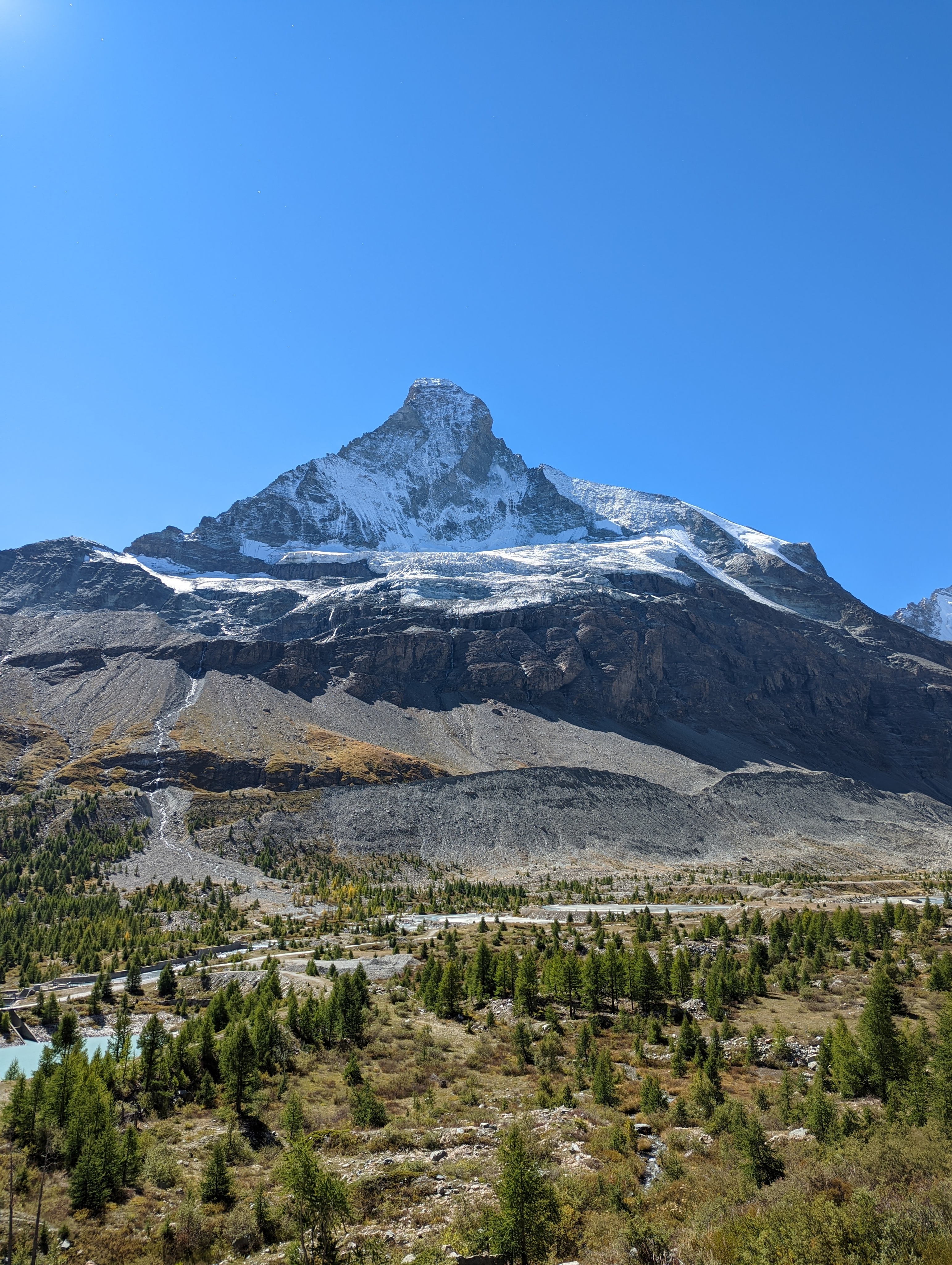
Up close, with a surprising number of dams below (which makes sense, I suppose, given the runoff from all the glaciers).
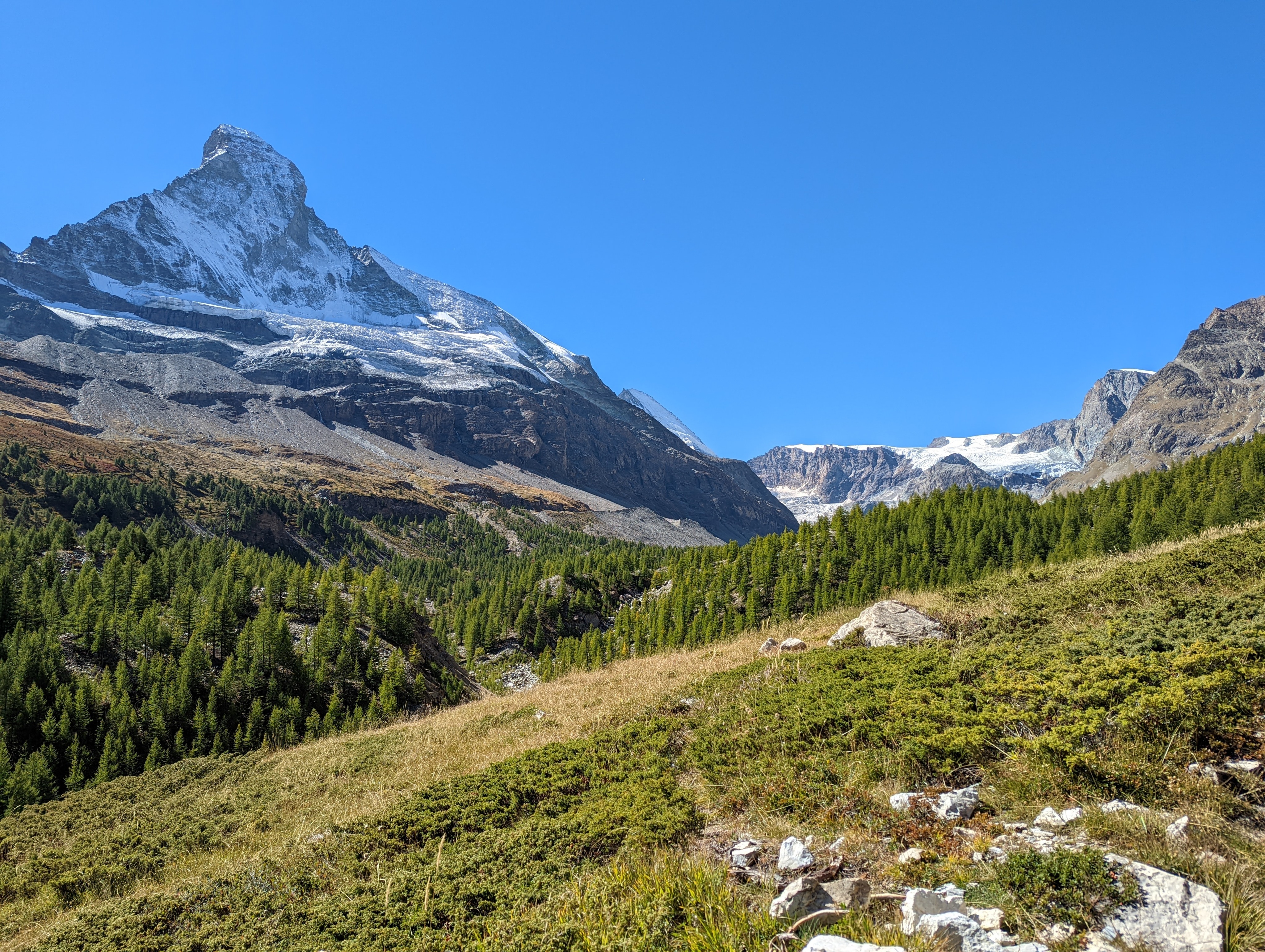
The first time we went through forest the entire weekend.
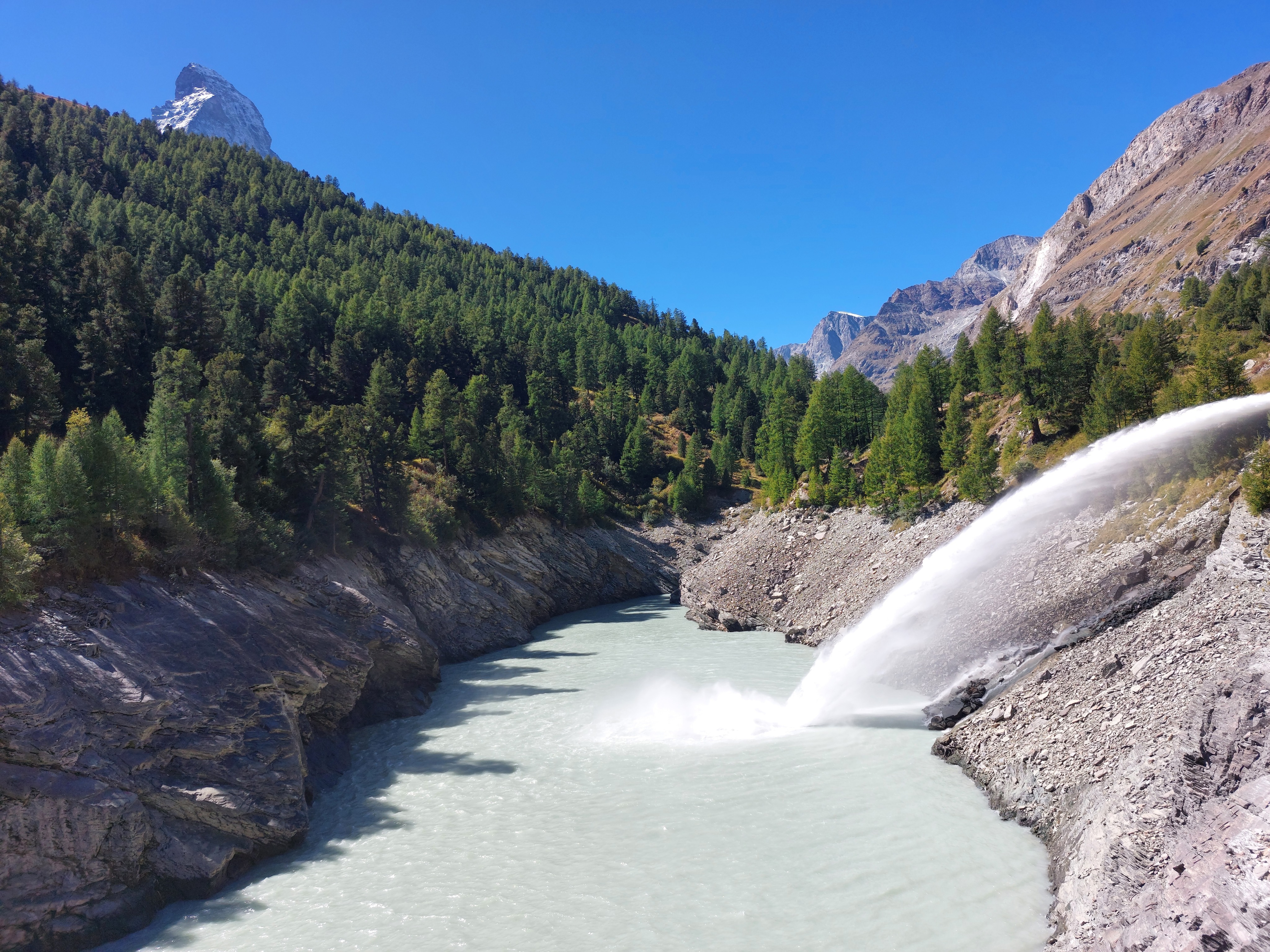
There was a pretty nifty dam on the way back we stopped on for a picture.