Brülisau to Gamplüt via Saxerlücke
I thought the last nice weather window would be the hike I had done on the 6th, but nature decided to grace us with one more snow-free day in Switzerland before I leave, so I decided to head back to the Alpstein massif and visit the other side.
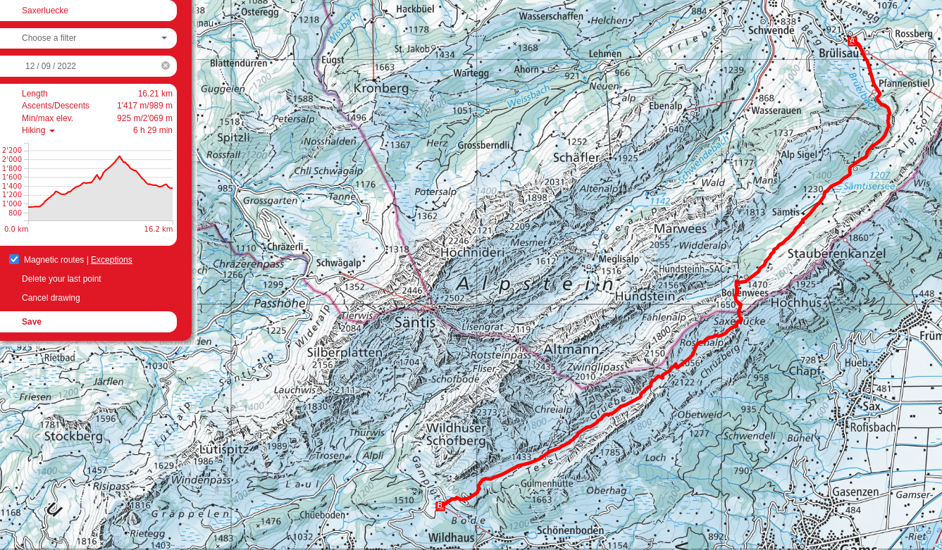
Map of the massif. My route started at the bottom right at Brülisau, then left to Pfannenstiel, up along the left to the Sämitsersee, left again to the Rainhütten, then Fählensee, Roslenalp (top left corner), over Mutschen, and then the off-map descent to Gamplüt.
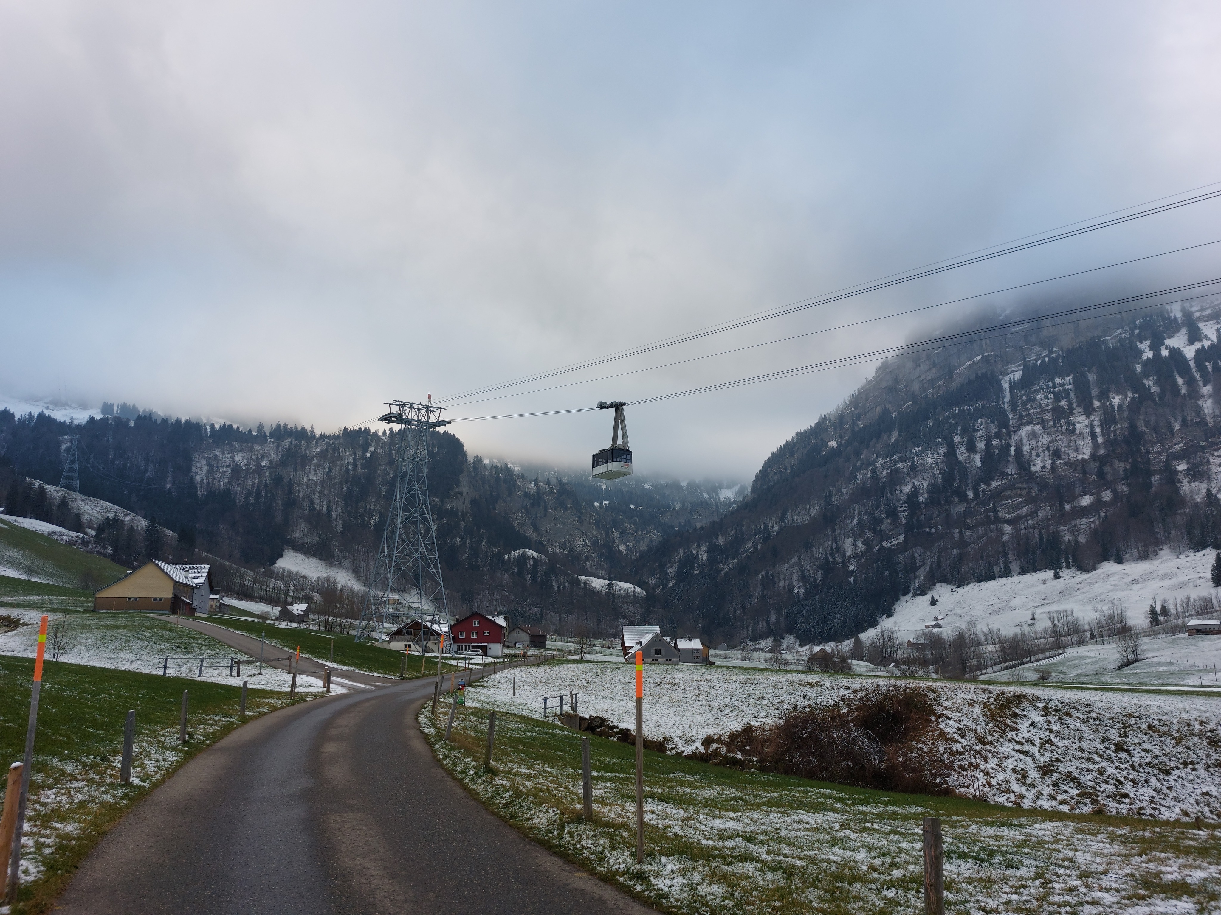
Cable car up to Hoher Kasten.
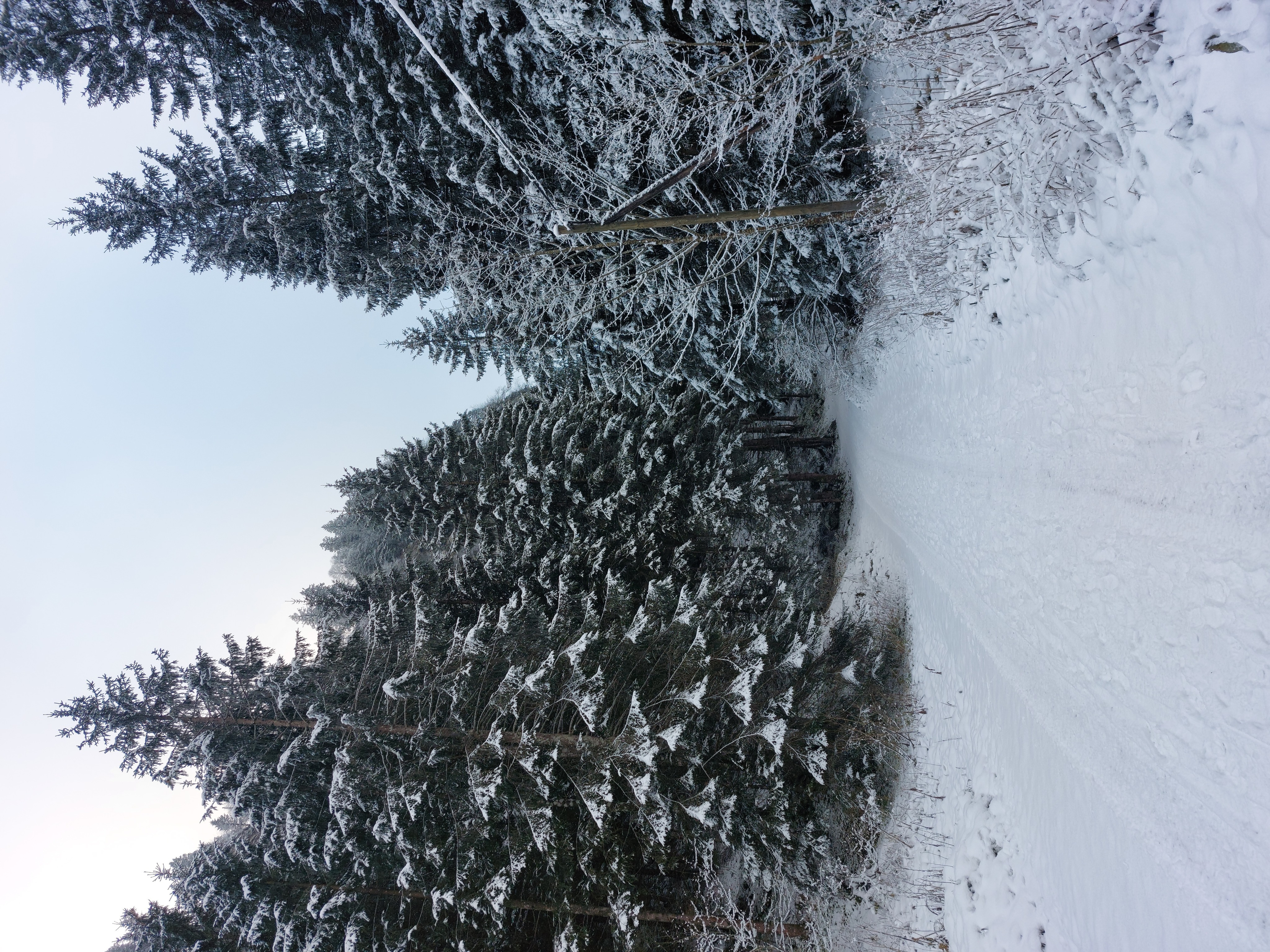
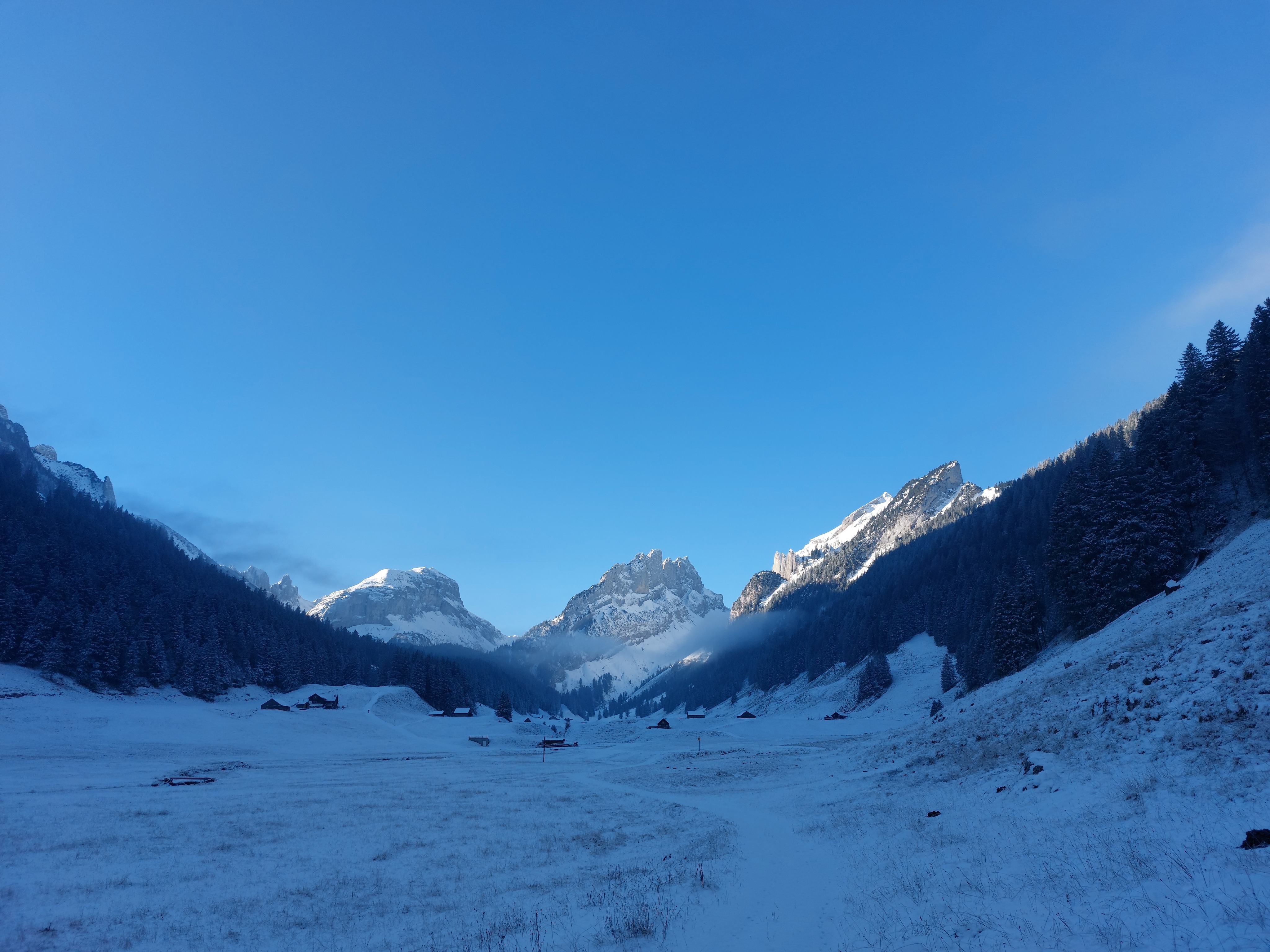
The first hour or so was a steady uphill through a lightly covered dirt road.
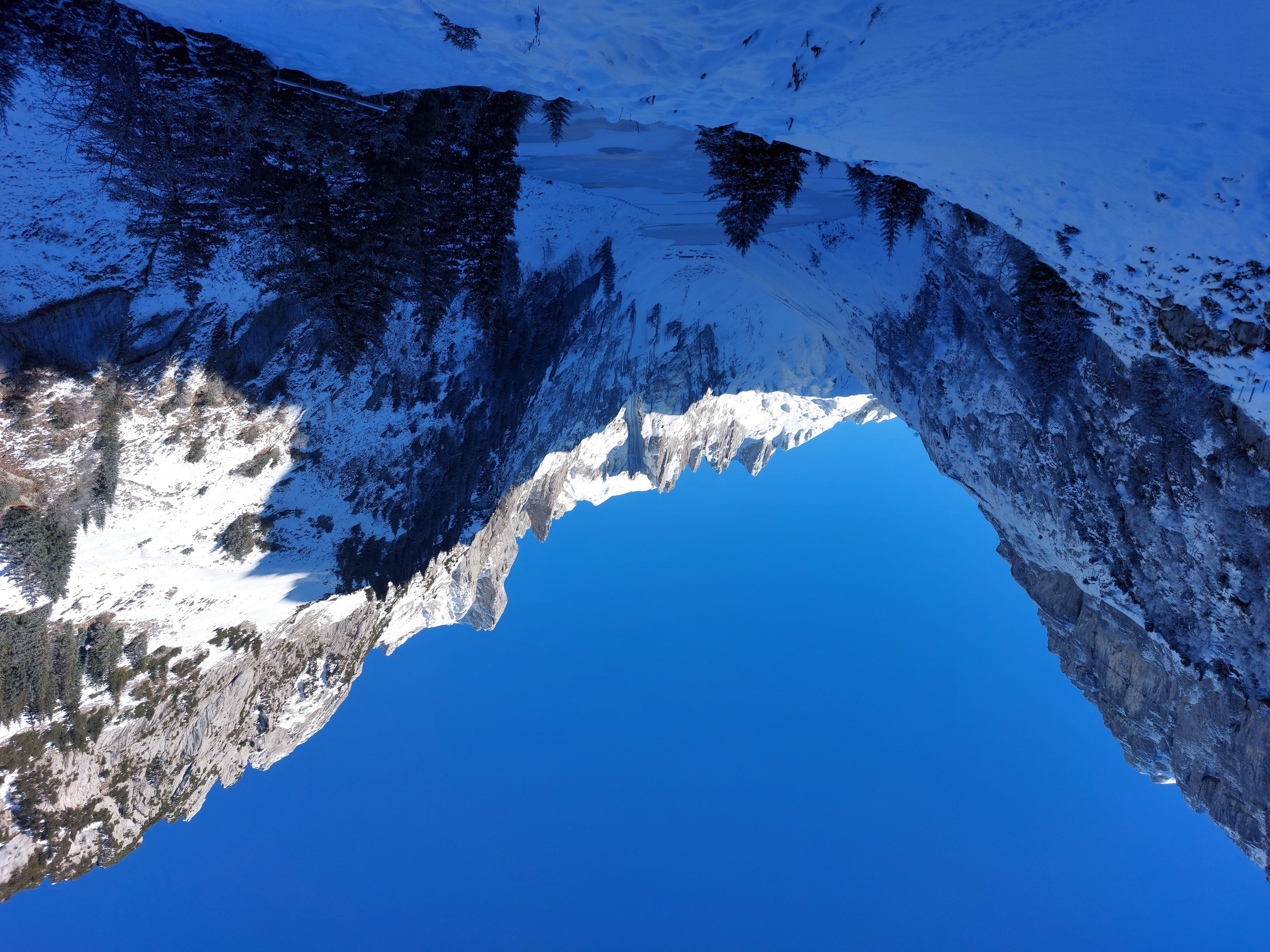
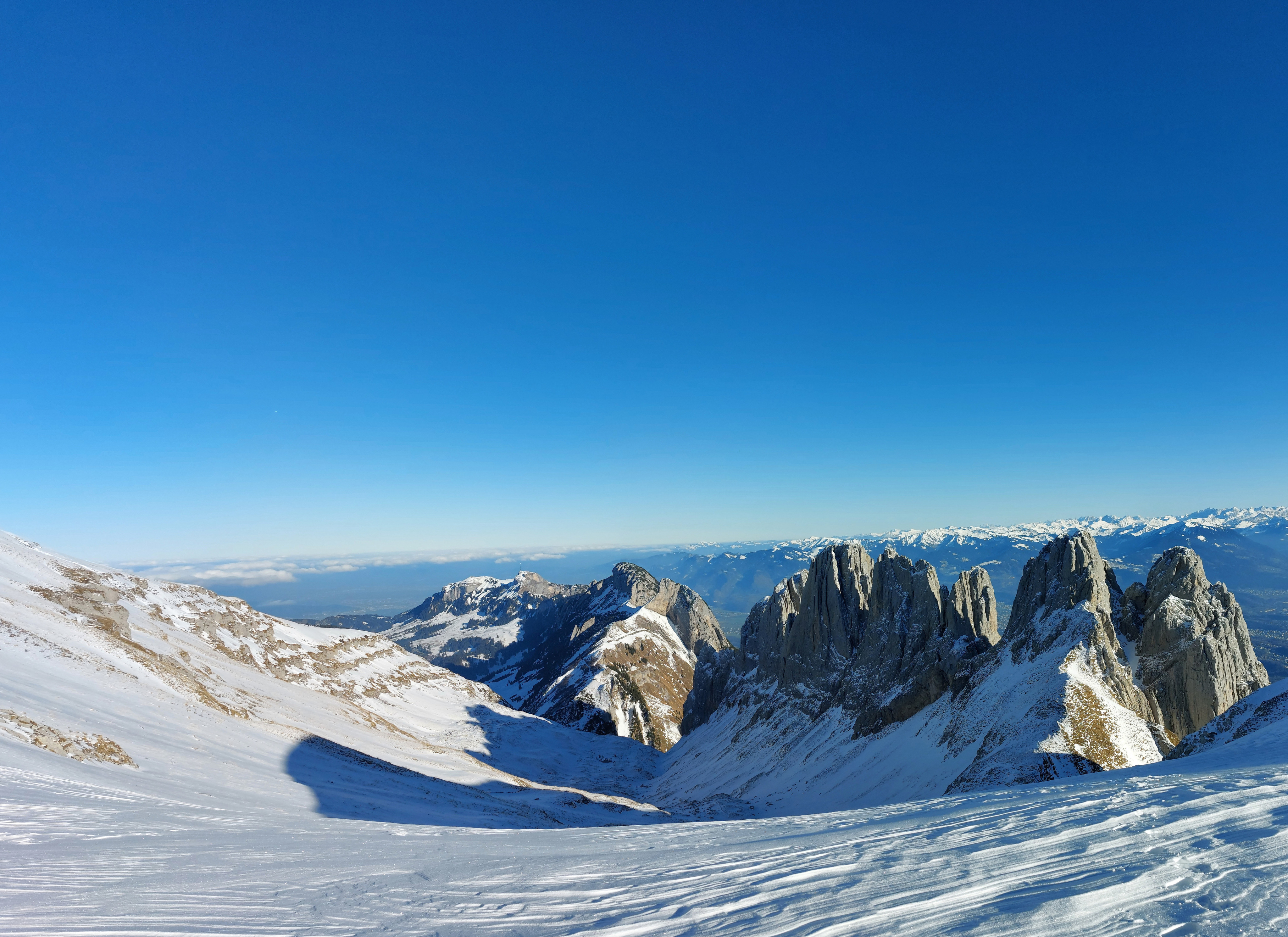
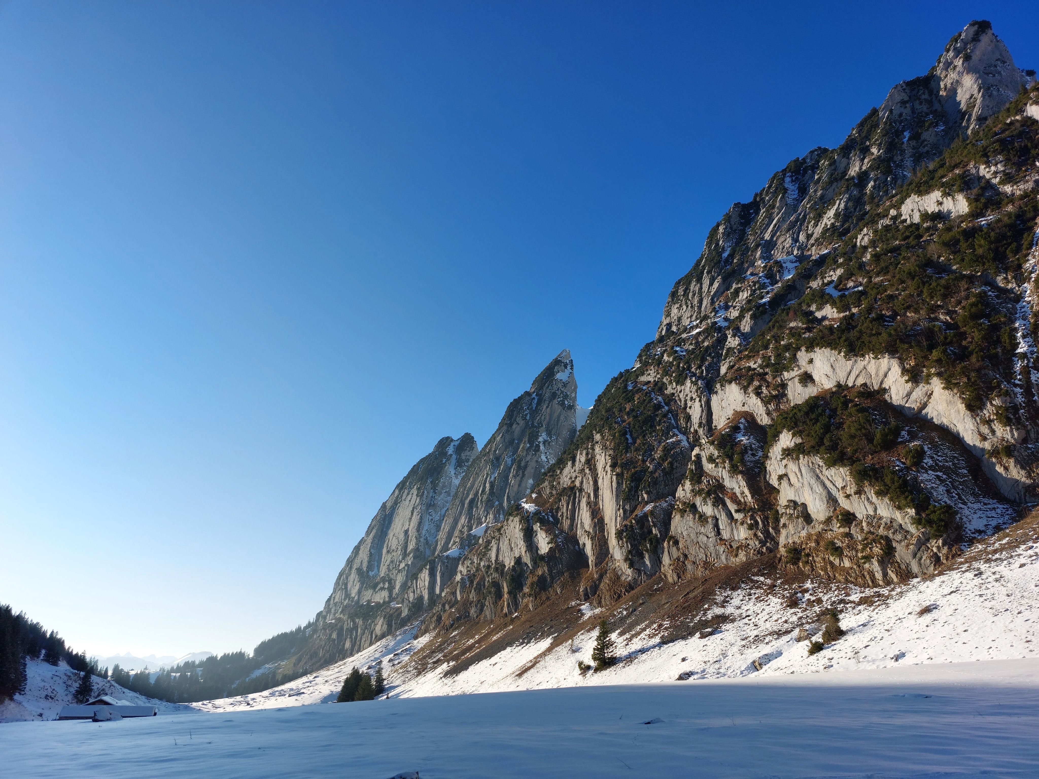
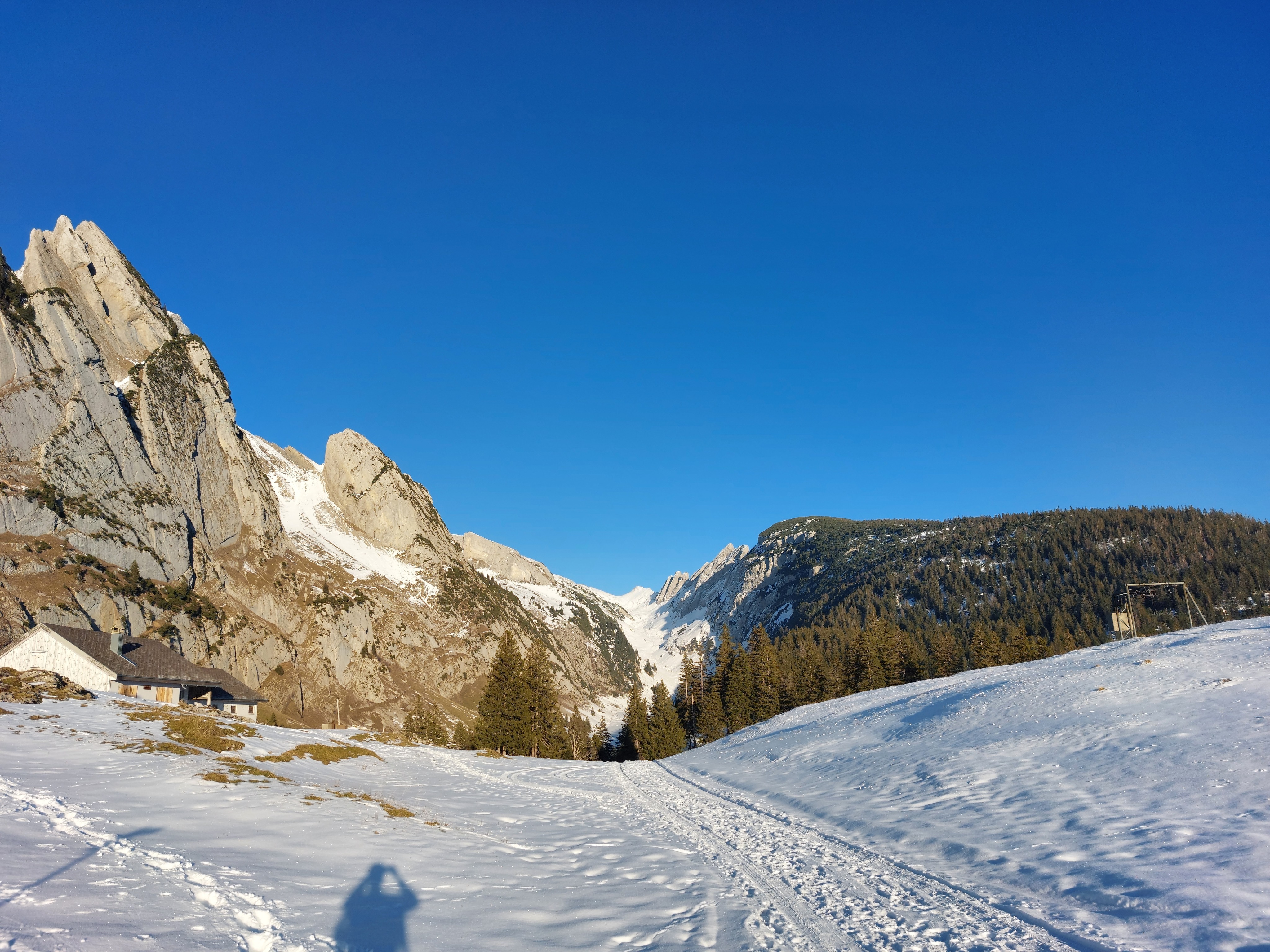
From the frozen shore of Sämtisersee, from left to right, Saxerlücke peeking out, then Roslenfirst, Widderalpstöck, and Marwees.
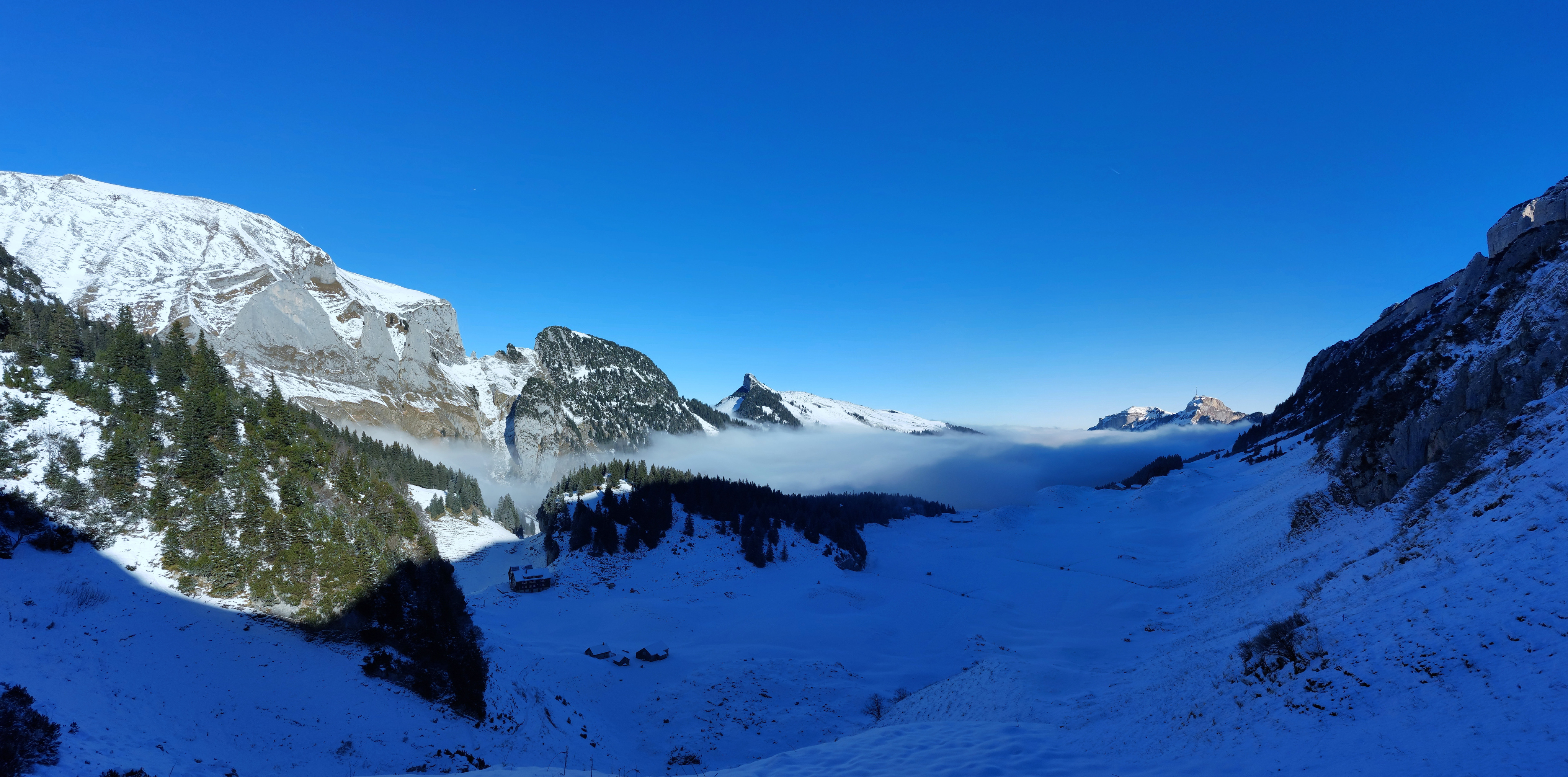
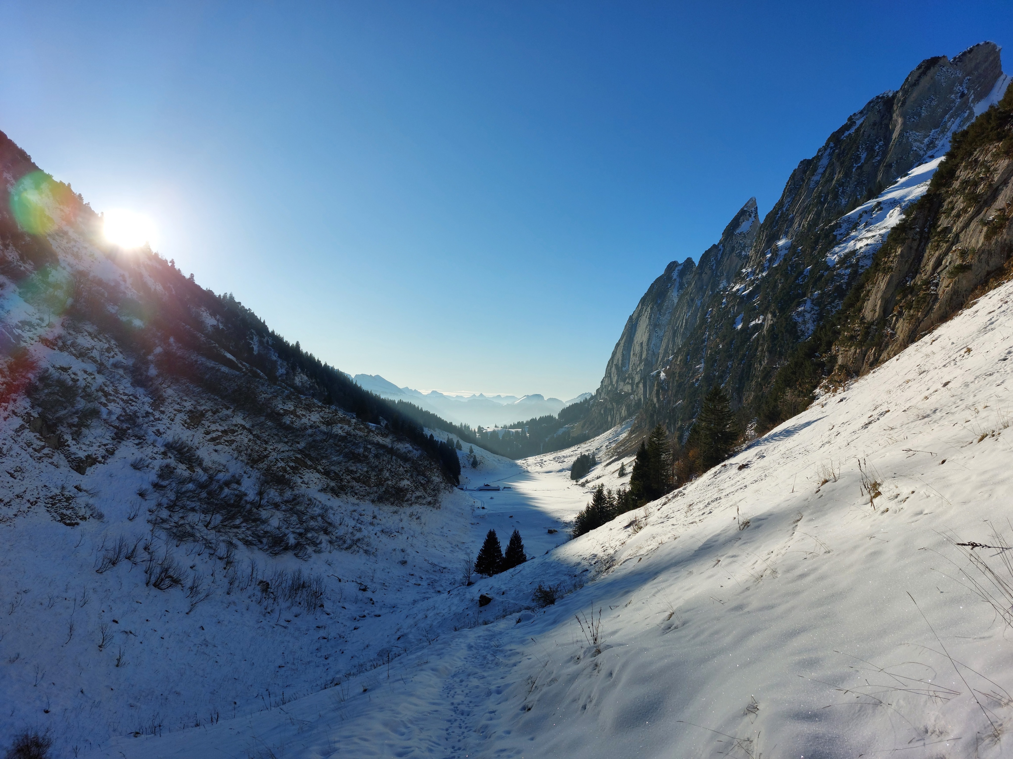
Fählensee. I'd love to come back in the summer. At this point, my good fortune began to fade as the tube to my water bladder froze solid. I really should have seen this coming sooner, but I got lucky the last three hikes and my hubris carried me forward. Needless to say, I ended up chewing on snow for the next 5 hours, which wasn’t great for staying hydrated.
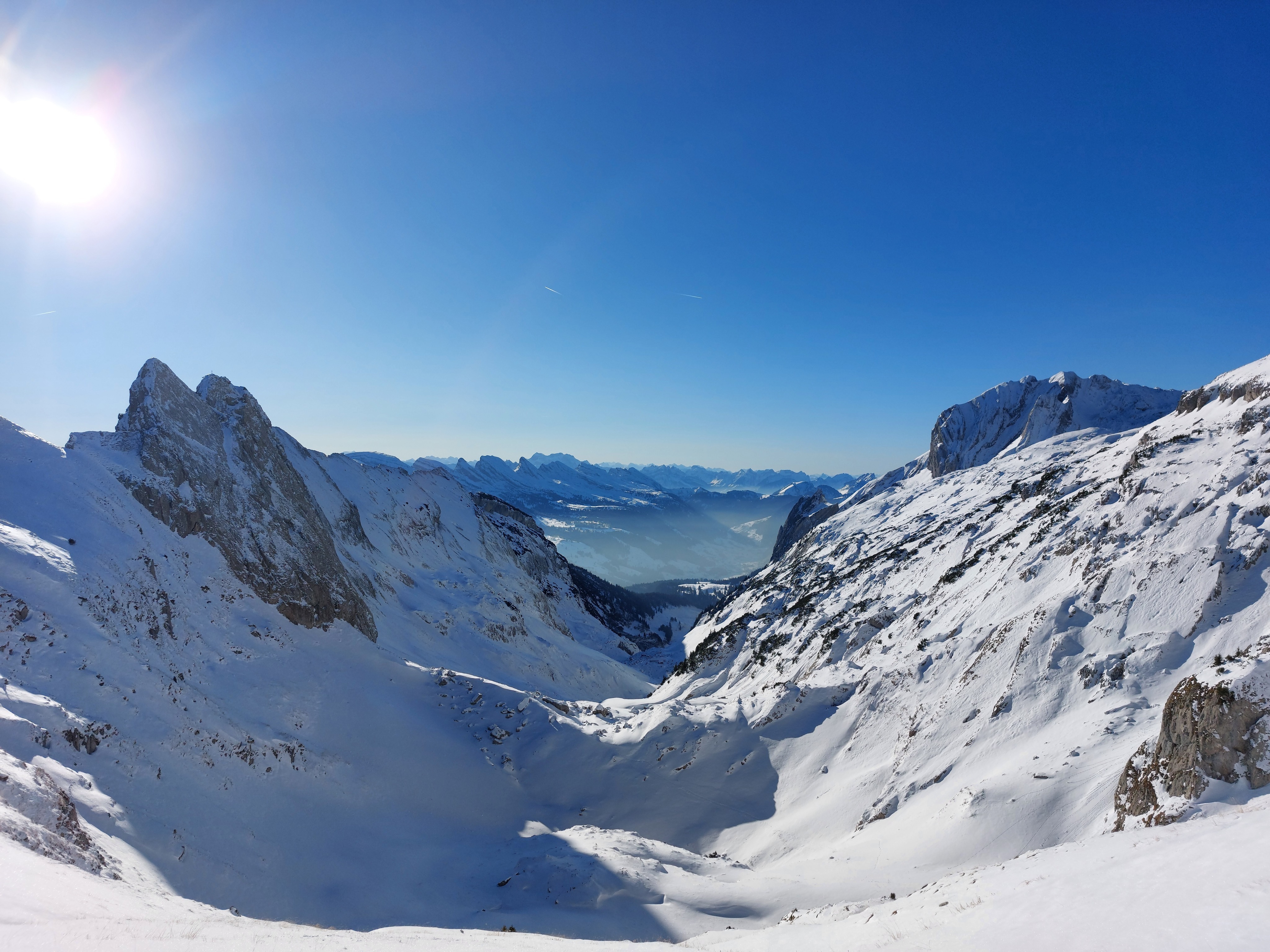
I turned south and climbed up to Saxerlücke, which offered a pretty spectacular view of the rest of the alps.
Looking back the way I came from partway up Saxerlücke. The hotel on the left, Bollenwees, was just behind me in the previous picture; to the right is the way I came. Hoher Kasten is visible up top to the right.
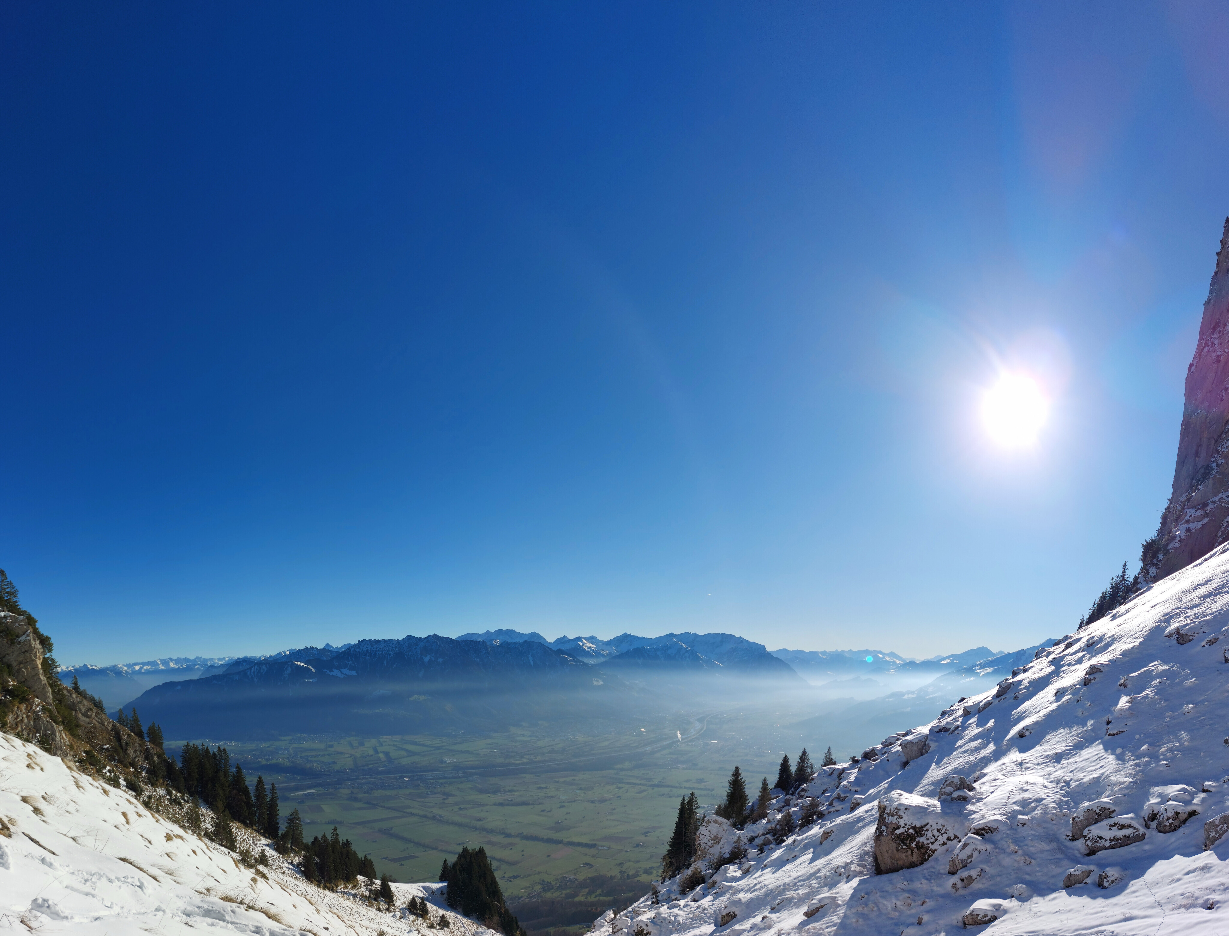
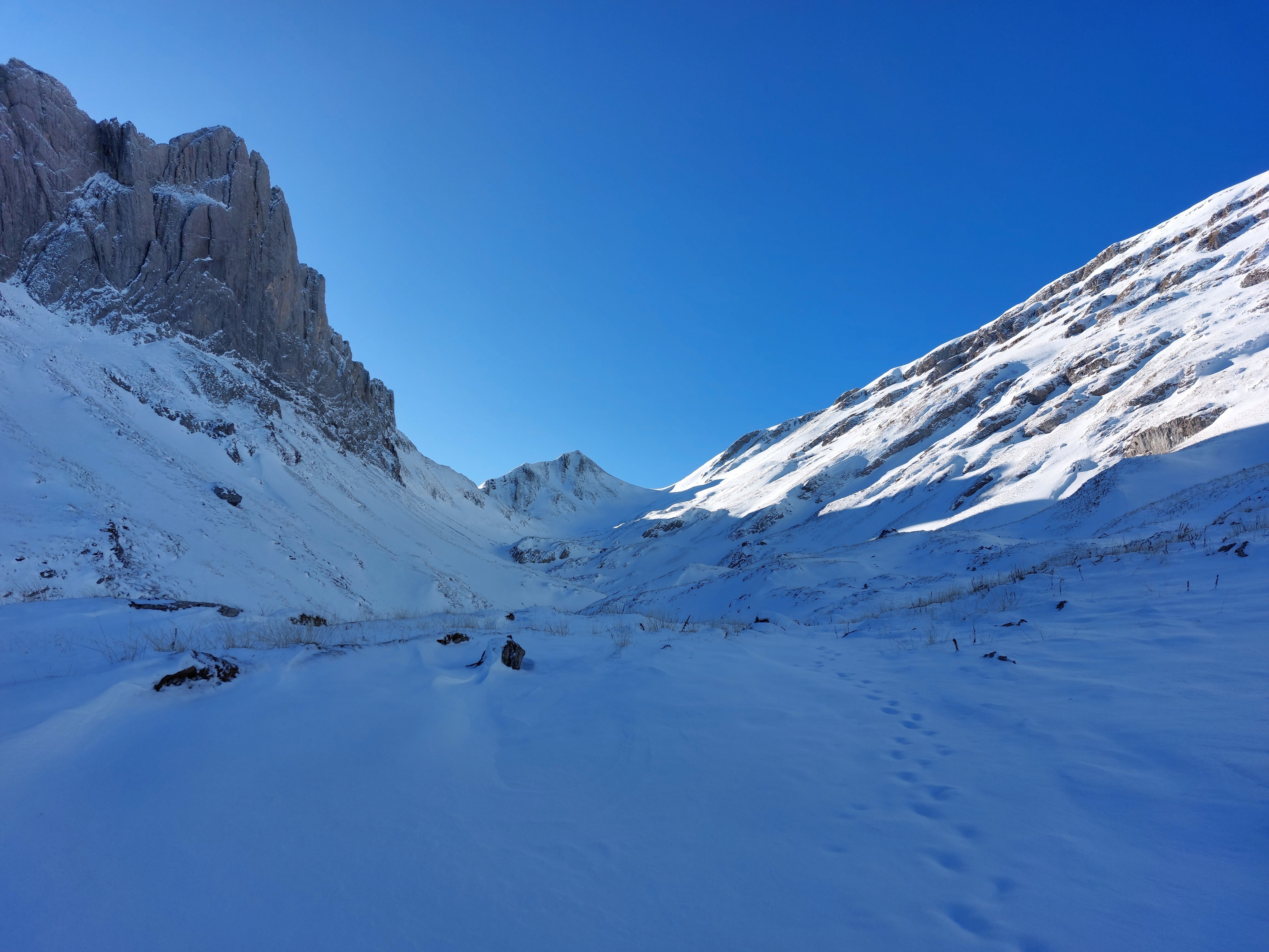
Looking south from below Saxerlücke on the southern side.
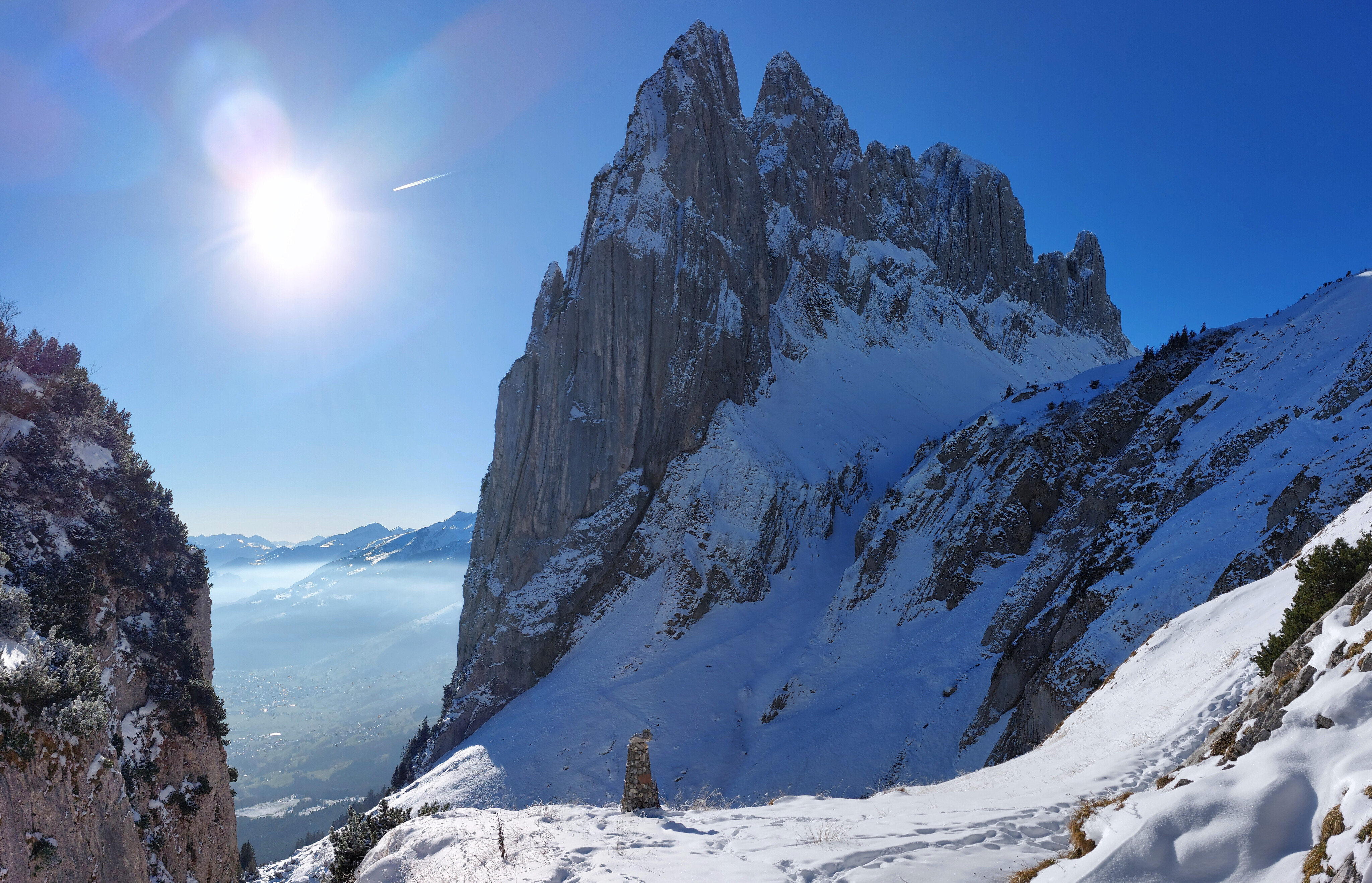
From atop Saxerlücke, looking south.
My options (minus turning around) from here weren't great. I could try my luck with the Letzi Krinnenpass (to the right of the above image), which had a section of pretty nasty exposure and warm, soft snow, or I could drop down a hundred or so meters and try the couloir to the south of the pass (switchbacks in the shadows of the image above), both routes eventually meeting up at Roslenalphütte. I tried the former and it freaked me out too much, so went with the latter. In hindsight, this was stupid; wind had clearly blown snow down the couloir, and a solid layer had settled on top with softer snow below; a thin, if not dangerous wind slab. It had all the warning signs of becoming a potential avalanche; styrofoam-esque feel, hollow sound, feet and poles post-holing. Worse, the slope was already over 30 degrees, and the wind deposit made sections even steeper, prime conditions for something to go wrong. Stupid me got most of the way up before the gravity of my situation became apparent, at which point going back down may have been more risky. I convinced myself that the inch or two of slab wasn’t an issue, and I knew the rest of the hike officially (foreshadowing) had no 30+ degree slopes, so I continued until I got to the top of the couloir.
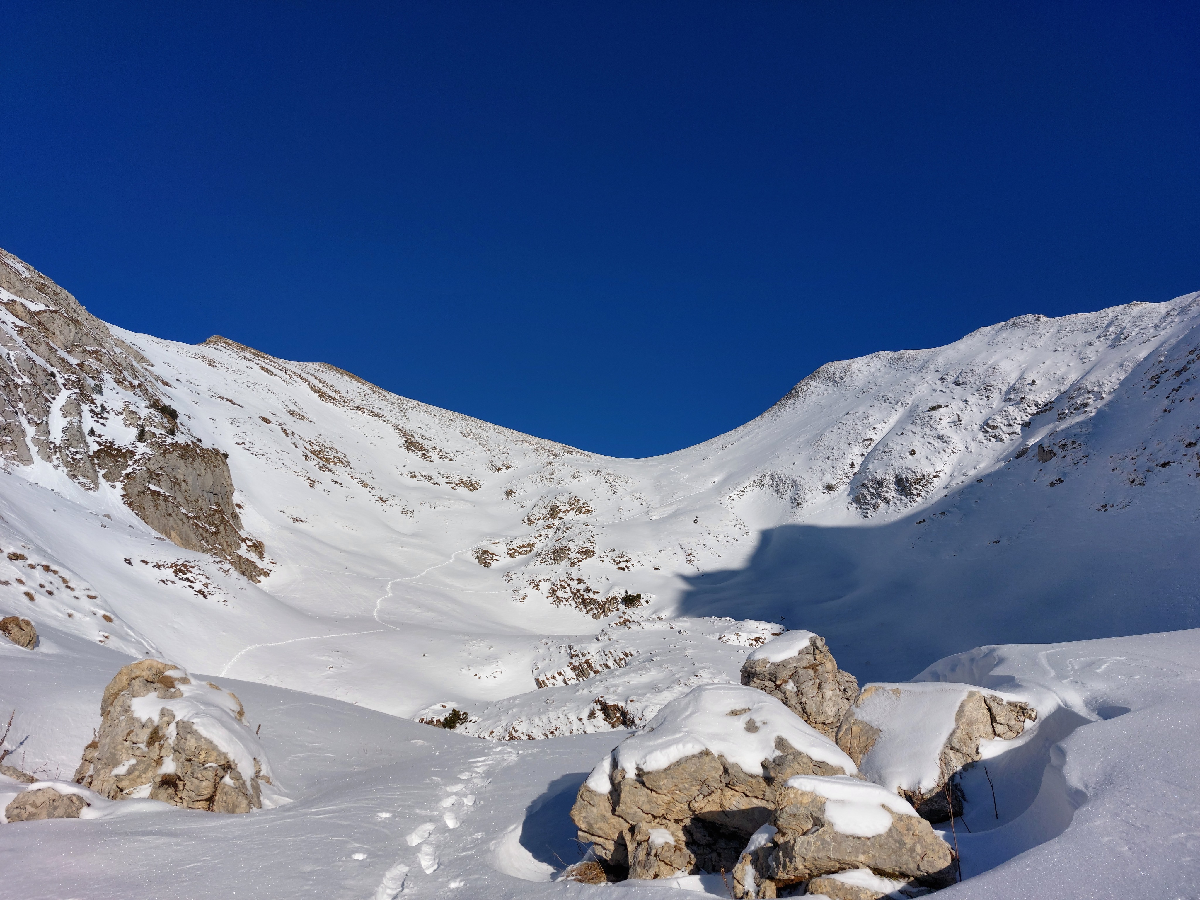
The next bit was all fine and dandy until I reached the pass beside Mutchen, far at the end of the above picture. This was somehow even worse than the couloir; what should have been a sub-30 degree slope was easily above that, with the same conditions as above; wind slab on top, soft snow underneath. The most terrifying part was cresting the hill. If you look up snow cornices on your search engine of choice, you’ll probably find snow which overhangs the leeward side of the slope pretty dramatically. In my case, it was less of a blade sticking out over my side, but instead a bulb that extended six to twelve inches, but was maybe a couple feet tall, and completely solid, with presumably more soft snow underneath; again, ripe for collapsing/triggering an avalanche. I didn’t want to turn around and backtrack, both to avoid facing the couloir again, and because if I went back the way I came, I’d miss the last bus (I guess in my mind, my life was worth less than an expensive taxi or bed and breakfast). I planted my poles on the top edge of the cornice and practically bunny-hopped onto it and off the other side to flat, actual ground.
Knife ridge as seen from beside.
From atop Mutschen, looking back the way I came. Roslenalphütte is in the shadows of the knife ridge, while Hoher Kasten is a few pixels on the mountains in the background.
Facing the other way (west) towards Gamplüt, and my descent route.
The descent was also fairly stressful. Not so much because I was in any impending danger; I was now on the windward side and kicking through deep, fluffy powder. Instead, it was a race against the clock to make it to the last cable-car down. I didn’t technically need to make it, since I could just walk an extra 45 minutes to get down myself, but after what would be 7 hours of stomping through deep snow and being fairly dehydrated, I wanted the easy way down. I made it with 15 minutes to spare.
Looking back up to Mutschen from partway down.
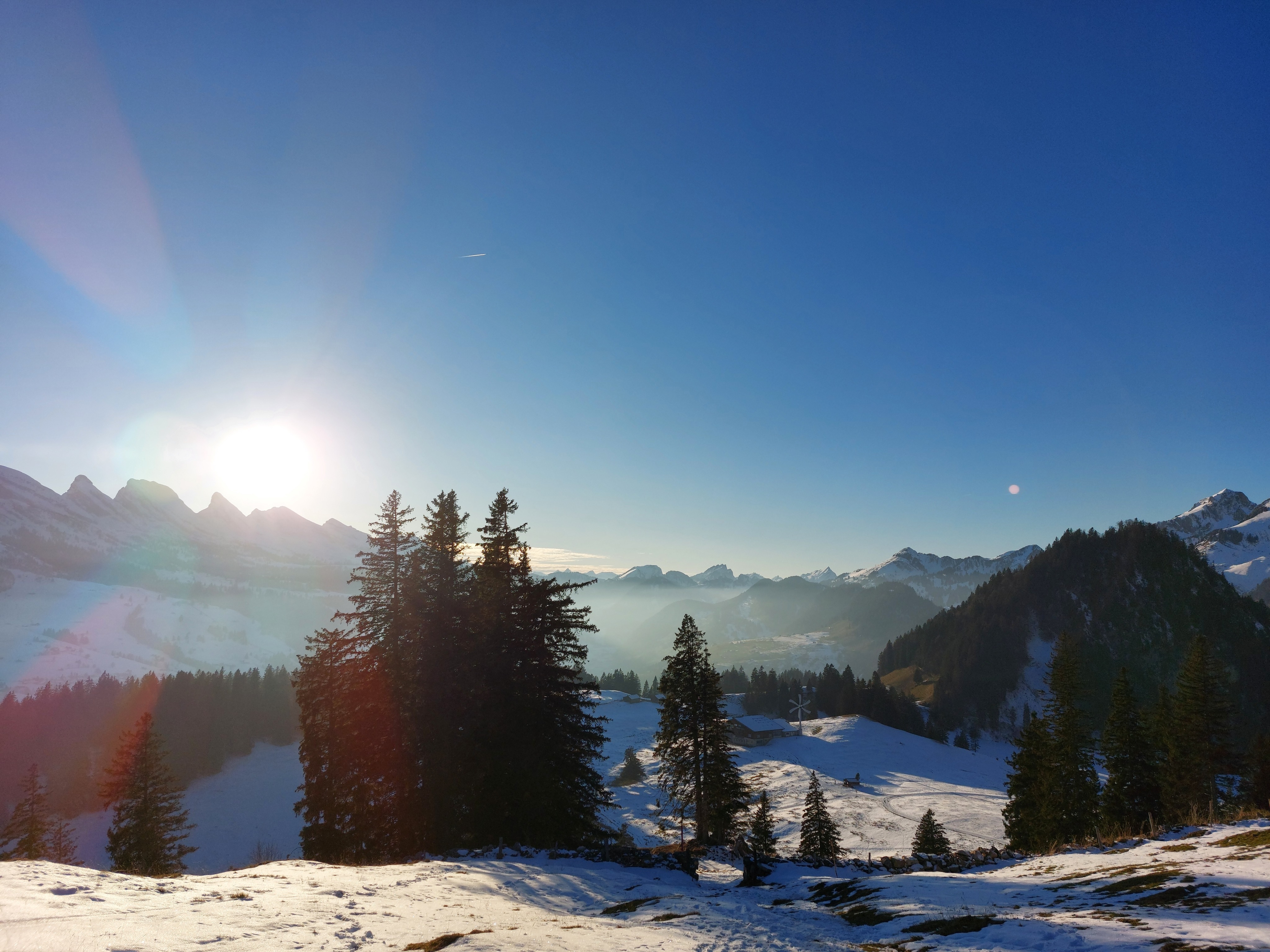
Tesel, the home stretch.
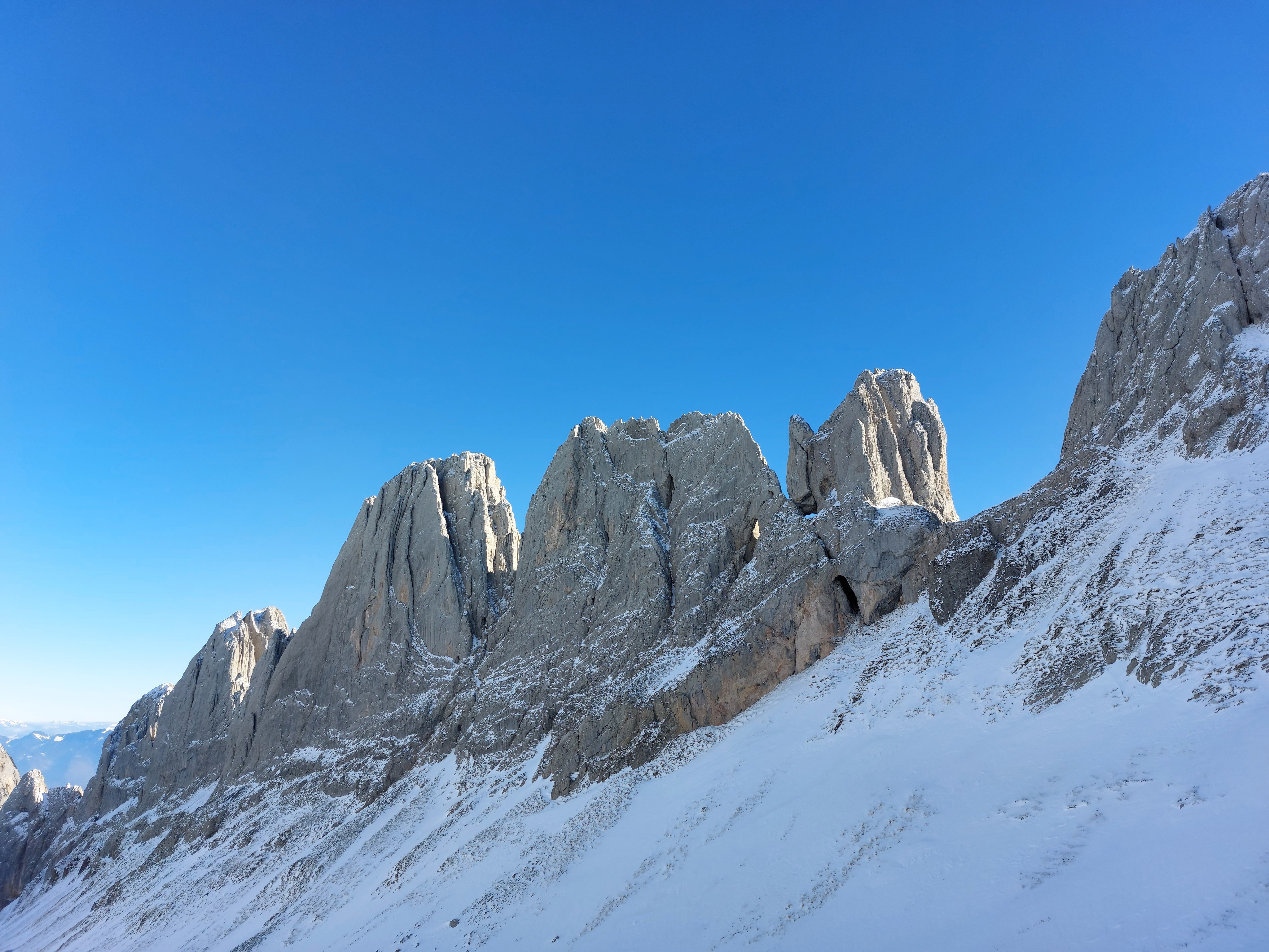
Some very pretty peaks.
Mutschen far above, as seen from near Gamplüt.
Gamplüt proper, and some glorious lighting to close out the day.
A lot went wrong this hike. All of it was on me; I should have brought water bottles instead of an (uninsulated) bladder. I should have figured out the slope conditions in advance and, when I discovered that they were ripe for a disaster, cut my losses and turned around.
All that said, it really was beautiful, and I’d love to come back in the summer. I’ve never seen a lake in such a restricted space like Fählensee, and the spar of rocks to the south between Saxerlücke and Mutchen are phenomenal.
Overall, it was probably a decent hike to end on before going home for the holidays, in that I was simultaneously satisfied with the views, and needed a good long while to calm my nerves.