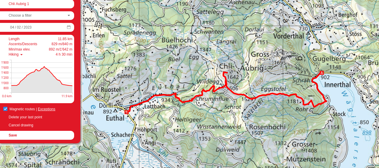
Chli Aubrig
Adequately shaken by my experience at Saxerlücke, I picked a risk-free hike for my first one back in Switzerland post-holidays: Chli Aubrig. Low, relatively flat, and south facing on a day with gorgeous weather. I started at Innerthal and made my way along the ridge south of the Aubrigs.
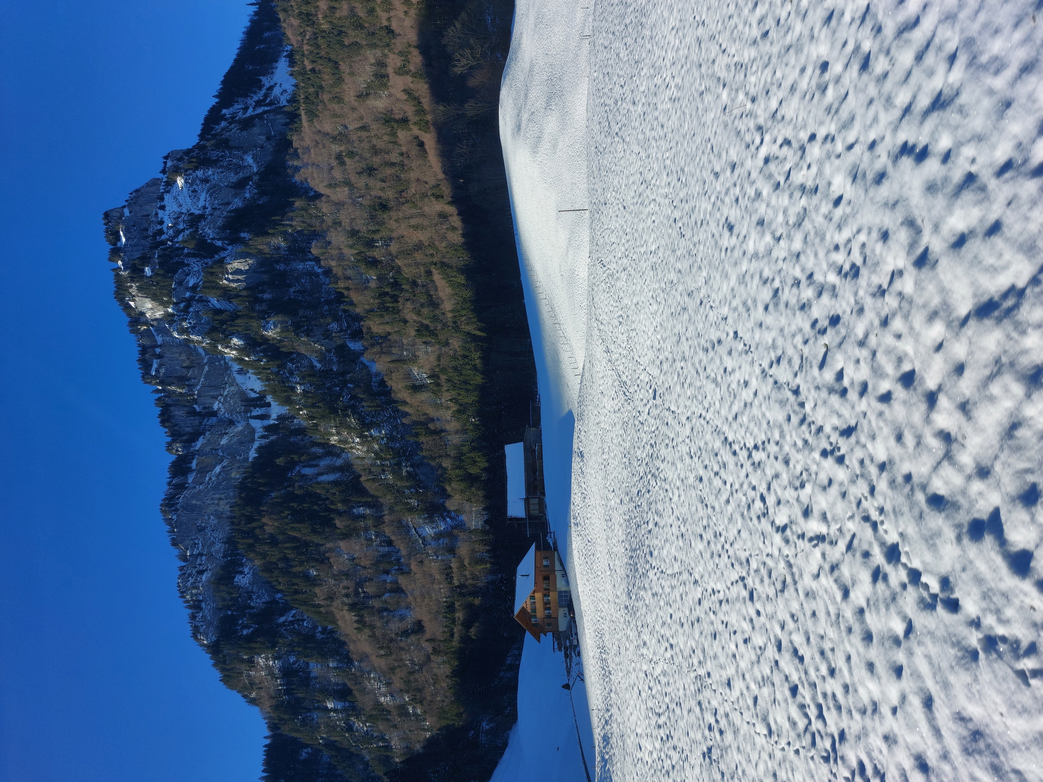
Gross Aubrig as seen from the bus to Innerthal. The route up from Siebnen-Wangen is incredibly beautiful, winding up through a forest valley until reaching Wägitalersee.
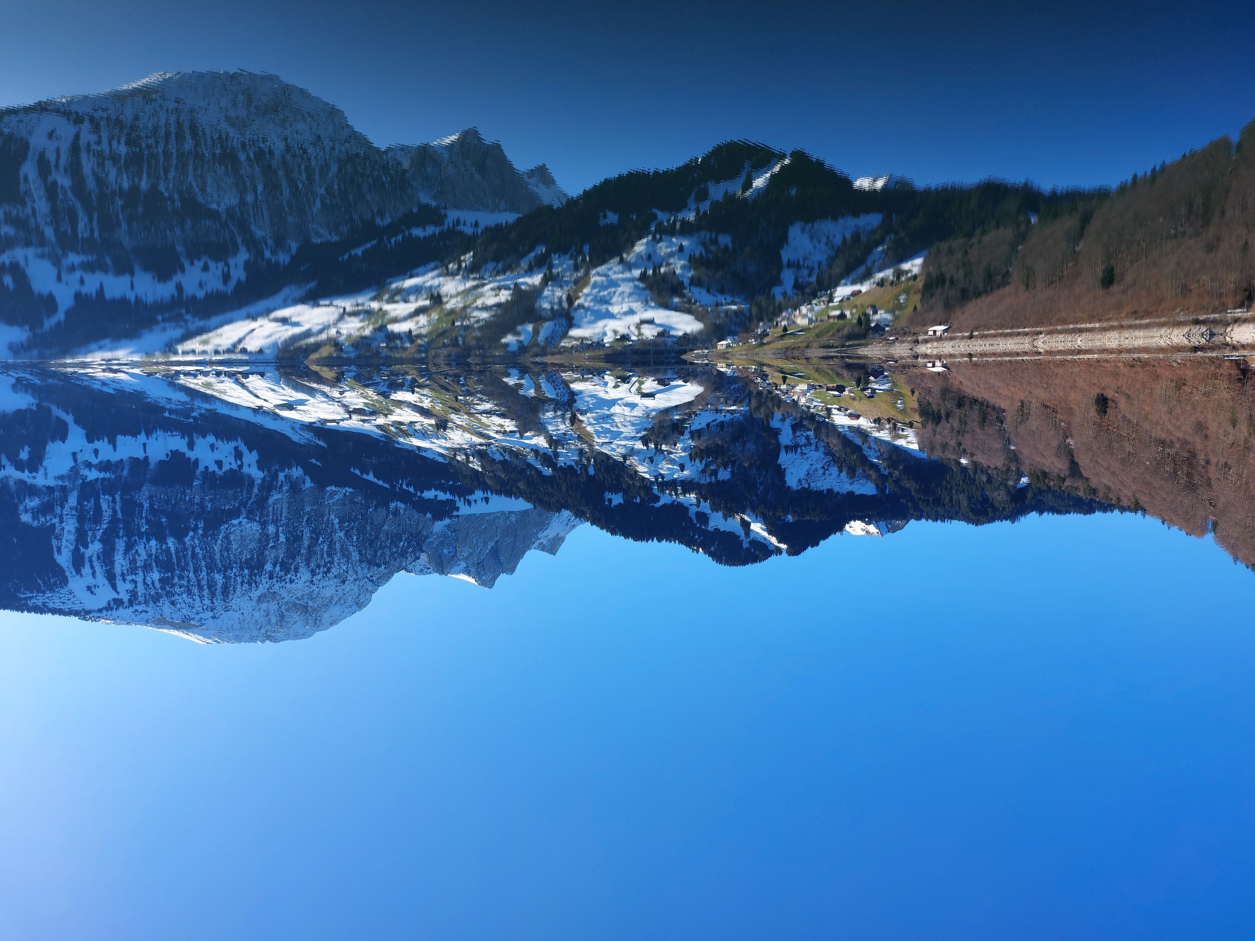
Wägitalersee with Bockmattli to the right.
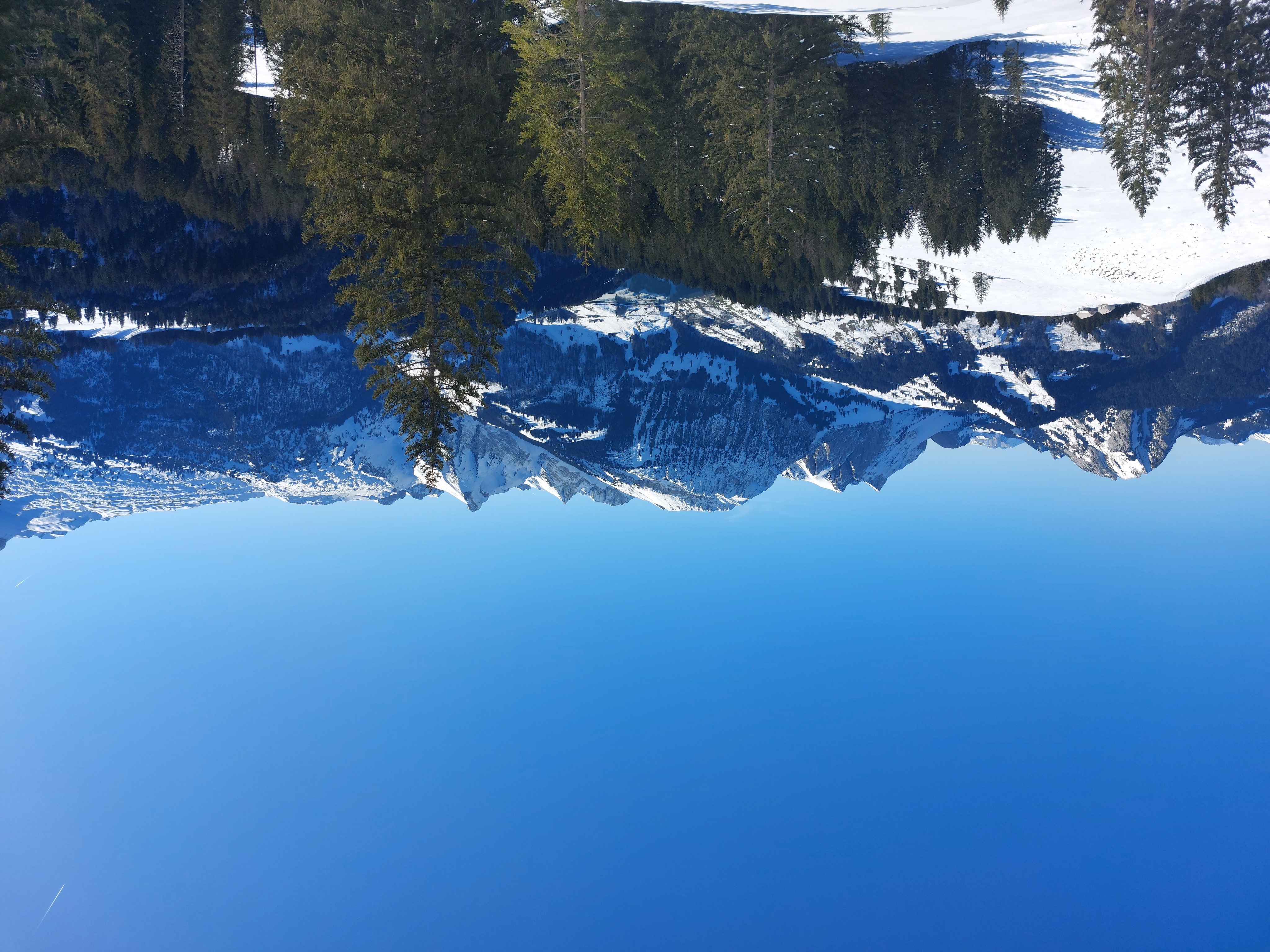
Looking east from above the tree line, back towards Innerthal and Bockmattli.
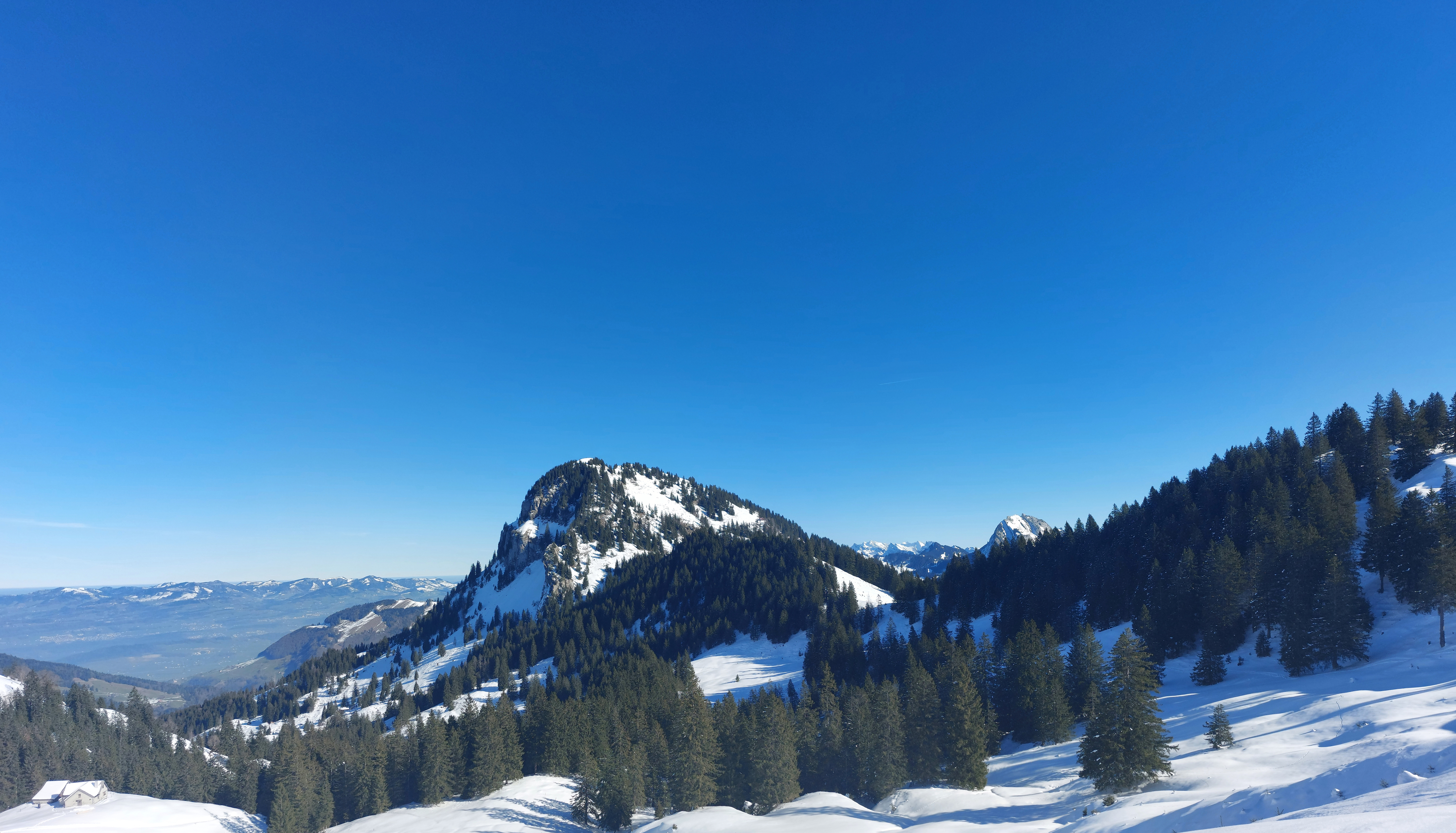
Gross Aubrig as seen from near the base of Chli Aubrig.
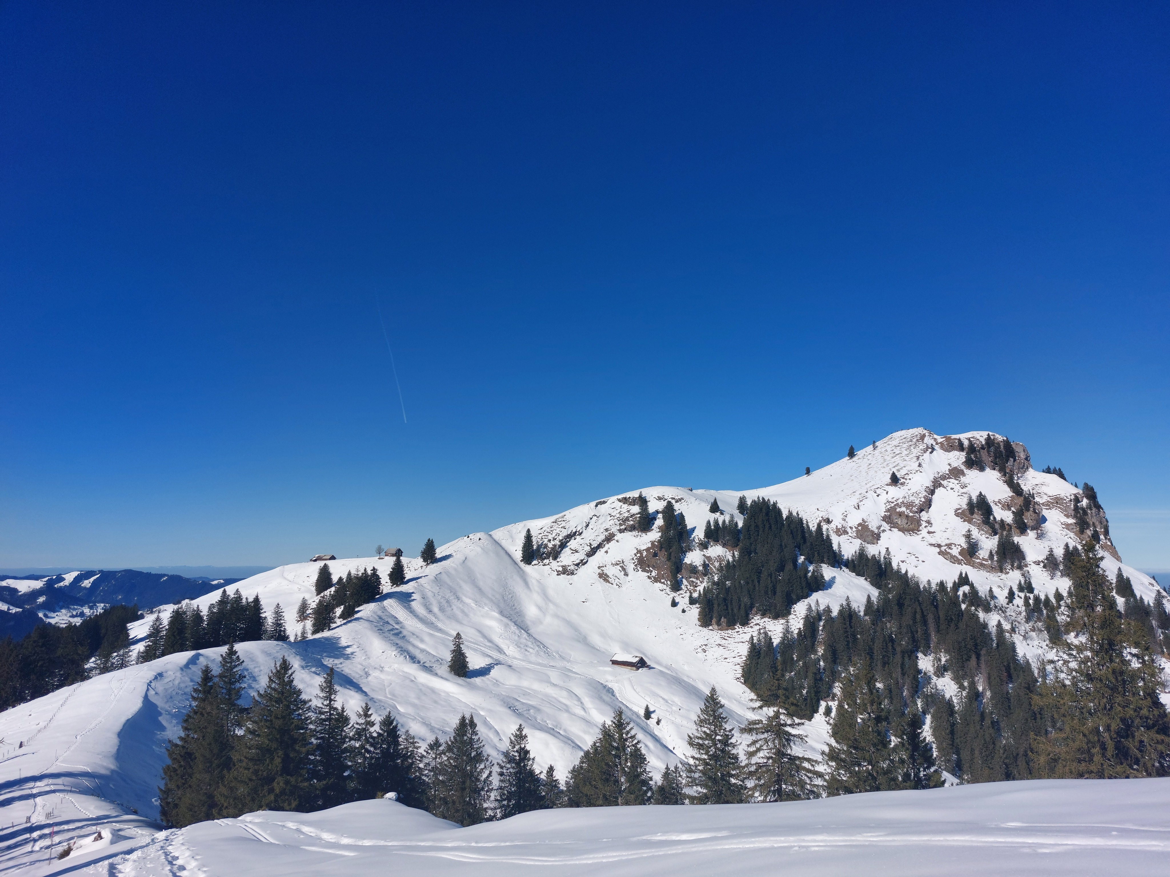
The way to Chli Aubrig. The last push to the summit was surprisingly steep! With the gorgeous weather, the hills were quite packed with groups of hikers/snow-shoe-ers.
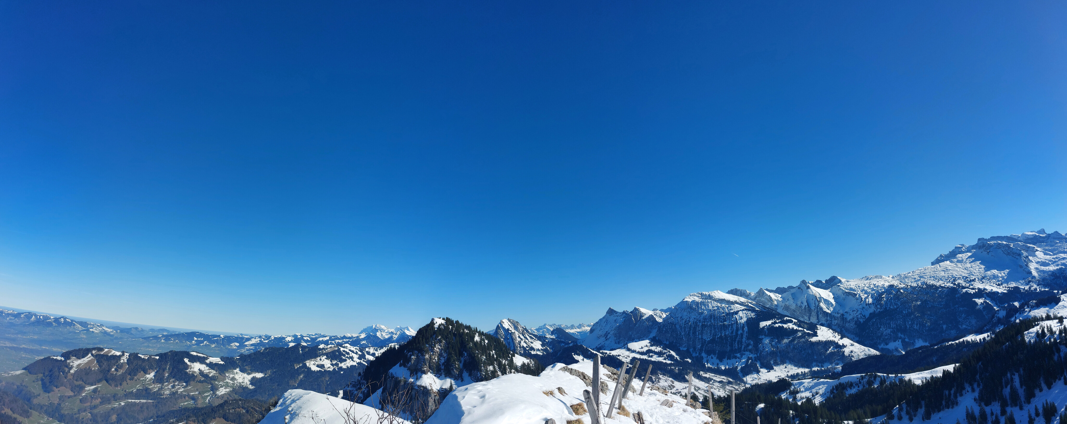
Looking east from the summit of Chli Aubrig: Säntis is the largest mountain in the background on the left, Gross Aubrig is the nearest mountain in the center, and the pass up to Bockmattli is the shadowy patch of snow between rock faces right of center.
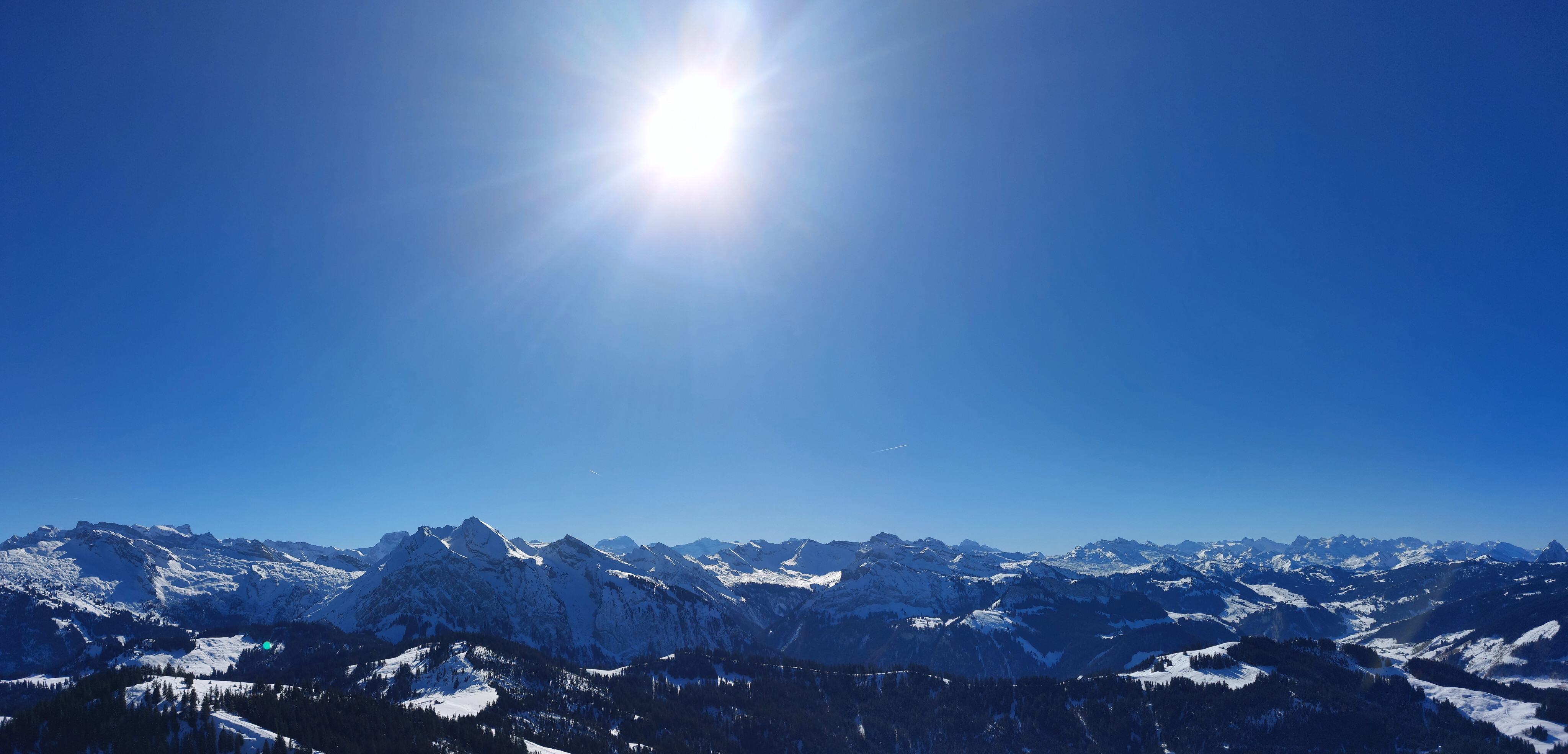
Looking south from the summit, with Chaiserstock hiding in the back on the right and Grosser Mythen, one of my todo mountains, peeking out at the edge on the right.
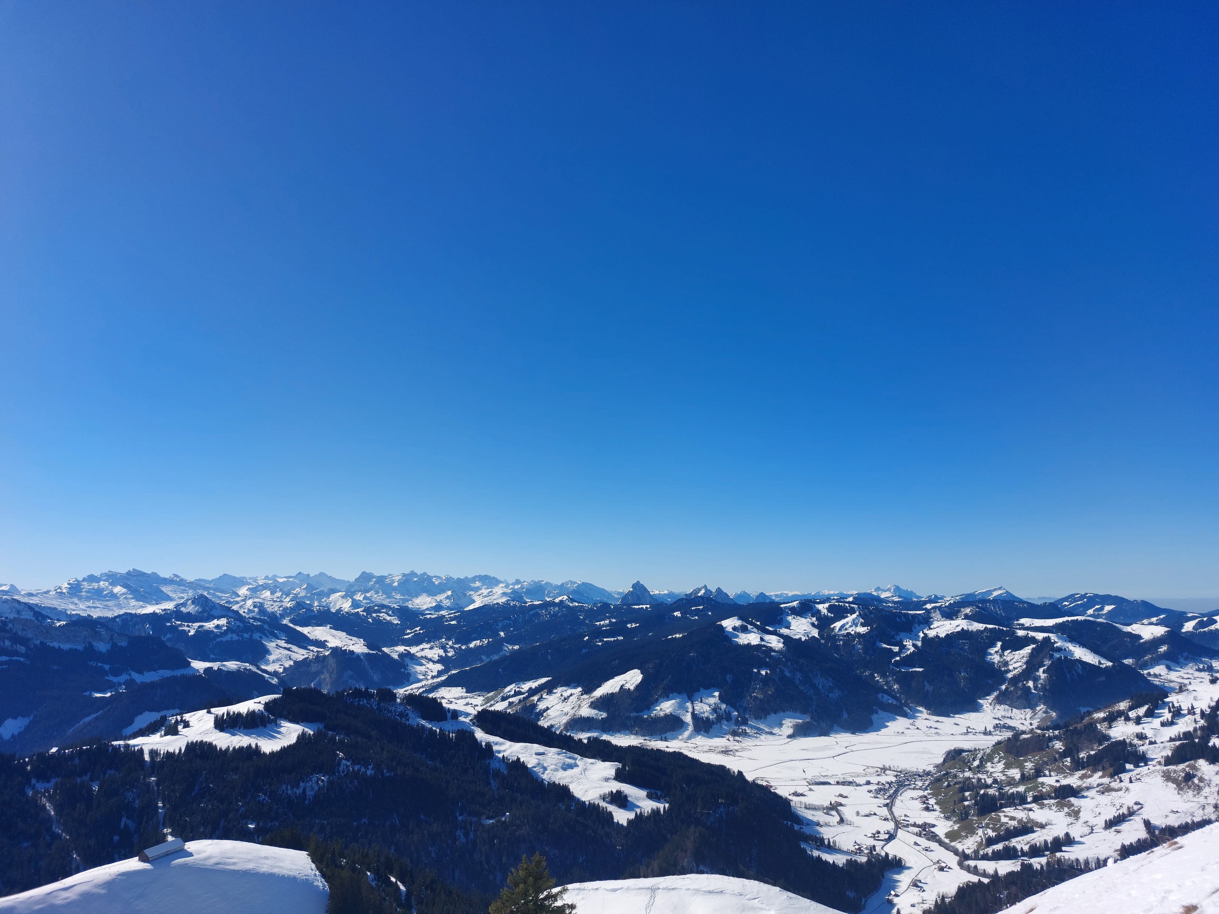
Facing west from the summit, Pilatus and Rigi are visible. The town below, Euthal, is the end of the hike.
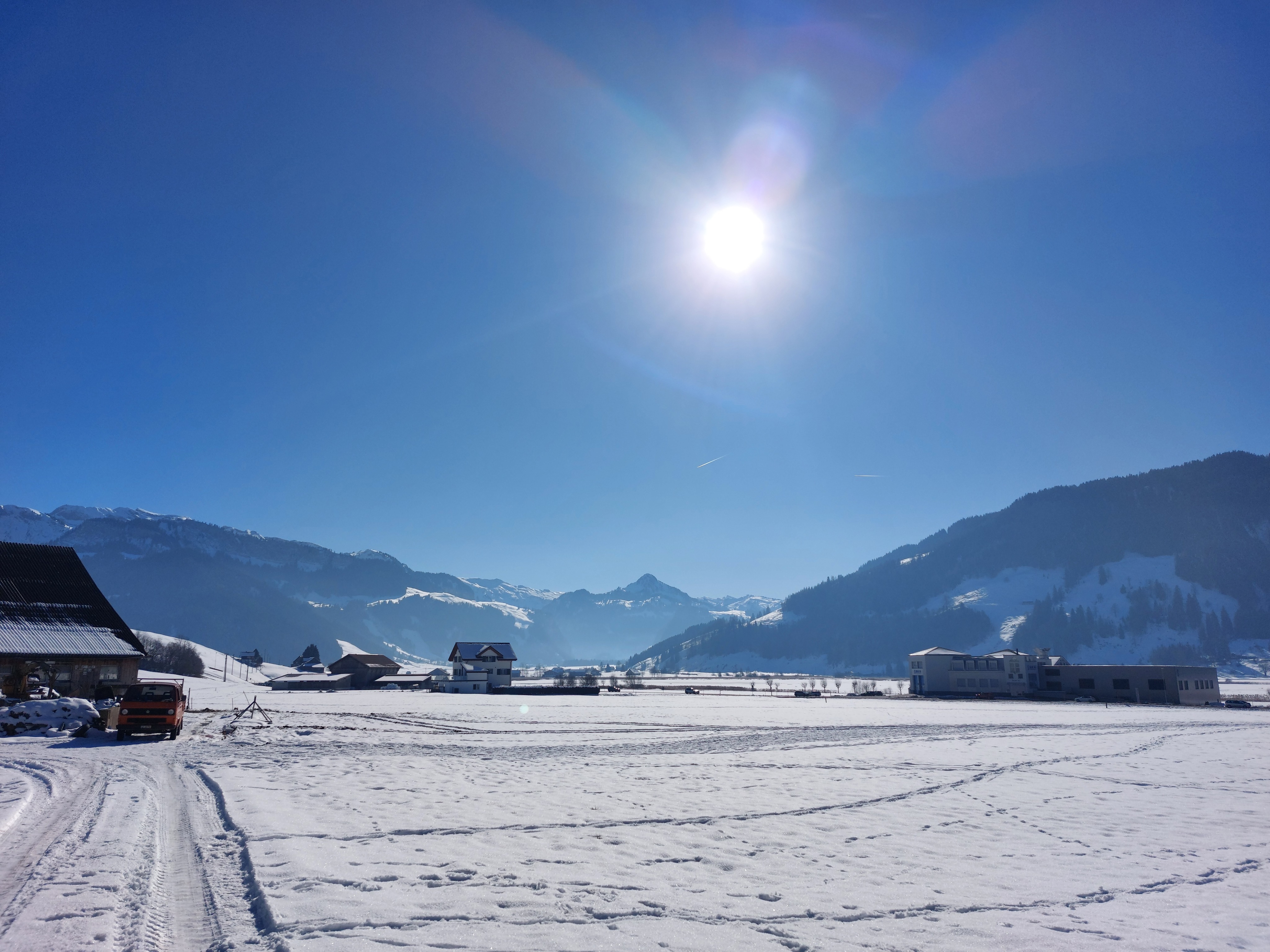
Chli Aubrig as seen from Euthal.
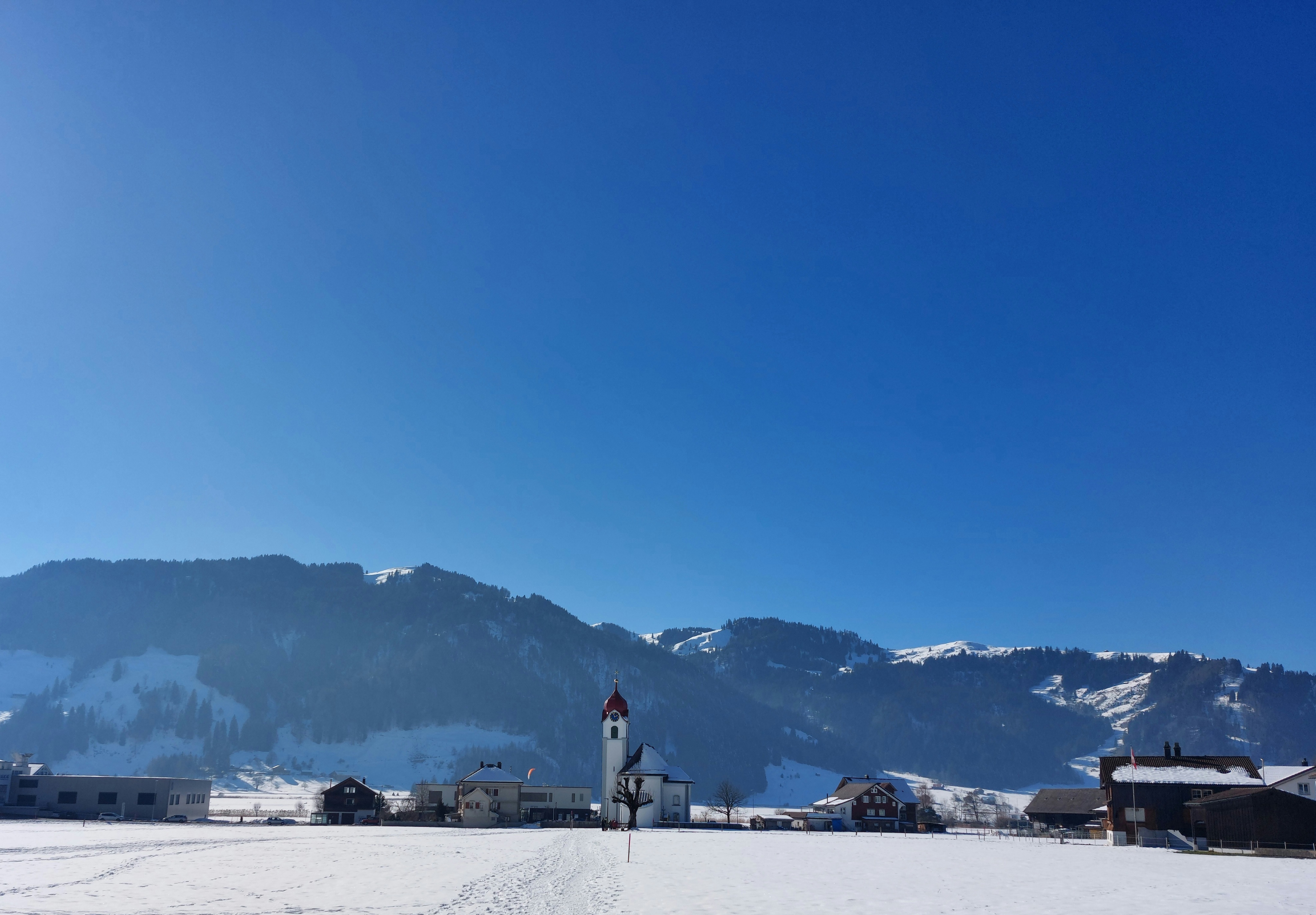
The end of the hike is right beside the church. Quite the scenic way to finish!