(Partial) Tour du Mont Blanc
Day 1
As a final hike before moving back to North American, I did a chunk of the Tour du Mont Blanc with a sibling and friend. We started in Chamonix, took the cable car up to Le Brévent. From there, we hiked north until we hit our refuge for the night, Chalet du Lac Blanc. We realized on our arrival that we had accidentally booked a month earlier, but they luckily had last minute cancellations, so we weren't forced to walk all the way down to town in the evening.
Looking north from just past Le Brévent; day one consisted of hiking along the central ridge out of view to our refuge for the night.
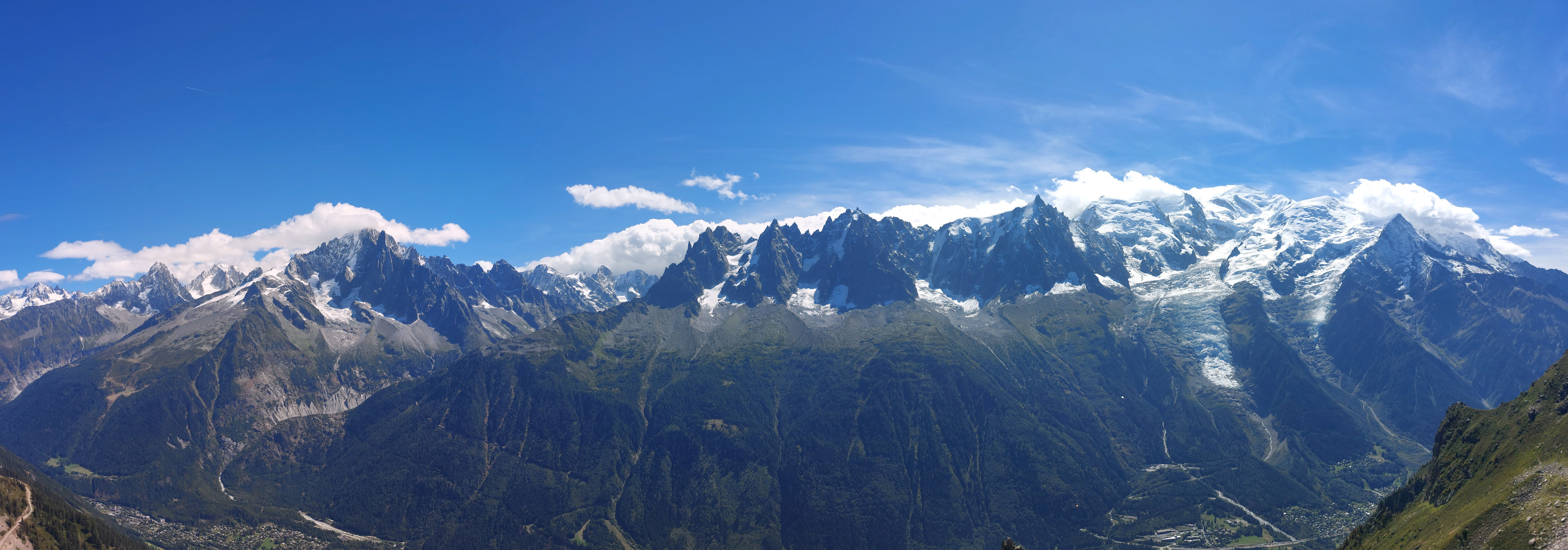
From a little further along the ridge, part of the Mont Blanc massif, with Mont Blanc proper on the far right. Photos really don't do justice to just how large it all is; if you squint just right, you can see l'Aiguille du Midi near Mont Blanc itself, and while they look about the same elevation from this angle, Mont Blanc is actually about a kilometer taller.
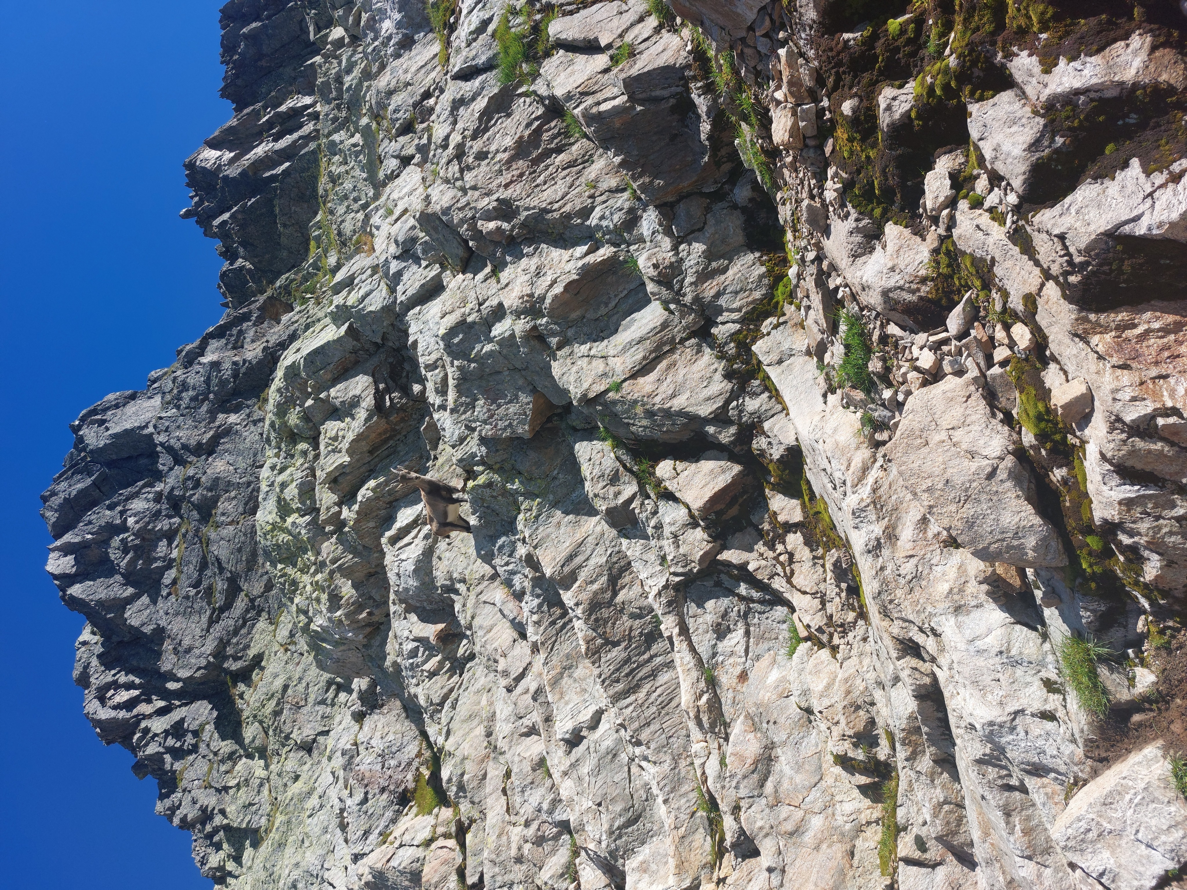
Goat friend. Much less skittish than the ones at the Brienzer Rothorn.
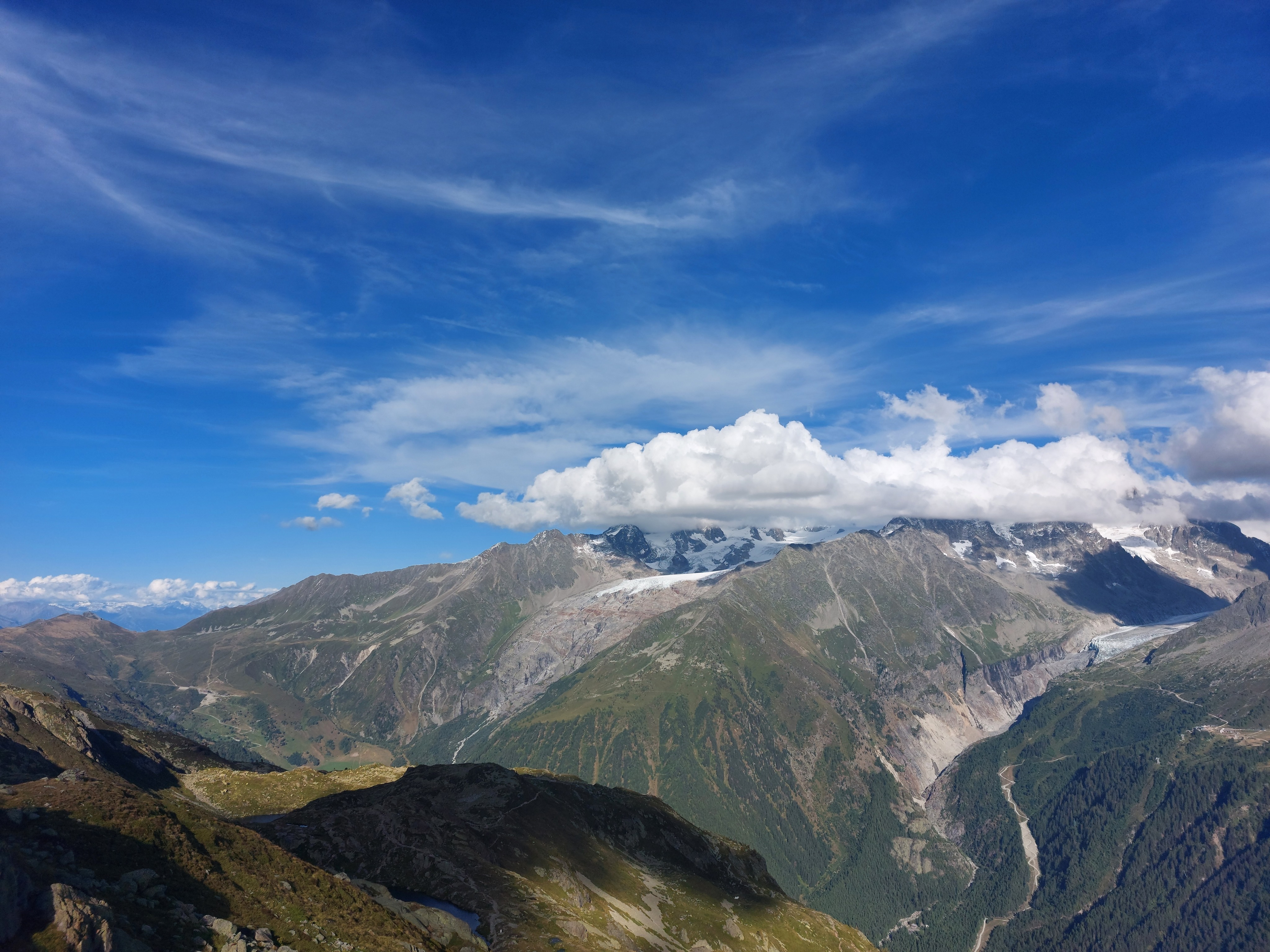
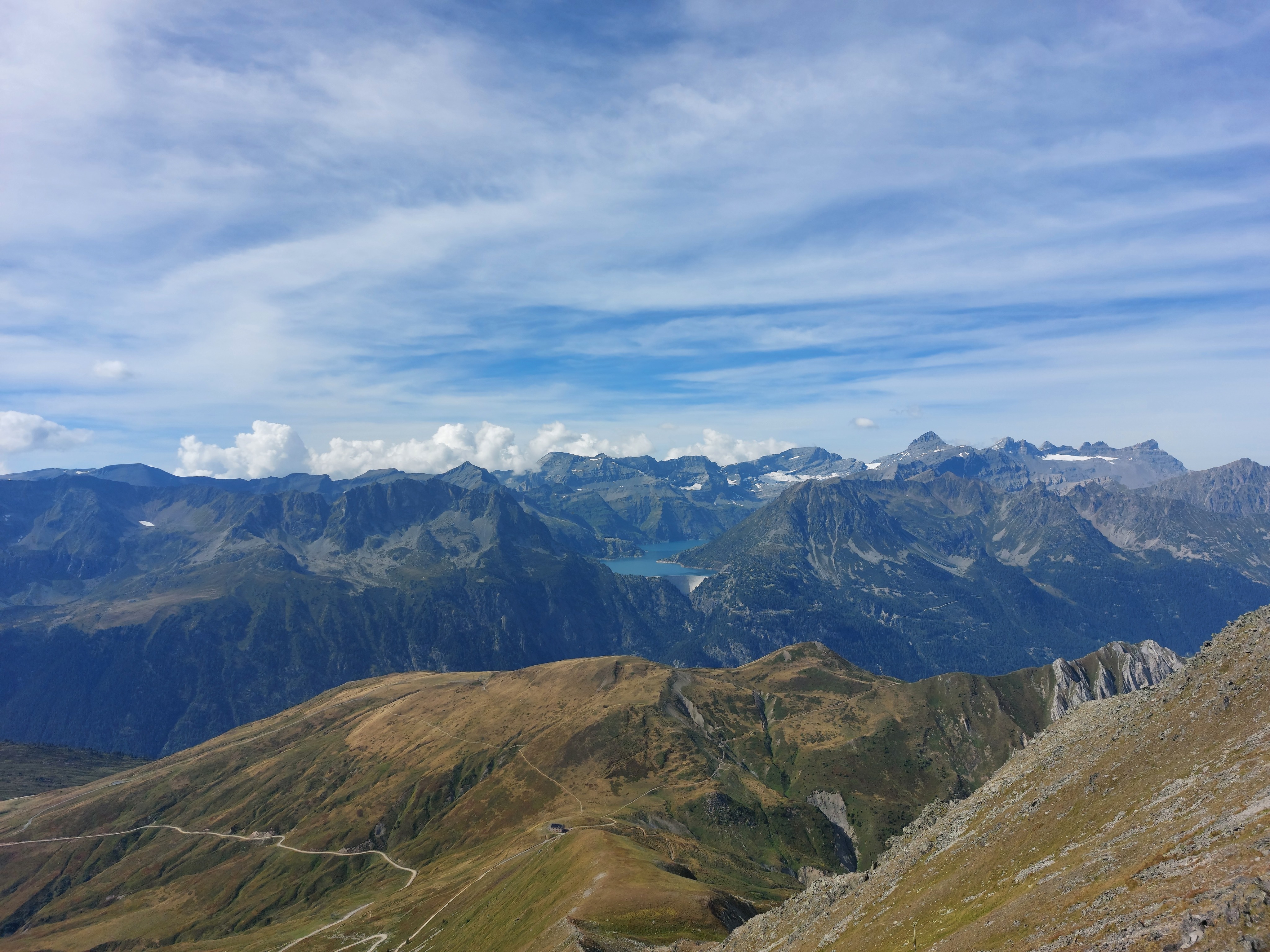
From Refuge du Lac Blanc looking towards the northern tail of the Mont Blanc massif; the second day of hiking is down into the valley, then up along the middle glacier to Refuge Albert 1er.
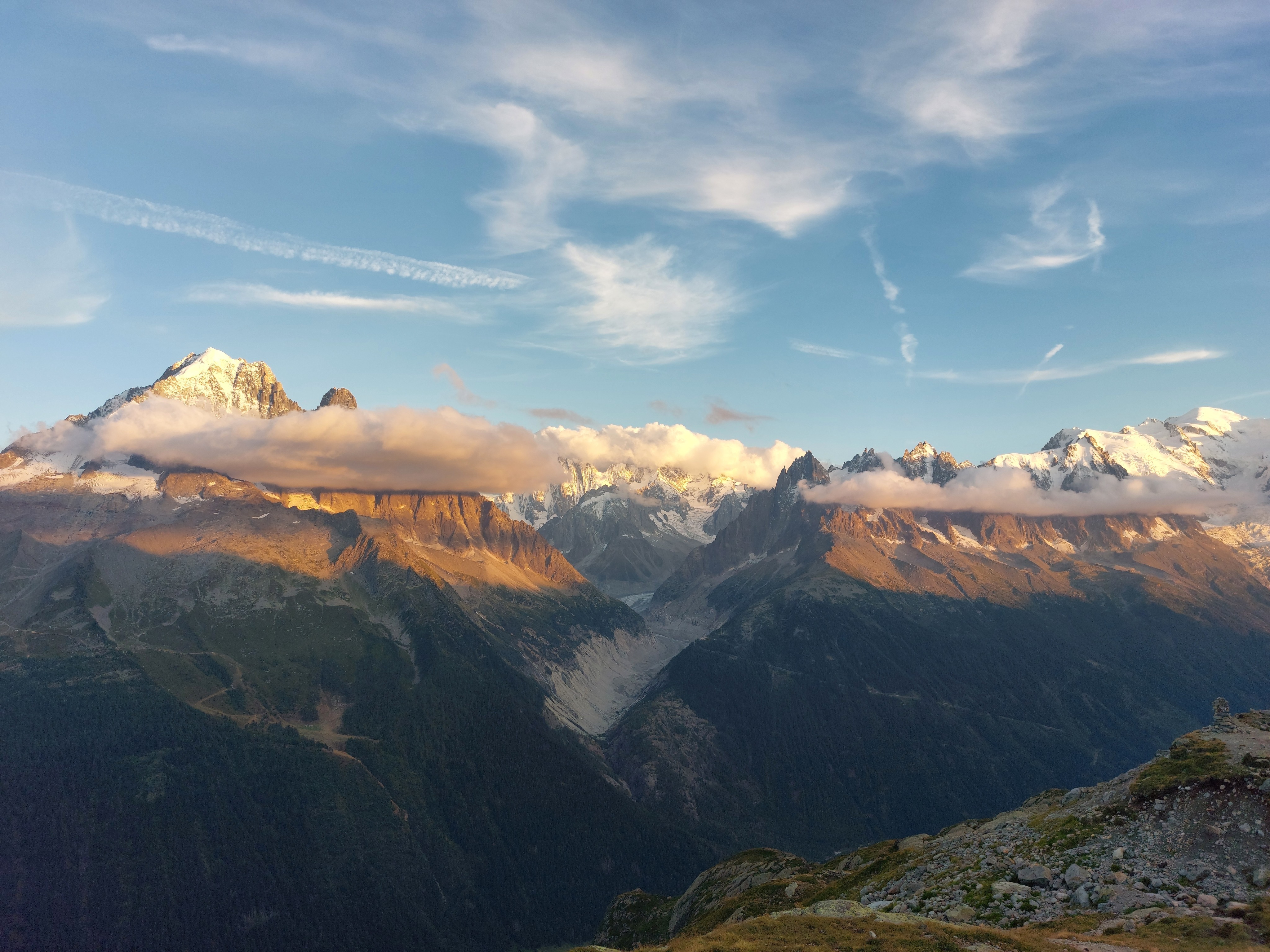
Evening light on the eastern flank of the massif.
Day 2
Day 2 was half descent to Montroc, and half ascent from there to the second refuge.
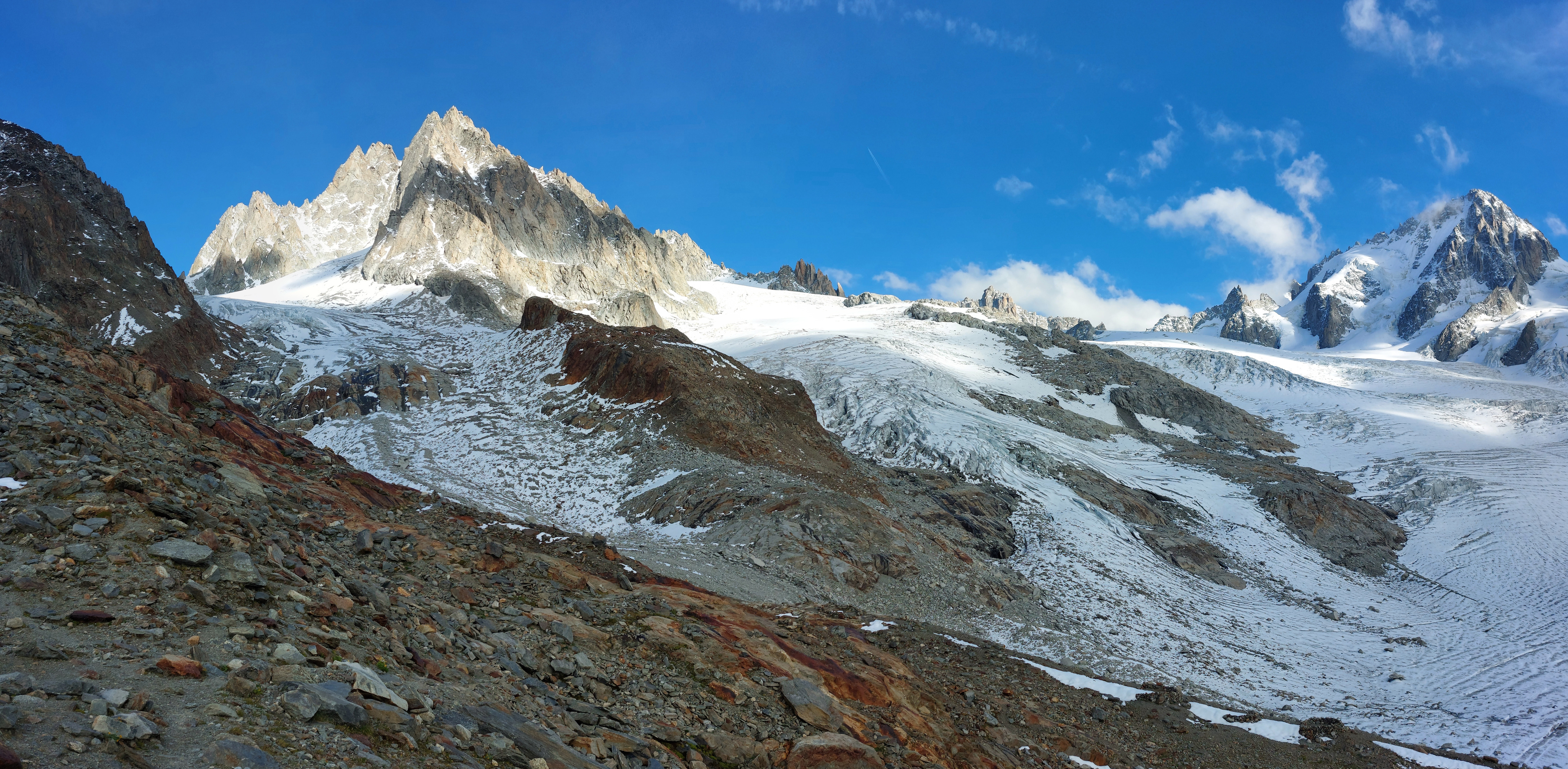
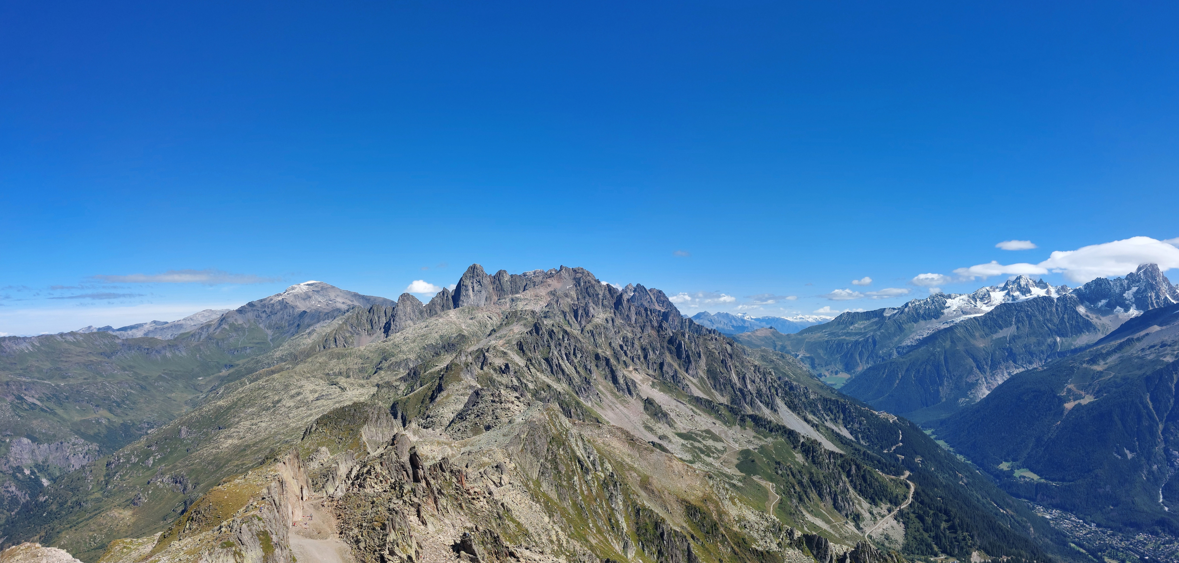
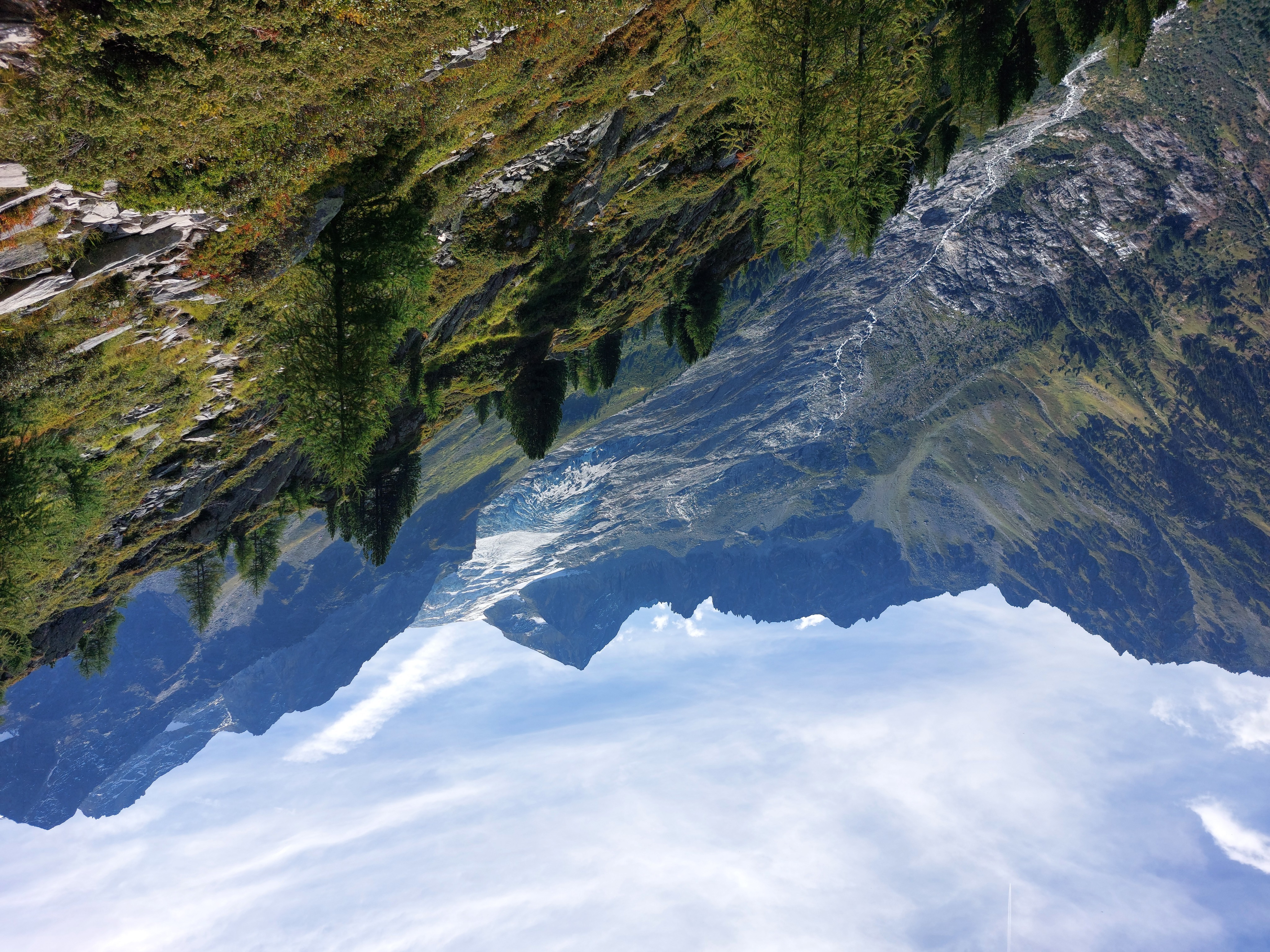
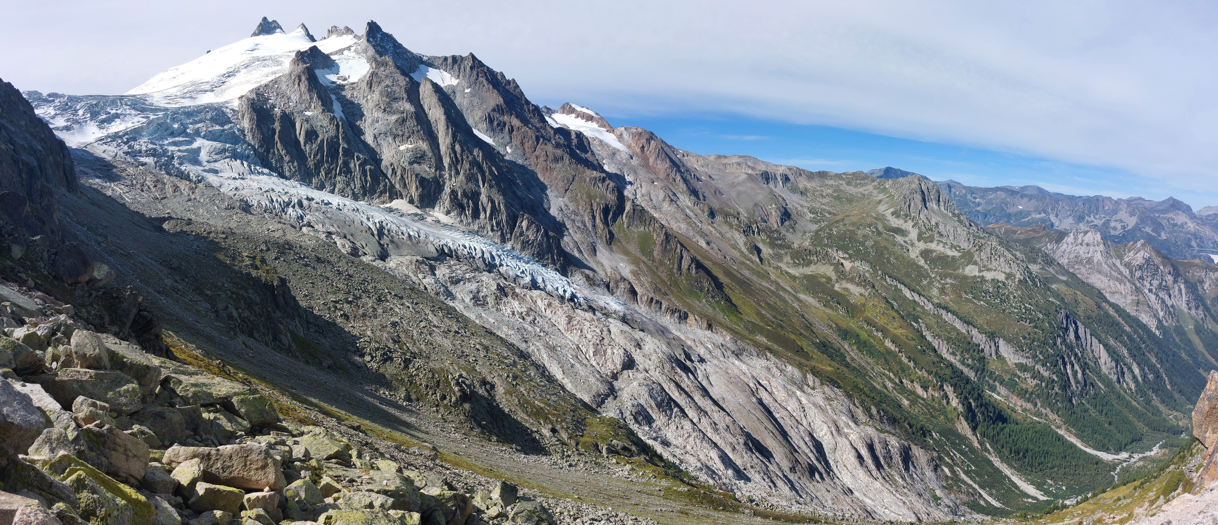
I think les Aiguilles du Tour and l'Aiguille du Chardonnet from just past Refuge Albert 1er. In the early morning, we could see little flashes of light from the headlamps of mountaineers heading for these peaks.
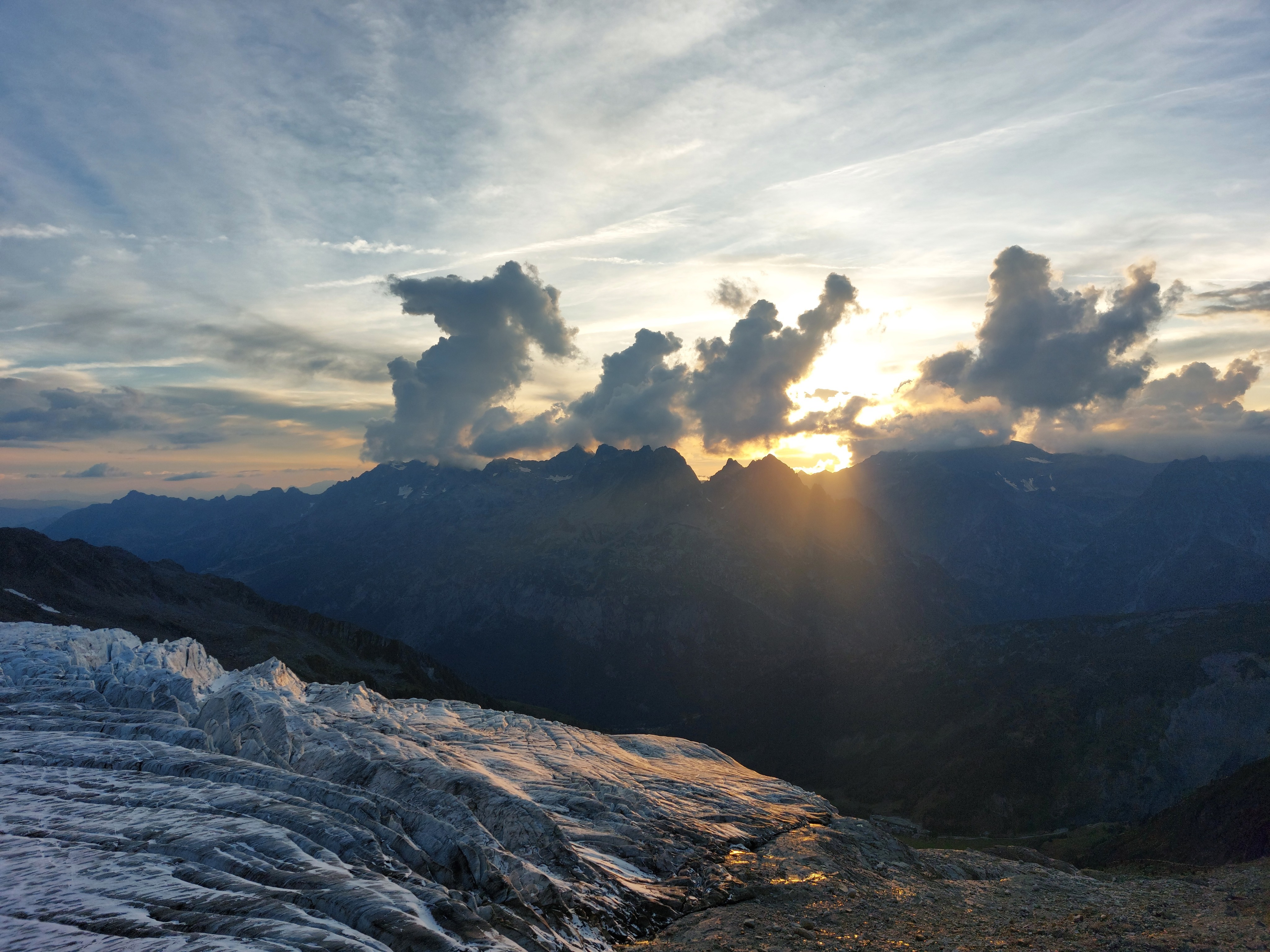
View from the refuge in the evening, looking over the Glacier du Tour and towards the chain of mountains we had hiked over the previous day.
Day 3
Day three we got up bright and early, and watched the alpinists shrink into the distance as they crossed the Glacier du Tour and up l'Aiguille du Chardonnet. We then skirted the mountains to the north, found our way to the Swiss border, and to our next refuge, le Chalet des Grands.
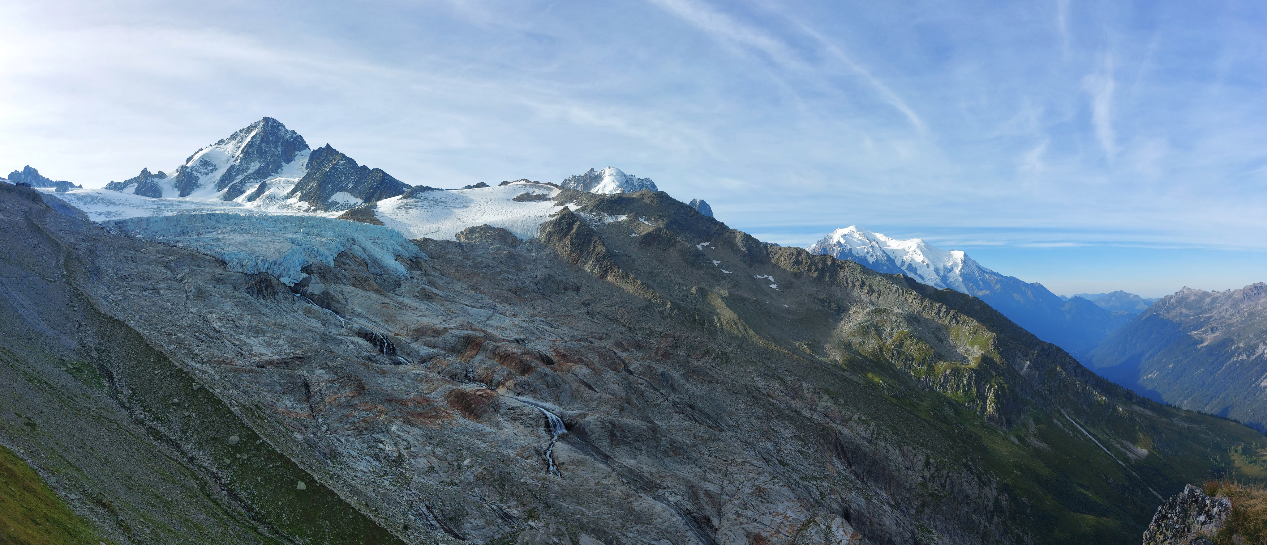
Refuge Albert 1er in the top right corner, then l'Aiguille du Chardonnet, and Mont Blanc proper peaking out on the right; the trial up the previous day was along the visible ridge descending from the refuge.
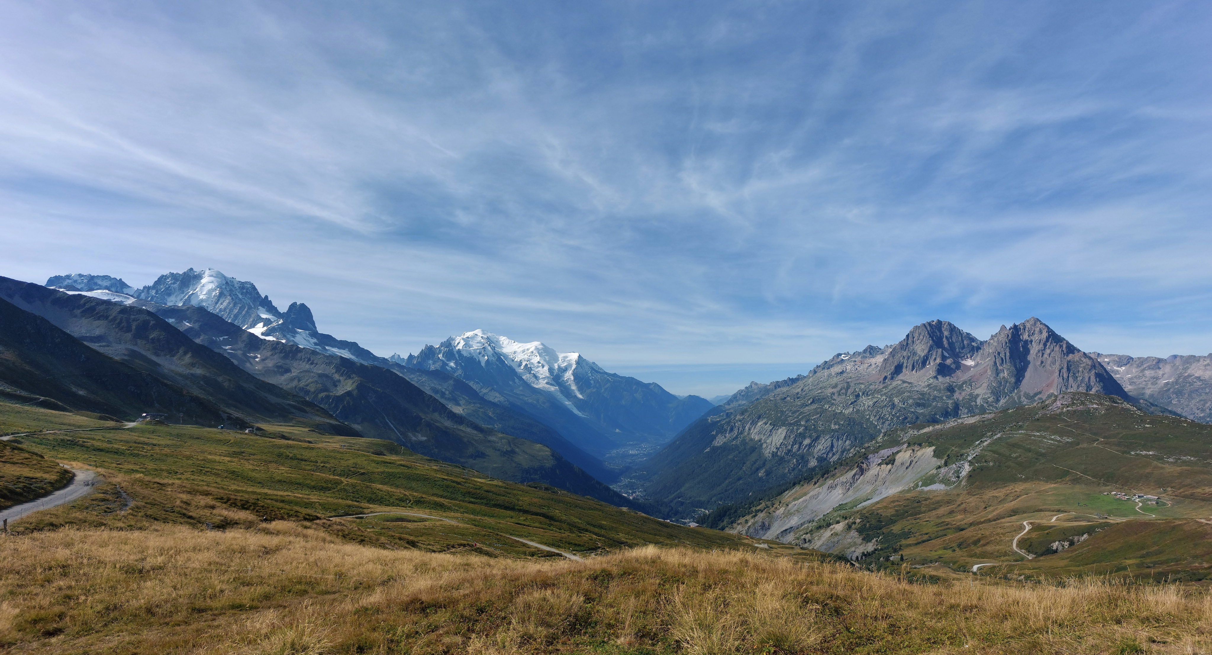
Looking south from the Swiss-French border.
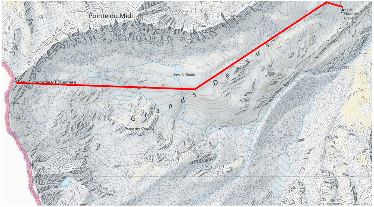
We arrived to the Chalet des Grands super early, so dumped our supplies and made our way up to Les Grandes Otanes, which gave us pretty spectacular view of Mont Blanc and friends to the south, as well as Lac d'Emosson to the east.
This refuge was definitely less glamping than the previous two; shower water came from a lake higher up, which was cute, except for waiting too long to take our turn, and the evening cooling the lake surface dramatically.
Day 4
For our final day, we ascended the Fenêtre D'Arpette, then came back down the other side to Champex-Lac.
Fenêtre d'Arpette from Chalet des Grands; our route was down into the valley, up the left-hand side of the river and through the gap in the mountains, then back down the far side.
Looking back from the Fenêtre d'Arpette towards l'Aiguilles du Midi/Tour, and Chalet des Grands near the cliffs on the right-hand side, following the trail up from the valley floor. Our extension the day before was up behind it, up the bowl and to the ridge of (relatively lower) mountains.
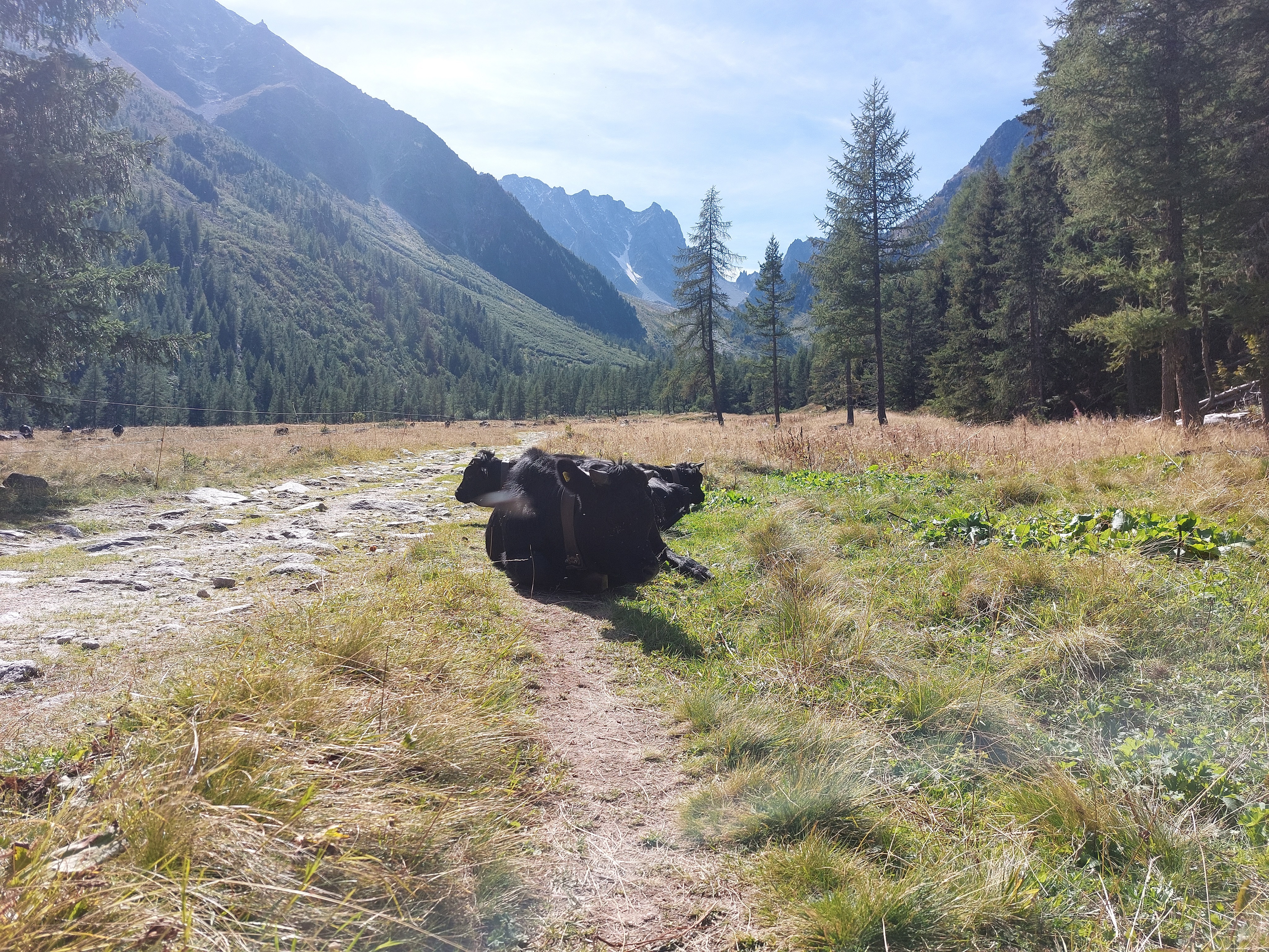
People going the opposite direction were telling us on the way up how spectacular the view was from the other side of the window, the view of the Matterhorn, etc. Honestly, slightly anti-climactic (especially the relatively non-descript and mostly-obscured backside of the Matterhorn). Still super pretty, but the views up until then were pretty hard to beat. So, mandatory final cow picture for the final Switzerland photo album.
Overall, this trip was a blast, and a great way to finish up my time in Switzerland (although there is perhaps something ironic about going to France for the final hike). I'm going to miss the sharp summits, massive glaciers, free-roaming cows, sheep, and goats, and a cable-car or refuge hidden around every corner. Maybe at some point in the future, I'll return to do the full circuit, until then, I'm very happy with the experience I've had.