Torres del Paine and El Chaltén
My partner, a friend, and I visited Patagonia this past February. The trip was split into two stages: the first was an extended W-circuit in Torres del Paine (7 days instead of the typical 4 or 5 days), and three days of day hiking out of El Chaltén. There's a day-by-day breakdown with pictures below, then some general notes, gear lists, cost estimates, and links at the bottom.
---
The Trip
February 15 - 16
The trip began with the slog down to the Chilean Antarctic: a quick flight from San Francisco to Los Angeles, a short layover, then an 11 hour red-eye to Santiago. It was a little worrying, seeing the smoke from the forest fires blotting out the nearby mountains, but luckily the smoke never extended as far south as we were during the meat of the trip.
It was quite a shock, going to the washroom in the Santiago airport and seeing the signs to throw toilet paper in the waste basket instead of the toilet, but after a couple days, it became normal enough.
We had a four hour layover in Santiago, then a three hour flight to Punta Arenas, rounding the flight portion of the trip to about 22 hours. We arrived in Punta Arenas around 2pm, and had originally booked our bus to Punta Arenas for 5pm to give us a sufficient large buffer; turns out, picking up our bags took all of ten minutes, so we called the bus company and got the last three seats on the 3pm bus. From there, it was a three and a half hour bus from Punta Arenas to Puerto Natales.
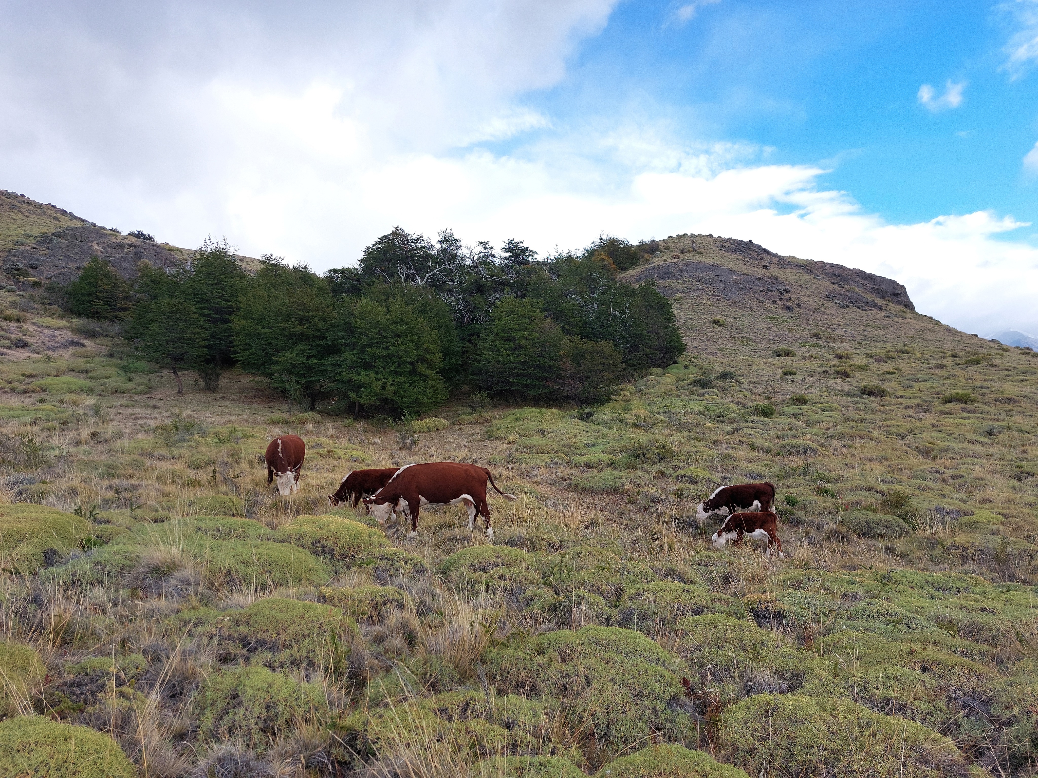
If I had to butcher the description of the the Magallanes, I would call them as a mixture of Canadian prairies and northern California; the area around Punta Arenas was very arid, with lots of small shrubs and low hills, with sheep, red llama-like guanaco, rhea, horses, and cows sharing pastures, and Chilean hawks sitting on the wooden posts of the endless fences lining both side of the highway. Eventually, this opened up to sprawling plains broken up by clusters of wind-warped trees, and smooth monolithic hills dotting the horizon. These transitioned into far-away mountains, smothered by low clouds and obstructed by the gnarled-tree hills and pastures we wound our way through. Eventually, we reached a large plain, revealing the mountains in their entirety and much closer than before, and finally Puerto Natales at the edge of the Última Esperanza Sound.
We dumped our bags at our hostel and headed to the waterfront for some moody evening views, making our way past stray dogs and pockets of trash, then picked a restaurant to try out the Guanaco (like beef, mostly) and lamb loin with Pastel de choclo and Calafate sauce (super yummy!). We then promptly crashed for the evening, after about 35 hours without any real sleep. Silver lining, adapting to the new time zone was super easy!
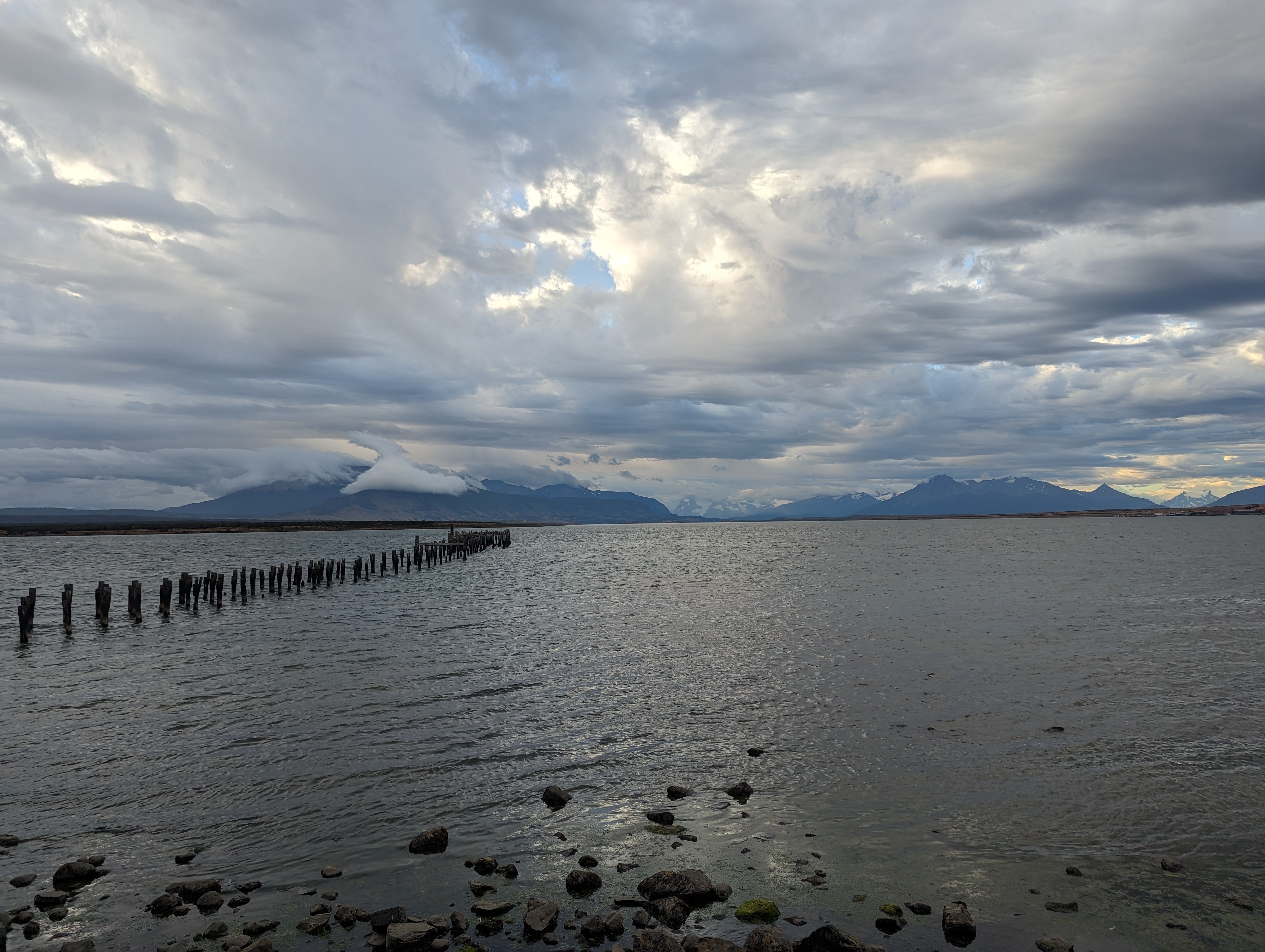
View from Puerto Natales waterfront.
February 17
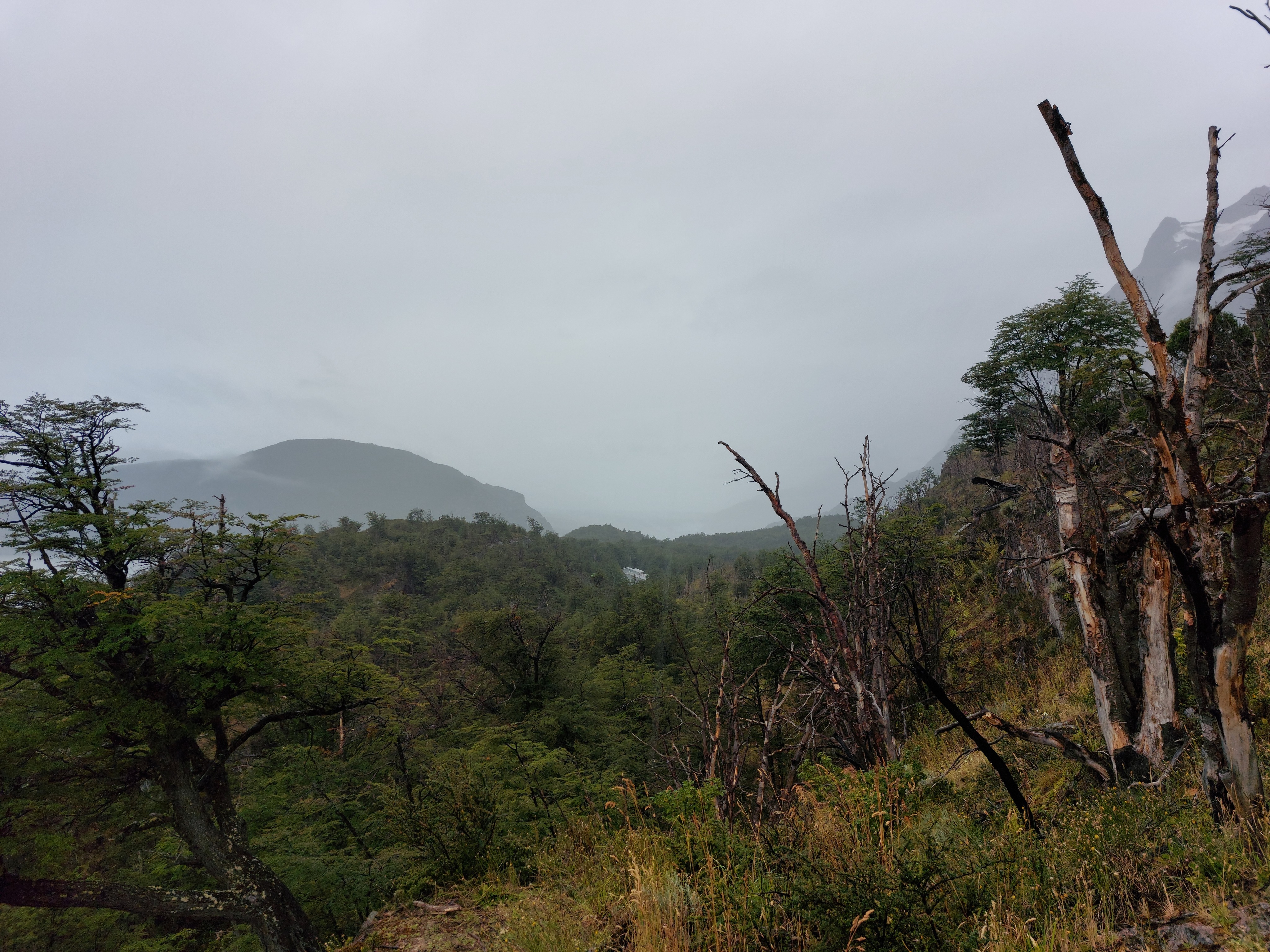
The next morning found us up bright and early walking through a light drizzle on our way to the 6:45 bus to the Pudeto Catamaran, our point of entry to Torres del Paine. Our ride bore witness to more antarctic tundra; patches of gnarled low trees, fields of scraggly grass, and more cows, sheep, and guanaco.
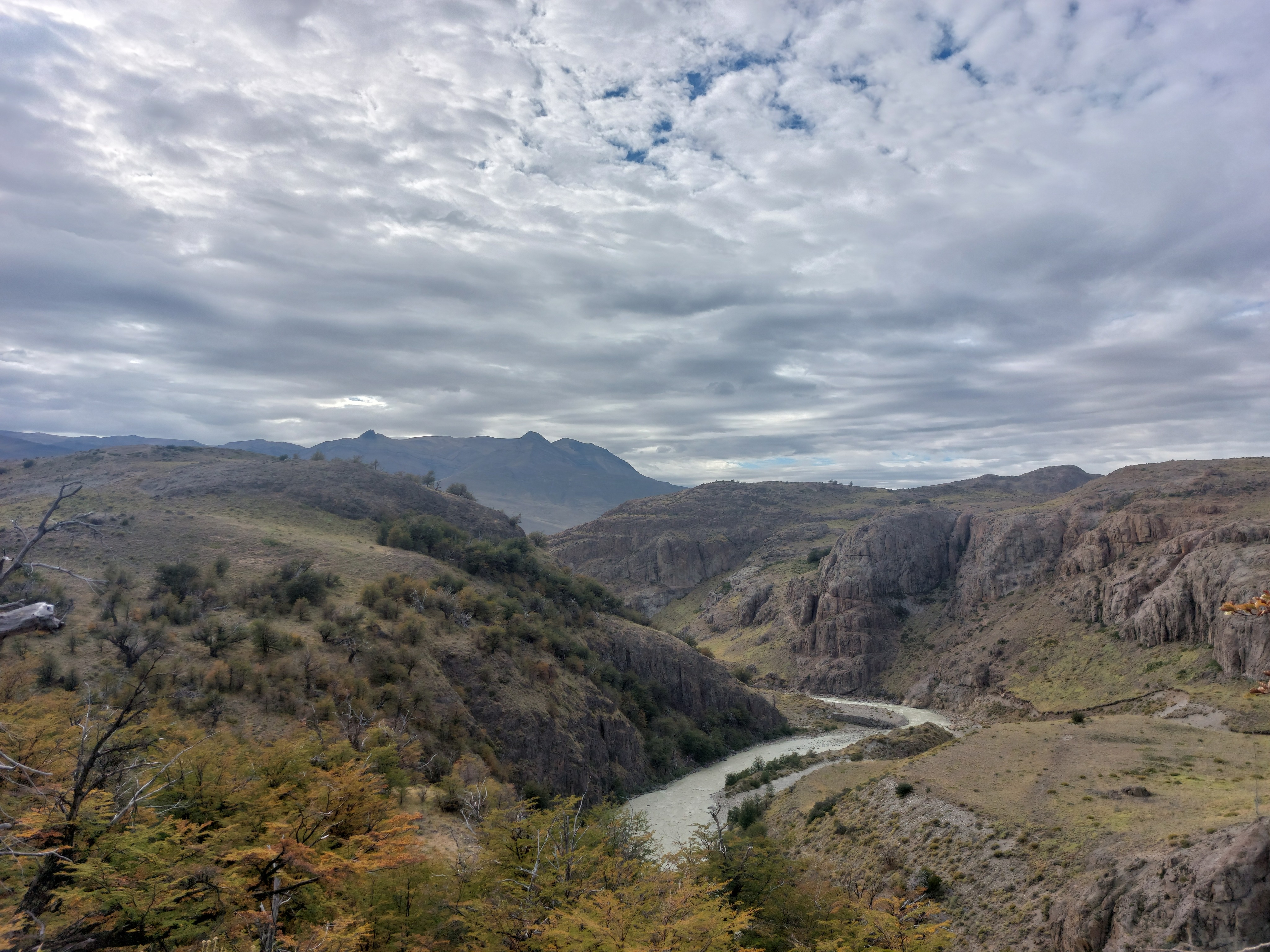
Not long after leaving Puerto Natales, we reached my favorite segment of the trip, and one I am remiss to have not photographed. On either side of the highway, flat yellow pastures dotted with little green shrubs stretched away, suddenly rising into rolling foothills, narrow winding valleys carved down from above emptying into the plains below. These hills transition into low sloped mountains, diligent parents of the offspring at their bases. A low ceiling of angry clouds suggested an impending storm, here and there thin enough to let tentative godrays poke through to the barren landscape below. In the distance, contours of jagged peaks darkened the horizon, interspersed with patchwork smears of rain.
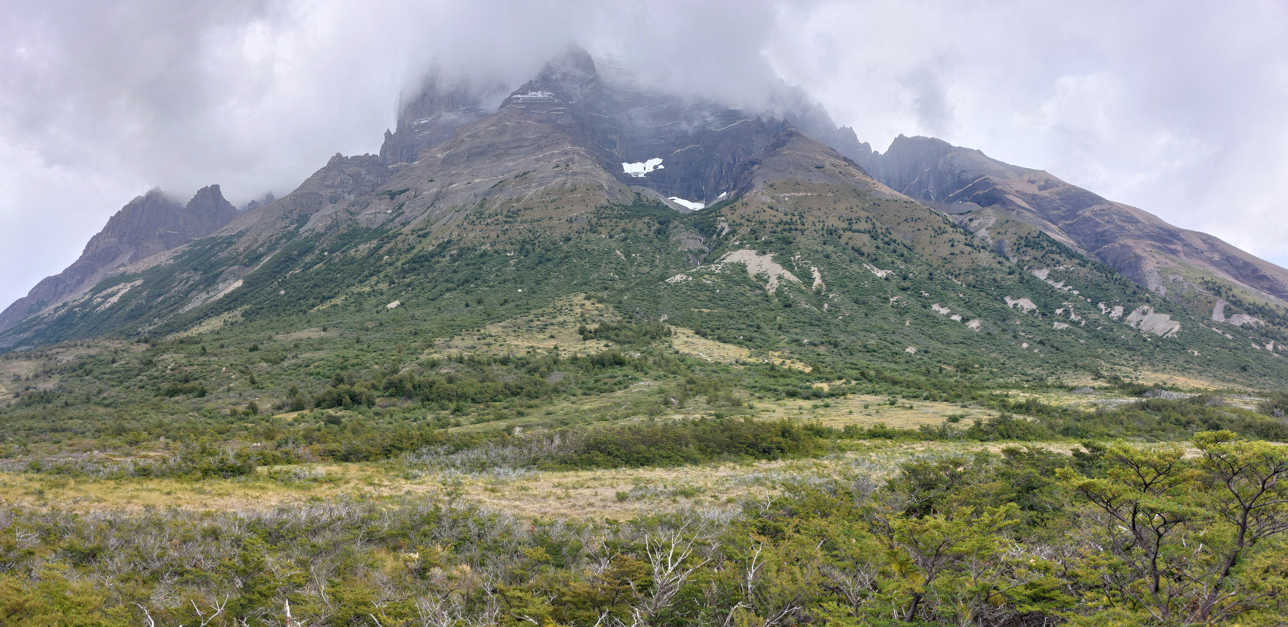
As we progressed into the park itself, sections of cloud opened up, although our destination remained wreathed in its own brooding cover. We passed a saline lake, pale flamingos lounging in the shallow water. We stopped at Laguna Amarga to have our park passes checked and got our first good view of Torres del Paine.
From there, it was back on the bus and up a switchback road to the catamaran. We passed the occasional bus-sized geometric boulder, no cliffs in sight for them to have fallen from.
We got to the catamaran around 9:30, with a scheduled departure time of 10:00; the schedule there indicated a departure time of 10:30, and the boat ended up actually leaving at 11:30. We still ended up at Paine Grande at the planned time though; "late" departures were a hallmark of this trip.
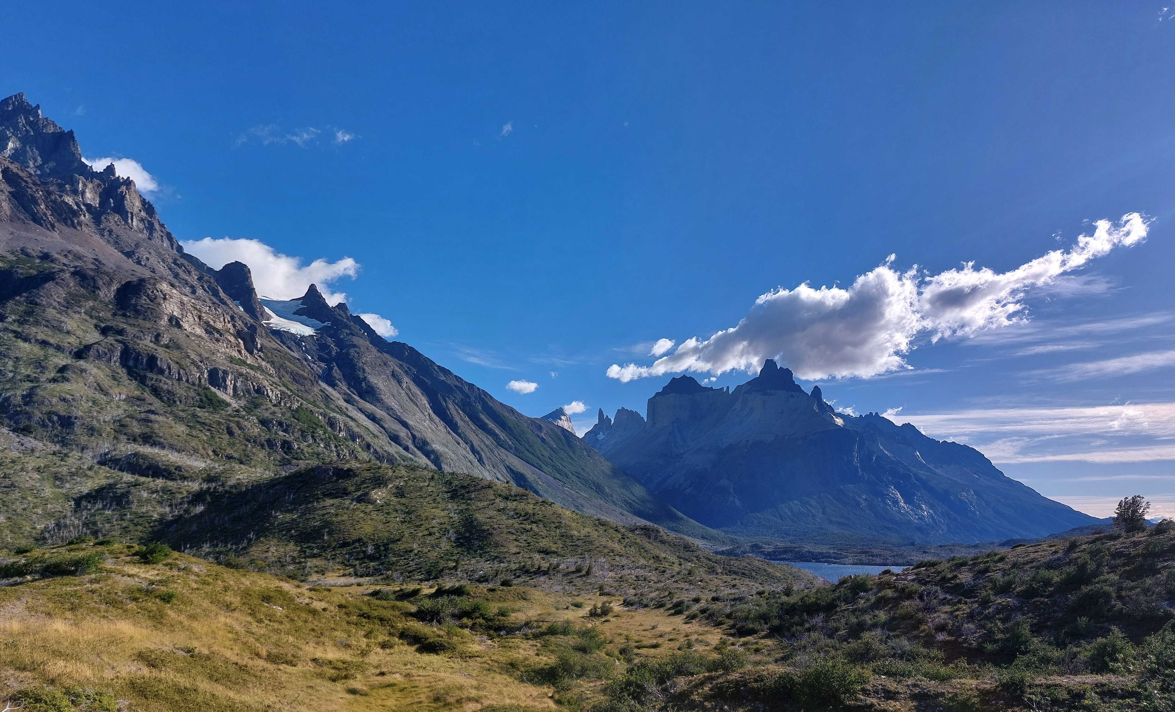
Los Cuernos from the catamaran on Lago Pehoé. The wind on the lake was intense; from how it was described to me, Katabatic winds off Glaciar Grey travel incredibly far, first off the glacier itself, across Lago Grey, over the land bridge, and finally across Lago Pehoé.
After a quick stretch at Refugio Paine Grande, we set off for Refugio Grey. While the first half of the hike was rocky with aggressive, blow-you-over-winds, the second half gave a bit of a reprieve from the gales, as we descended to lake level, dirt trails, and finally camp.
Looking back from trail just past Refugio Paine Grande.
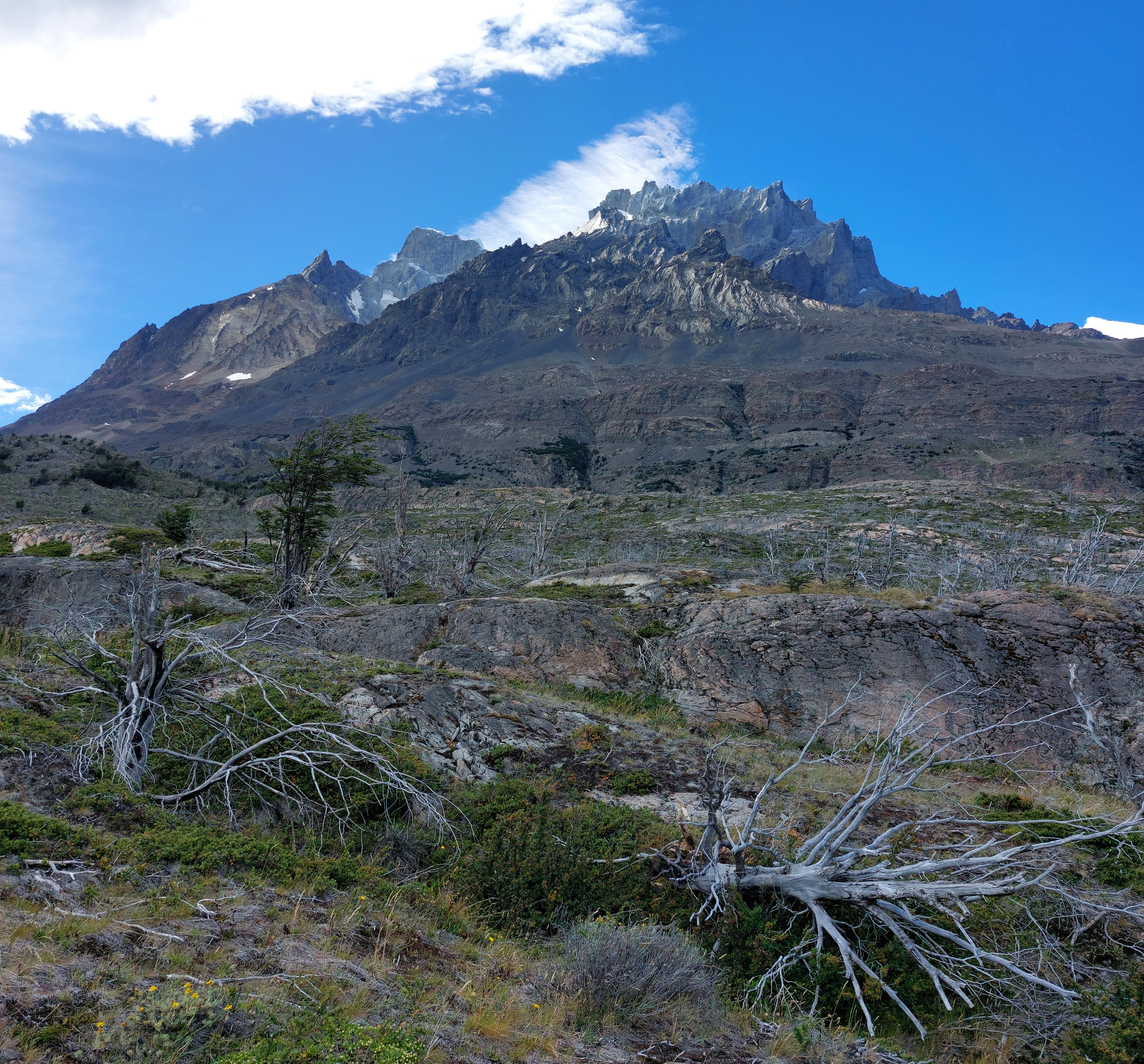
Paine Grande from the trail.
Mirador Lago Grey.
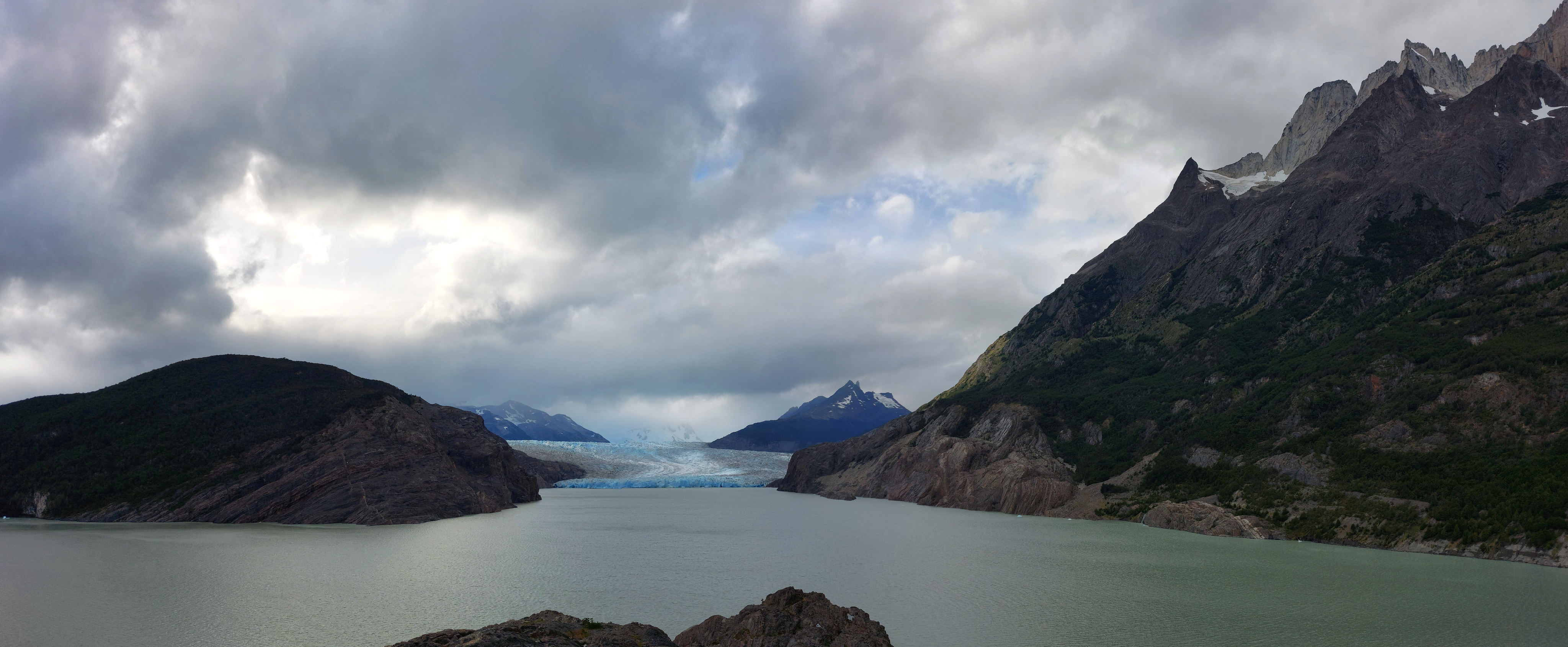
The main building of Refugio Grey, with Glaciar Grey behind.
Mirador Glaciar Grey, just past the refugio. After a quick excursion here, we settled in for the night.
February 18
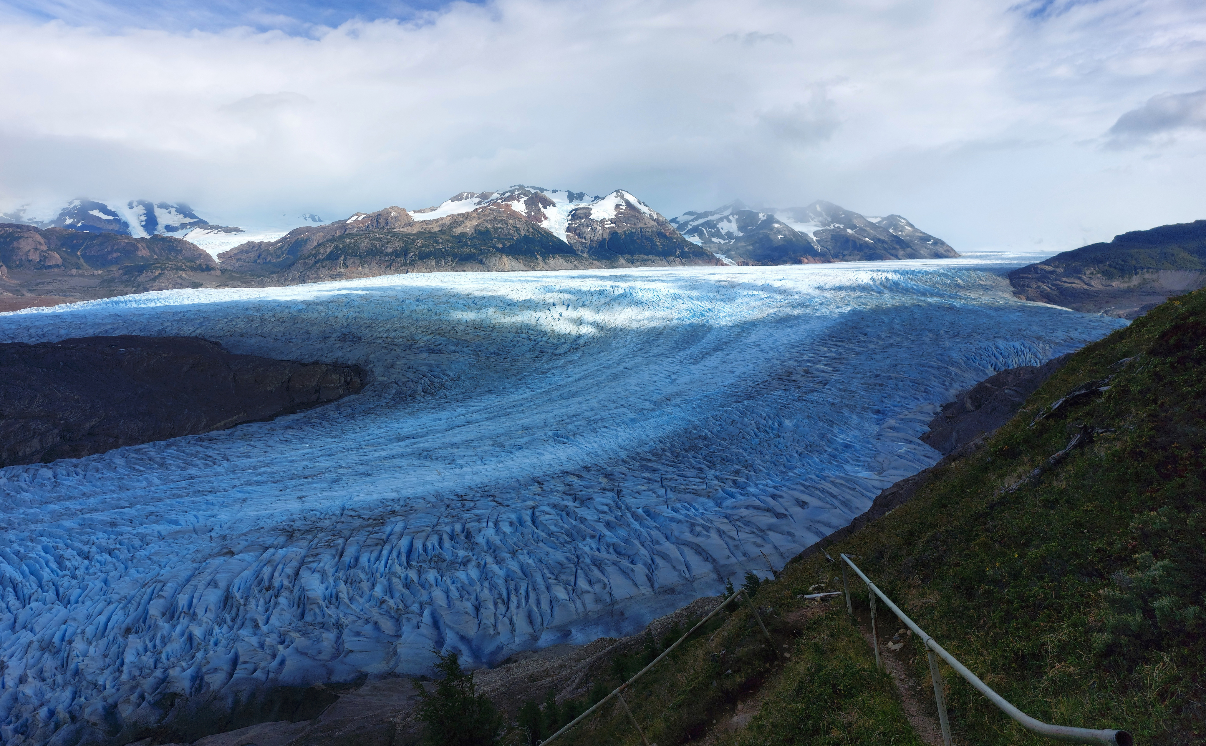
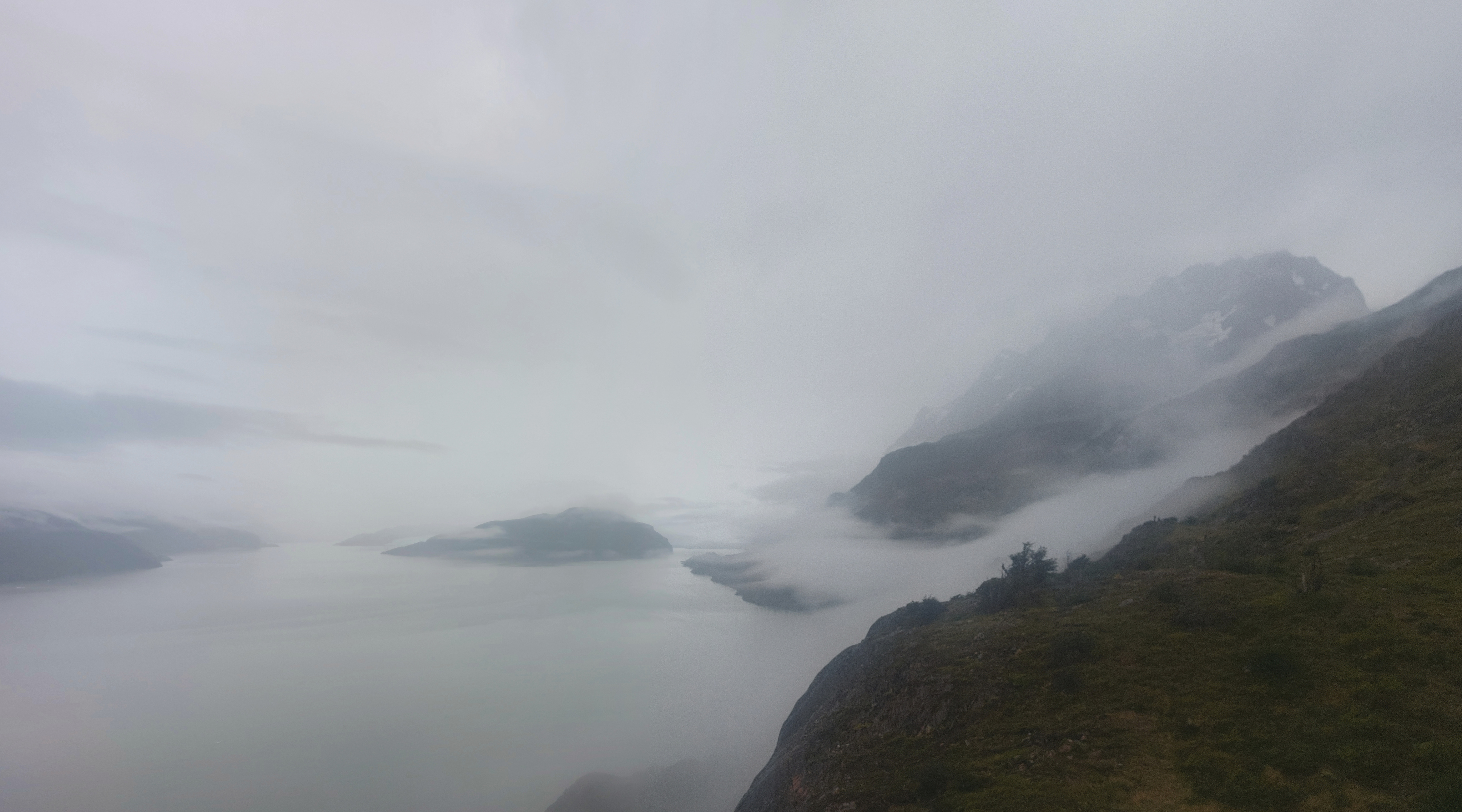
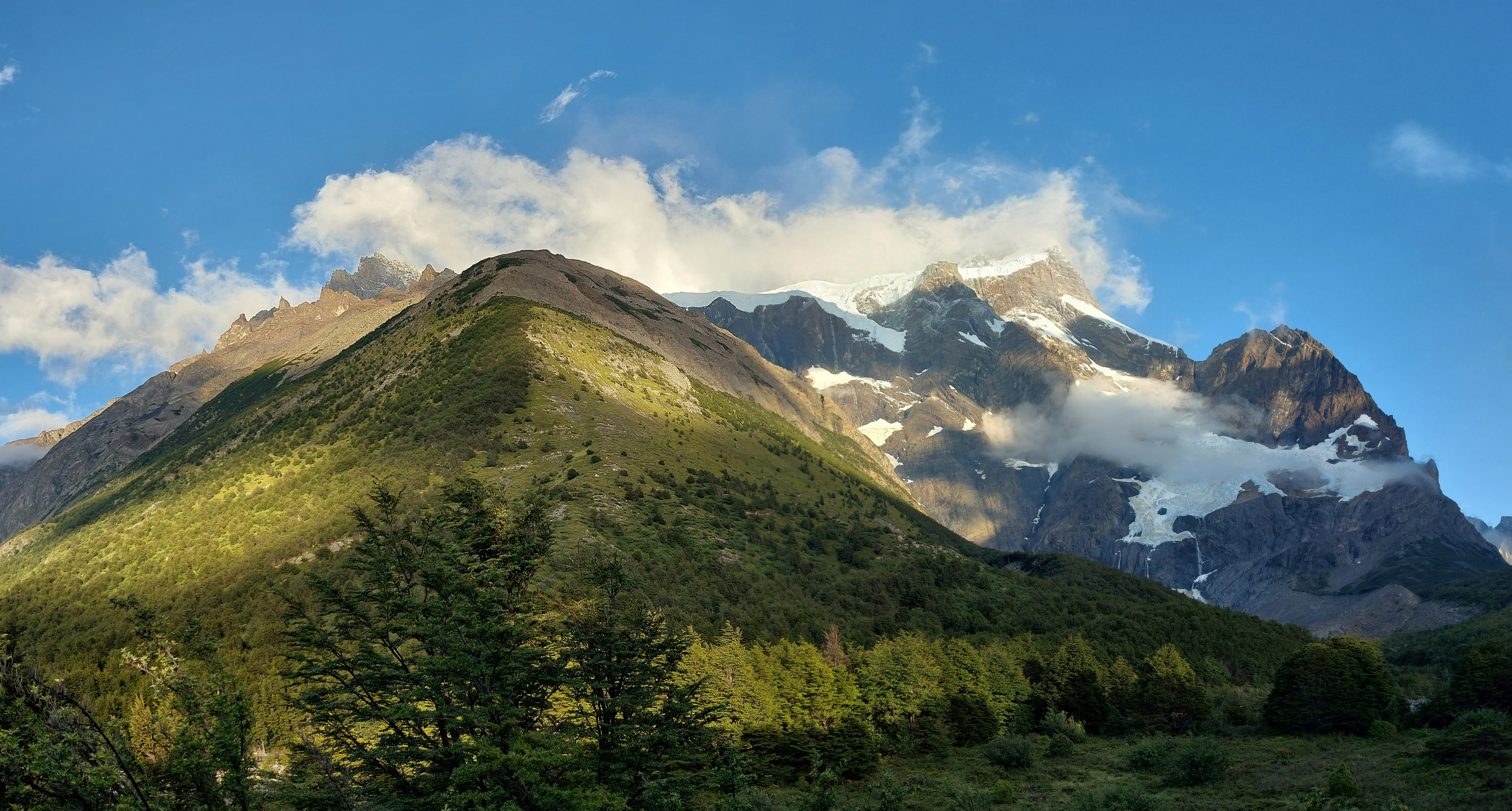
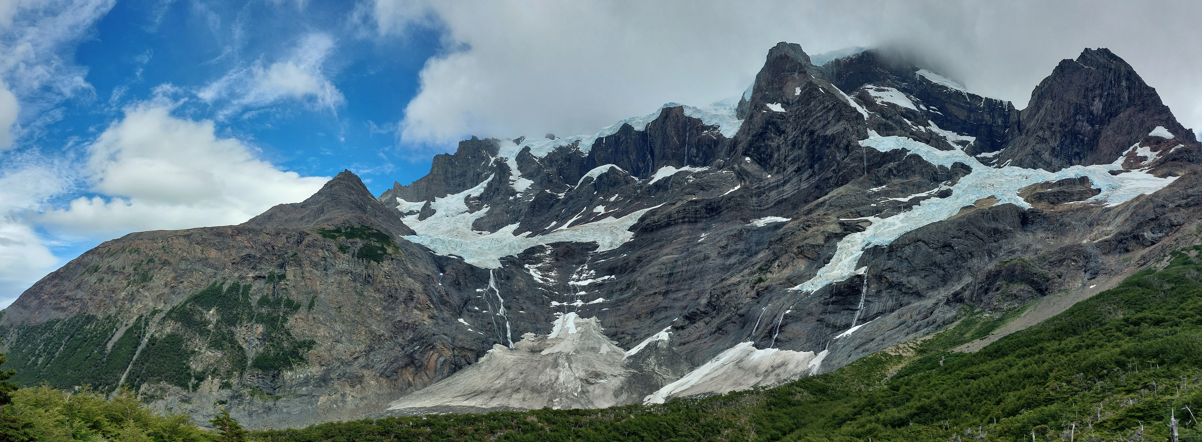
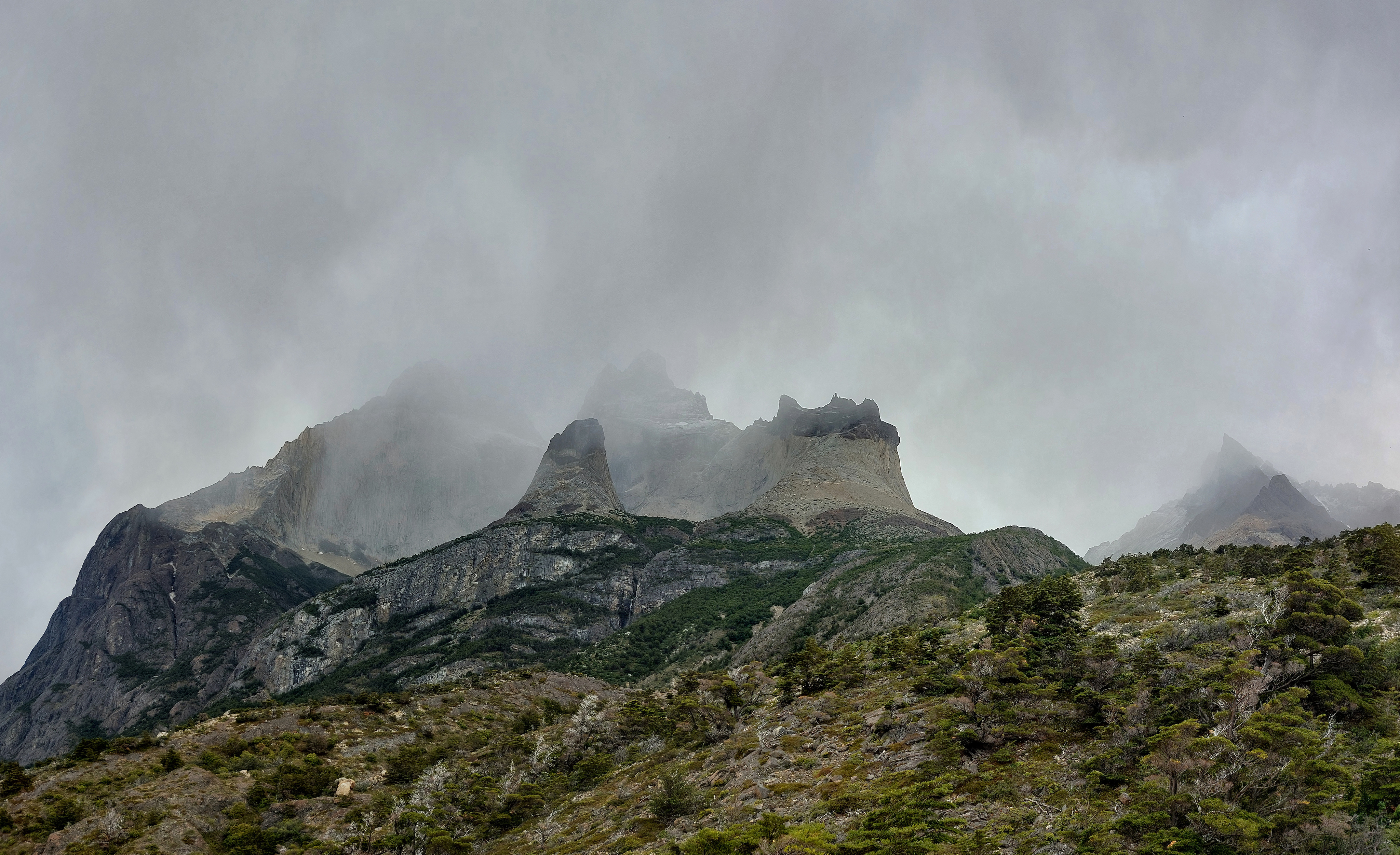
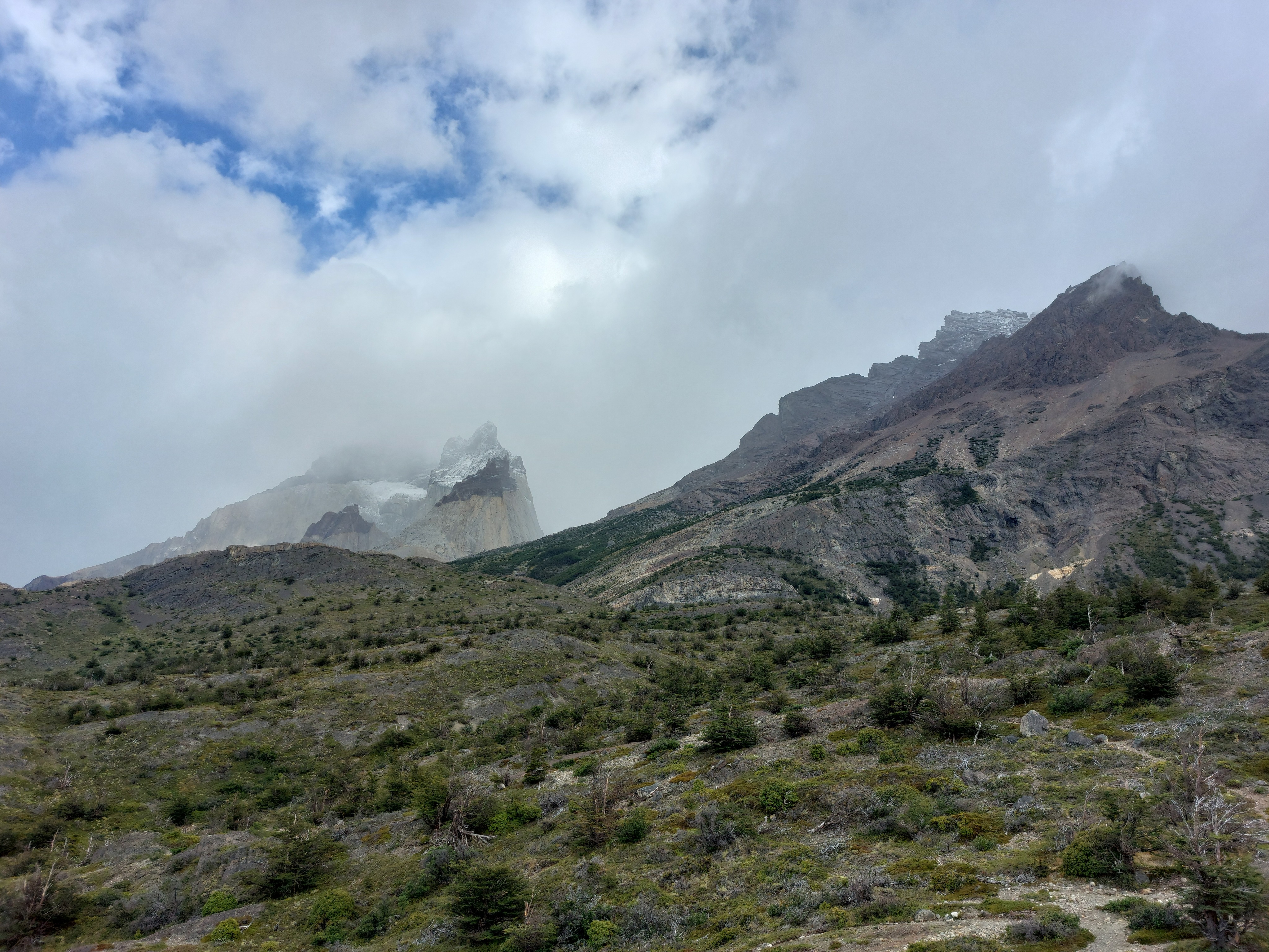
The typical W circuit goes from Paine Grande to Grey and back again in a single day. We were doing a lazy W, and wanted to hit Paso John Garner for views of Glaciar Grey from above, so we skirted along the east side of the lake up past the glacier.
From near the beginning of the trail; we went up the right-hand side through the trees to the glacier. The first half was in the shade of the trees and relatively calm; the second half opened up, absolutely blasting us with wind.
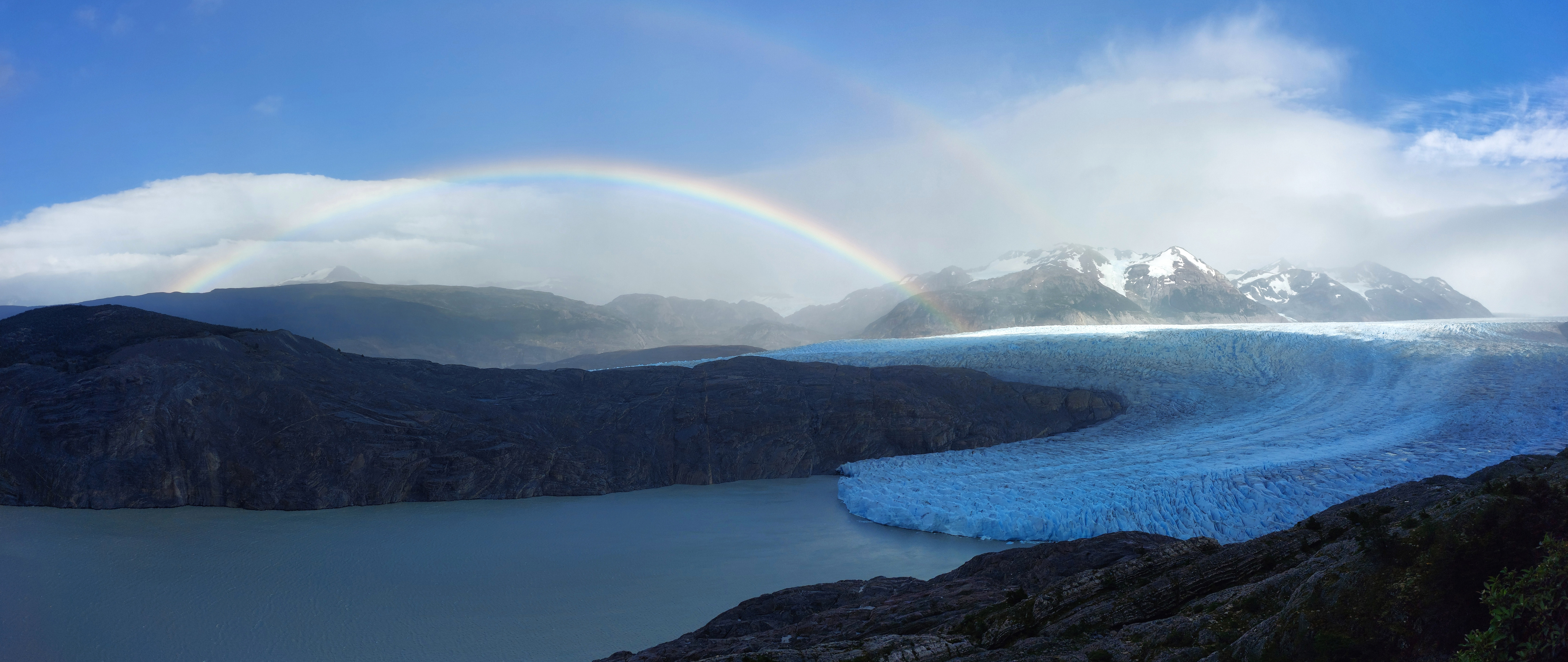
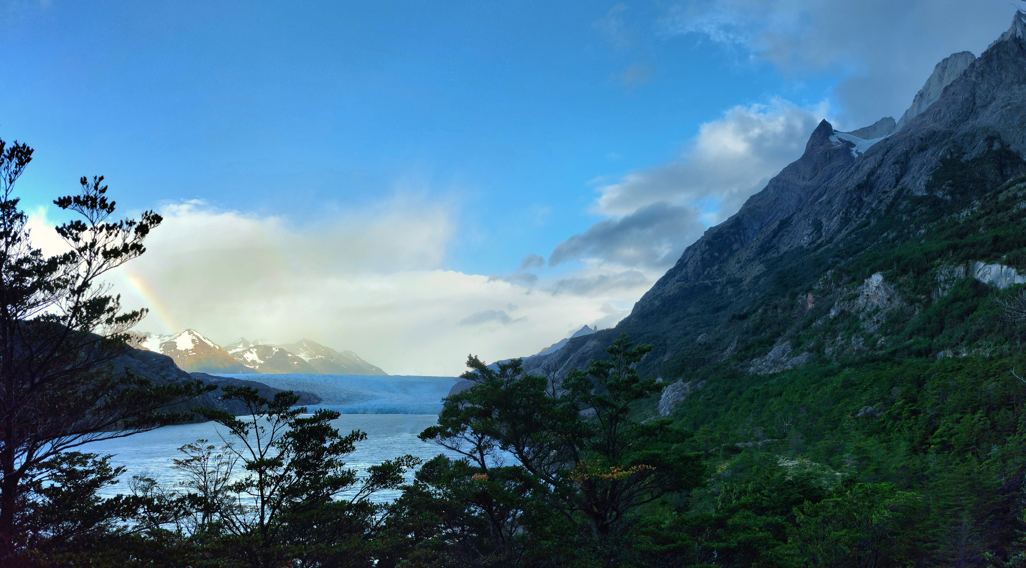
Impeccable weather; clear-ish skies, the glacier, and a double rainbow. Boy was it windy.
We didn't go much further than this point; we ended up making it past the third suspension bridge and almost to Campamento Paso, the last stop before the final ascent to the pass, when we were informed by a few groups that rangers were turning people attemping to climb the pass around, as apparently after 11am, the wind becomes too aggressive, and past that time, it's solely one-way down from Los Perros. We still got some pretty phenomenal views from where we ended up, so no complaints about saving a bunch of elevation gain.
Sense of scale never really works with these pictures; Glaciar Grey may not be the tallest at its tip, but the ice field just keeps going, to the horizon and out of view.
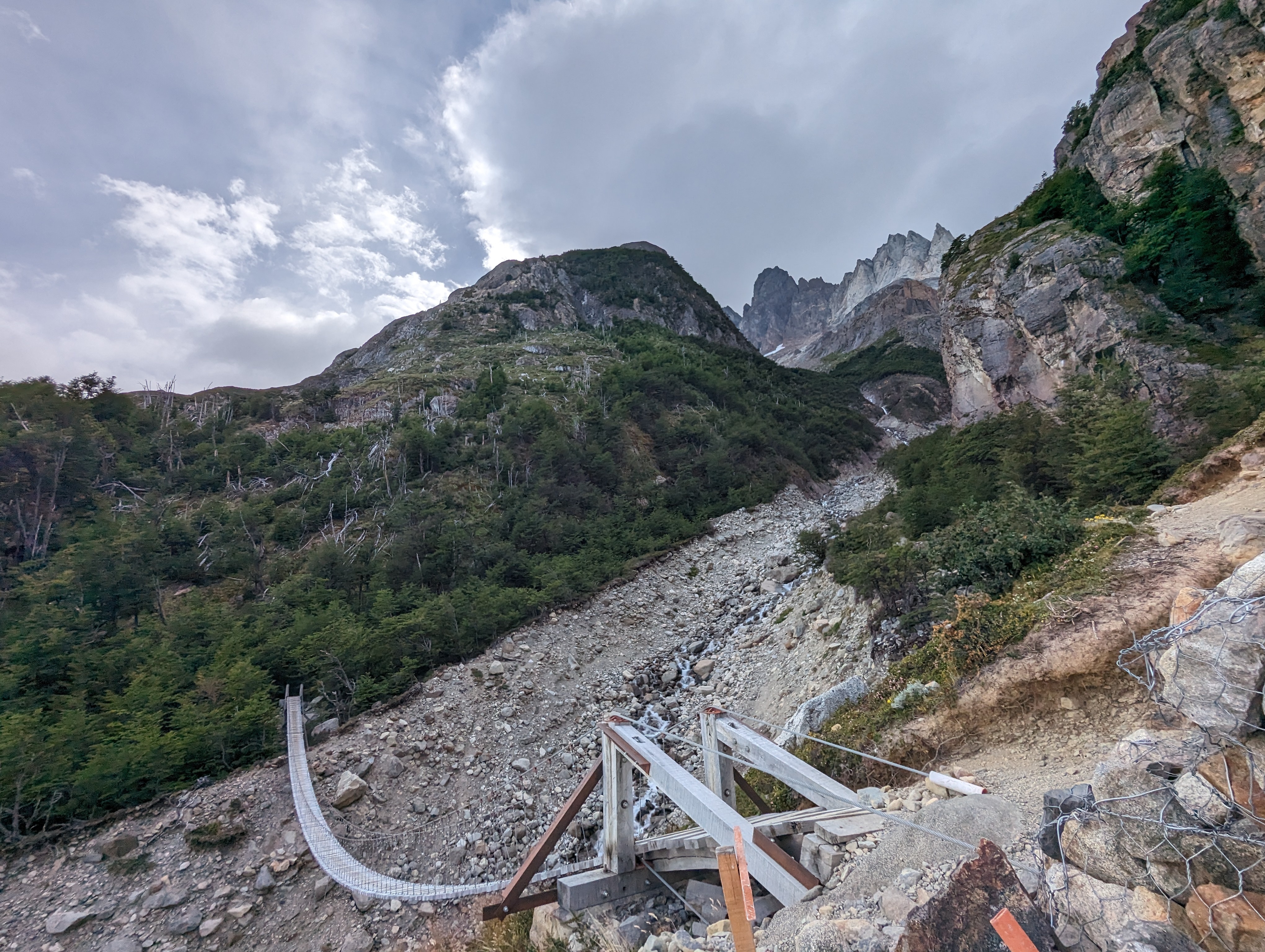
One of the three suspension bridges. These were a blast to cross with the crazy winds.
February 19
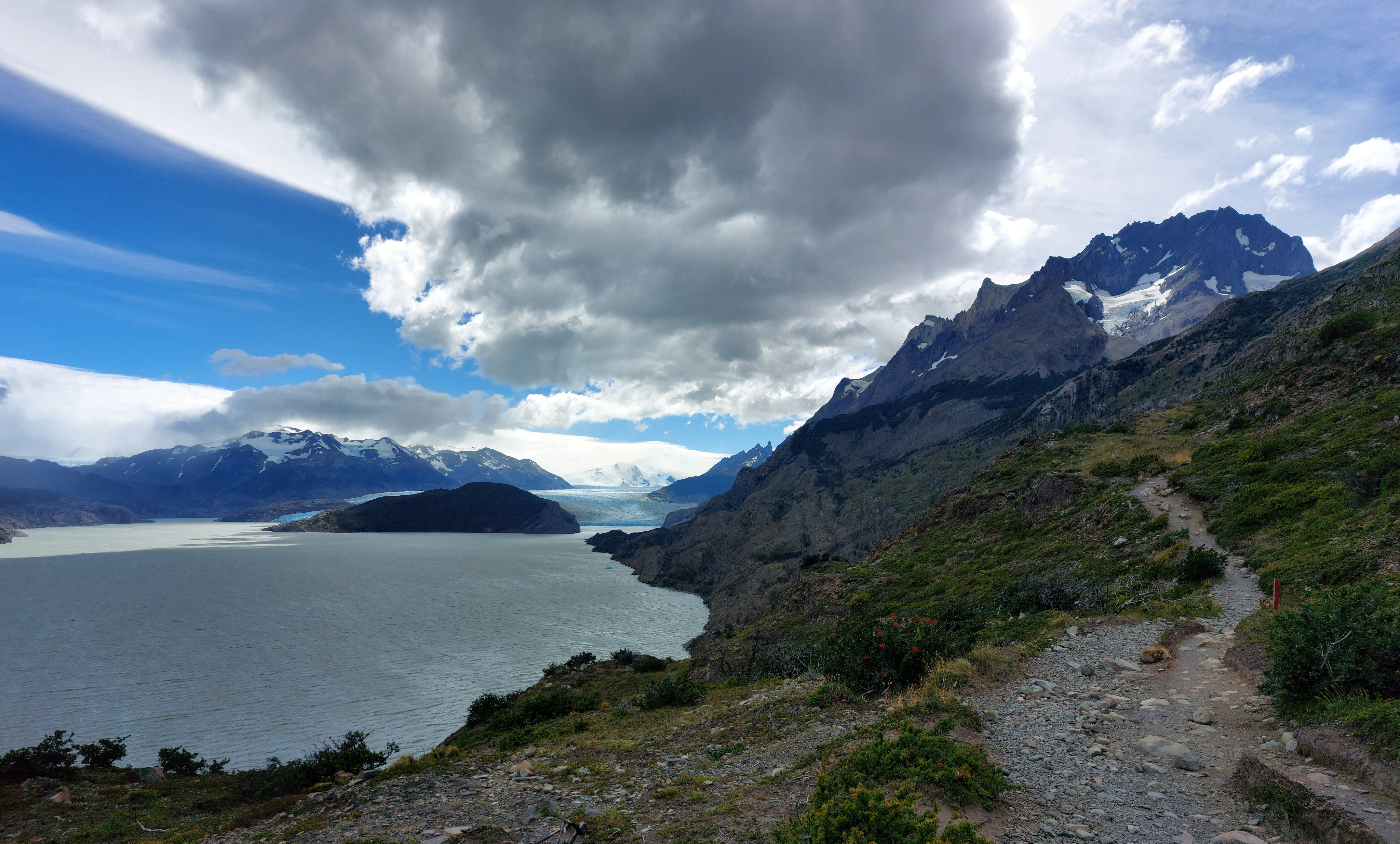
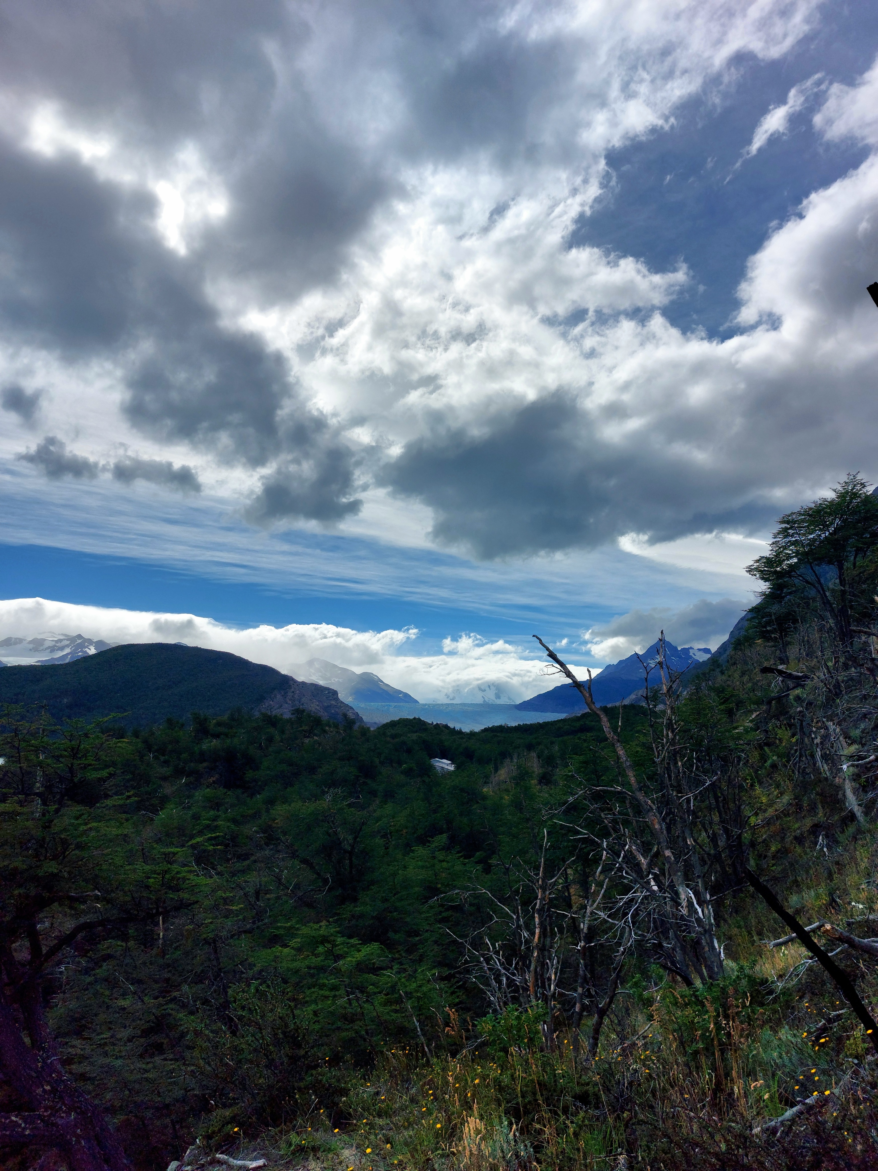
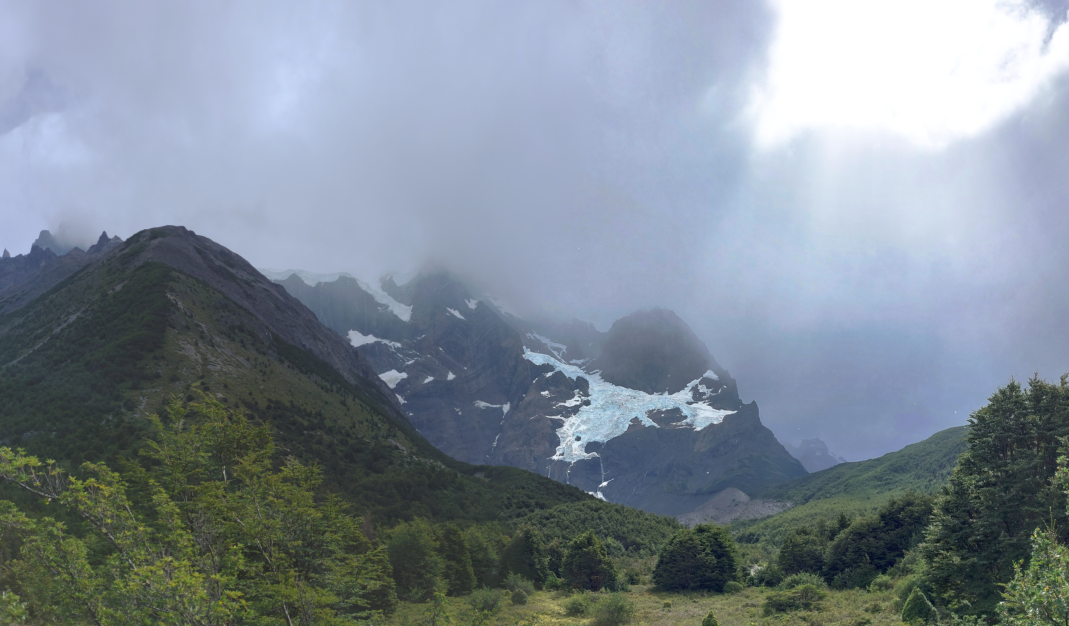
We fell asleep to the pitter-patter of light rain on our tent, and woke up to a proper downpour, which persisted throughout most of the day, our one instance of sour weather during the trip. Thankfully for us, it was also our one day of backtracking, from Grey to Paine Grande, and so we got to experience the repeat section under much more moody conditions, with the glacier and mountains peeking in and out of clusters of lazy clouds taking advantage of the break in the wind to meander about.
Refugio Grey, Glaciar Grey invisible in the clouds behind it.
Mirador Glaciar Grey again, minus Glaciar Grey.
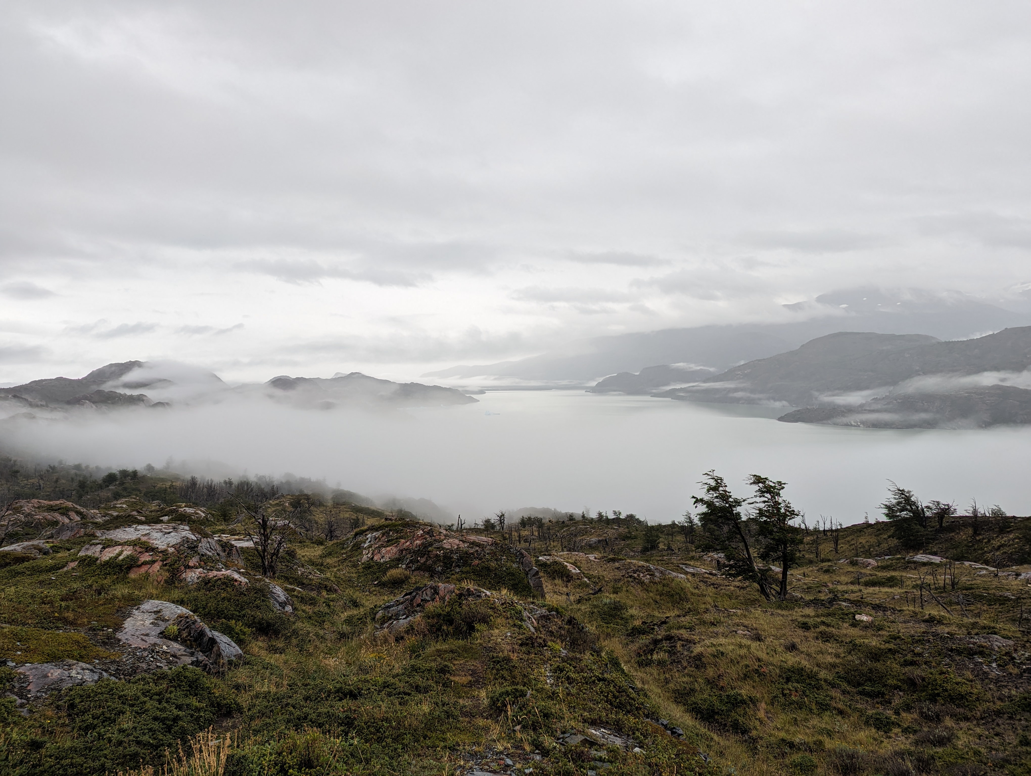
Looking south towards Lago Grey.
By the end, persistent rain and flooded trails had ensured my not-so-great rain jacket and trail runners were completely soaked. We set up our tents at Paine Grande in the rain, which stopped pretty much immediately afterwards. This ended up being a non-issue though, as the wind quickly blew in and dried all our clothing and the tents in no time at all.
Chicken!
February 20
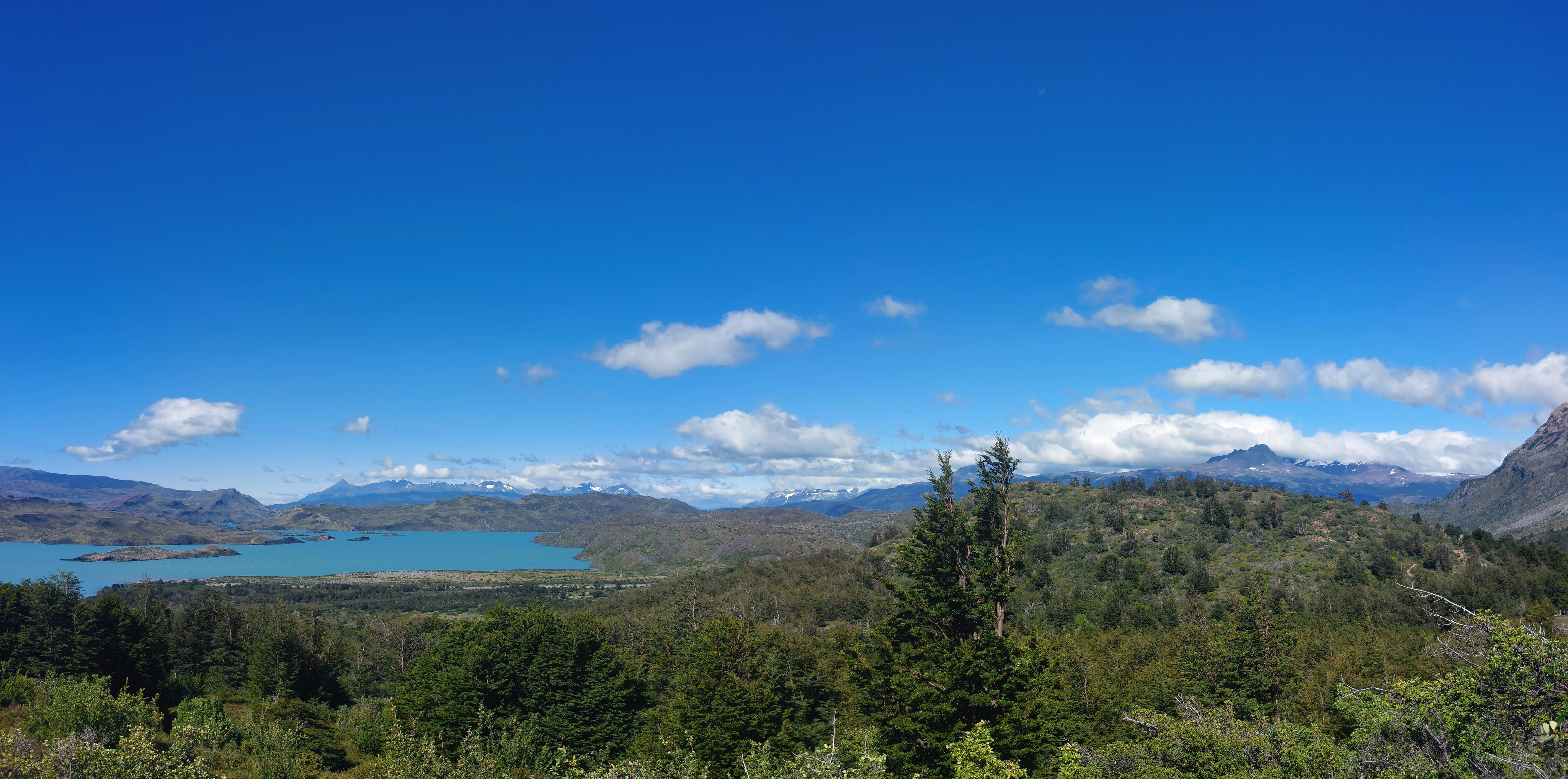
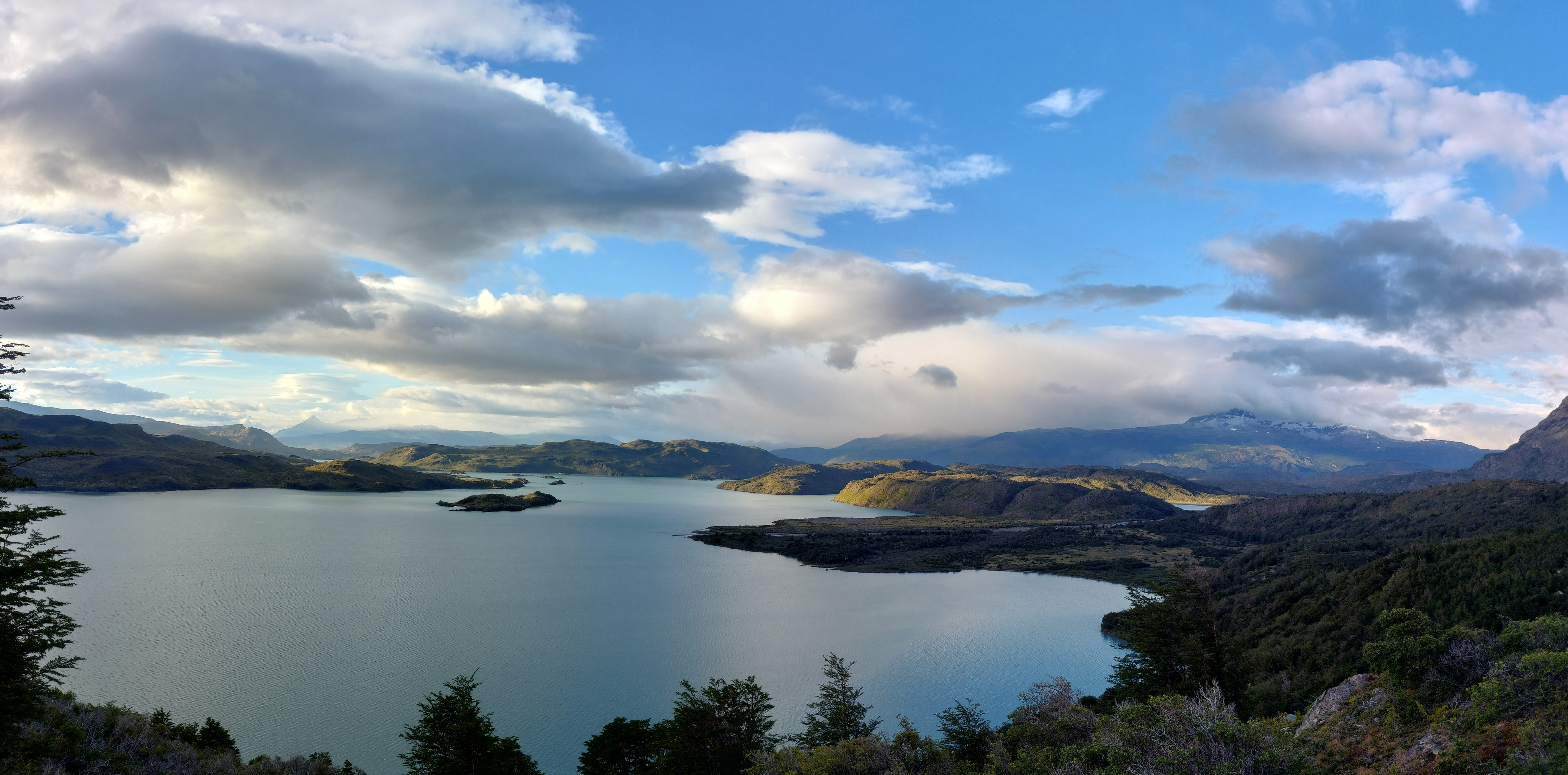
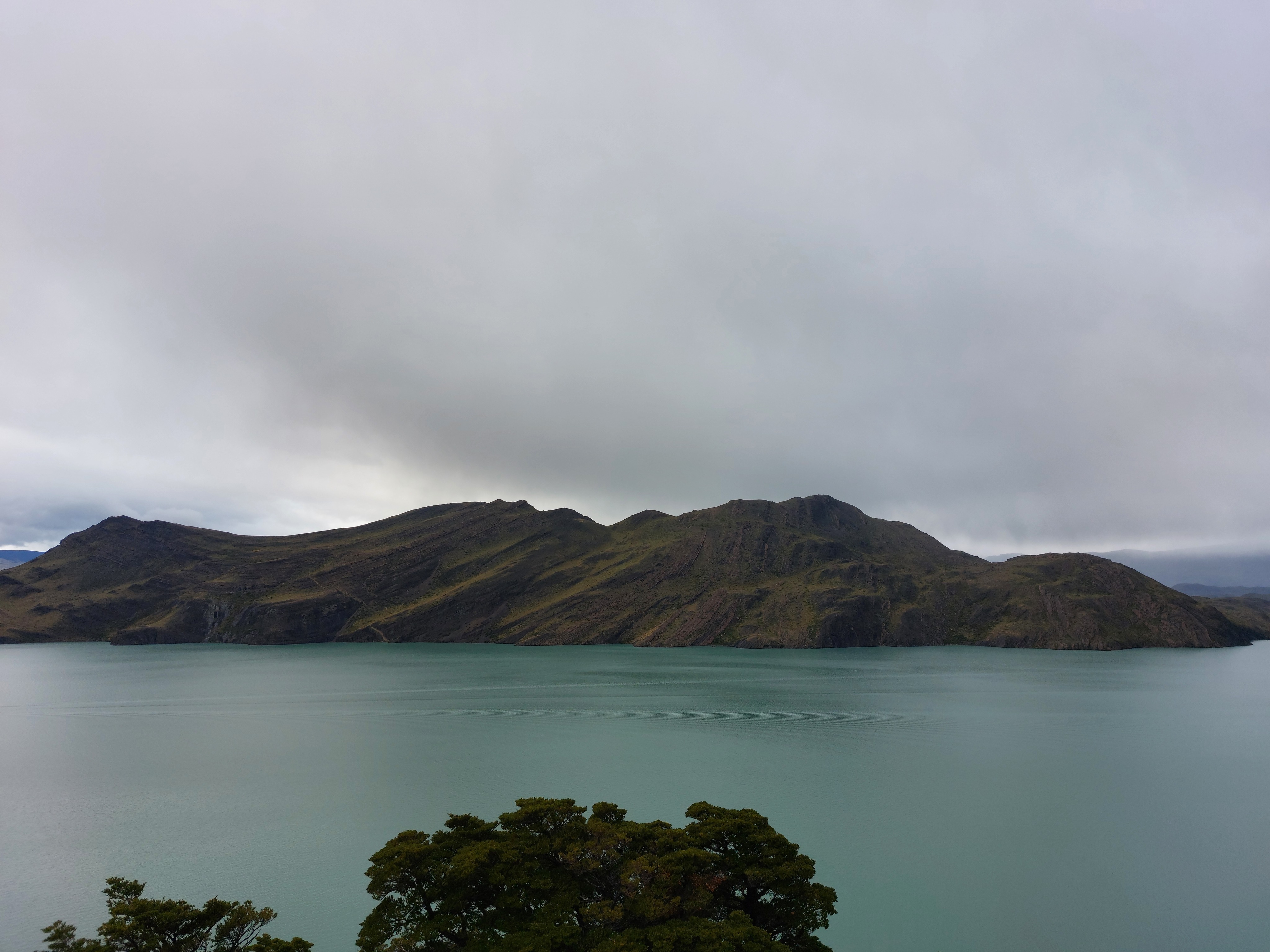
People typically hit the stretch between Refugio Francés and Paine Grande, as well as the Francés valley, in a single day; our extended W split these into two separate days. In hindsight, doing both in a single day would have probaby made a lot of sense, since neither stretch was especially long. This ended up being our shortest day, an easy, flat, sunny walk from Paine Grande to Francés. The variety in lake colours was startling; Lago Grey was, well, grey, Skottsberg a deep blue, and Lago Nordenskjöld a glacial blue not dissimilar from (yet not identical to) Lago Pehoé.
Paine Grande and Los Cuernos with Lago Skottsberg peeking out.
Looking back from the entrance of Valle del Francés towards where we started, Lago Nordenskjöld on the left, Refugio Paine Grande hidden behind the hills on the right.

Refugio Francés was built on a relatively steep hill, so the tents were on these platforms.
What 60 USD gets you at Refugio Francés; this camp might be worth skipping the box dinner... Looking through our receipts, it was a bit of a shock just how much more expensive the Las Torres owned Refugios were than the Vertice ones (the latter including Grey and Paine Grande, and the former including all the others we stayed at): the cost of a two-person tent platform jumped from 11 USD to 70 USD at Francés and 140 USD at Chileno.
February 21
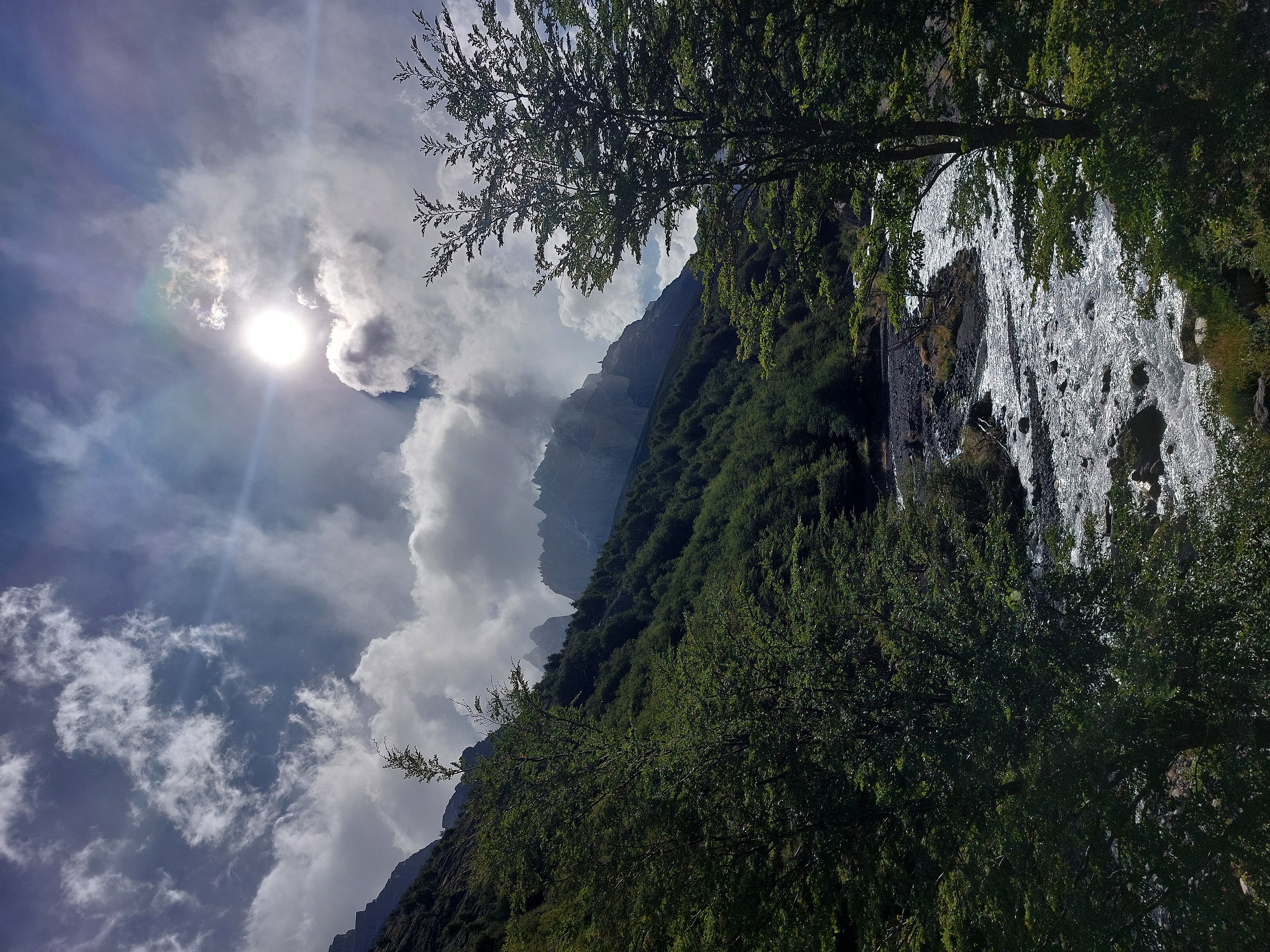
From Refugio Francés up through Valle del Francés, to Mirador Britannico. We went early in the morning, and were greeted by soft sunlight and a descent of massive Magellanic woodpeckers tapping away at a warped tree. After a steady ascent up the valley, we had the lookout to ourselves for a fair minute before the horde arrived. We were once again struck with fortunate weather, up until the very end of the hike, at which point rainclouds chased us back to camp just in time to grab our hanging clothing before an afternoon sprinkle.
Paine Grande, minus the Guy Fieri frosted tips on the top right blocked by clouds.
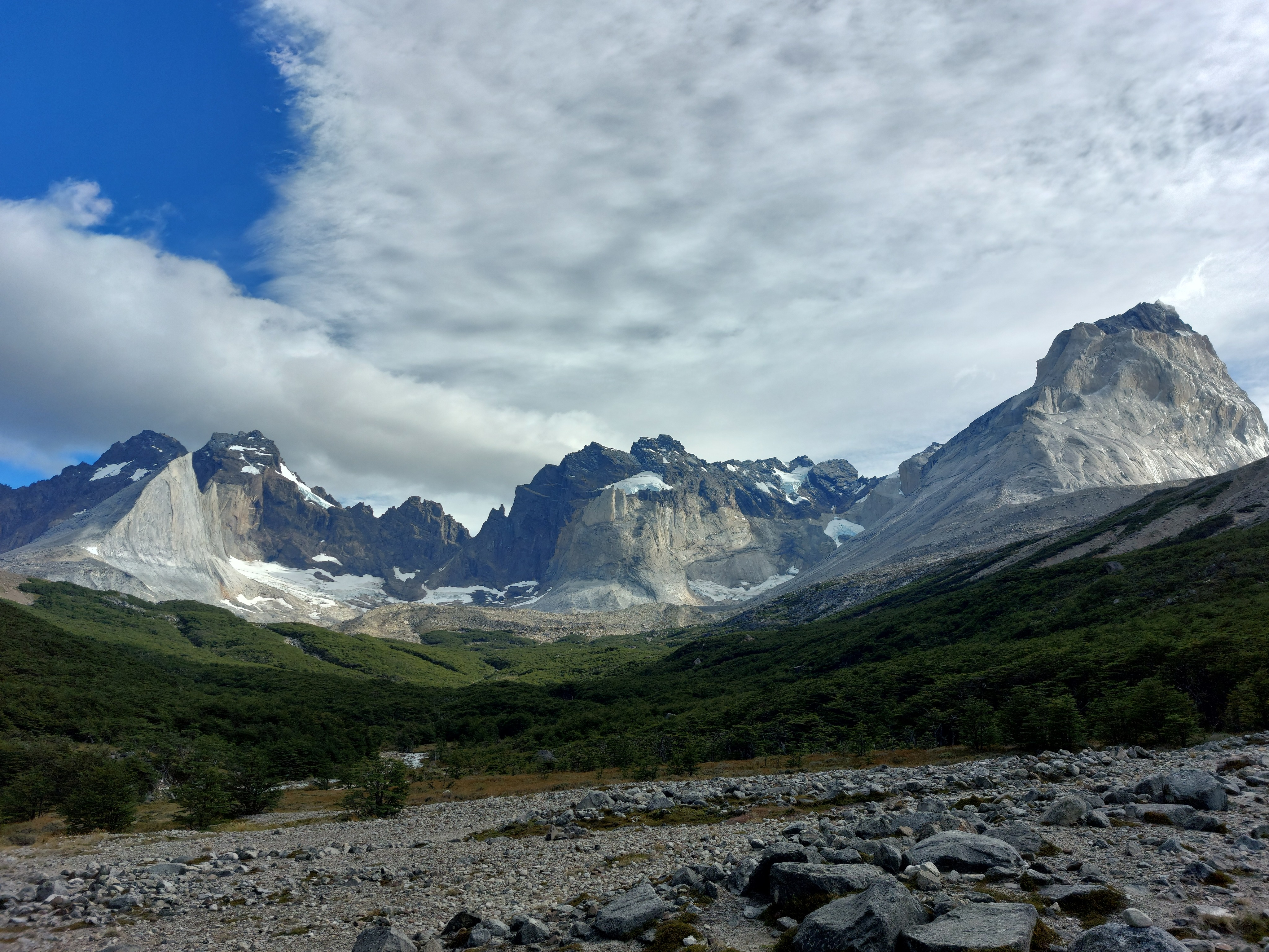
The end of the valley, Aleta de Tiburón (Shark Fin) on the left.
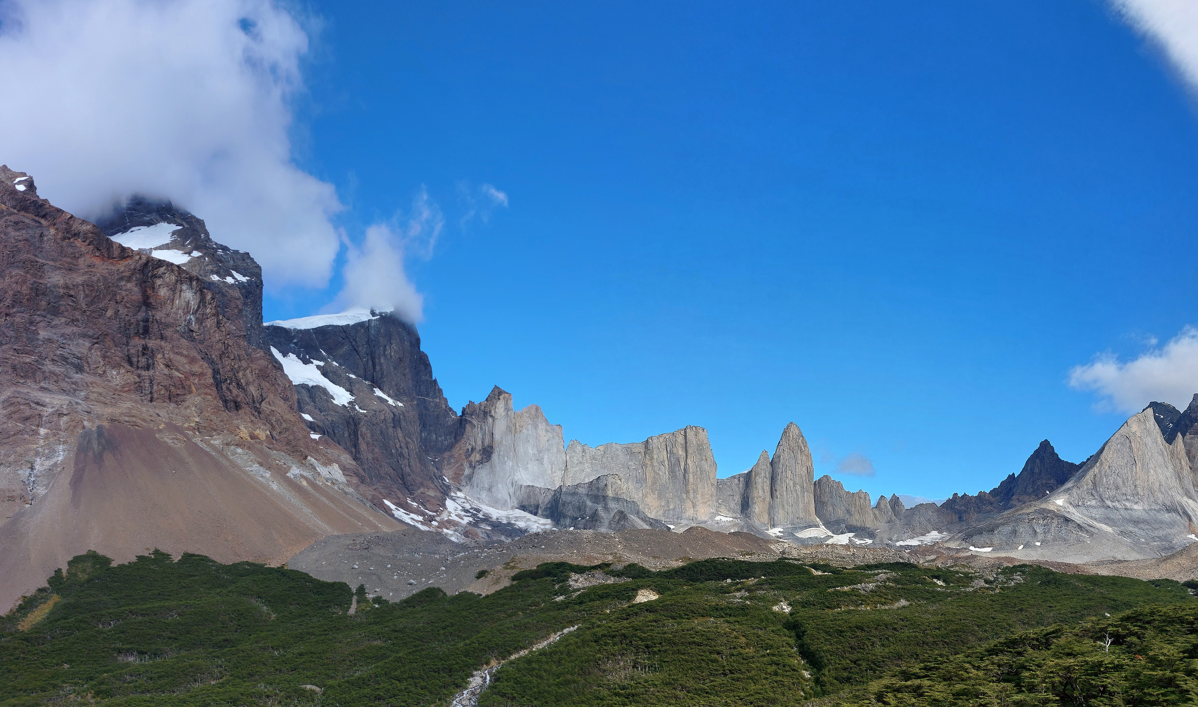
Facing west from Mirador Britannico, the edge of Paine Grande on the far left.
Looking back towards the entrance of the valley and Paine Grande.
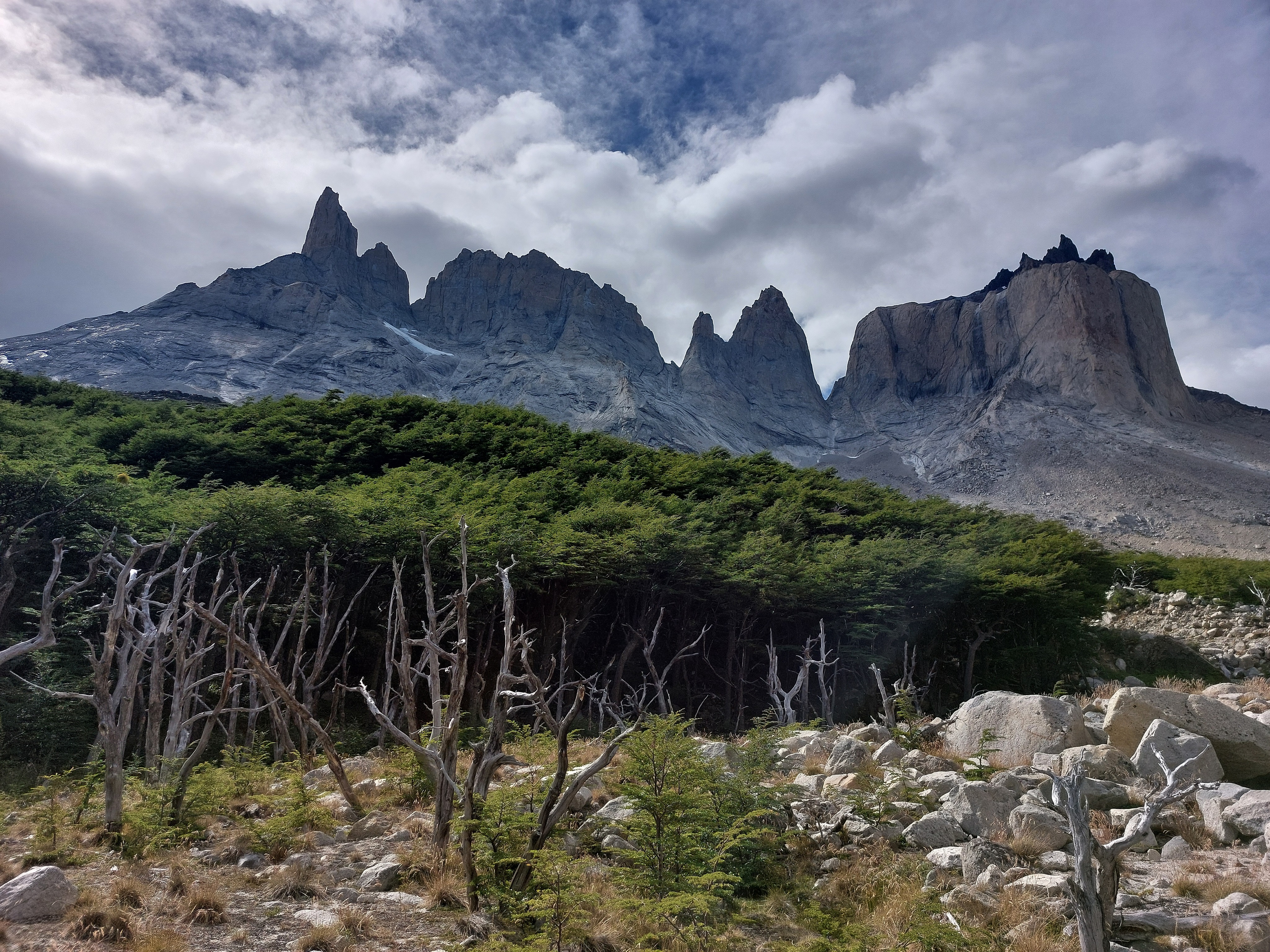
Looking east towards Los Cuernos and their spikey friends.
Paine Grande from up close near Mirador Francés. We sat at the lookout for a good hour, watching little avalanches slide off loose pockets of snow.
Eventually, we were chased back to camp by incoming rainclouds, but not after soaking in the valley, mountains, and sun. Night was accompanied by light wind rustling the trees and distance avalanches on Paine Grande echoing down the slopes.
Februrary 22
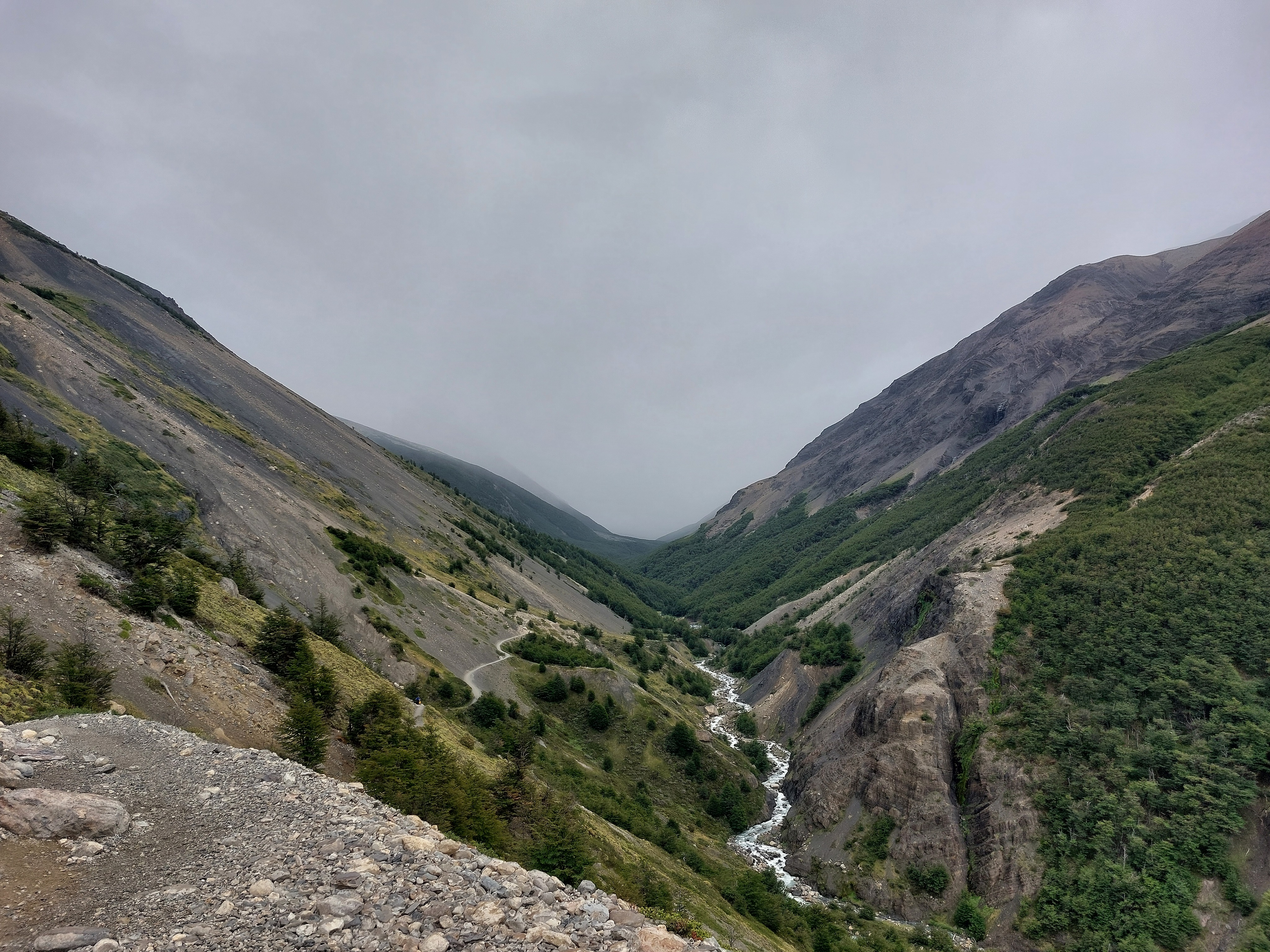
From Refugio Francés to Refugio Chileno. Light drizzles nipped at our heels for the first half, but the valley held the rainclouds and their full ire at bay; once again, we were lucky with the weather, and were treated to no more than little flecks of rain, with sun the rest of the day. This section deviated from the standard formula of wind-worn outcrops and gnarled forest, trading these for marsh crossings and cow-pie fields infested with mosquitoes. As we climbed higher and entered the valley holding Refugio Chileno, the mosquitoes and temperature dropped away. We ended up standing off the trail a couple times as horses bringing supplies up to and refuse down from Chileno crossed our path. We got lucky when checking in; Las Torres had left a tent on our campsite, and offered it to us for free. Not one to complain about less setup and take-down work, we happily accepted it.
Looking west along the trail, Lago Nordenskjöld.
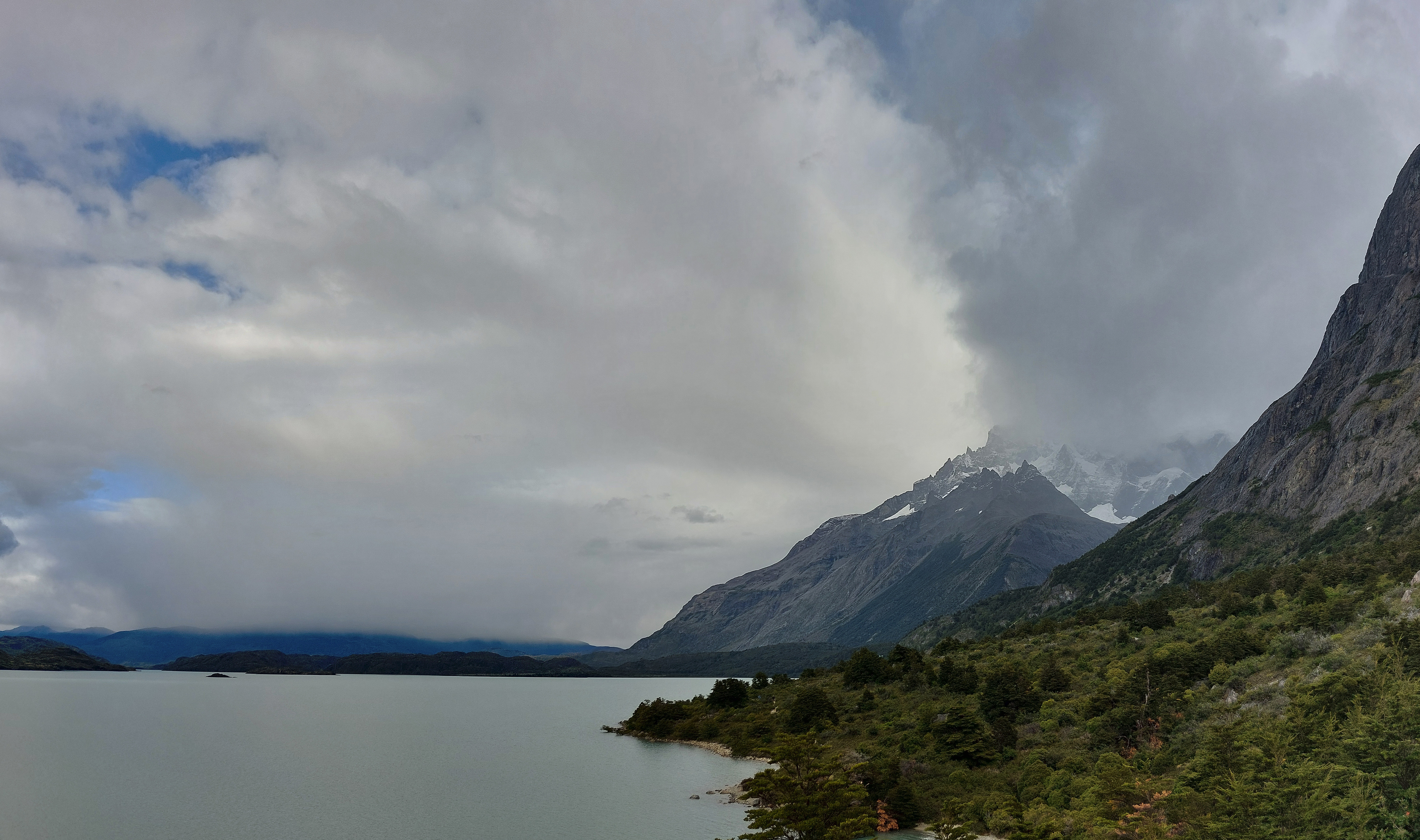
Paine Grande and Lago Nordenskjöld.
Los Cuernos from below; the mountains did a wonderful job of blocking rainclouds from making their way further south.
Los Cuernos again from further east along the trail.
Looking south across Lago Nordenskjöld.
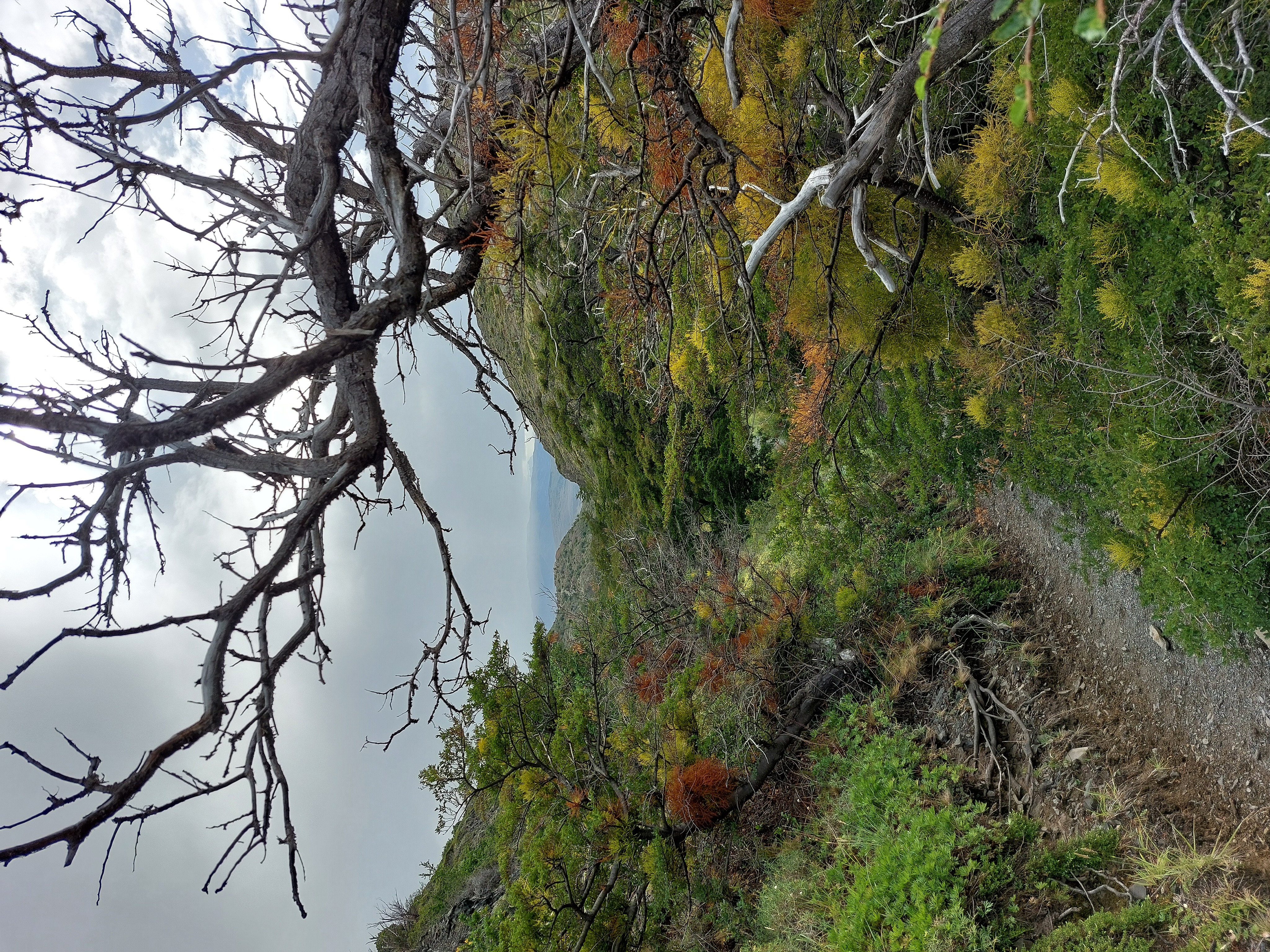
Fall colours beginning to appear.
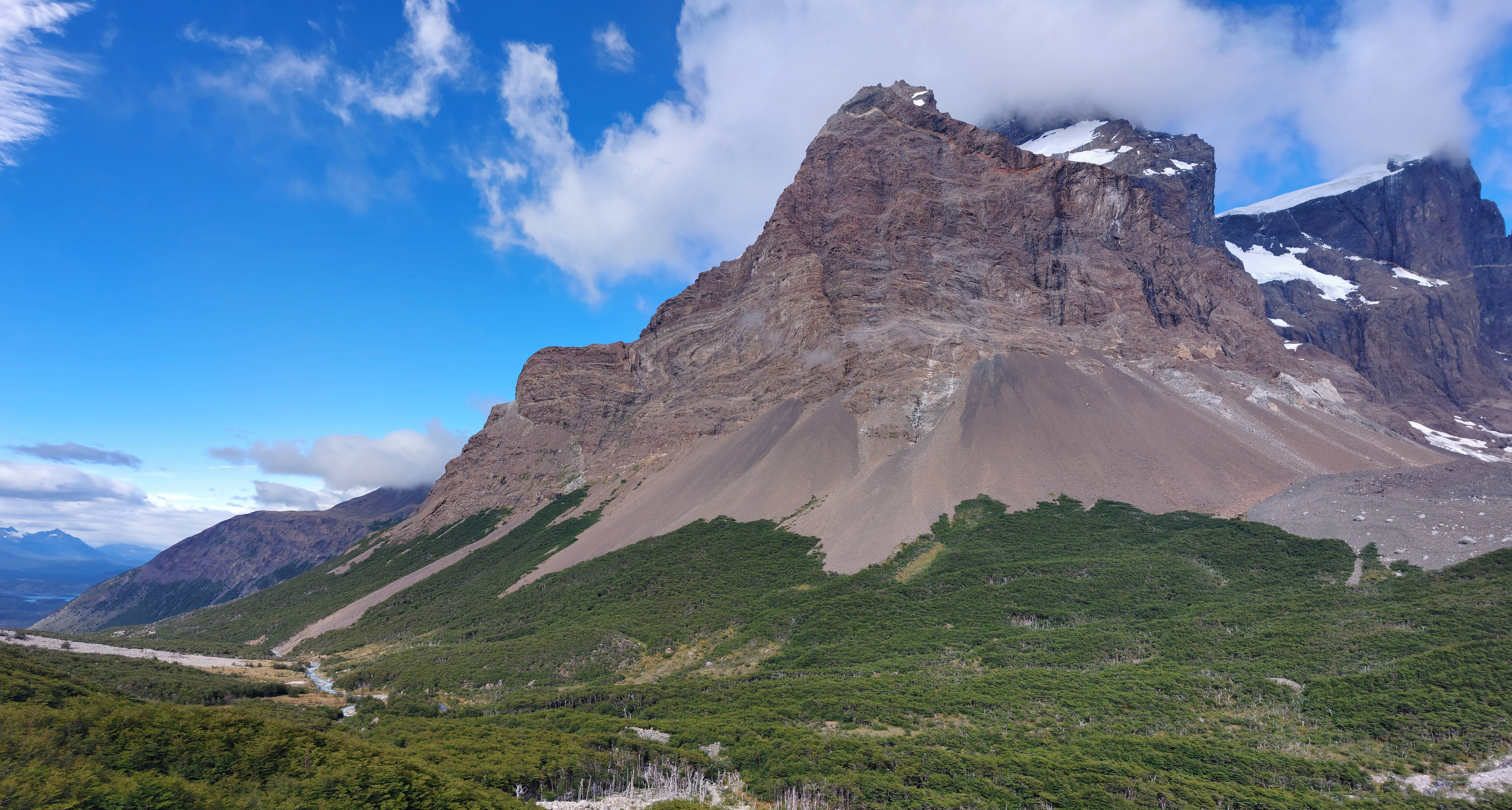
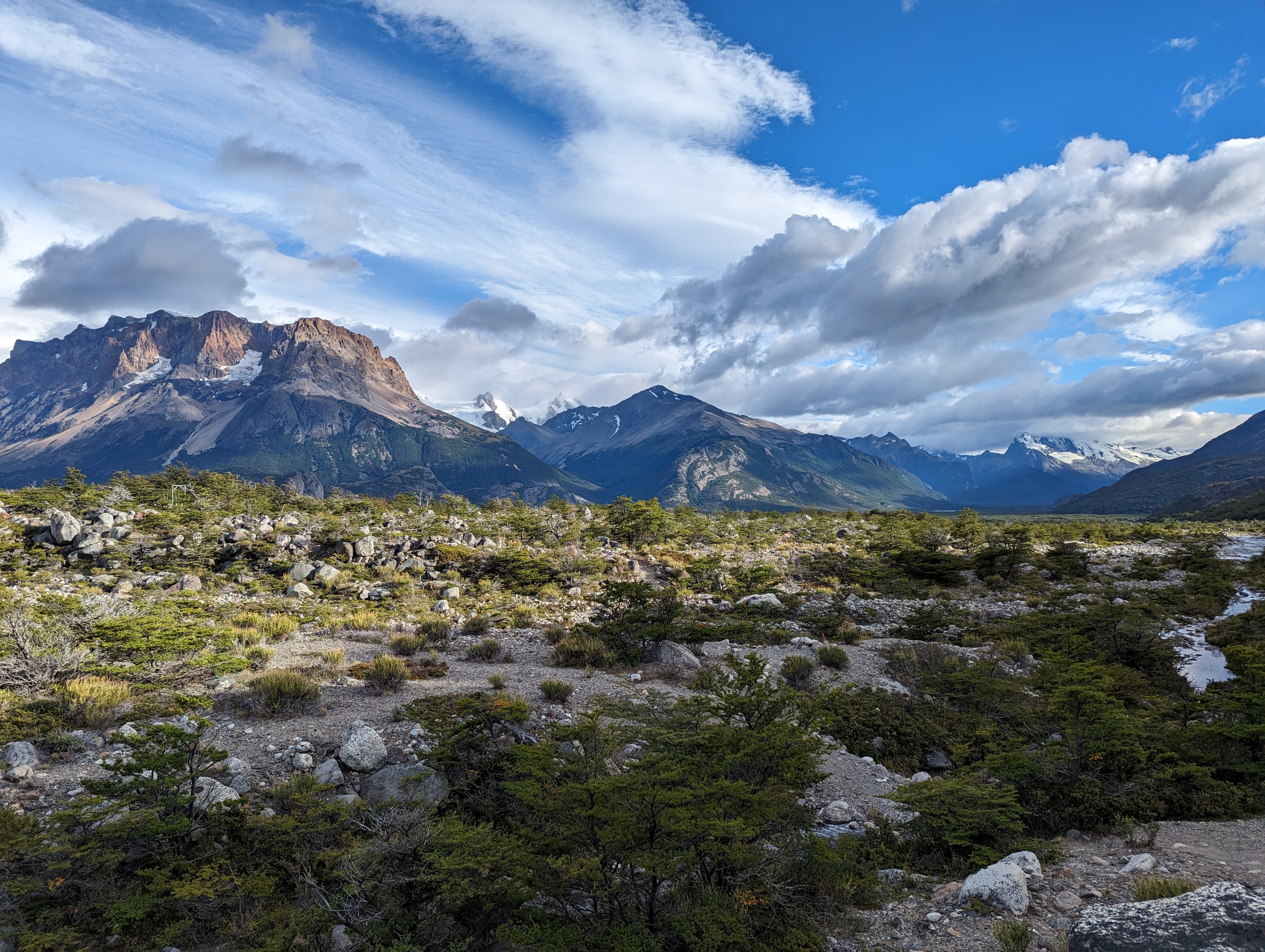
Cerro Almirante Nieto (I think); our route skirted the right-hand side of the mountain and into its flanking valley.
High point of the mountain pass leading to Refugio Chileno, visible down by the river, nestled in the trees.
Las Torres peeking out around a mountain from the refugio.
February 23
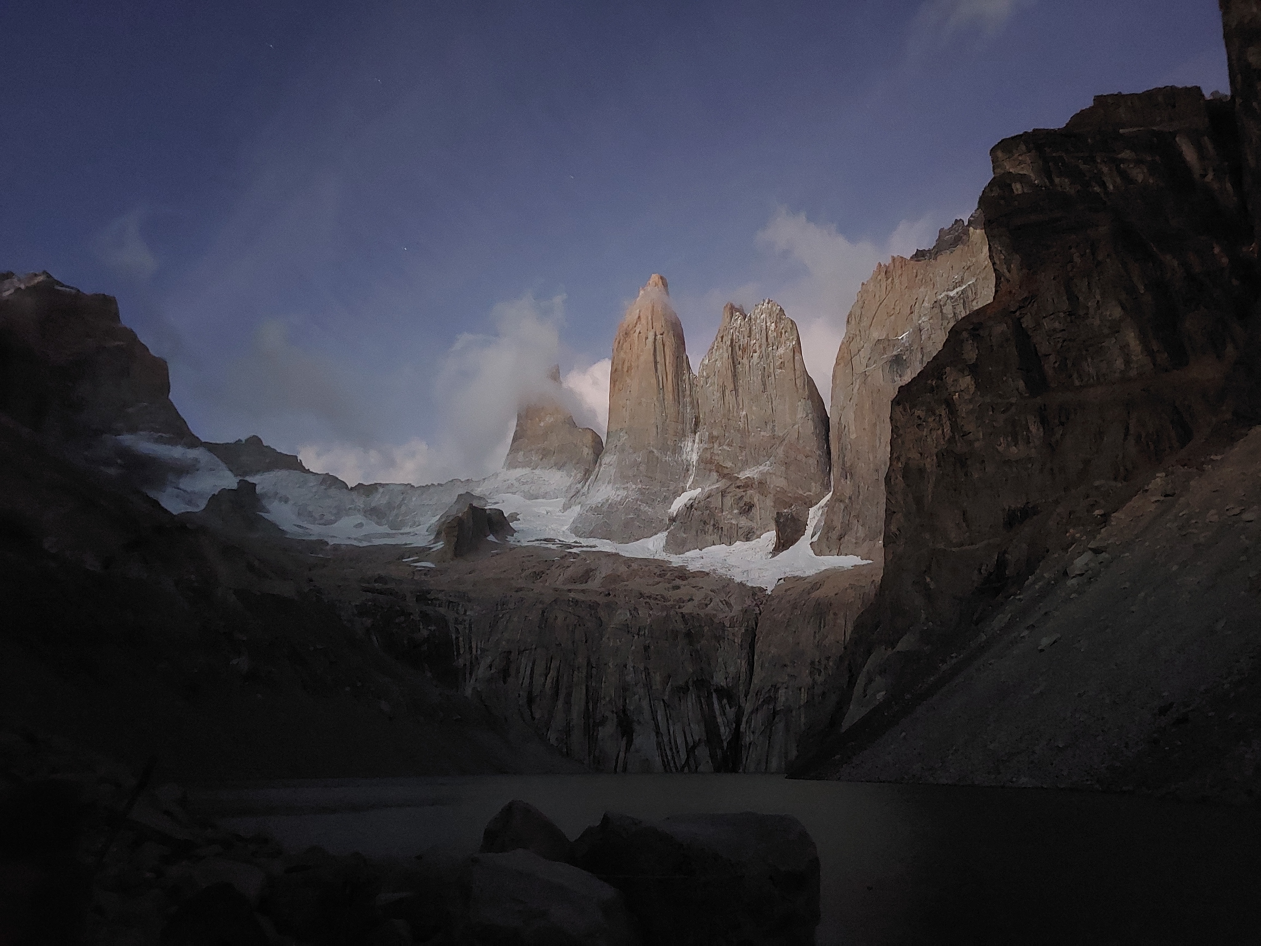
We woke up at 3:30am to a sky full of stars. We set down the second tent, packed up our bags, left them by the refugio, then made our way up into the mountains by torch-light.
Headlamps of other hikers in the dark.
After a couple hours of steady ascent, we arrived at Mirador Las Torres for 6:30 and hunkered down to watch the sunrise. It was brutally cold, but we snuggled deep into our sleeping bags, while others shivered, paced, and danced to keep warm.
The first indirect sunlight to illuminate Las Torres.
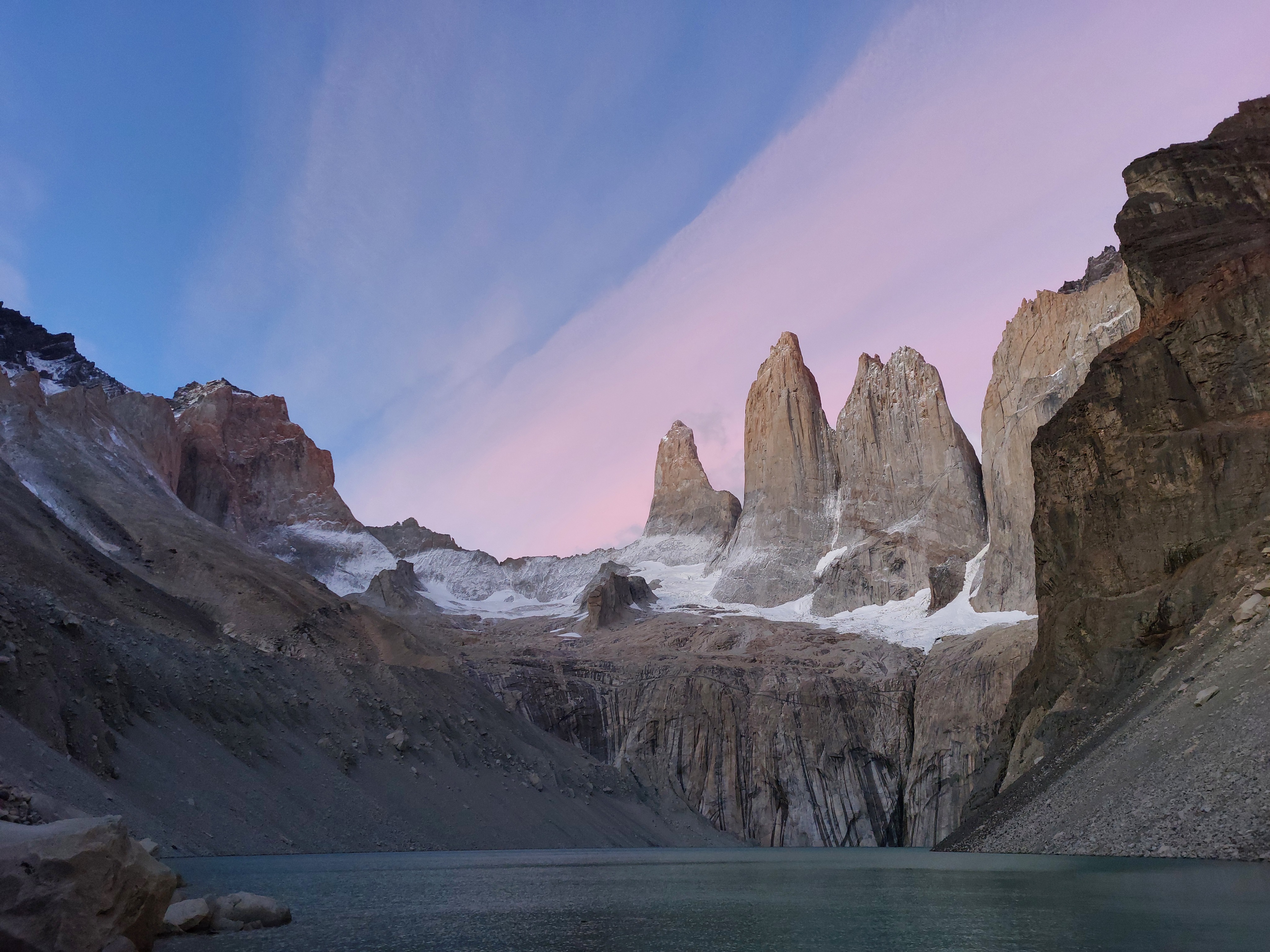
At 6:50, cotton-candy skies.
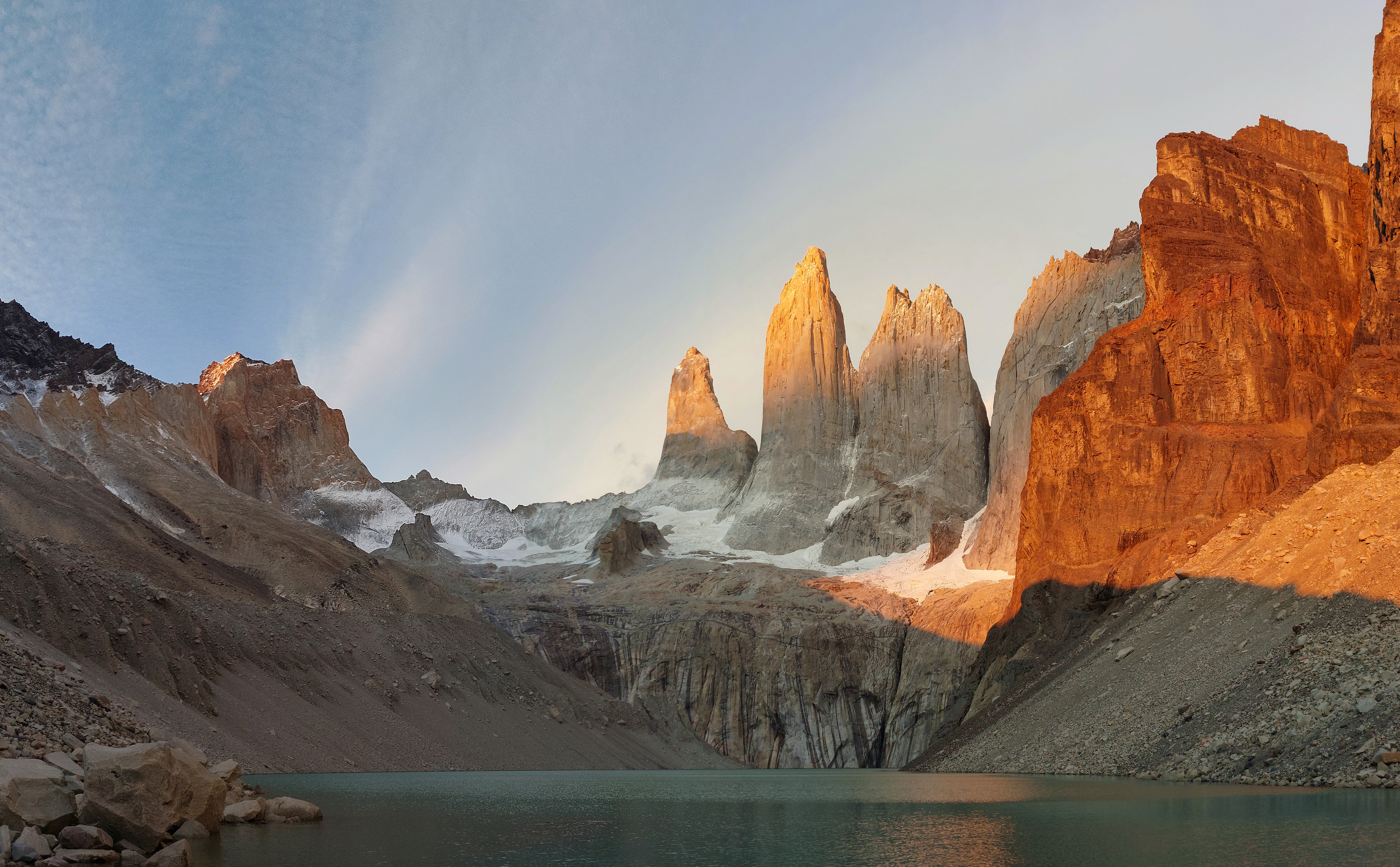
At 7:10, deep orange alpine glow making its way down the towers.
What was perhaps most surprising was how small the towers looked; there was definitely some optical illusion nonsense going on, as the lake felt small, and it seemed as though Las Torres were directly on the opposite shore, but a cursory glance at any map reveals a long stretch of rising stone between the deceptively large lake and the towers themselves; from Refugio Central, they looked positively gigantic.
The idiots were out in full swing this morning. More than a few people had crossed the "stay behind this line" signs, and someone had decided the "no drones" sign didn't apply to them.
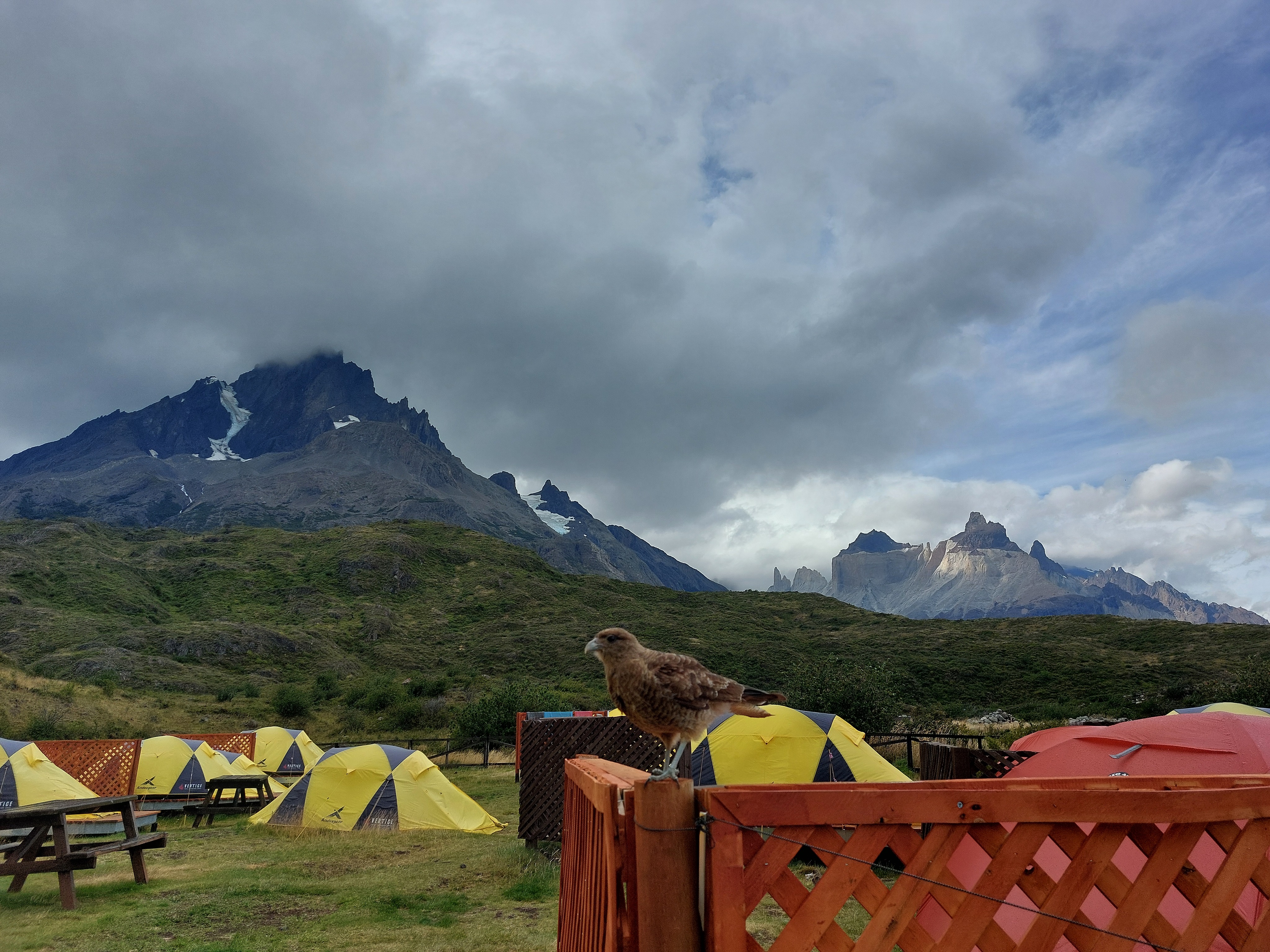
We descended around 7:30 and were back in camp for 9:45, where hot chocolate melted away the last of our morning chills, and we watched the swathes of hikers from Central drop off their full backpacks before heading up to Las Torres. From there, it was an easy enough descent to Refugio Central and the welcome center. Once again, our planning was overly conservative; we booked our bus for around 8pm, but could have easily made the 3pm bus, which was full. It was no major loss though, as we sat in Refugio Central with Calafate Lemonade and watched godrays peek through the evening clouds to illuminate individual peaks and flanks of the massif.
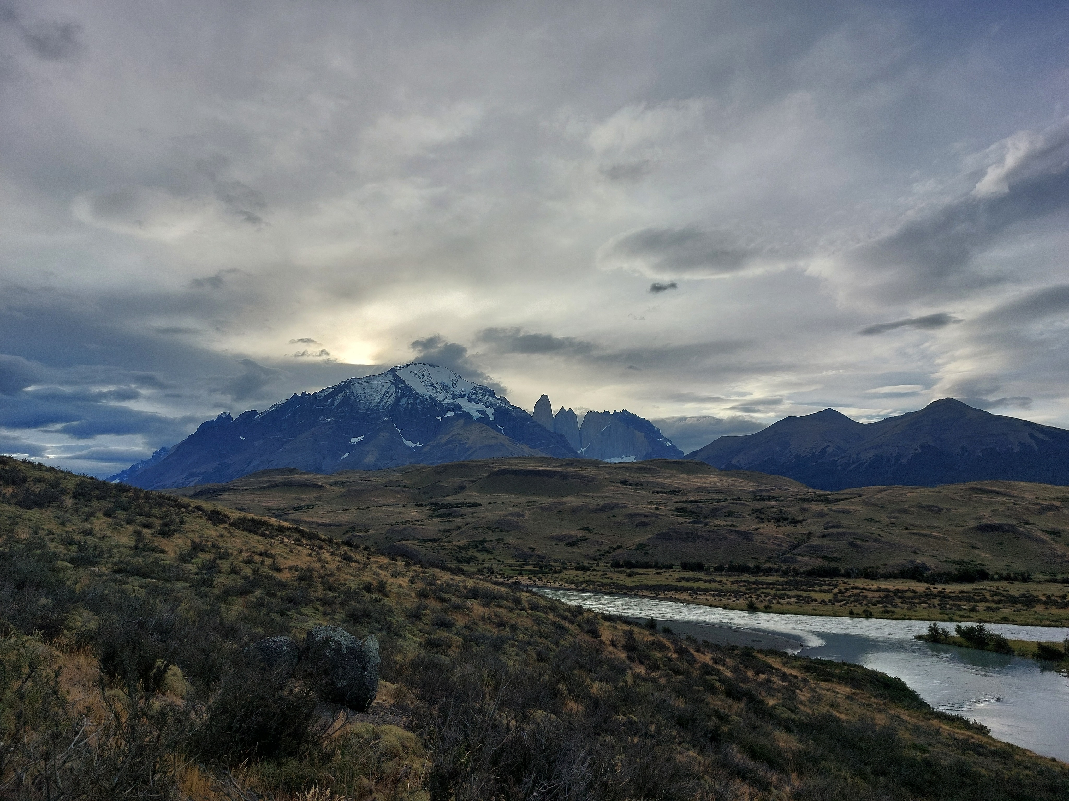
Our last close-up view of Torres del Paine, from Laguna Amarga.
The bus ride back was as scenic as the way there (a reversal of route, to be expected), with more stellar views of flat yellow plains, rolling hills, and smooth massifs along the End of the World Route back to Puerto Natales.
February 24
A transit and clean-up day; we took the bus from Puerto Natales to El Calafate, a surprisingly comfortable 6-hour bus (plus the slow wait at the Chilean and Argentinian borders). The stretch of Argentina we passed through was quite barren and lacked the distinct trees or hills of the Chilean highway; it was essentially flat the entire way, minus the last descent to the plains bordering Lago Argentino. We spent the evening doing laundry and catching our breath.
February 25
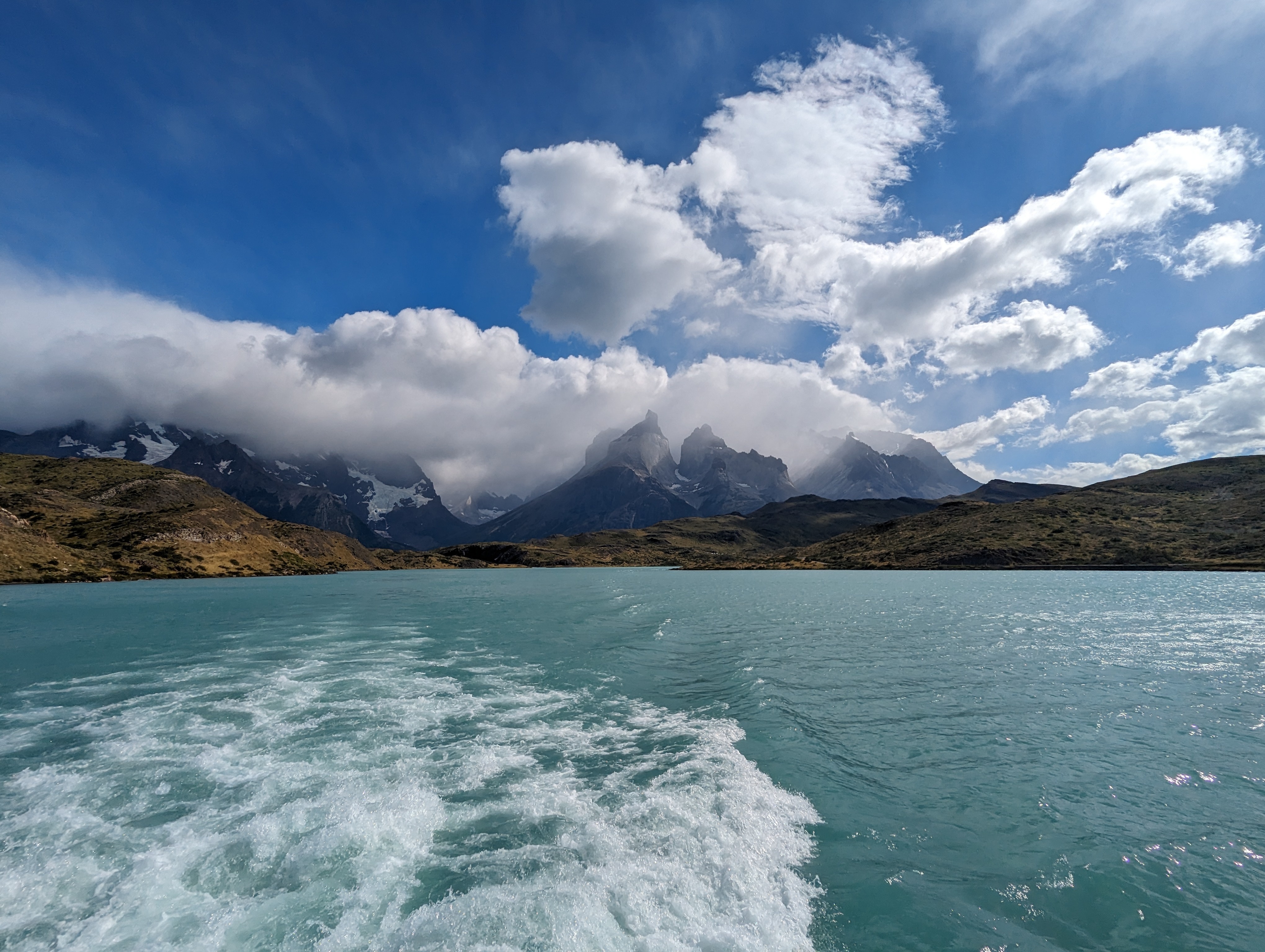
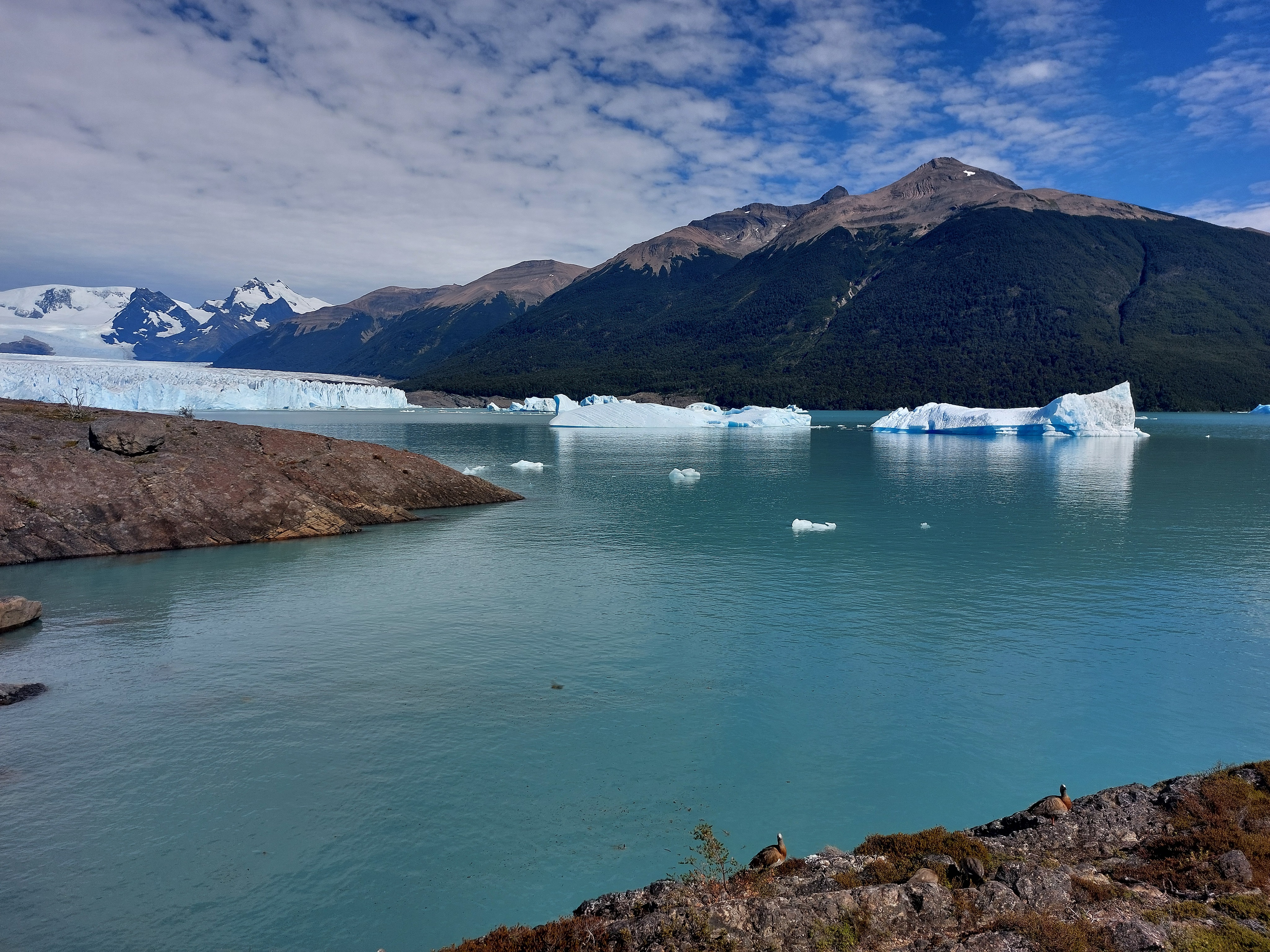
We rented a car for the day and drove to Glaciar Perito Moreno. It was impressively tall, once again not showing at all in pictures.
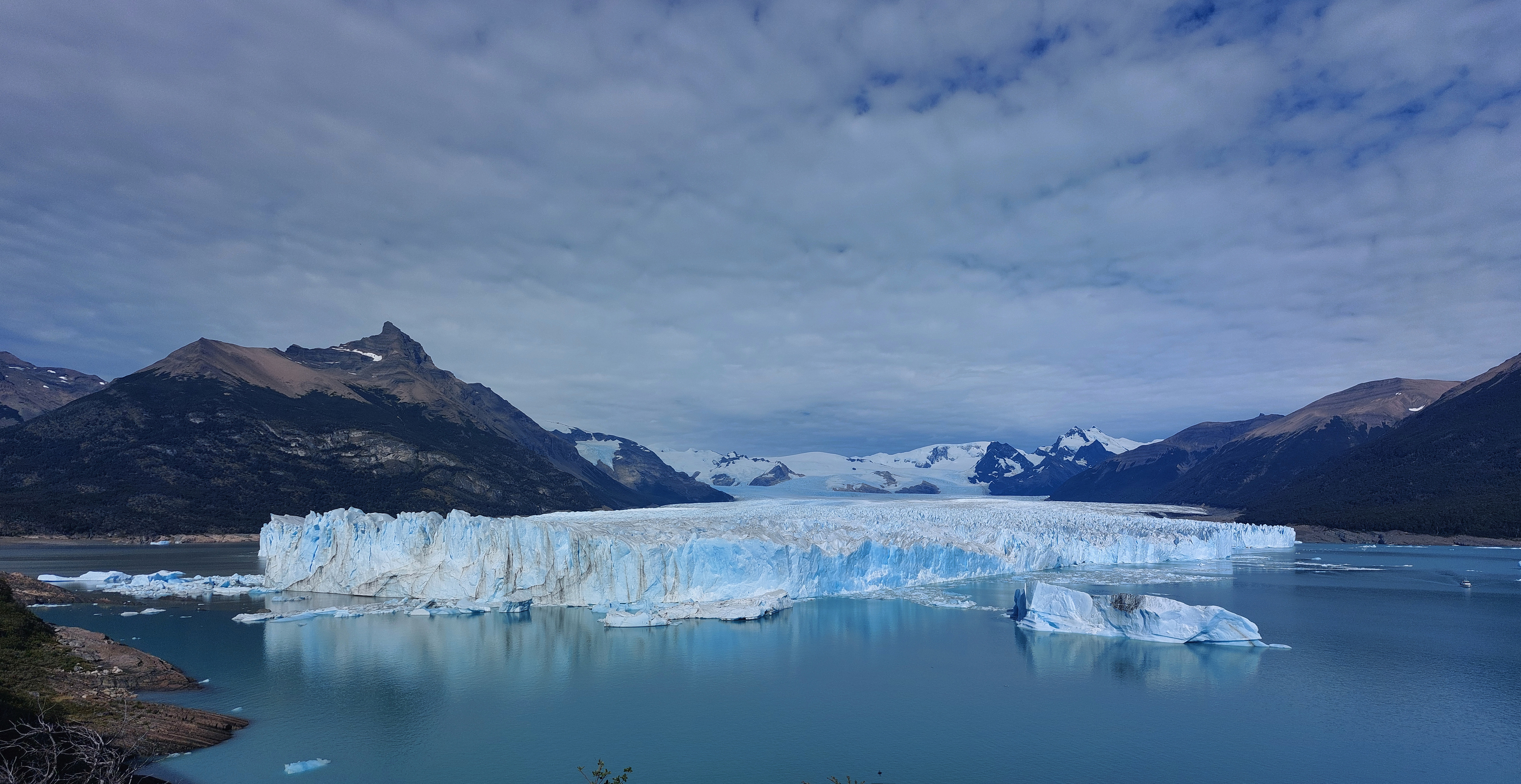
Glaciar Perito Moreno. We watched a 40m tall slab of ice shear off and explode outwards, scaring away the nearby boatload of glaciar-watchers.
More chickens!
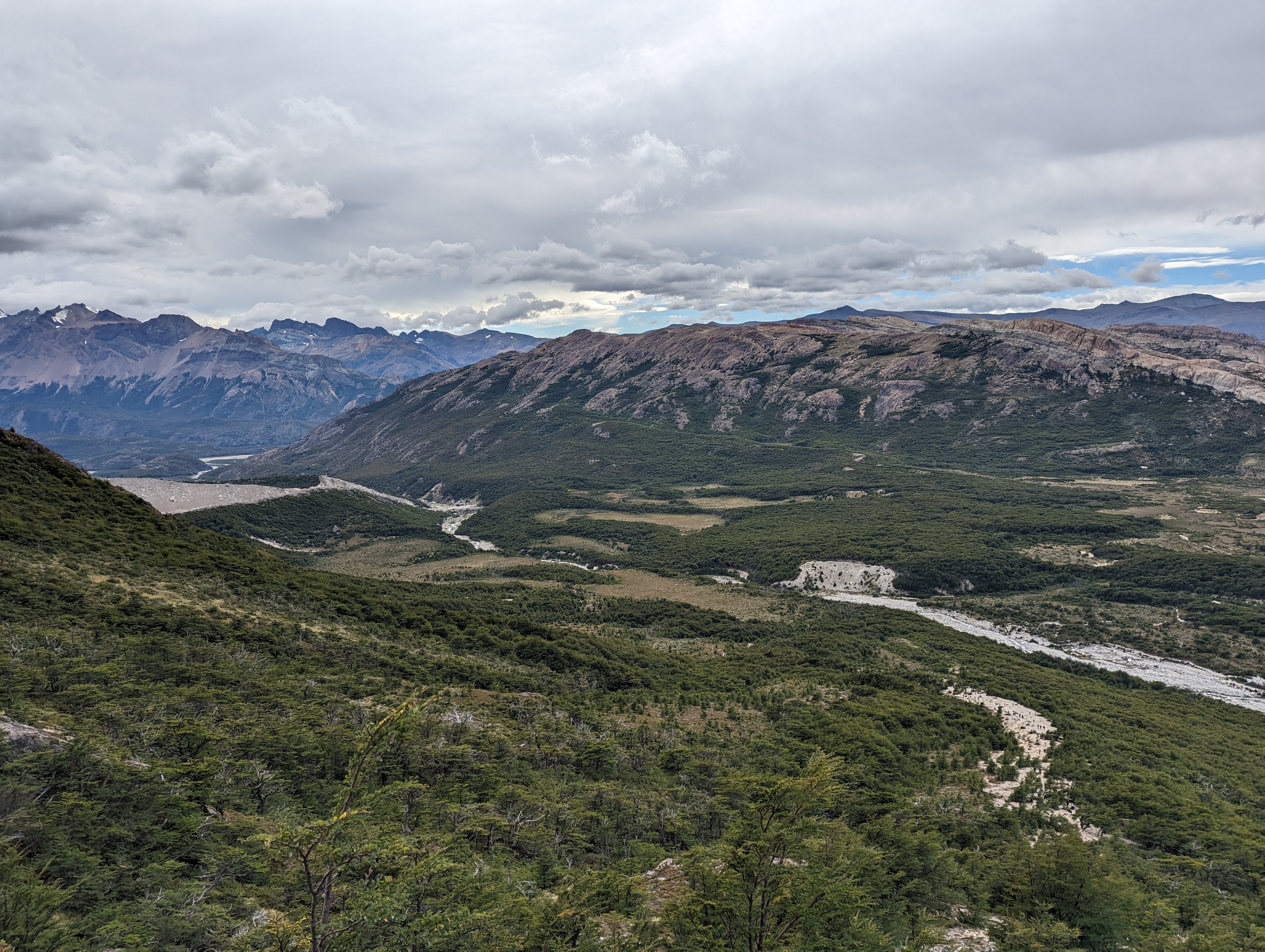
We dropped the rental car off, then jumped on a bus to El Chaltén for the final leg of the trip, Monte Fitz Roy and friends looming above the highway during the last stretch into town.
February 26
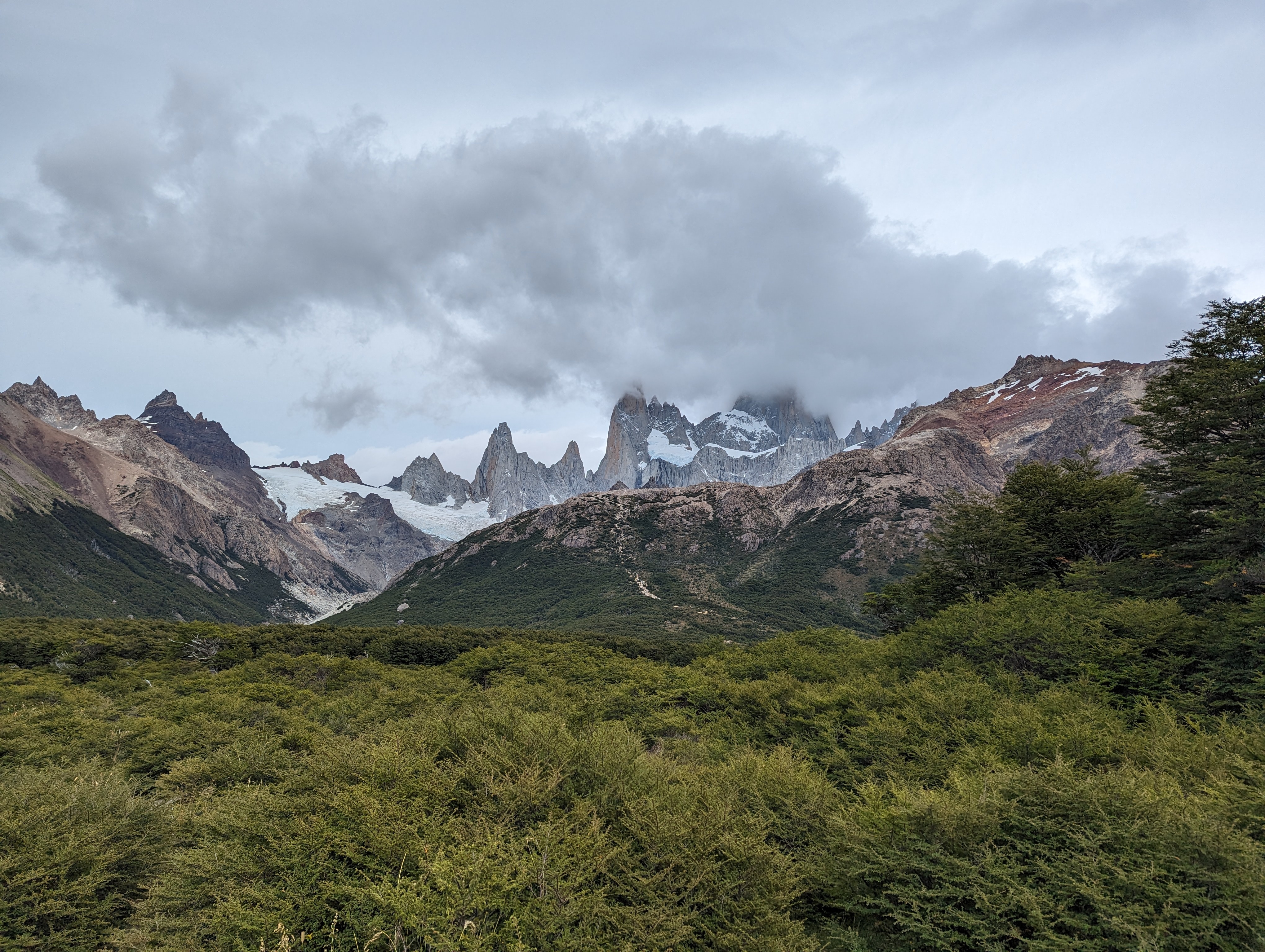
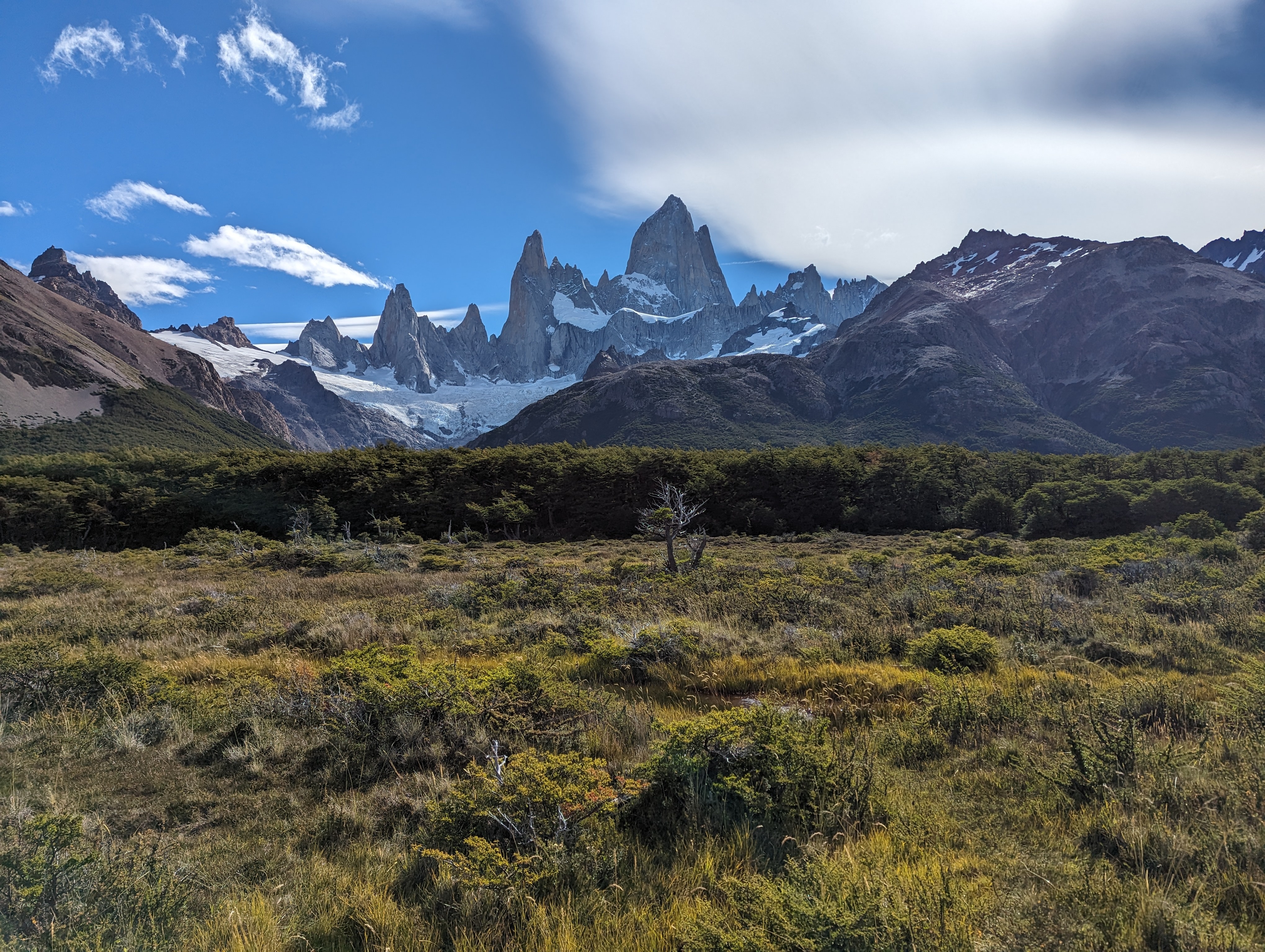
There are three main hikes people tend to do out of El Chaltén: Laguna Torre, Loma del Pliegue Tumbado, and Laguna de los Tres; we did them in that order. The mountains were mostly obscured by clouds during the morning, but cleared up around the time we arrived at Laguna Torre itself.
Río Fitz Roy, near the start of the hike; the area around El Chaltén was significantly more arid than Torres del Paine.
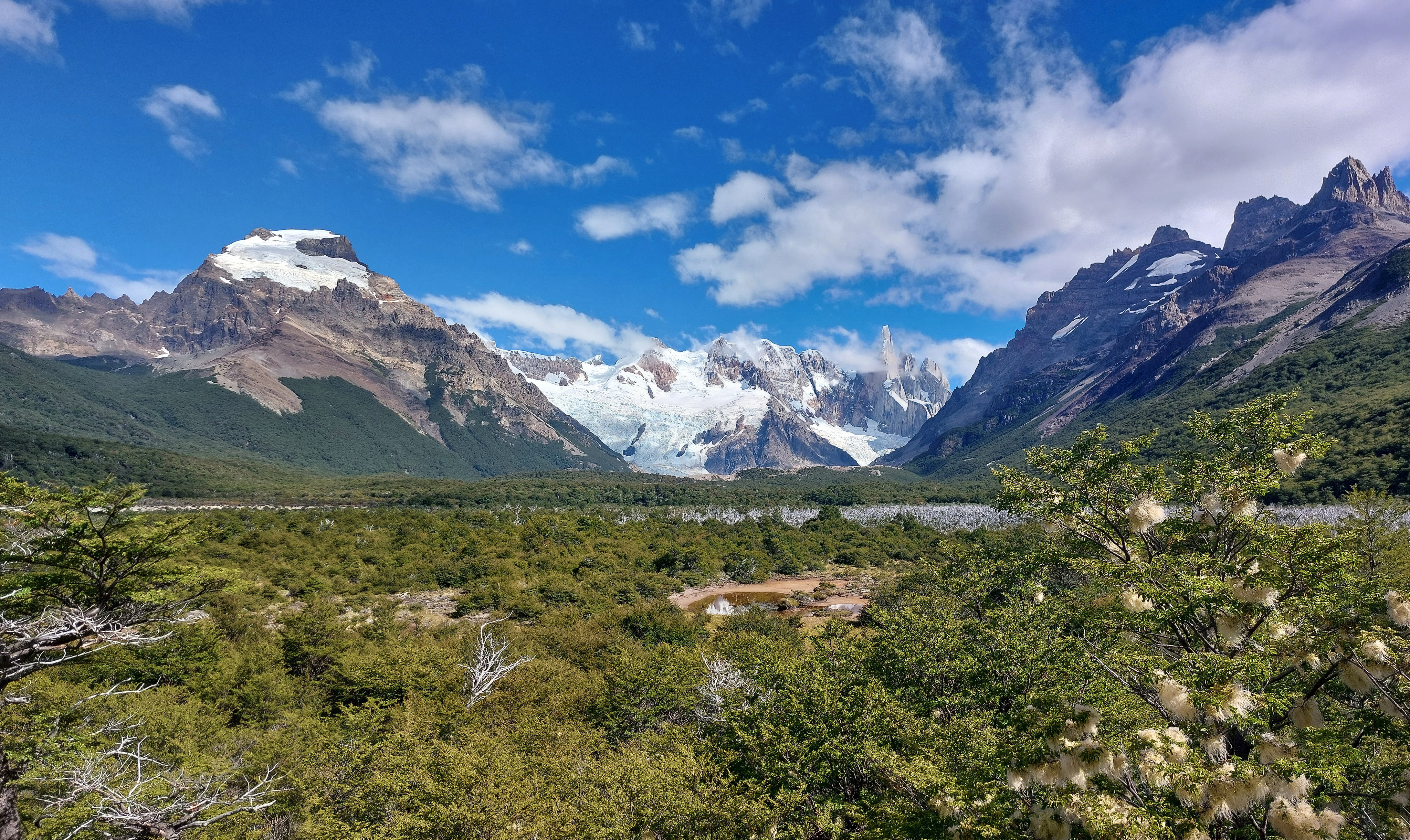
Cerro Torre from along the trail.
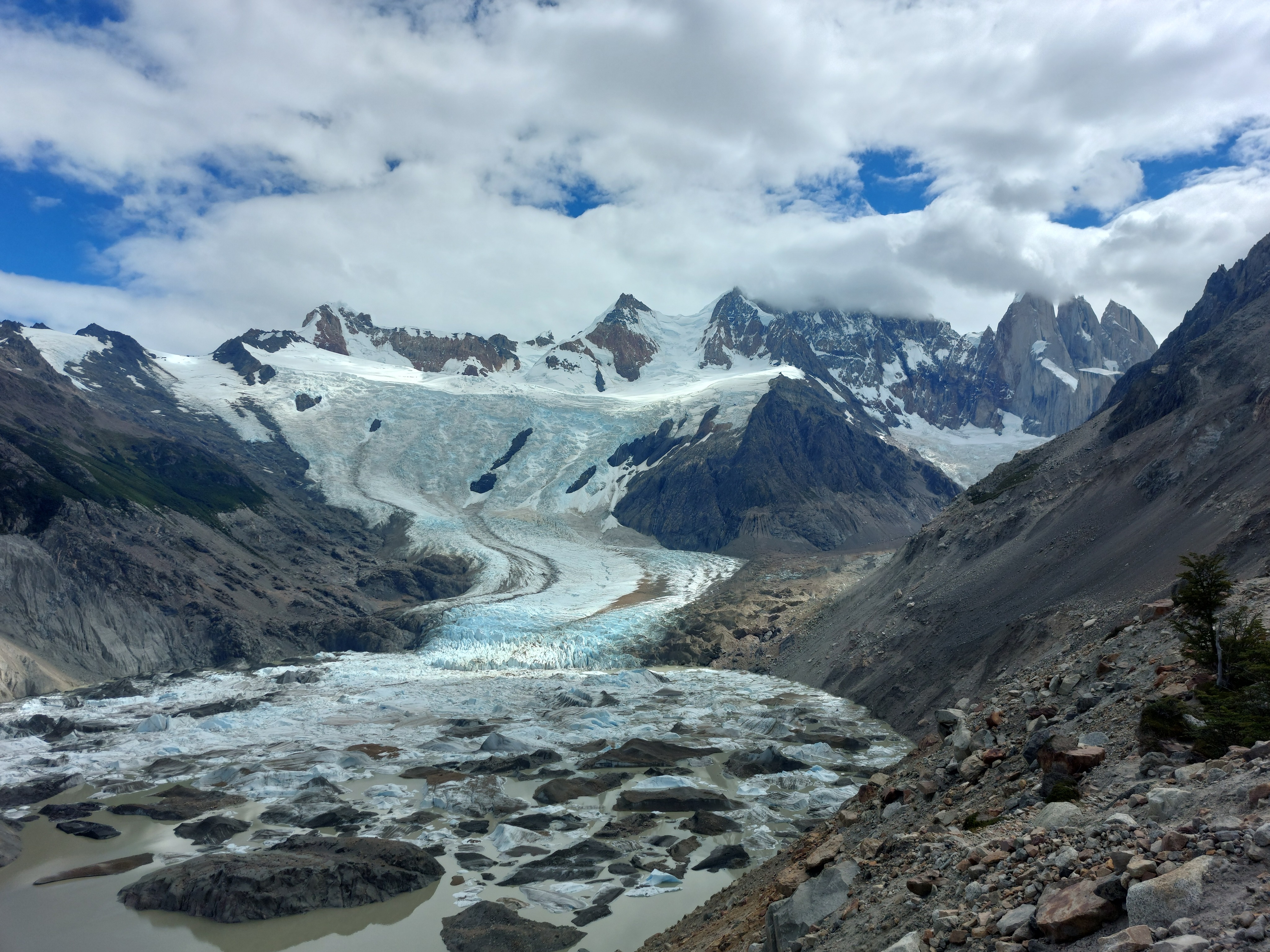
Once we arrived at the lake, we went up the right-hand moraine spine to the lookout, offering an impressive view of the glacier.
The area around El Chaltén was much warmer than Torres del Paine, and with the sun out in full force in the afternoon, it was HOT, with the head-height trees and open brush sections offering essentially no cover for our return. That, and the cold creeping up on me resulted in a less than stellar feeling hike.
February 27
I woke up with the cold in full swing; joints, eyes, head, throat all angry and unwilling to cooperate. I made it about a half hour out of town on the way to Loma del Pliegue Tumbado before turning around to nap the rest of the day away. Apparently the views from the top were obstructed by persistent clouds, which is unfortunate for the rest of our party.
Wild chickens.
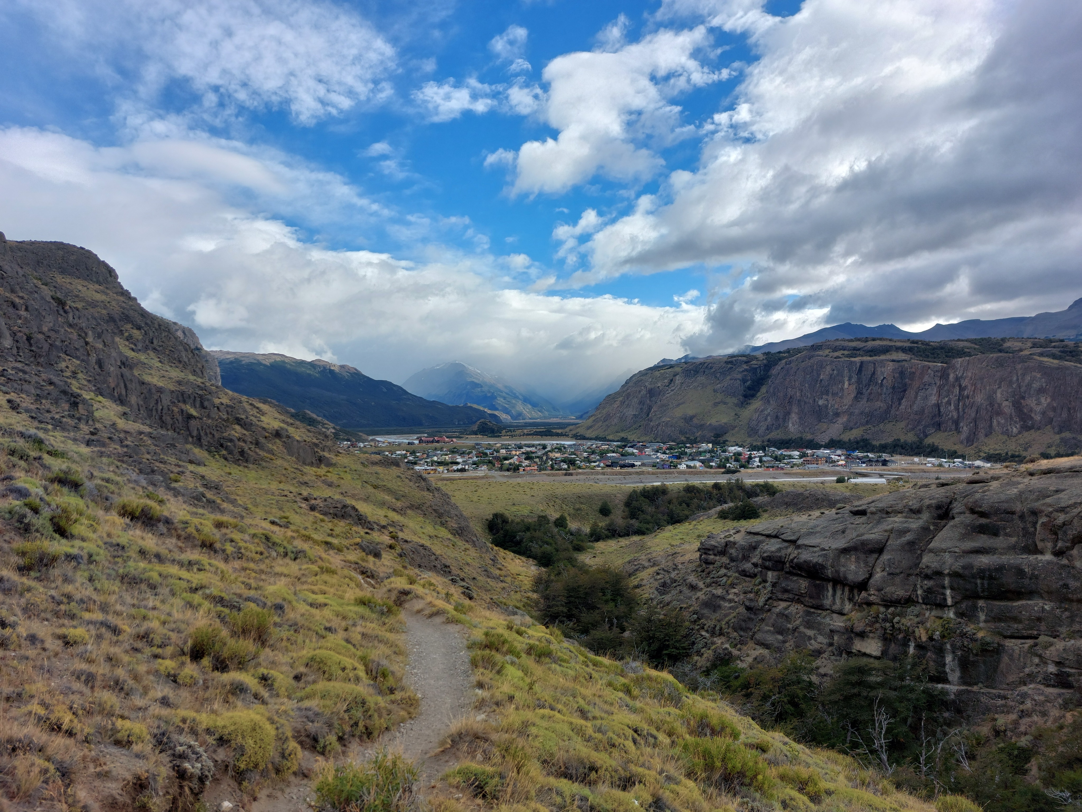
El Chaltén from a little up the route to Loma del Pliegue Tumbado.
February 28
Sick or no, Laguna de los Tres was a no-skip hike, especially considering its terminal status in our trip. Instead of starting the hike from town and doing a there-and-back, we took the advice of a random backpacker and took a bus to just past El Pilar. The ascent was much more gradual, with some beautiful views of the valleys to the north we would have missed doing the regular route.
Valleys to the north of El Pilar.
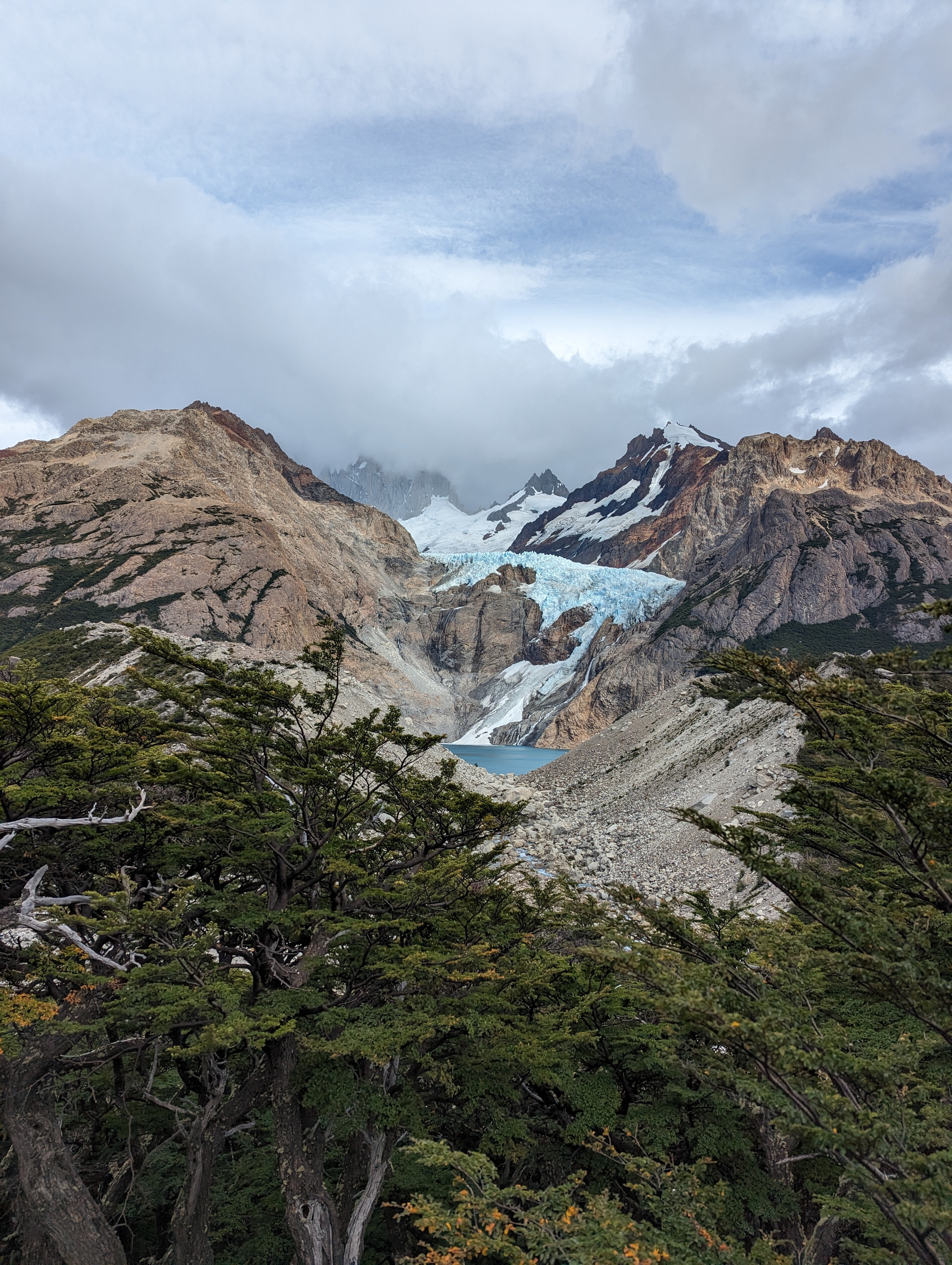
Mirador del Glaciar Piedras blancas.
Our destination was at the top of the switchbacks. The route up to here had been tolerable so far, a nice gradual ascent. A sign near the beginning of the final climb was far more ominous: 400m of ascent in the last 1km. This was rough, to say the least; I had no energy and was essentially hobbling up the switchbacks at a pace I can only compare to the immortal snail, on the verge of dropping into an impromptu nap for most of it.
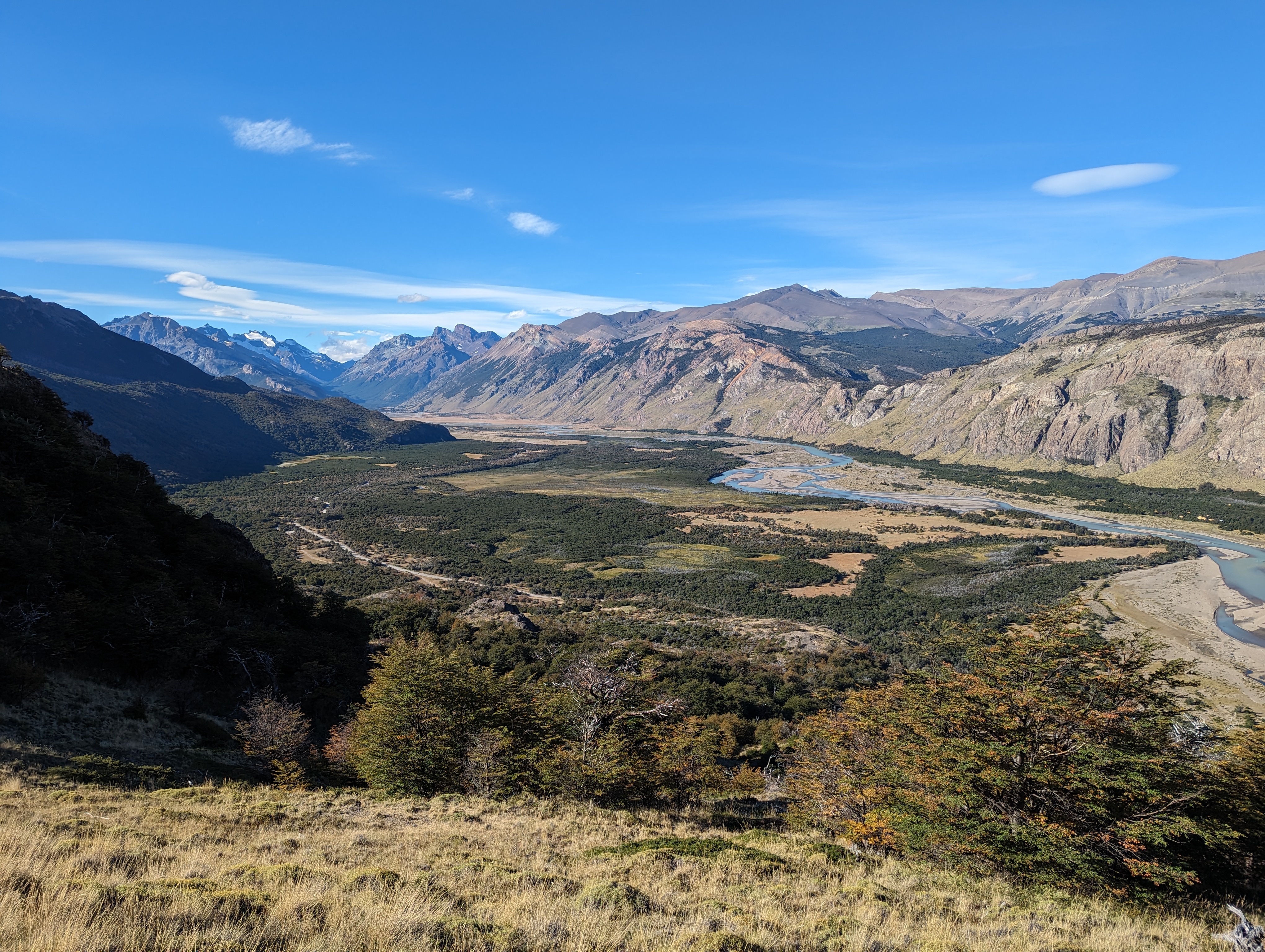
Looking back the way we came, near the top of the switchbacks; our route started near the winding river in the top left corner, with the moraine on the left opening to Mirador del Glaciar Piedras blancas. After far too much huffing and puffing, we made it to the top, and were greeted to the promised view (after a couple hours of letting the clouds obscuring the summits dissipate):
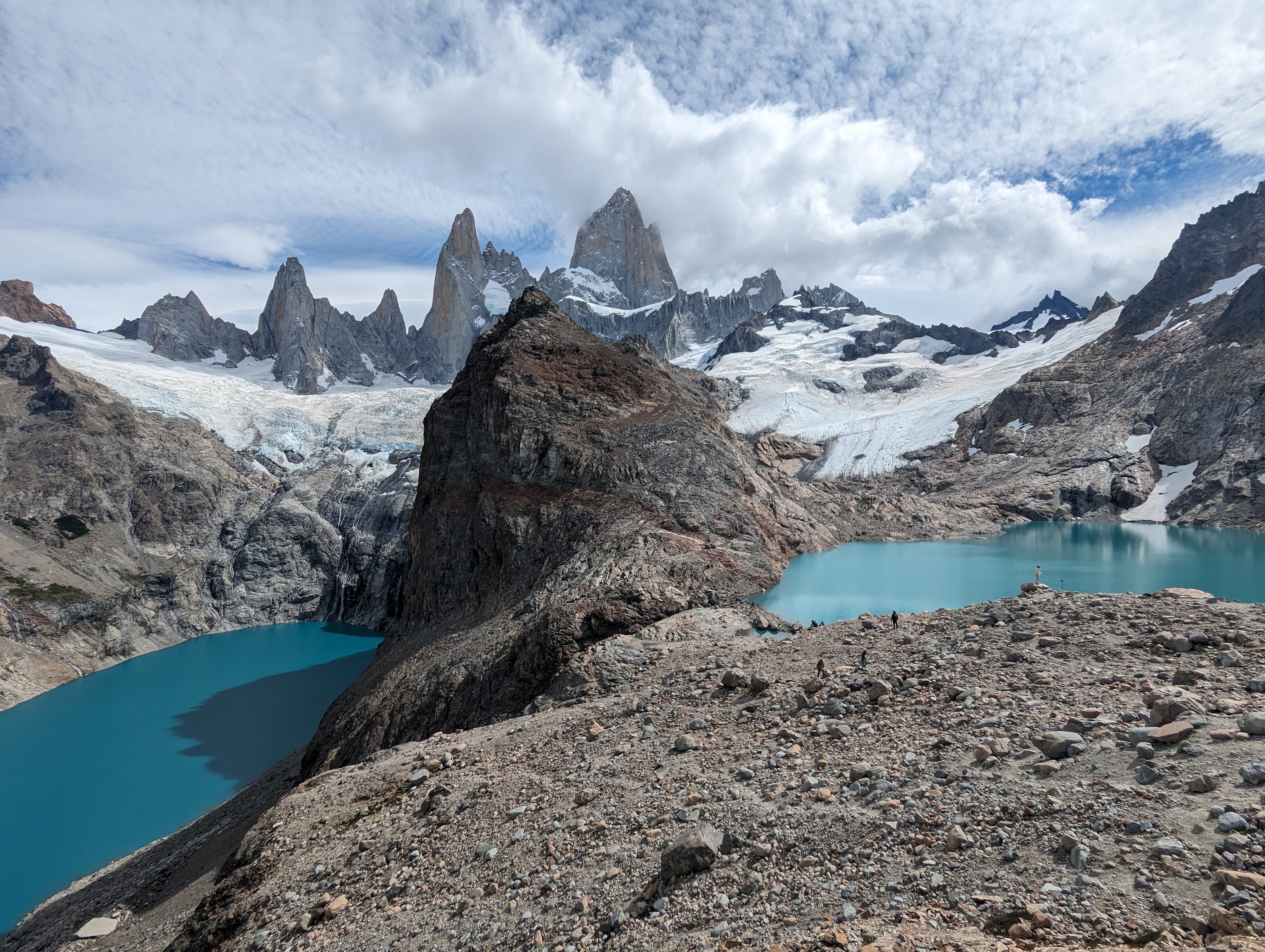
Monte Fitz Roy, Laguna de los Tres, and Laguna Sucia. While photos fail to transmit scale, the mountain felt properly large from up close, no optical illusion like Las Torres; I suppose being a full kilometer taller probably helps a little bit.
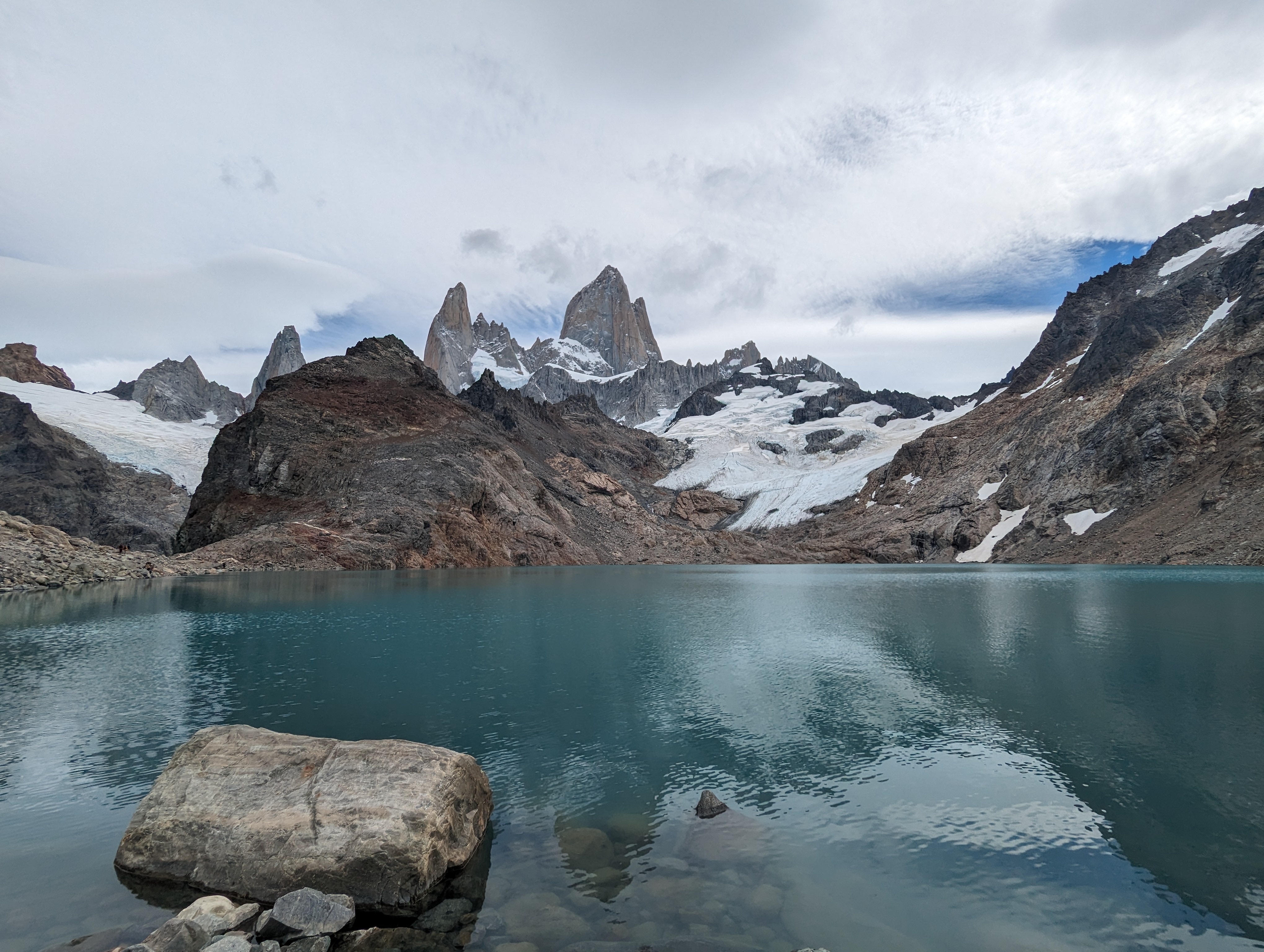
Laguna de los Tres from up close.
There was a fox wandering around by the lake, which attracted a crowd of photographers. The most entertaining interaction was between someone recording the fox with their phone, and another person trying to take pictures of the fox with a full-sized camera; both complained that the other was ruining their shot, since the fox was directly between them.
On our way back down, we were lucky enough to see an Andean Condor up close as it coasted by; while it probably didn't have the hypothetical 10ft wingspan, it was definitely still an absolute unit.
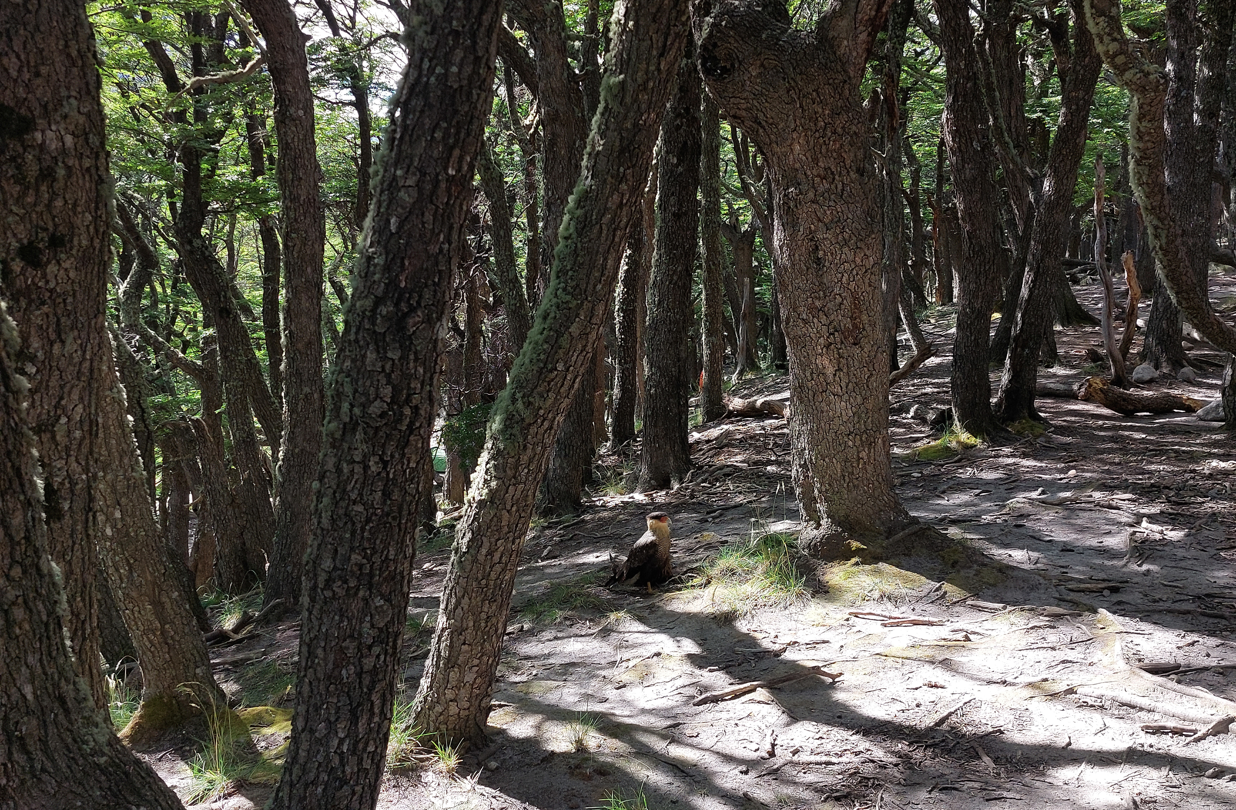
Strange chicken at Campamento Poincenot.
A last look at Monte Fitz Roy.
The road leading north out of El Chaltén towards El Pilar, and our last views before returning to town, and back home.
February 29
A transit day, first from El Chaltén to El Calafate, then Puerto Natales for the night. We got a decent view of Torres del Piane from the highway with evening light poking through the clouds, although it didn't photograph very well at such a distance. Customs were again quite slow when crossing the border; I wouldn't plan any tight connection on either side of the Puerto Natales-El Calafate stretch. My cold had passed on to the other trip goers, so this day and the return flights were marked mainly by silence, dazed looks, and slipping in and out of fevered sleep.
March 01-02
Puerto Natales to Punta Arenas, then the reverse set of flights back to San Francisco.
Fin
This trip was a blast. We were incredibly lucky with the weather, only having it turn sour when most convenient for getting a unique view, and otherwise basking in the sun (and wind). The parks were beautiful and quite distinct from anywhere else I've been. Overall, I can highly recommend visiting, and would love to go back to visit the other parks.
---
General Notes and Recommendations
A collection of random thoughts.
- Book campsites far in advance; campsites with Vertice and Las Torres (the two campground companies in Torres del Paine) open something like 6 months in advance and begin selling out within days; premium campsites remain available up until the last minute, but cost significantly more
- Likewise, make sure to book your flights relatively in advance. We waited for too long, and our flights from San Francisco to Punta Arenas ended up costing 1500 USD instead of 800 USD
- You'll receive a PDI form after going through customs (and filling out the Digital Affidavit to enter Chile); make sure to keep this, as they'll collect them when you leave the country
- You need to fill out the digital affidavit before entering by air, as well as when returning from El Calafate
- Our digital tickets (park passes for Torres del Paine, Parque Nacional Los Glaciares, bus tickets, etc.) were always accepted, no paper copies needed (although we did print them, just in case)
- Our financial proof to enter Chile was never checked, although it might be worth bringing just in case
- We inadvertedly booked hostels further from the bus stations. After a long day of travel, hiking or busing, the walk to and from lodging is amplified; in hindsight, I'd prioritize hostels close to bus depots
- The beginning and end of the trip is a lot of travel, be prepared
- Customs between Puerto Natales and El Calafate can take arbitrarily long, so make sure you have a sufficiently large buffer if planning to travel more that day on either end
- The campsites on the W-circuit are more glamping than proper camping; you have access to how showers, full cafeterias, bars, and if willing to pay for it, full board meals
- Torres del Paine weather has the reputation for being incredibly inconsistent; expect the unexpected
- It felt like 99% of people we met were north american or european tourists with fancy jobs and incredibly lenient remote working policies; a local event, this is not
- Restaurants are priced like North American ones, with a lot of meals sitting around 30 USD
- Everything in the hostels is a little busted, from broken locks, to inconsistent step heights, to molding showers with non-existent heat tanks, and more
- Chile and Argentina have mastered nano-technology, and used their sophisticated scientific achievements to design the thinnest toilet paper known to man. Some say each sheet is composed of three molecules of paper, stretched to length, in the only known instance of 1/100th-ply toilet paper
- Bring your own toilet paper and hand sanitizer: publish washrooms and bus washrooms will often have neither
---
Gear List/Wishlist
We brought some stuff we didn't need, and didn't bring some stuff that would have been nice. This is my "in hindsight" packing list for the trip:
- At least two pairs of hiking clothes, one to wear and one to dry overnight/on your backpack. I brought significantly more socks and underwear; with perfect weather, you could hypothetically wash one in the shower/sink and wear the other, but if you get any more rain than we did, you may end up with two wet pairs if this is all you bring. Risk and reward
- Raincoat for wind and rain; make sure its DWR isn't gone, because soaking through in a half-hour isn't fun
- Rainpants, super useful for heavy rain
- Waterproof shoes/boots: I brought trail runners, which worked perfectly when the weather was nice, but not so well in a downpour or when crossing streams, flooded trails, or marshy sections
- Ball cap for sun, rain (or something with a cord, for the crazy windy sections by Sector Grey)
- Sunglasses for sun and wind
- Warm layers, especially for Las Torres: fleece/puffer, gloves, toque, neck warmer, thick socks
- Evening/post-shower/sleeping clothing
- Camp shoes/shower shoes/sandals
- Plastic bags for dirty and wet clothing
- Headlamp, mainly for late evenings and the early morning up to Las Torres
- Charger, battery pack, cable
- Soap (not all showers during the W circuit had soap available, although most did; most hostels did not)
- Face mask/earplugs for neighbors at night
- Sunscreen
- Bug spray/net if sensitive to bugs (there were some at Francés, but nothing too bad)
- Laundry line/cord
- Roll of toilet paper (just in case) and hand sanitizer (definitely used a lot) for public washrooms and buses
- Dry bag/ziploc for passport, PDI, other important documents, electronics
- Water bottle/bladder; stream water and refugio water is safe to drink without filtering
- Enough snacks and meals for what you don't buy on the way or in advance; jet boil or equivalent for meals, although lots of refugios have hot water available
- Tent/sleeping bag/sleeping mat (if not staying in "premium campsites")
- Backpack large enough to fit all your gear (I brought a 65L, but saw people with 40L, 80L)
- Rain cover to protect said backpack
- (optional) daypack for Mirador Britannico, Las Torres, Paso John Garner, El Chaltén
---
Cost
Visiting Patagonia doesn't need to be an exhorbitantly expensive trip; while you can definitely bump up the cost by going to restaurants every evening, booking the premium rooms at the refugios, and getting full board every night, the bare minimum isn't obscene. Here are our approximate transit and lodging costs per person; it is worth keeping in mind that our hostel costs may be a little higher, may be a little lower, since we typically got a room for four.
| Flight - San Francisco to Punta Arenas | 1500 |
| Bus - Punta Arenas Airport to Puerto Natales | 12.79 |
| Hostel - Puerto Natales | 18.55 |
| Bus - Puerto Natales to Torres del Paine (Pudeto) | 14.75 |
| Parque Nacional Torres del Paine | 13 |
| Catamaran Pudeto to Paine Grande | 25 |
| Vertice (Grey and Paine Grande + full board) | 275 |
| Las Torres (Francés, Chileno + some board) | 215 |
| Bus - Torres del Paine (Laguna Amarga) to Puerto Natales | 14.77 |
| Hostel - Puerto Natales | 16.65 |
| Bus - Puerto Natales to El Calafate | 34.06 |
| Hostel - El Calafate | 19.03 |
| Car rental - El Calafate | 17.50 |
| Parque Nacional Los Glaciares entry pass | 14.19 |
| Bus - El Calafate to El Chaltén | 22 |
| Hostel - El Chaltén (four nights) | 178.08 |
| Bus - El Chaltén to El Calafate | 22 |
| Hostel - Puerto Natales | 22.90 |
| Bus - Puerto Natales to Punta Arenas (airport) | 12.37 |
| Total Cost (Approx) - USD | 2464 |
There are definitely cost savings that can be made; booking our flights earlier would have costed about 800 USD instead of 1500 USD, and carrying our food while in Torres del Paine would have brought the cost of Vertice and Las Torres down 160 USD and 110 USD respectively, bringing the total down to just under 1500 USD, minus the cost of food (and assuming you already have all the camping gear you'll need). We also did an extended W circuit over 7 days instead of the typical 4 or 5, which would have saved even more. The full board and restaurants (not shown above) are definitely quality of life trade-offs; booking our flights in advance would have just been free savings of nearly a third of the cost of the trip, so I'd highly recommend figuring out when flights are the cheapest, and nabbing them then.
---
Links
- Bus Sur for trips in Chile and across the border (Punta Arenas, Puerto Natales, Torres del Paine, Pudeto, El Calafate)
- Cal Tur for trips in Argentina (between El Calafate and El Chaltén) - must contact via WhatsApp
- Parque Nacional Torres del Paine for park passes
- Parque Nacional Los Glaciares for park passes if visiting Perito Moreno (not necessary for hiking around El Chaltén)
- Digital Affidavit for entering Chile
- Las Torres Patagonia for booking Francés, Chileno campsites
- Vertice for booking Paine Grande, Grey
- Hostelworld and Google Maps for hostels